
Chief Meteorologist in Dothan, AL, continuing my life-long passion for weather. B.S. Degree in Meteorology from Northern Illinois University.
Joined April 2013
- Tweets 12,929
- Following 354
- Followers 1,642
- Likes 2,845
11,856 Photos and videos


One model doesn't make a forecast, but it's interesting that the most-accurate model of the 2025 hurricane season - the Google DeepMind Ensemble - says "nope" to any chance of tropical development from the weak spin over Mexico. There's a low-end potential in some of the other modeling, so it's worth watching, but this disturbance mainly looks to be a rain-maker for the Gulf Coast this week, rather than a wind-maker.

4
203
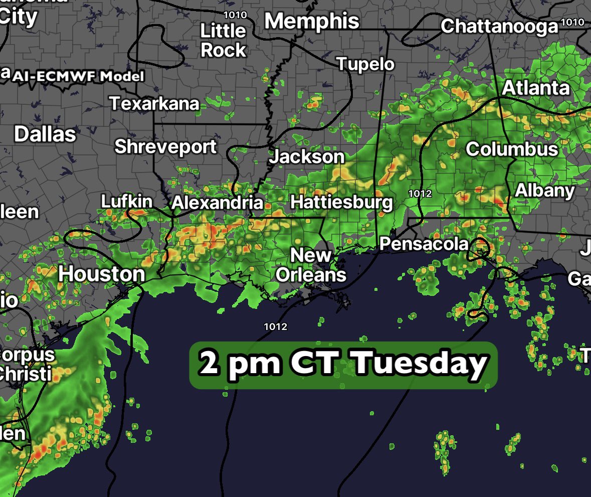
The atmosphere is loading up and will dump copious amounts of moisture across the Gulf Coast over the days ahead. There could also be some brief, low-end tropical development over the far Northwest Gulf if low pressure moves over the water on Wednesday.
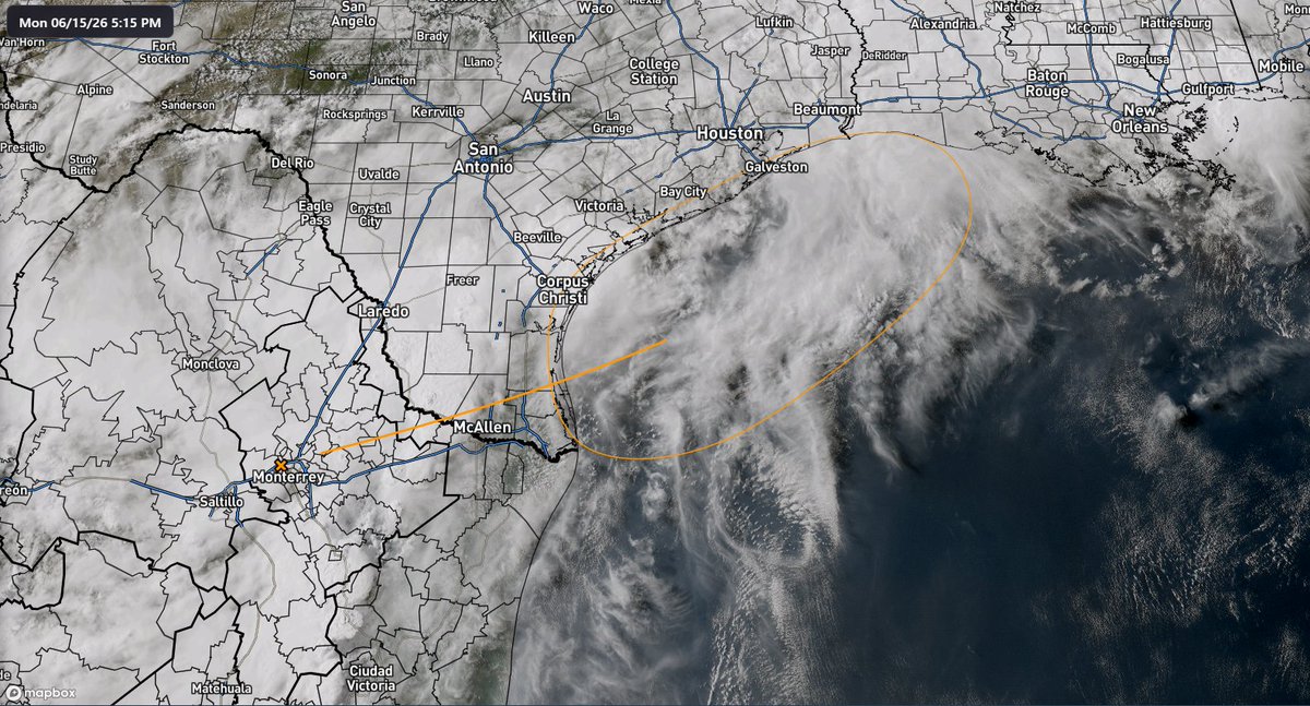
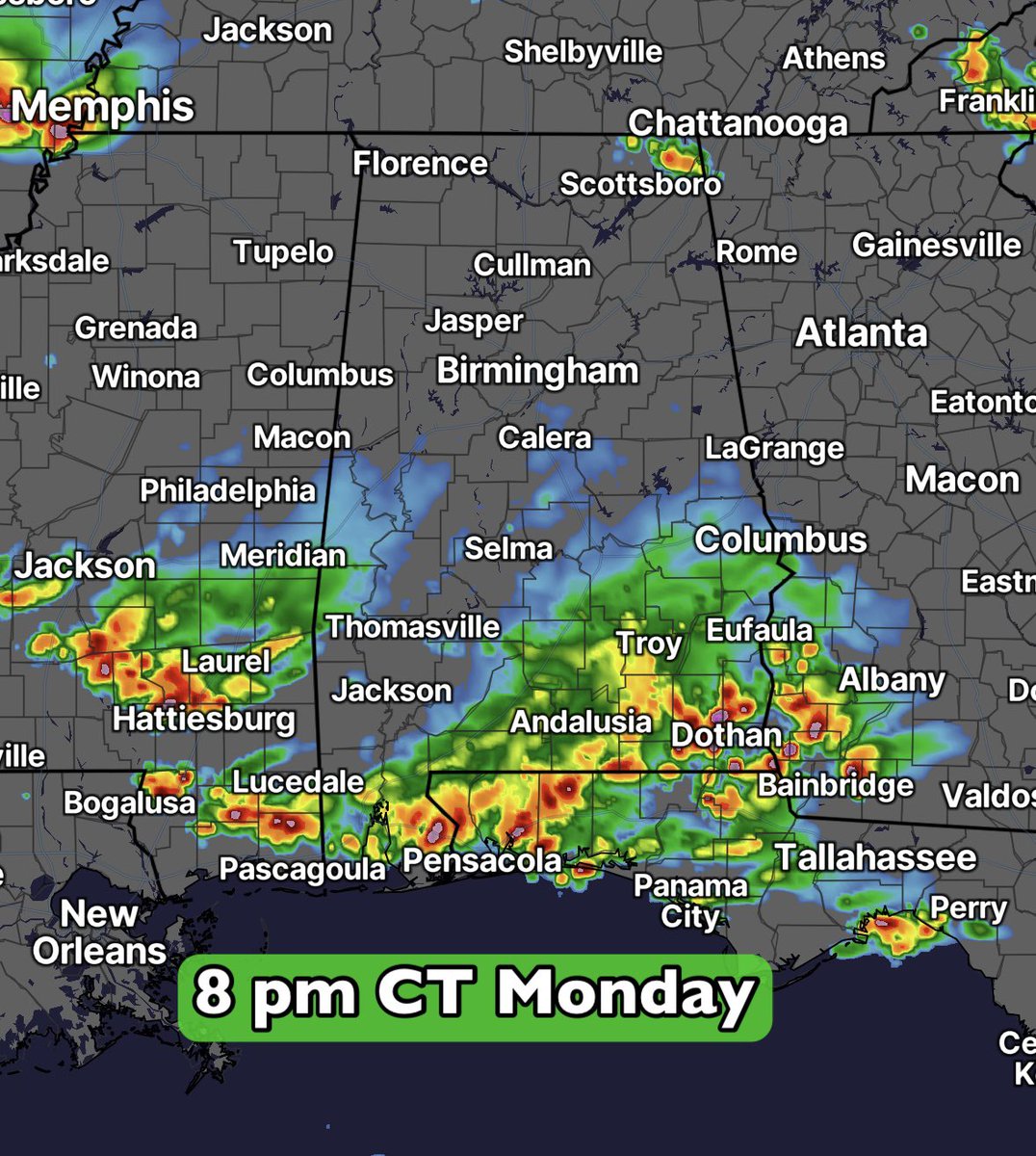
I’m showing you a big view here to give you an idea of the evolution of this pattern. Rain in Texas, Louisiana and Mississippi will be spreading eastward. 🌧️
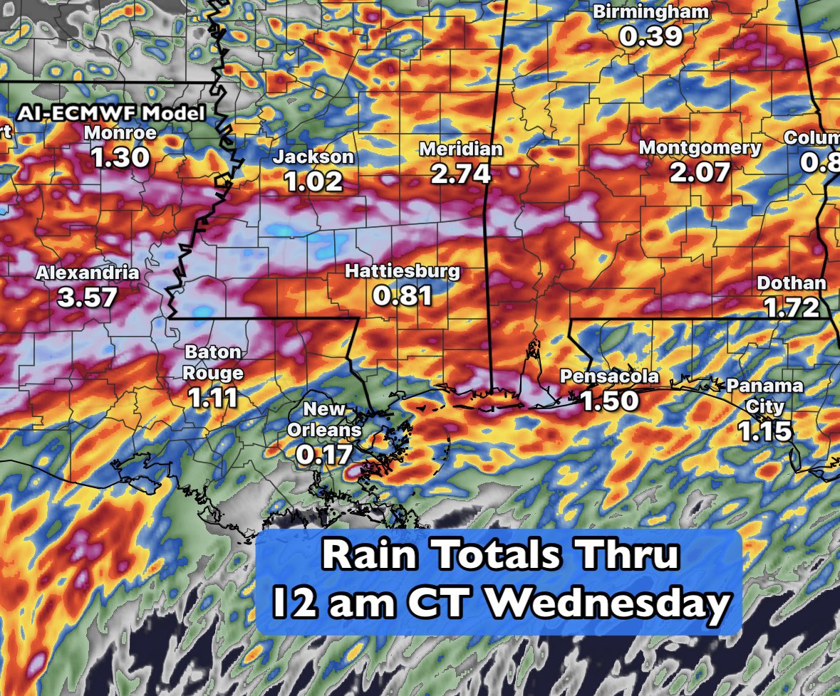
💧 Rain totals thru 12 am Wednesday are impressive. What really stands out are the pockets of higher totals, especially over parts of Louisiana and Mississippi - over 7” are possible.
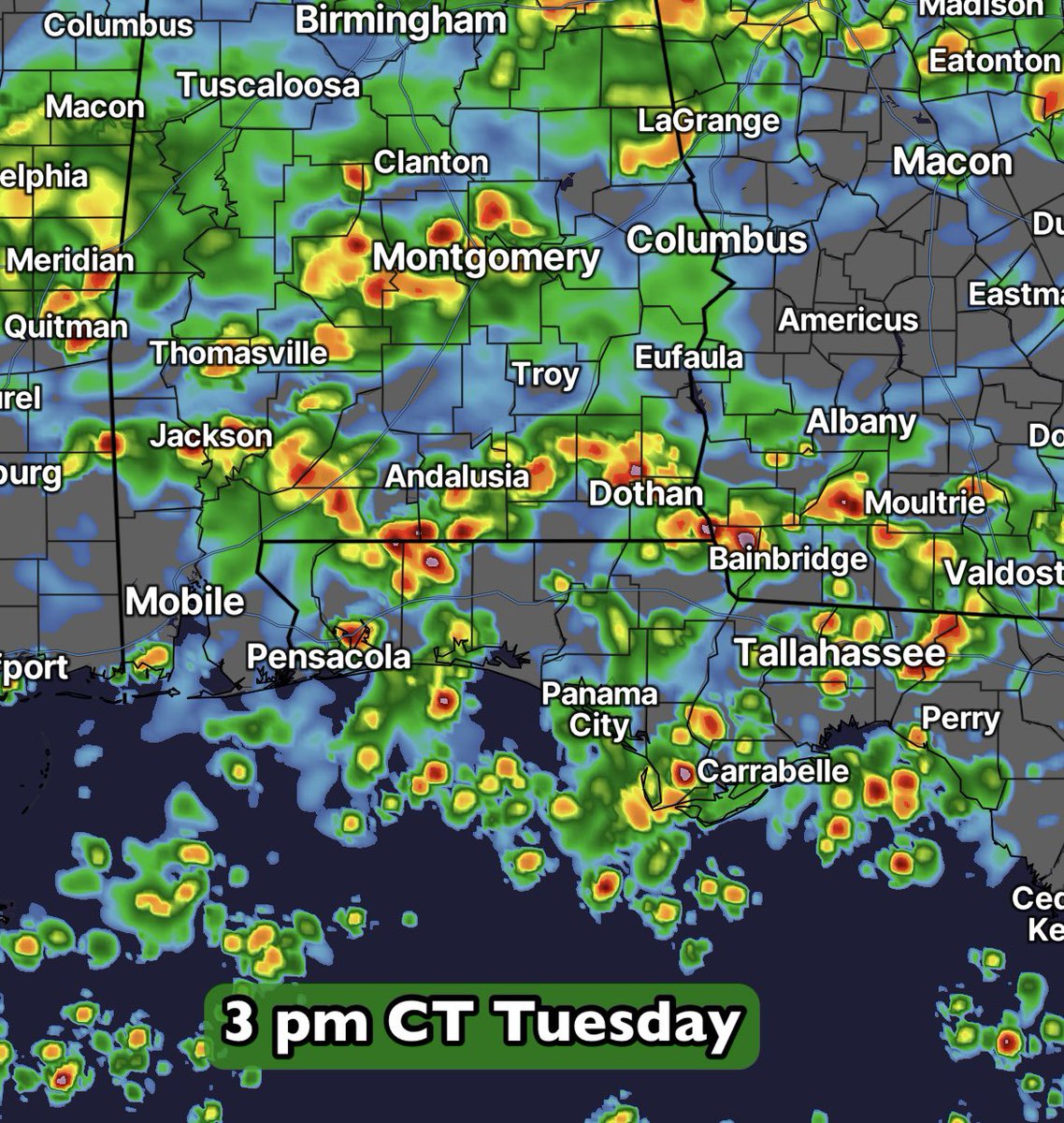
This setup features showers and thunderstorms, rather than any notable severe weather threat. Keep the rain gear handy! 🌂

3
120
🚨 ☔️ Rain gear alert! ☔️ 🚨
Rain chances increase for the coming days across the South. An incoming boundary will team with deep tropical moisture to produce widespread showers and a few thunderstorms. Temperatures are going down 📉 , rain totals are going up 📈!
Prepare for some wet weather, especially for the afternoon hours. For many areas we’re looking at 2-4” for the work week ahead. 🌧️
2
146

Jun 14
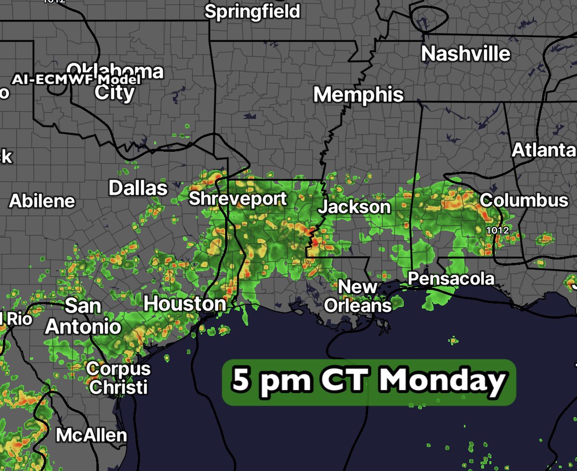
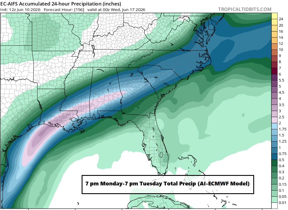
An incoming boundary into the Deep South…plus incoming tropical moisture from a weak system over Texas…adding up to abundant rainfall over the days ahead. 🌧️
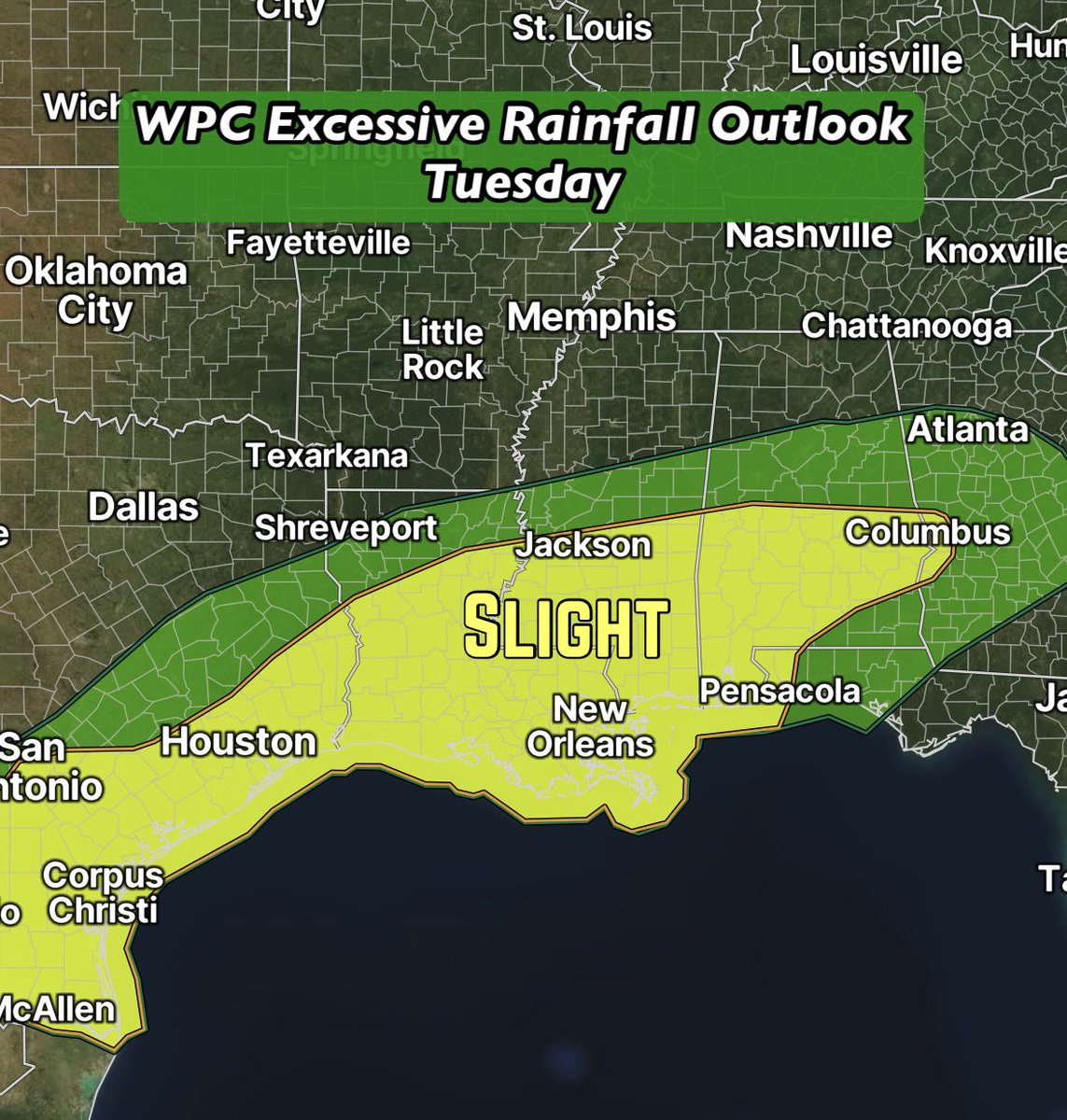
The focus will be from Coastal Texas, through Louisiana, Mississippi and into Alabama. All the areas in red are projected to pick up over 2” through Tuesday, according to the reliable AI-ECMWF model.
The Weather Prediction Center has a large area of slight and marginal risk for excessive rainfall. Flood-prone areas need to be on-guard. The week ahead is shaping up to be wet! 💧


2
18
745
Jun 13
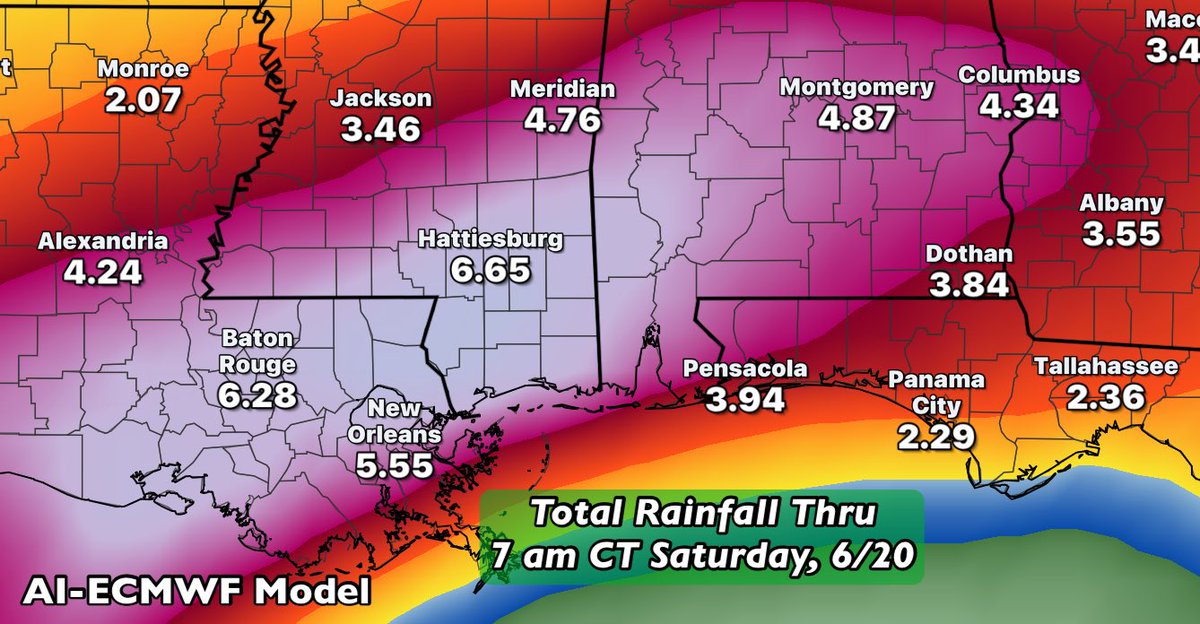
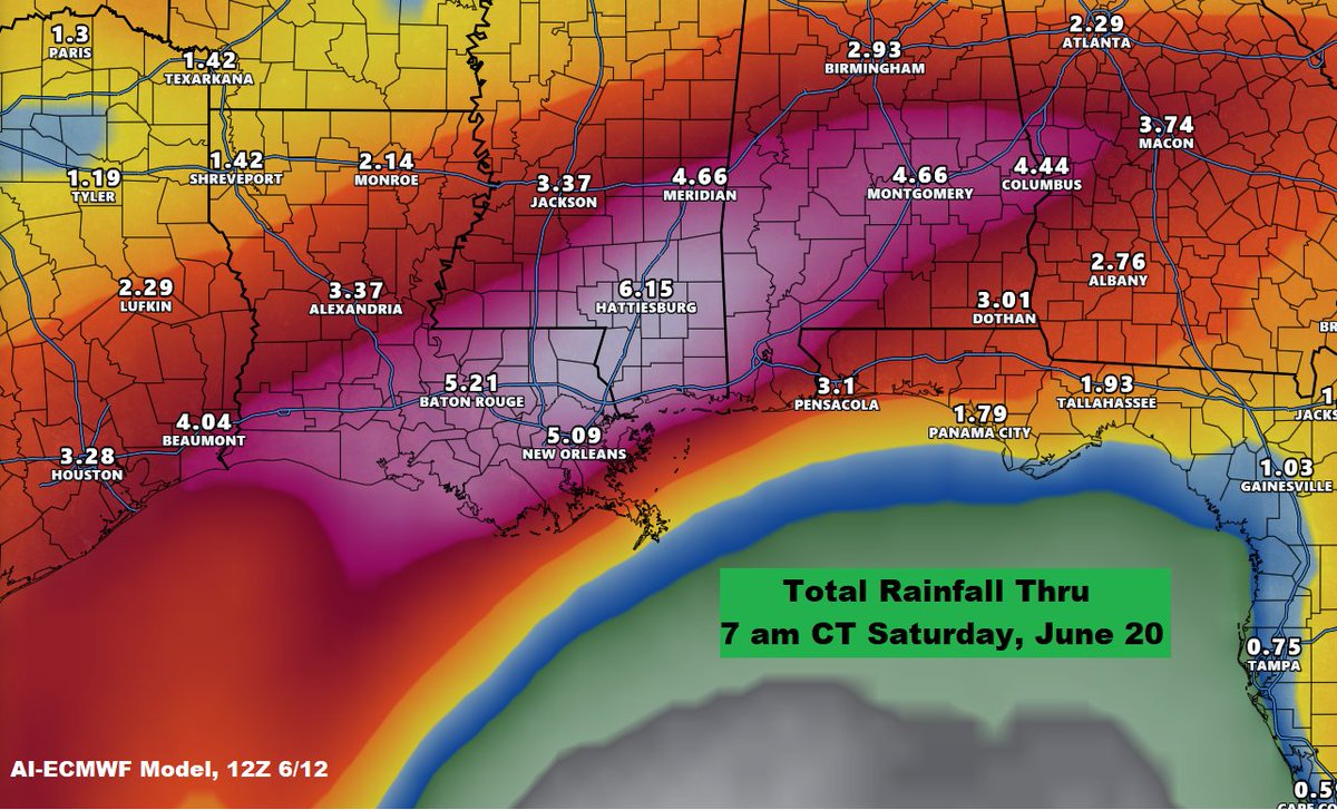
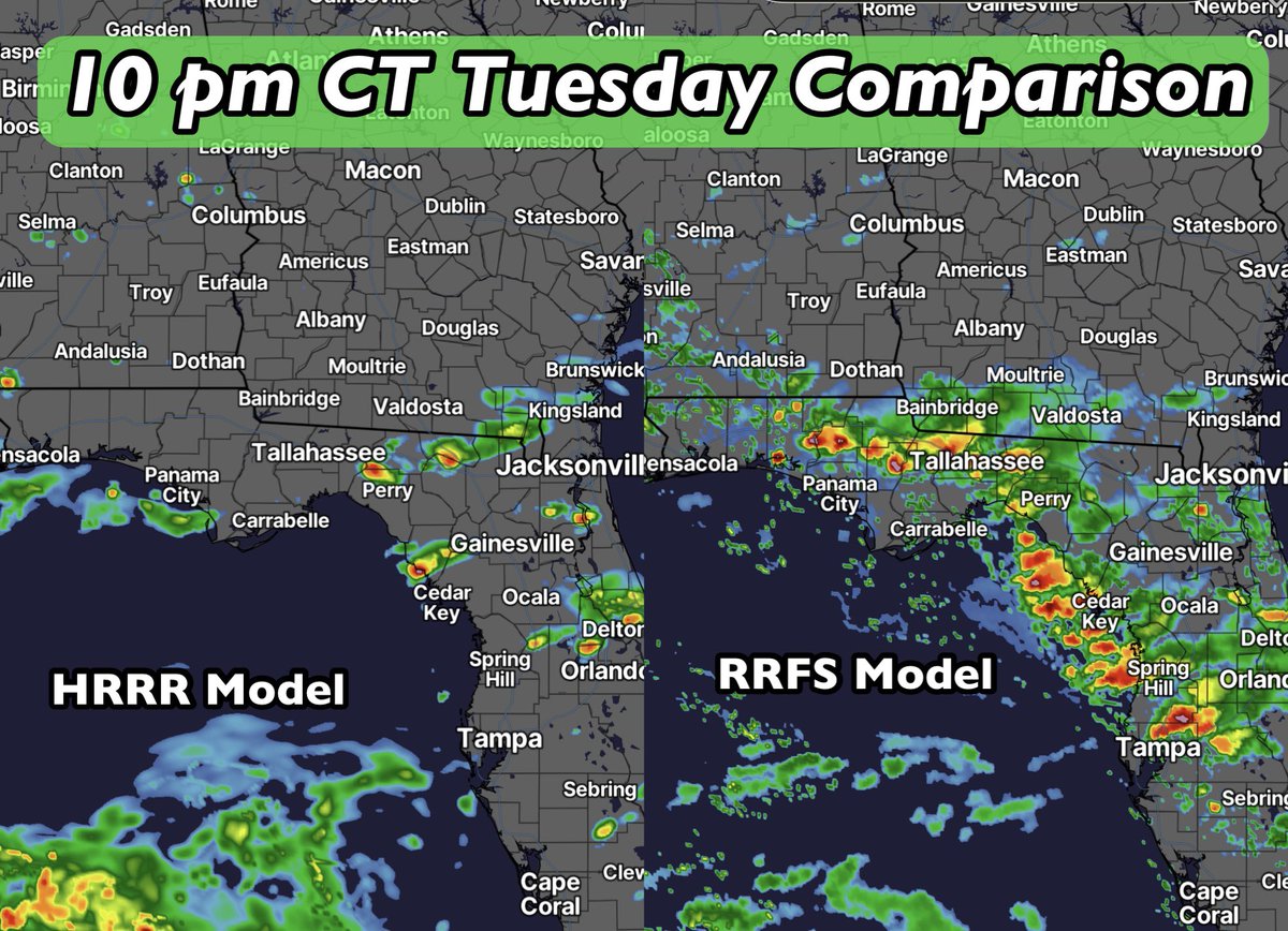
A very wet signal continues to show up in the modeling for the week ahead. This is the AI-ECMWF model, which is consistently at/near the top for accuracy, showing total rainfall thru 7 am CT Saturday, June 20.
Some areas really need this across the South, while for others - Louisiana into Mississippi - this is a little too much. Deep tropical moisture is on the way! 🌧️
1
2
38
2,090
Jun 12
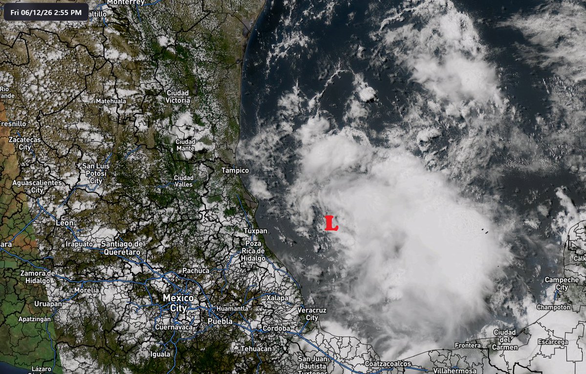
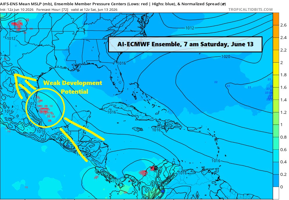
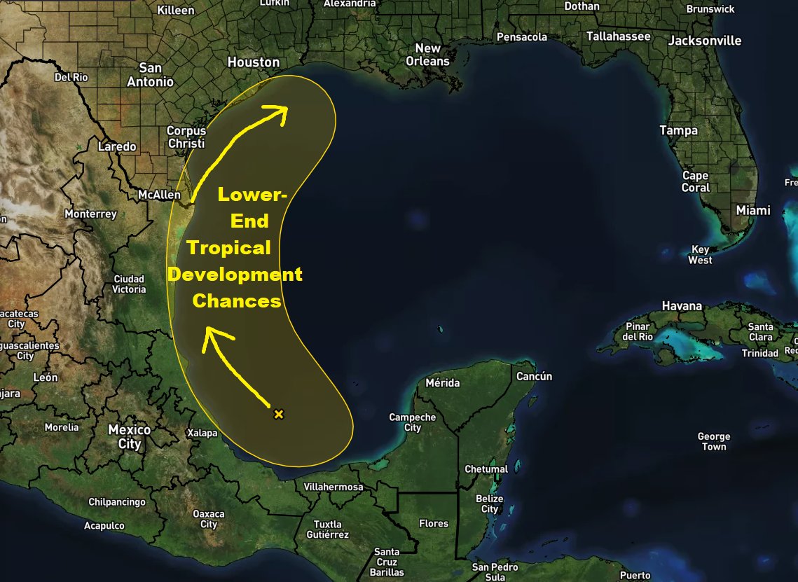
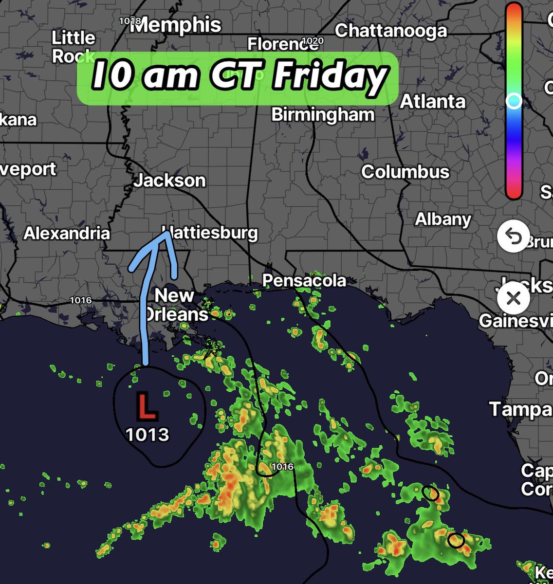
There's a weak area of low pressure in the Bay of Campeche Friday, moving to the northwest. Tropical development chances are low, but not out of the question. If the disorganized center remains over water, there could certainly be some lower-end development.
The big story from this disturbance will be the rain for the Gulf Coast. Beginning in Texas over the weekend, then spreading to the ENE over the week ahead. Some spots will likely be measuring totals in the inches across the Deep South. These totals are subject to fluctuations, but the AI-ECMWF model has been consistent in cranking out some hefty totals.
2
15
751
Jun 11
From my cousin…weak rotation with this cell around 4 pm near Byron, IL. Big severe weather outbreak unfolding across the Midwest.

2
130
Jun 11
🚨 Next week is looking wet! 🚨
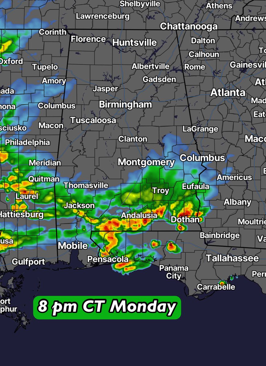
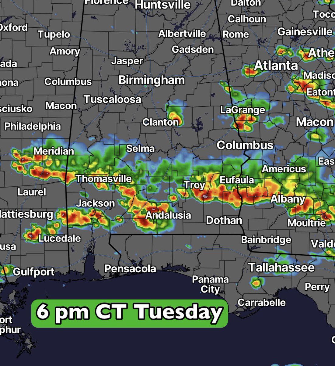
Rain…lots of rain for the Gulf Coast. 🌧️ The majority of this long-range rainfall will fall between Monday and Friday, June 15-19. A boundary looks to lay out across the Deep South, being fed by copious amounts of Gulf/tropical moisture.
Rain gauge totals are likely to be measured in inches. If you work outdoors, this is likely to cause some interruptions to your work flow. Monday, Tuesday and Wednesday, in particular, could feature washout weather where a heavier band looks to set up. Not a severe scenario…rather a heavy rain scenario. 💧
105
Jun 11
Tropical development in the SW Gulf heading into the weekend? Not out of the question, but the chances are low. There does look to be a decent chance of a defined area of low pressure moving through the Bay of Campeche, but the system may not have enough time to organize into a tropical depression before moving into Mexico. One thing I've learned in my nearly three decades as a meteorologist, though...never say never!
13
510
Jun 10
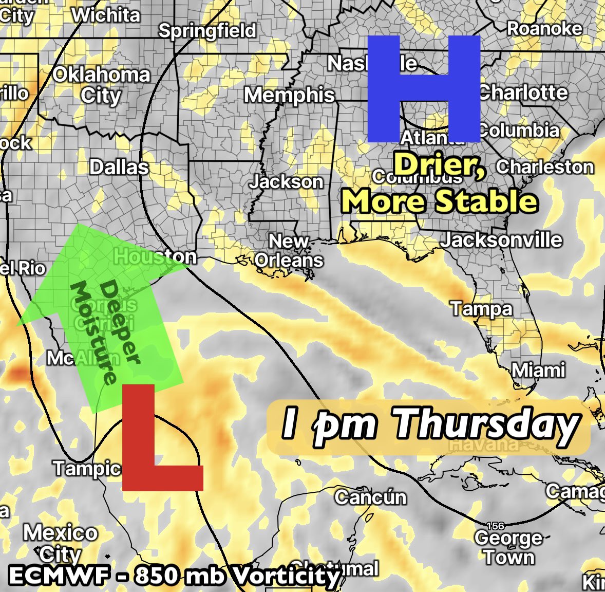
The remnants of Cristina (Eastern Pacific system), along with some energy over Central America, will join forces and move across the Bay of Campeche/Western Gulf Saturday. The ensemble data has been hinting at weak development, but the overall chances remain low. Any organization will have a limited development window before moving into Mexico.
I'm more interested in the long-range outlook for the Deep South. Very moist air will move in from the Gulf early next week, setting the stage for some heavy rains. The 24-hour rainfall totals from Monday evening to Tuesday evening could top 2" over parts of Louisiana, Mississippi and Alabama.
1
13
891
Jun 8
⛈️ There’s a better chance for scattered afternoon showers and thunderstorms Tuesday across Southeast Alabama into the Florida Panhandle and Southwest Georgia. Watch out for locally heavy downpours with the humid air. The activity will diminish Tuesday evening.
2
113
Jun 4
There’s quite a cluster of showers and thunderstorms bubbling in the Gulf Thursday. Wind shear and vertical misalignment are keeping any development in check. Some of the energy aloft is moving towards South Florida, while a lower-level spin will emerge and move to the NNW. Tropical development odds are very low due to the aforementioned shear, but scattered showers and a few thunderstorms will impact parts of Louisiana and Mississippi on Friday and Saturday.
It’s hurricane season…always a good idea to stay alert! 🌀
4
296
Jun 3
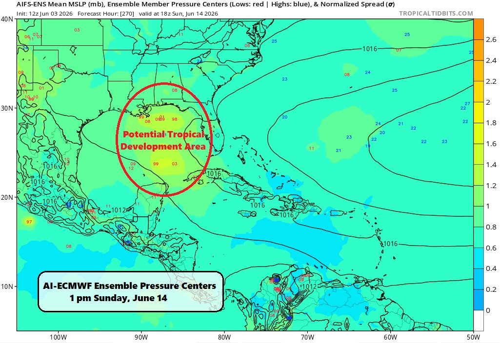
I'm definitely keeping my eye on the Gulf, not so much for the current disturbed weather, but for what potentially follows. There are plenty of hints in the long-range ensemble data showing a potential low pressure system moving northward through the Gulf around the weekend of the 13th/14th. An Eastern Pacific -> Central America -> Gulf crossover disturbance. Could be a tropical system, so I'll be tracking this potential closely.
This year definitely has the feel of producing some kind of a lower-end named storm in the Gulf in June. That's just a nearly three-decade-long-career-meteorologist's-gut feeling! 😆
2
8
34
2,595
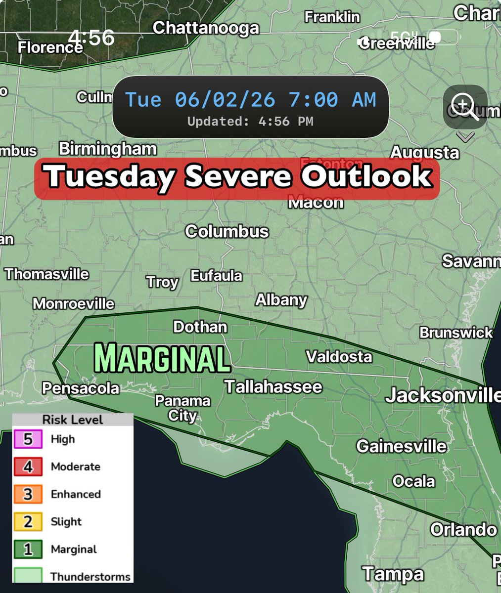
Jun 2
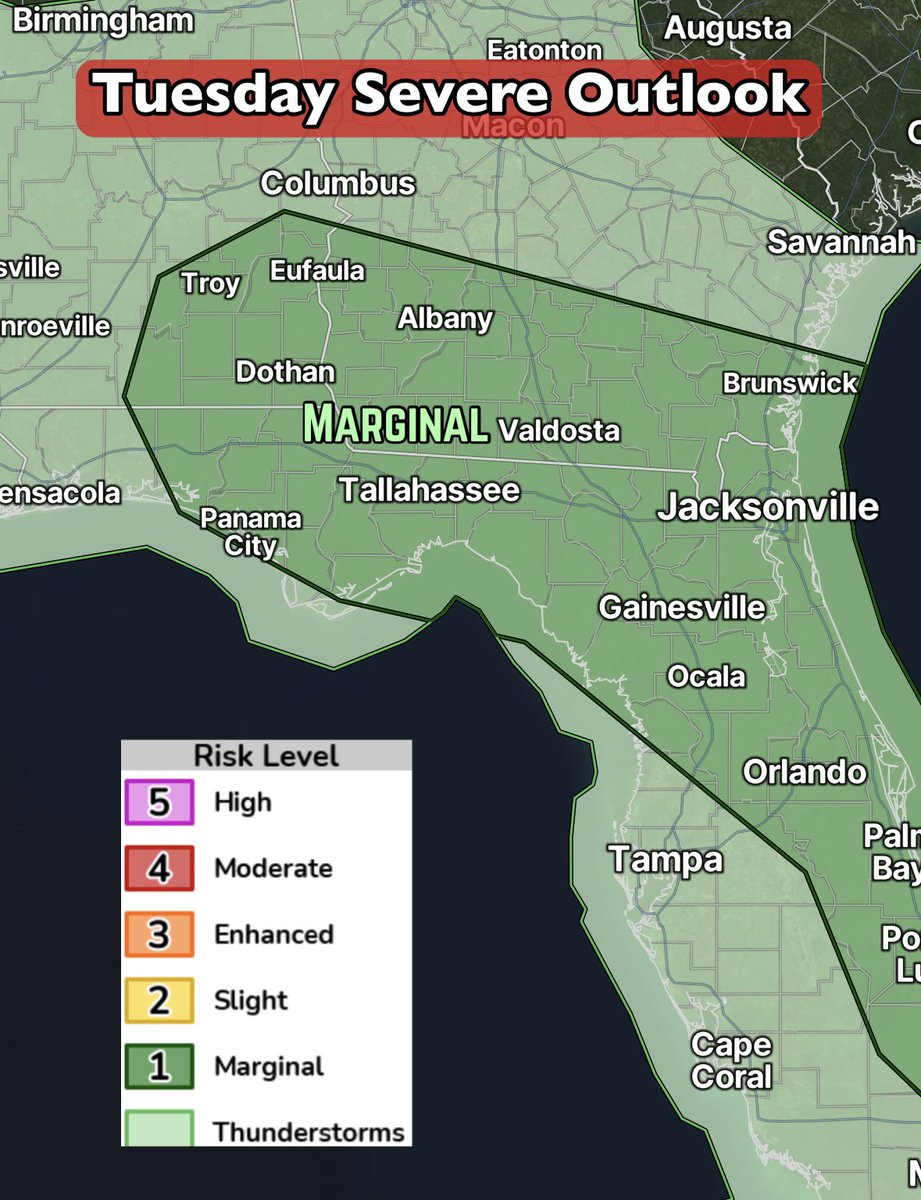
⛈️ Remain weather-aware Tuesday afternoon across the Southeast as isolated to scattered showers and thunderstorms will pop. The overall coverage is questionable, as you can see from two of the main short-range, hi-res models. The SPC has part of the area outlined under a Marginal Risk, level 1/5. Depends how this impulse moving in from the northeast triggers convection during the heating of the day.
🖊️ Bottom line: Any storms that form could produce gusty winds and some hail, along with heavy downpours and frequent lightning. The movement will be generally southward or south-southwestward. The threat will increase through the afternoon, then wind down Tuesday evening.

91
Jun 1
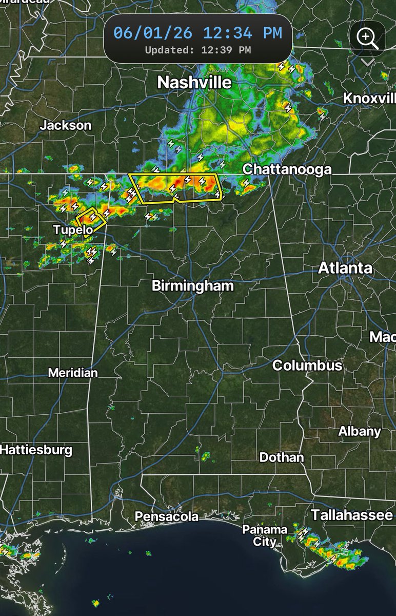
A significant line of showers and thunderstorms is moving southward across North Alabama early Monday afternoon. There’s certainly a chance this makes it into South Alabama this evening. A good day to keep an eye on the radar! ⛈️ Gusty winds are possible at times. 💨
1
3
199
May 31
More scattered showers and thunderstorms are on the way for Monday and Tuesday and a few stronger thunderstorms could produce gusty winds, frequent lightning and locally heavy rain.
The Storm Prediction Center has parts of the South outlined in a Marginal Risk for both Monday and Tuesday.
Looking at the latest guidance, Monday will feature scattered thunderstorms dropping southward. A few stronger cells may survive into Southeast Alabama, but widespread severe weather is not expected. Tuesday looks similar with scattered afternoon and evening thunderstorms, some capable of brief strong wind gusts. The overall severe threat remains isolated, but worth recognizing and paying attention to.

1
103
May 31
A definite westward shift this weekend in the placement of weak energy in the Gulf over the days ahead. Looks like the focus will be towards Texas later in the week with deep moisture, while high pressure takes hold over the Southeast.
🌧️ Wet weather in Texas/Louisiana.
☀️ Dry stretch for Alabama/Georgia/Carolinas/much of Florida.
🏖️ Beach plans looking good!
🚜 Outdoor work made easier!
Lots of model support for this - I’ll keep watching it.
1
4
366
May 27
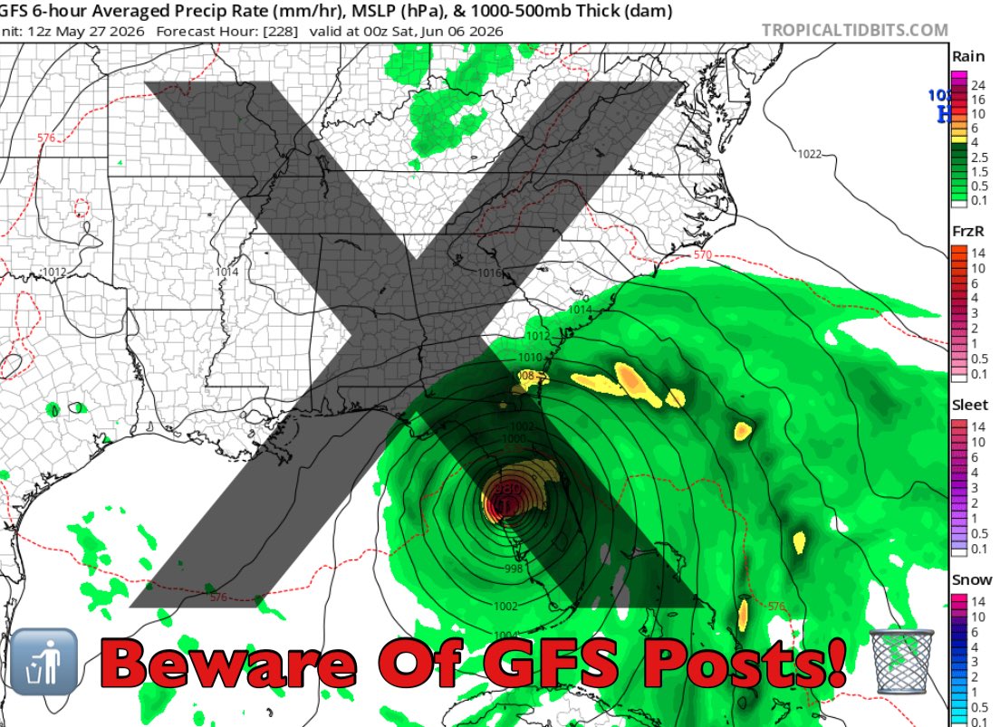
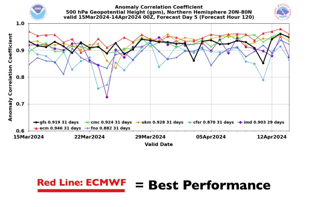
Quick reminder as we approach tropical season. If you’re seeing the GFS model posted with crazy phantom storms, question it. Tropical forecasting is WAY more complicated than posting a GFS run. It’s an inferior model as-is and the latest 30-day model verification reinforces that. Unless/until there’s development consensus with the various ensemble data and AI modeling, there’s not much to worry about. GFS posts are usually for engagement farming.
1
110

May 26
View of the Monday evening tornado in Henry County, AL, courtesy of Savana Glover, looking from 134E towards CR15.
1
6
551