New Zealand's weather service. Helping Kiwi's be ready, whatever the weather.
- Tweets 53,736
- Following 1,418
- Followers 147,689
- Likes 11,776
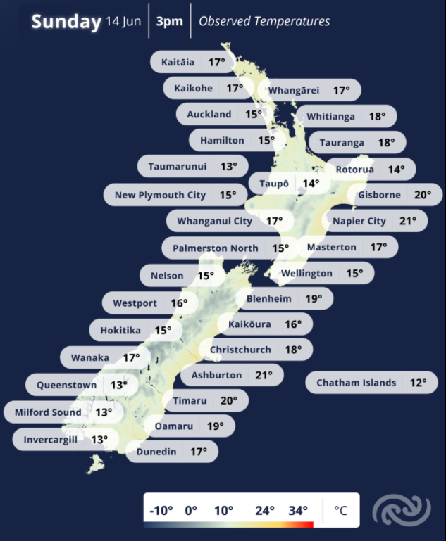


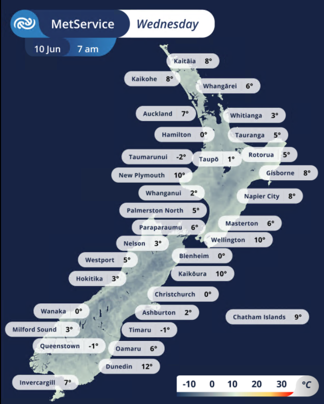

ALT Map of NZ with observed temperatures around the country at 7 am, 10 June 2026.
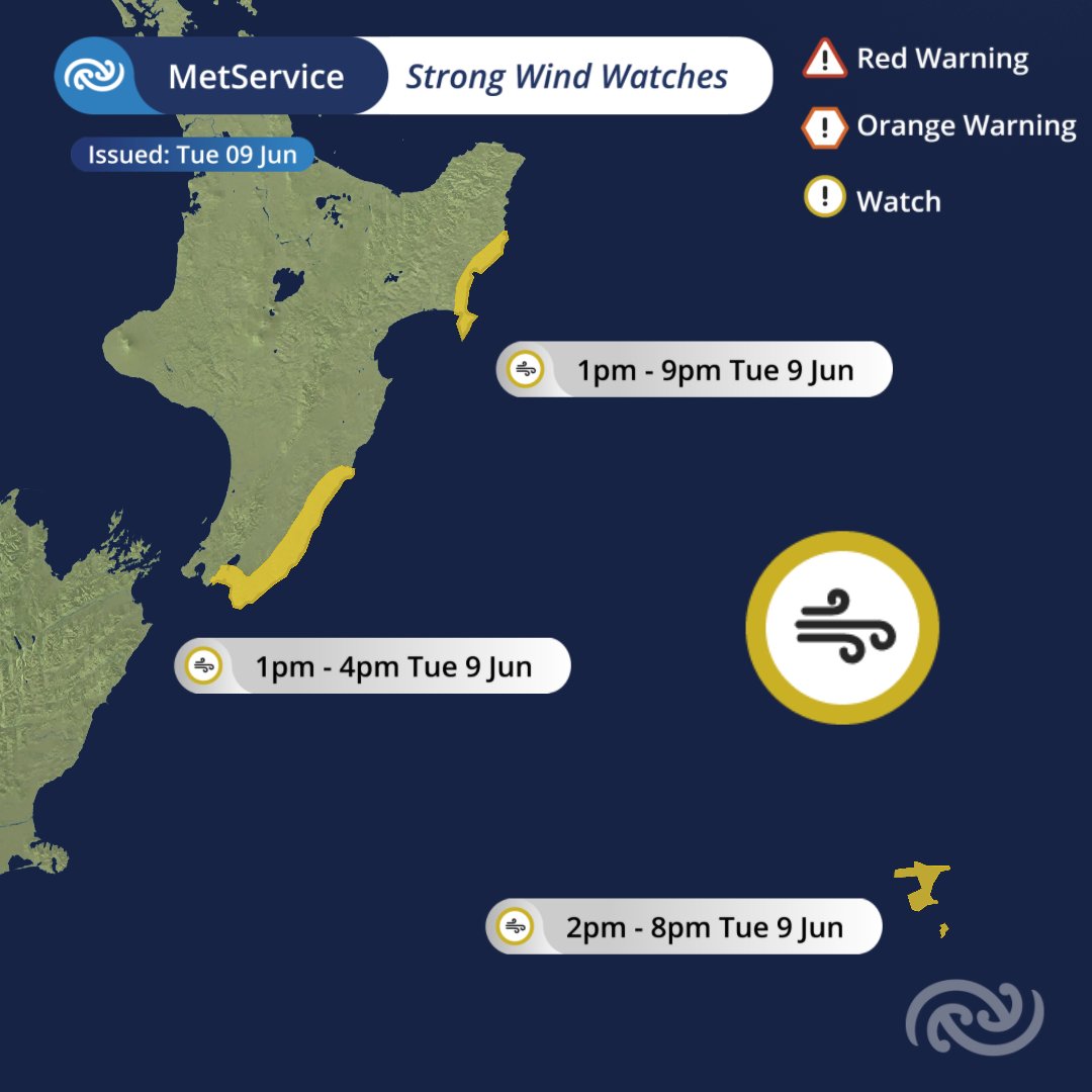
ALT Map of Aotearoa New Zealand with strong wind watch areas highlighted in yellow. A heading at the top reads "Metsevice Strong Wind Watches, Issued Tuesday 9 June". A legend in the top right shows a red triangle icon labelled "Red Warning", an orange hexagon icon labelled "Orange Warning", and a yellow circle icon labelled "Watch". Coastal parts of Gisborne/Tairawhiti and Hawke's Bay, from Tolaga Bay to Mahia Peninsula are highlighted yellow, with a yellow circle icon with a wind symbol in the centre, and a label reading "1pm to 9pm Tuesday 9 June". Coastal parts of Wairarapa and the Tararua District are highlighted yellow, with a yellow circle icon with a wind symbol in the centre, and a label reading "1pm to 4pm Tuesday 9 June". The Chatham Islands are highlighted yellow, with a yellow circle icon with a wind symbol in the centre, and a label reading "2pm to 8pm Tuesday 9 June". A large yellow circle icon with a wind symbol in the centre lies over the ocean.