
entrepreneur | owner of weather station
Joined May 2018
- Tweets 316
- Following 0
- Followers 31
- Likes 2
Photos and videos
Pinned Tweet

12 May 2018
i've been using davis vantage vue for more than 2007. one of the best weather station i'd recommend in 2018.
weatherstationlab.com/review…
do read those guides. #weatherstation
1
1 Jun 2018
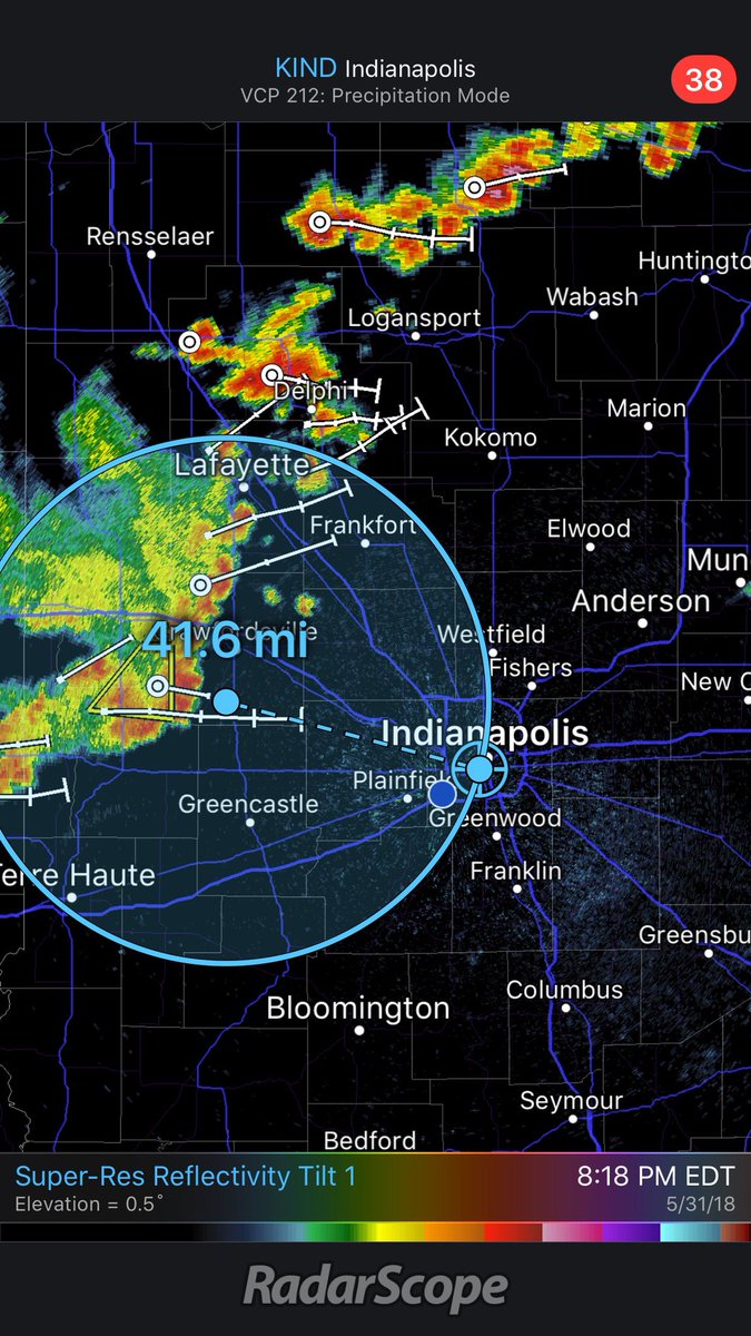
RT KristaMcEnany: Storms are a little over 40 miles away. For those of you who are enjoying the indyindians game with me, we have about an hour (give or take) before these pass by. At this pace, we might have the game in by then! #INwx theWXauthority FOX…
1 Jun 2018
Yes however, strength is waning. Could be thundery downpour 9:30 to 10 pm. x.com/NellysDraft/status/100…
1 Jun 2018

Do you think these storms will hit Avon? And if so, will they have any power to them?
1 Jun 2018
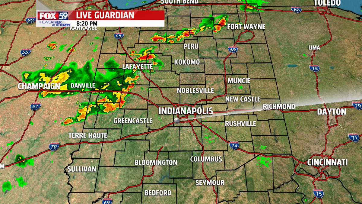
RADAR UPDATE: ESE bound storms will struggle with intensity & mainly become gusty, rain makers. Stable air building in just after 8:10 pm Thu #INwx

31 May 2018
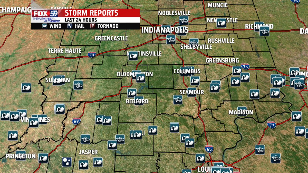
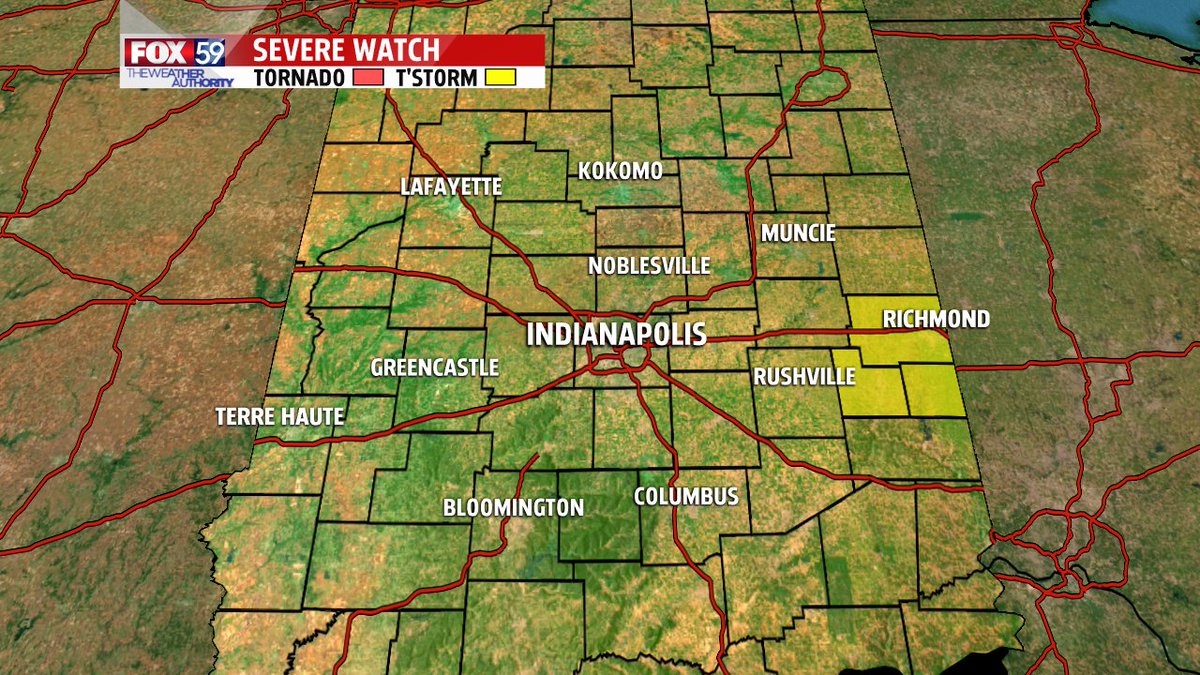
WEATHER ALERT: Severe Thunderstorm Warning for Parke County in IN until 8:30pm EDT. Fox59 #INWX
31 May 2018
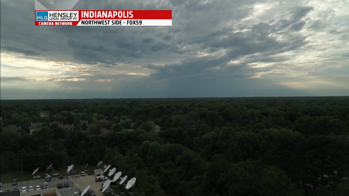
View of severe warned tstorms entering western IN from our FOX59 CBS4Indy studio camera. Radar scans storm to 40k feet #INwx


31 May 2018
WEATHER ALERT: Severe Thunderstorm Warning for Parke County in IN until 8:15pm EDT. Fox59 #INWX
31 May 2018
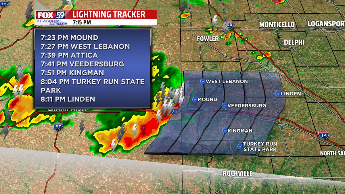
UPDATE: new t-storms (east bound) are entering Indiana just after 7:15 pm Thursday. NEW STORMS are developing and have favorable environment to expand east. "Cap" (storm suppressing) here holds for now
31 May 2018
NEW STORMS are developing and have favorable environment to expand east. "Cap" (storm suppressing) here holds for now #inwx

31 May 2018
What a strange spring! Entering May among the coldest on record then every day above normal in May. Temps end 50/50 split falls & middle of the pack #inwx

31 May 2018
A hot and stormy end to meteorological spring. New storm threat returns tonight. More in my update below #inwx via.fox59.com/pmgDH
31 May 2018
RT KristaMcEnany: Hanging out behind home plate with Ashley with kibiorg. Part of the proceeds from tonight’s indyindians game will go to Keep Indianapolis Beautiful. Just use promo code BEAUTIFUL when buying your tickets online. You still have time! Fir…


31 May 2018
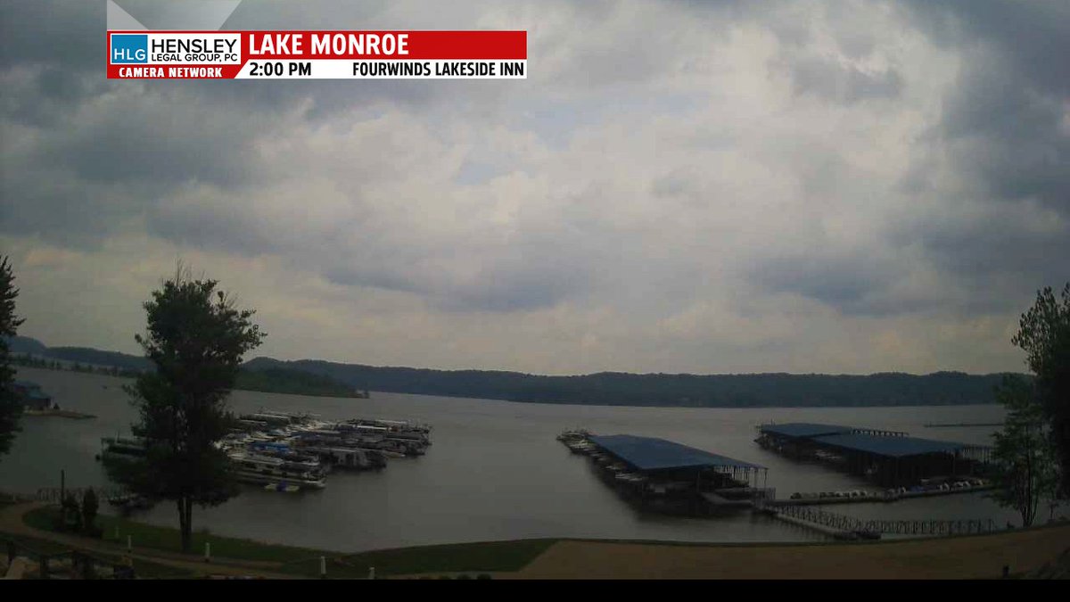
Acuriousdog tmm6043 SeanWTHR Our cam has stopped FourwindsFun around 2:00 pm. Guessing power outage #inwx
31 May 2018
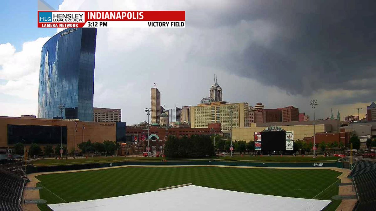
Three snap shots of the day from our Fox59 cam at Victory Field. New storms are poss for indyindians game later tonight. #inwx


31 May 2018
In the wake of the the storms an out flow of cooler air sweeping north. Couldactivate new storms but for now a lull and a cool down for some.
A lull developing in the wake of earlier storms.... facebook.com/permalink.php?s…