
This account is inactive. Follow @NASAEarth and subscribe to our newsletter for data releases and other Earthdata news: earthdata.nasa.gov/subscribe
- Tweets 6,515
- Following 379
- Followers 39,503
- Likes 1,973


ALT This Day/Night Band image from the VIIRS instrument aboard the Suomi NPP satellite features an aurora in the northern hemisphere on February 22, 2017. Credit: NASA Worldview
ALT Satellite imagery of the Great Salt Lake in Utah, USA.

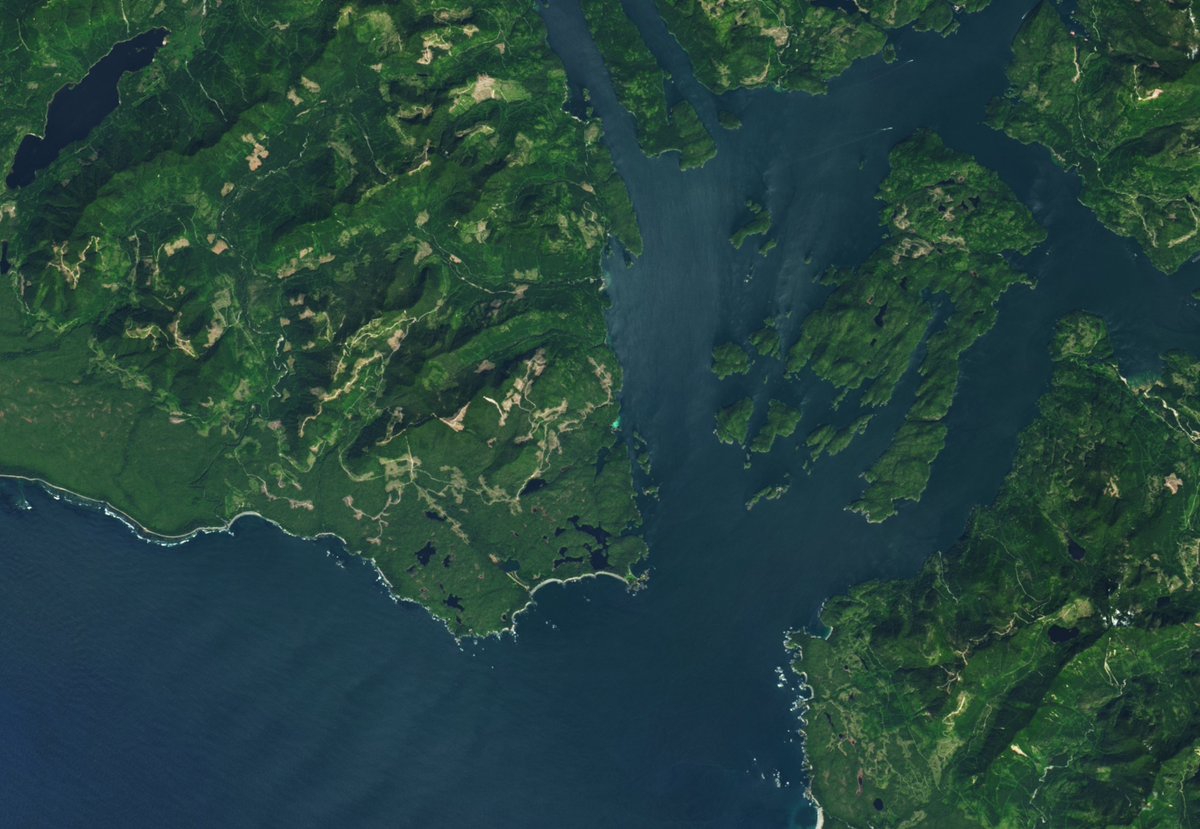
ALT Satellite image showing a coastline with many islands and inlets. The land is lush green and mountainous, surrounded by dark blue waters. In one area, right next to the coastline, there is a bright turquoise glow in the water.

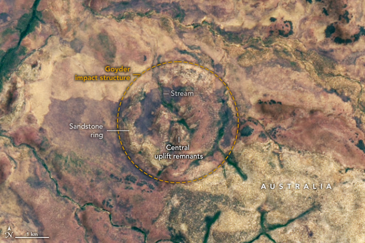
ALT A satellite image shows the land surface of part of Australia’s Northern Territory. A yellow circle in the center of the image highlights the location of the Goyder impact structure, the eroded remnants of the central uplift portion of an impact crater. The central uplift remnants appear as small hills in the center of the circle, with a light-colored ring of sandstone surrounding them. Most of the dry-looking surface is tan or red, but stream valleys are green. The image was acquired by Landsat 8 on November 6, 2024.
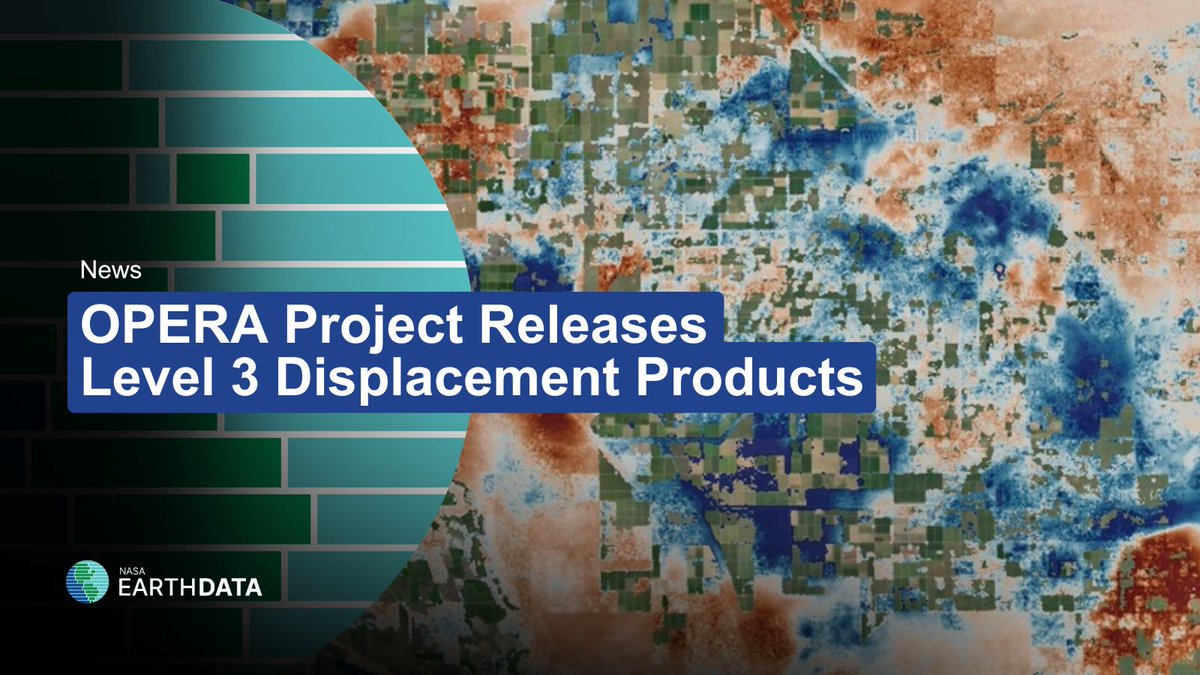
ALT Satellite imagery in the background with overlaid text that reads, "OPERA Project releases Level 3 displacement products."
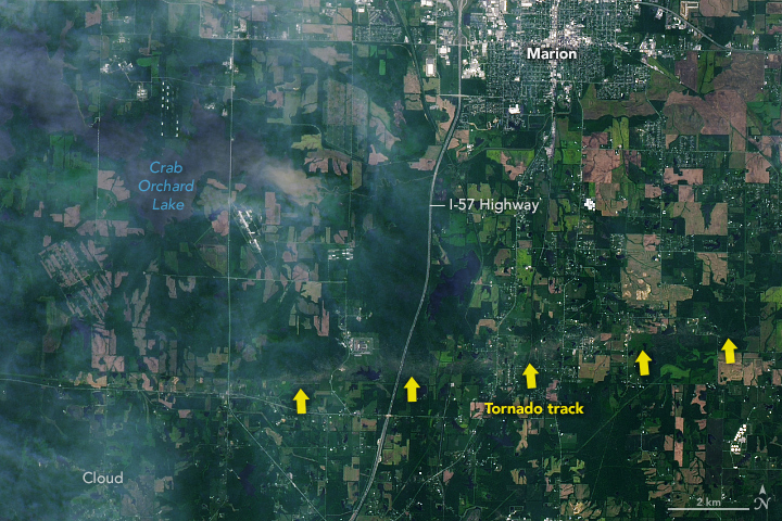
ALT A satellite image shows a patchwork of green spaces in southern Illinois. A tornado track cuts through the vegetation from west to east. Large yellow arrows have been added to point to the tornado track. Marion, Illinois is visible at the top of the image and the I-57 Highway cuts through north to south.
ALT April 2025 global surface air temperatures and precipitation data released.