
NASA’s favorite (habitable) planet. 🌎💚 Studying Earth from ground to orbit.
- Tweets 24,844
- Following 86
- Followers 3,730,372
- Likes 2,905

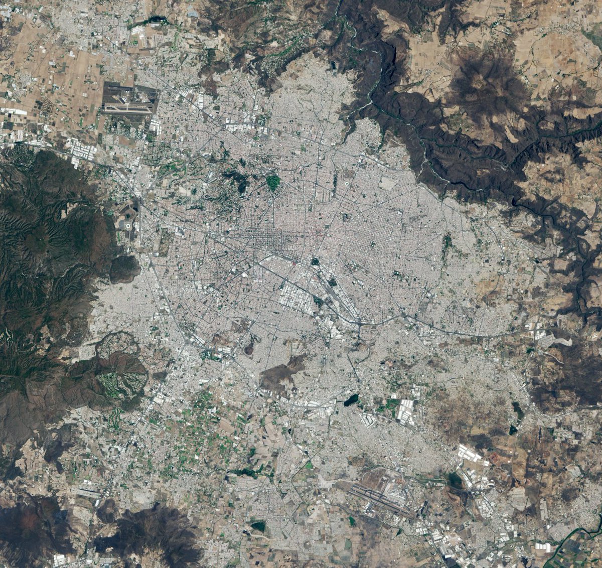


ALT Landsat 8 satellite image of Guadalajara, Mexico. The sprawling gray city dominates the image and is surrounded by grids of farmland and dark mountain ranges.
ALT Four people with backpacks pause to examine rocks on a hillside under a clear blue sky, with a large orange and tan boulder in the foreground. Credit: NASA
ALT Photograph of three soccer balls on green grass. There is red and white painted concrete visible in the bottom left corner of the image. A person’s foot, clad in a tennis shoe, is visible near the bottom of the photo, indicating that the person is taking a photograph straight down at the ground below their feet. Credit: NASA GLOBE
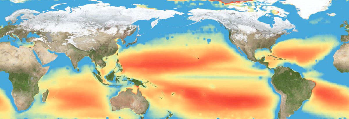
ALT A flat map of the world showing regions in the ocean colored red to indicate the areas of highest nutrient-related stress. Large red bands are seen across the Pacific, Atlantic, and Indian Ocean. Credit: NASA
ALT Artist’s illustration of the twin spacecraft of the GRACE-FO mission. The two satellites look similar and look like they are following each other as they orbit Earth. Below the satellites, parts of Central and South America are visible as green land masses surrounded by dark blue water. Credit: NASA/JPL-Caltech
ALT The Artemis III crew poses for an official portrait (from left: Andre Douglas, Luca Parmitano, Randy Bresnik, Frank Rubio).


ALT Satellite image of the Benguela Current off the southwestern coast of Africa, showing green and blue swirls of plankton blooms. The image was captured by PACE’s Ocean Color Instrument on May 16, 2025. Credit: NASA
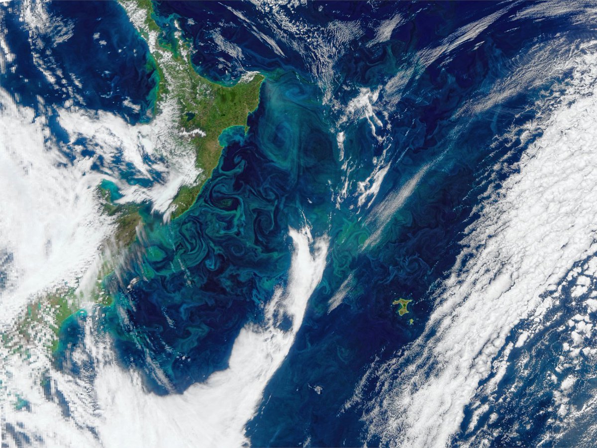
ALT Satellite image of a phytoplankton bloom off the east coast of New Zealand. Green and blue swirls extend toward the Chatham Islands near the center. This image was captured by PACE’s Ocean Color Instrument on November 6, 2025. Credit: NASA

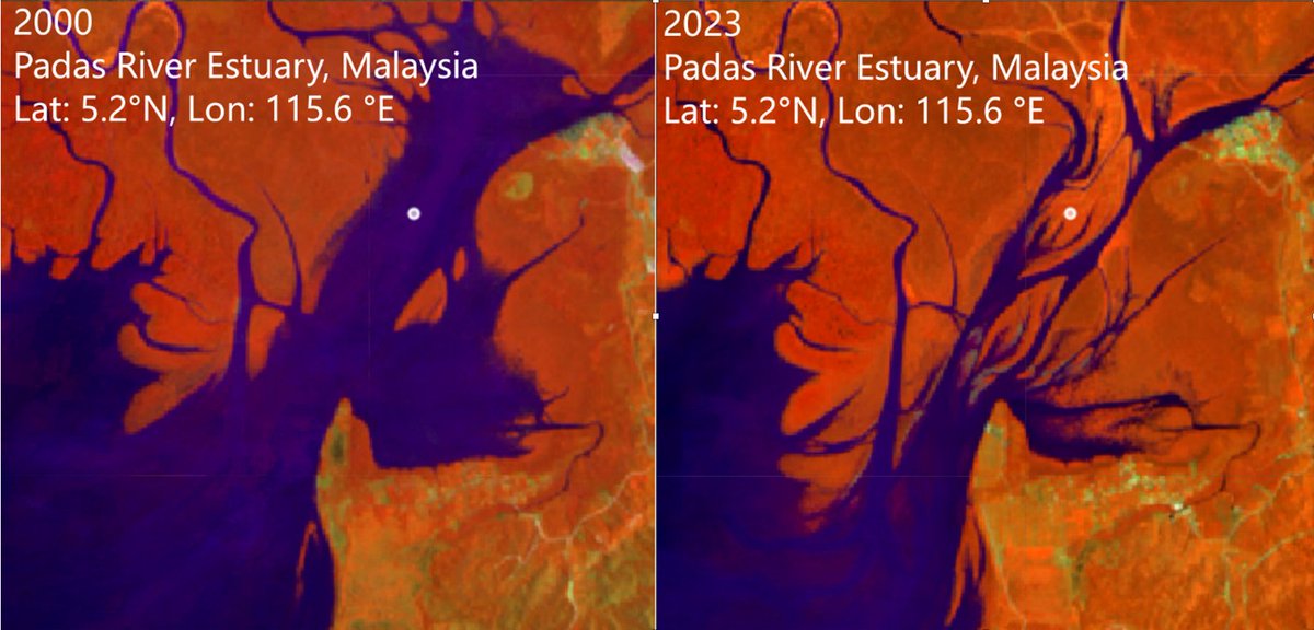
ALT Before and after Landsat satellite images show increased coverage of mangrove forests. The images are from the Padas River Estuary in Malaysia in 2000 and 2023. The estuary channels are in dark purple, while the surrounding land is in orange with spots of green. Credit: Zhen Zhang, Tulane University