
Official operational X account of the National Hurricane Center for the Atlantic basin. More details: weather.gov/nws_x
Joined May 2011
- Tweets 15,563
- Following 76
- Followers 1,351,528
- Likes 21
4,689 Photos and videos
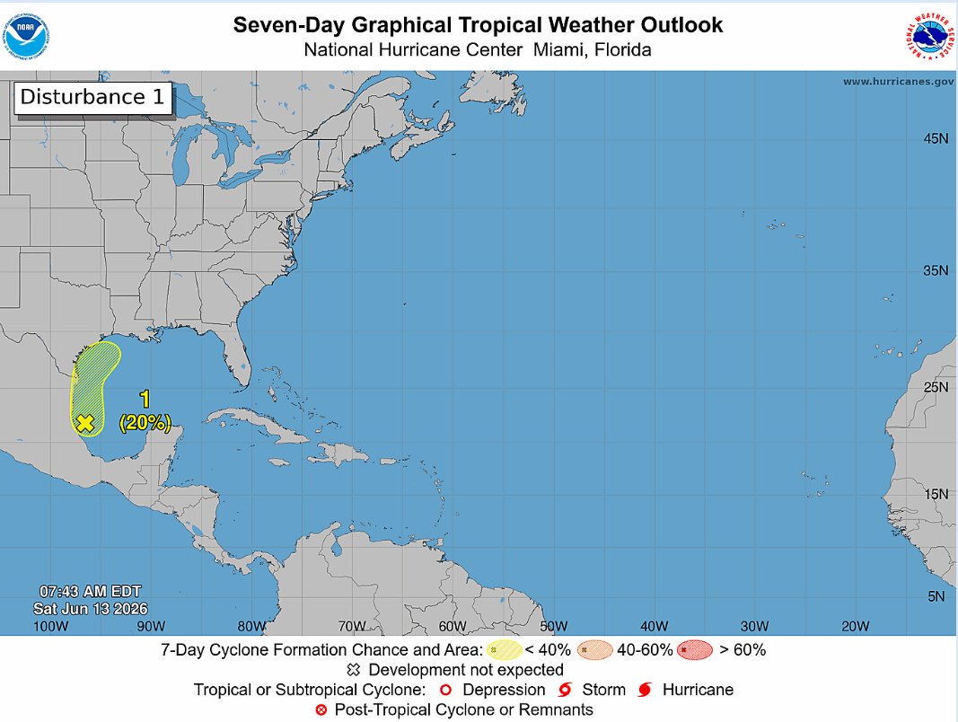


Sat 8 am EDT: We are still watching a broad area of low pressure over the southwestern Gulf with a 20% chance of formation during the next week. For more tropical information, check out hurricanes.gov or your local forecast at weather.gov
12
100
468
44,782
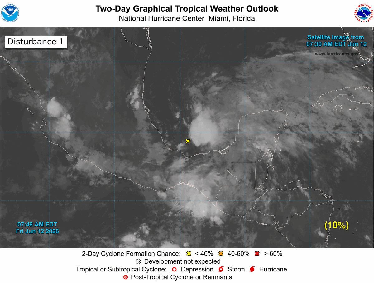
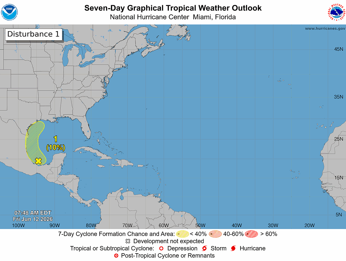
8 am EDT Fri, Jun 12: A broad area of low pressure over the southern Bay of Campeche is producing disorganized showers and thunderstorms. Any development before the system moves inland over eastern Mexico this weekend is expected to be limited. The system could re-emerge over the northwestern Gulf next week, but formation chances remain low (10%) through 7 days.
Monitor hurricanes.gov for the latest forecast.
10
96
413
47,657
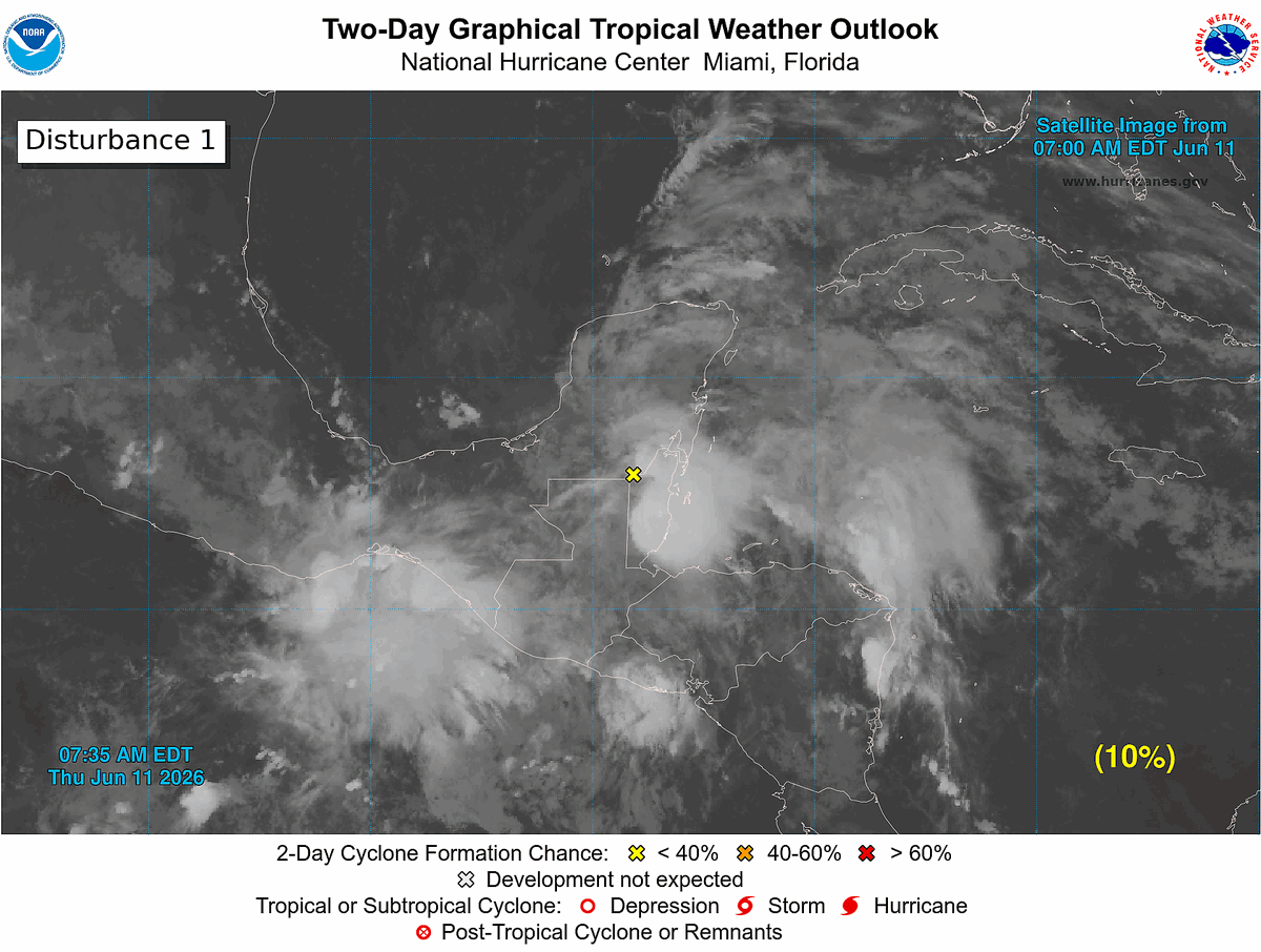
8pm EDT 11 Jun -- We are continuing to monitor the Bay of Campeche where a broad area of low pressure is likely to form on Friday. The system still only has a low chance (10%🟡) to become a tropical cyclone before it moves inland over eastern Mexico by Sunday.
Latest Outlook: hurricanes.gov/gtwo.php?basi…
ALT 7 Day Tropical Weather Outlook highlighting the disturbance in the Bay of Campeche.
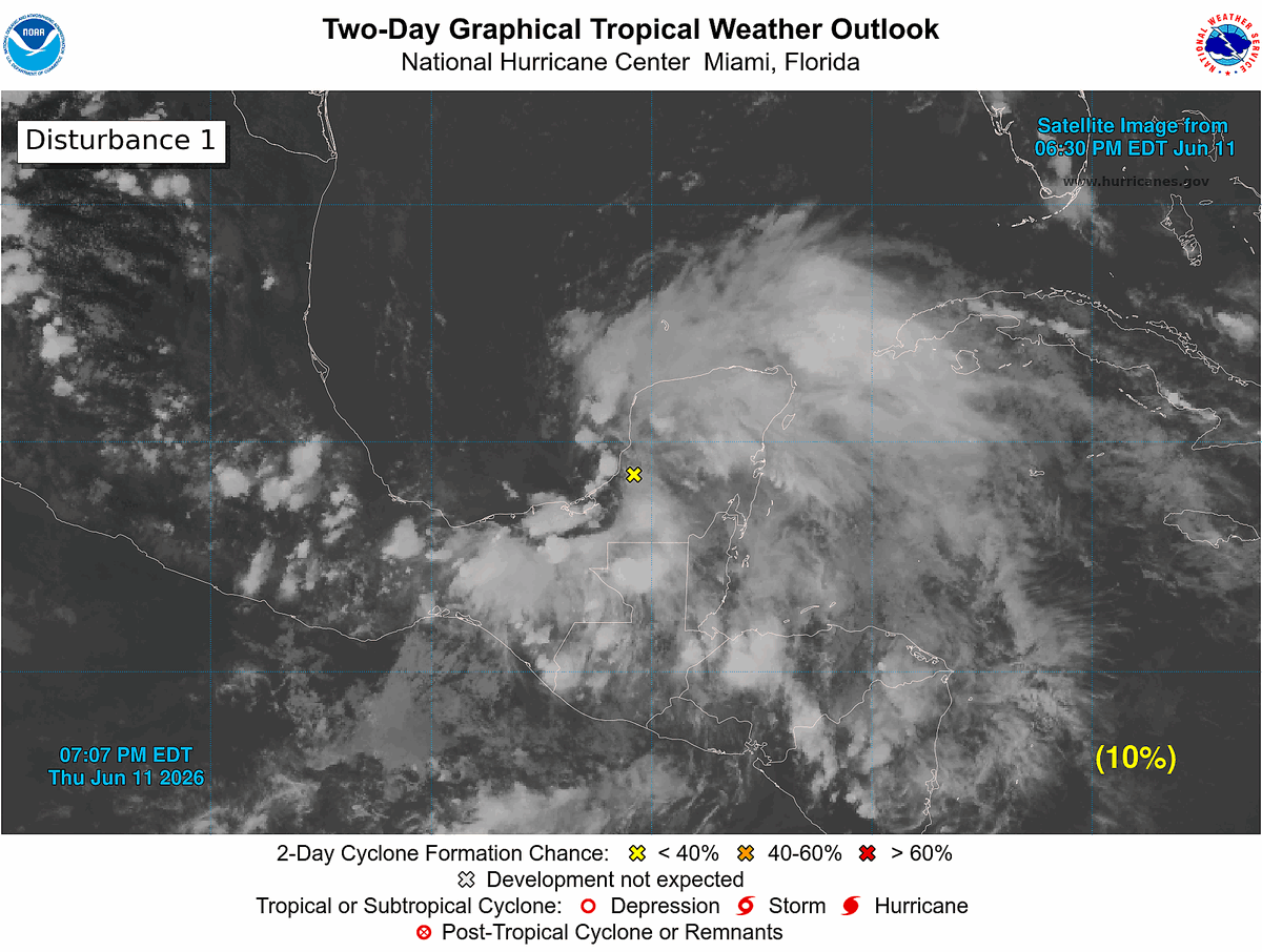
ALT 2 day Tropical Weather Outlook highlighting the disturbance moving into the Bay of Campeche.
3
73
387
46,731
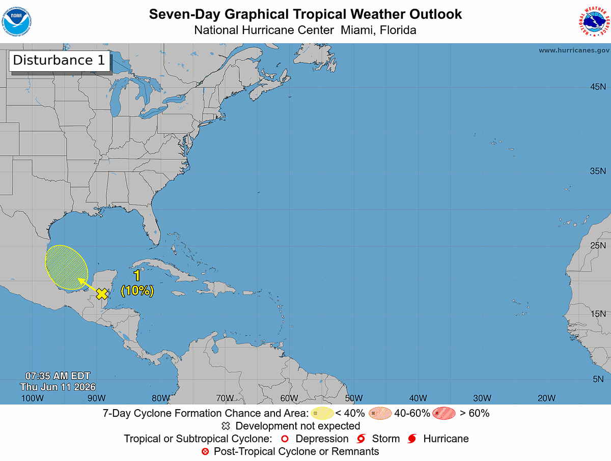
8 AM Thu, Jun 11: The Bay of Campeche is the only area of interest in the tropics right now. A tropical wave moving west across the Yucatán Peninsula could spawn a broad low-pressure area on Friday, but conditions are only marginally favorable for development before the system moves inland over eastern Mexico this weekend.
📈 Development chances remain low:
• 10% in 48 hours
• 10% in 7 days
Visit hurricanes.gov for the latest info.
3
77
344
42,955
8 PM EDT Wed, 6/10: A broad area of low pressure could form over the Bay of Campeche on Friday from a westward-moving tropical wave located over the NW Caribbean Sea. Environmental conditions are forecast to be only marginally conducive (10% chance) for development, and the system should move inland over eastern Mexico by late this weekend. Follow the latest at hurricanes.gov
ALT Seven-Day Graphical Tropical Weather Outlook. Disturbance 1: A yellow X is highlighted over the northwestern Caribbean and is forecast to move into the Bay of Campeche by Friday, where there is a 10% chance of formation within the next 48 hours and the next 7 days.
5
100
354
55,011
8 AM EDT Wednesday, June 10: A broad area of low pressure could form over the Bay of Campeche later this week. The system has a low chance (10%) of formation before it moves inland over eastern Mexico over the weekend. Follow the latest at hurricanes.gov
9
123
475
61,110
As the 2026 Atlantic hurricane season begins, NHC Director Dr. Michael Brennan shares an important message about hurricane preparedness.
Learn more at hurricanes.gov and noaa.gov/hurricane-prep
6
65
149
49,985
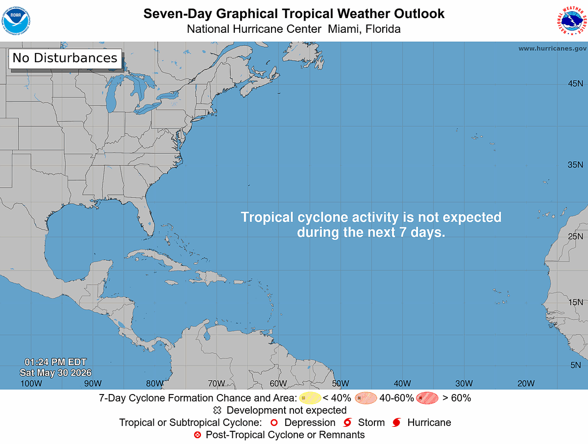
You probably haven't heard from us much since we began our Tropical Weather Outlooks on May 15--because the Atlantic has so far been quiet!
Tropical cyclone formation is not expected over the next 7 days as approach the first official day of hurricane season on Monday, June 1. Be sure to check hurricanes.gov daily for the latest.
27
188
1,210
98,131
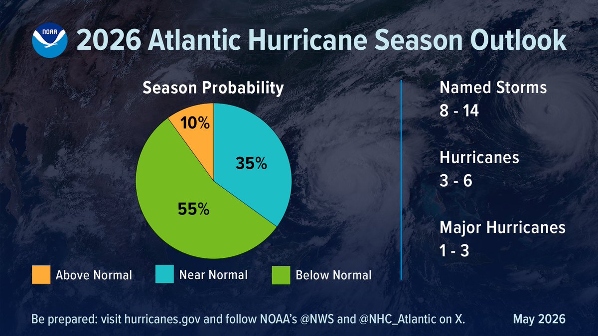
Remember, even if the Atlantic hurricane season ends up being below to near normal, it only takes one storm in your community to make it a bad hurricane season for you. Prepare this year like you would any other!

Atlantic #HurricaneSeason Outlook 2026: 8-14 named storms of which 3-6 could become hurricanes, including 1-3 major hurricanes:
bit.ly/2026AtlanticHurricane…
@NWSCPC #HurricaneOutlook #WeatherReadyNation
17
168
434
113,084
Now is the time of year we begin monitoring "tropical waves" that move off the west coast of Africa over the Atlantic Ocean. Tropical waves can develop into tropical cyclones if conditions are just right.
Fortunately, we are not expecting tropical cyclone development over the Atlantic for the next 7 days: hurricanes.gov
11
53
235
39,247
The National Hurricane Center is testing its communication systems for the upcoming hurricane season. While we prepare our systems, please take time to prepare your home and family. Determine your risk and develop a plan today: noaa.gov/hurricane-prep
2
43
181
27,581
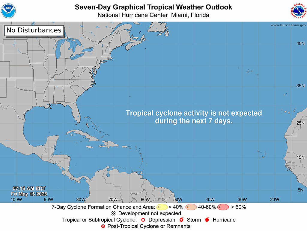
The first Atlantic Tropical Weather Outlook of 2026 is out.
Good news: No tropical cyclone formation is expected over the next 7 days across the Atlantic, Caribbean Sea, or Gulf.
Today (May 15) marks the start of daily Tropical Weather Outlooks, issued through Nov 30 at 2 AM, 8 AM, 2 PM, and 8 PM EDT.
Stay informed all season long: hurricanes.gov
19
392
1,352
130,223
Do you know the difference between a Tropical Cyclone Public Advisory, a Tropical Cyclone Discussion, and a Tropical Weather Outlook?
Before hurricane season ramps up, take a few minutes to brush up on the products issued by the National Hurricane Center.
NHC just updated its guide explaining what each product is, who it’s for, and when it’s issued: nhc.noaa.gov/pdf/NHC_Product…
2
41
155
27,829
Did you know that rip currents are the 3rd-highest cause of fatalities in the U.S. from tropical cyclones? Rip currents are the hidden hurricane hazard. noaanhc.wordpress.com/2025/0…
1
29
125
34,131
As part of Hurricane Preparedness Week, NHC is encouraging you to build your knowledge kit. For day 7 of preparedness week, Lisa Bucci will be discussing the Tropical Weather Outlook. youtube.com/shorts/20jOQnagu…
10
81
49,478
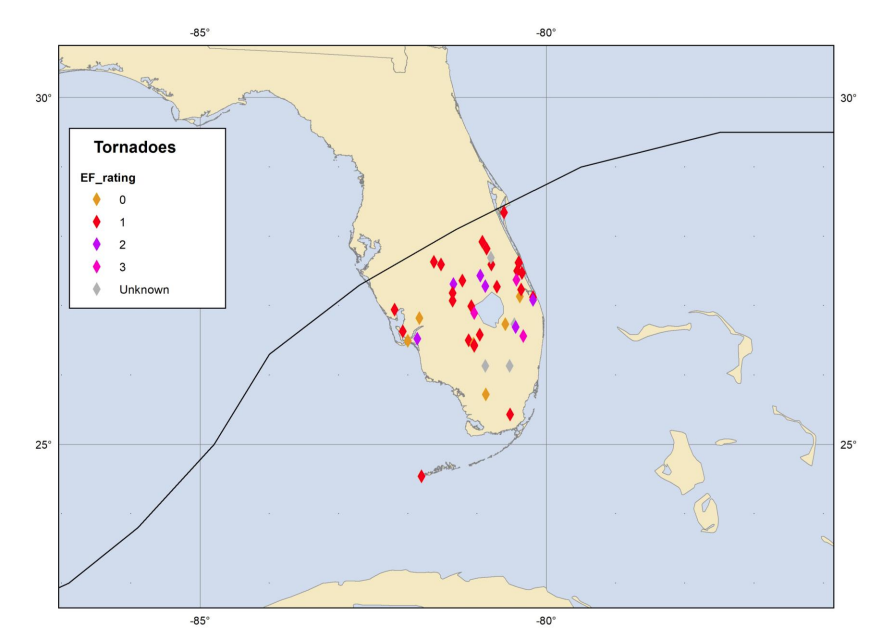
Hurricanes can produce tornadoes, on average 70% of hurricanes produce at least one tornado. Tornadoes can occur far away from the center of the storm and may occur even a few days after landfall. Below is an example of confirmed tornadoes from Hurricane Milton in 2024.
9
71
434
52,380
Take action TODAY to be better prepared. Even if you’re already well-prepared, there is always more to learn. Understand your risk from water & wind! Find out if you live in a flood-prone area or evacuation zone, and know your home’s structural risks youtube.com/watch?v=xmpu_VHs…
2
12
68
40,721
Are you ready for hurricane season? Take action TODAY to be better prepared for when the worst happens. Even if you feel ready, there may be additional things you could do or learn. #HurricanePrep #HurricaneStrong
noaa.gov/take-action-today #HurricanePrep #HurricaneStrong
5
22
93
27,026
Tropical Cyclone Series Part 3, How does the accuracy and consistency of NHC tropical cyclone track forecasts and compares them with the accuracy and consistency of the models that are used to make those forecasts. youtube.com/watch?v=RB1mTkgk…
10
75
44,820