
Chief meteorologist at KHGI-NTV and KFXL. Twreith@sbgtv.com. Love weather, sports, and being outdoors.
Joined January 2012
- Tweets 28,928
- Following 317
- Followers 3,547
- Likes 4,266
16,683 Photos and videos


Tim Reith retweeted
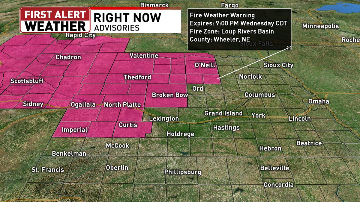
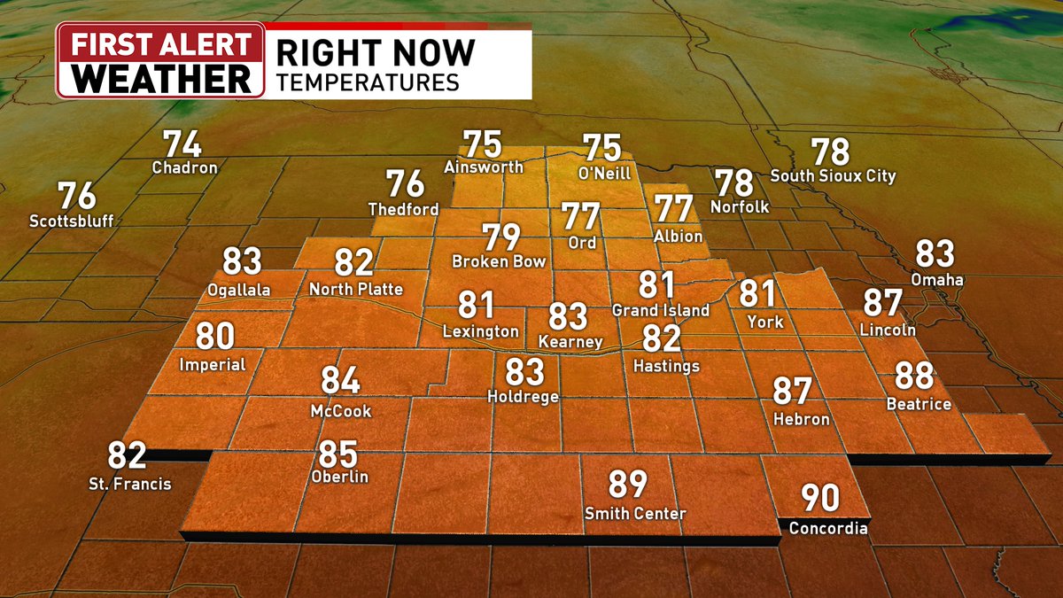
A Red Flag Warning is in effect for parts of northern and western Nebraska until 9 p.m. CDT. It is hot and breezy out there. Temperatures are already pushing 90 in some places with wind gusts 30 to 40 mph. Highs will be in the 80s and 90s this afternoon.

1
84


Jun 15
Monday evening forecast. Fairly quiet this week but the weekend looks damp.
4
313
Jun 15
6/15/26 4:22PM
A wonderful start to our work week with 4PM temps in the upper 70's and lower 80's.
96
Tim Reith retweeted

Jun 15
It will be a comfortably cool night with lows in the 40s for most of us. Go ahead and open those windows... if your allergies can handle it! Highs tomorrow will be right around 80, so another fantastic day!

1
124
Tim Reith retweeted
Jun 15
We had an incredibly gorgeous day with highs mainly in the 70s! Tomorrow will be slightly warmer with less wind, so another top tier day!

1
133

Tim Reith retweeted

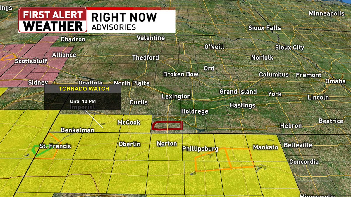
Jun 13
Flash Flood Warning including Republic KS until 8:45 PM CDT

2
1
719
Tim Reith retweeted
Jun 13
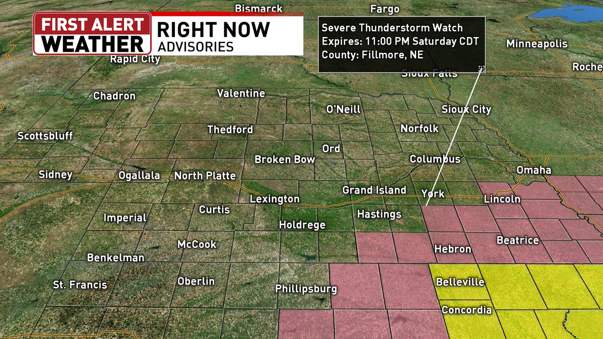
A Severe Thunderstorm Watch has been issued for parts of southeastern Nebraska and northern Kansas until 11 p.m. CDT. Republic County, KS is also in a Tornado Watch until 11 p.m. CDT.
1
171
Tim Reith retweeted

Jun 13
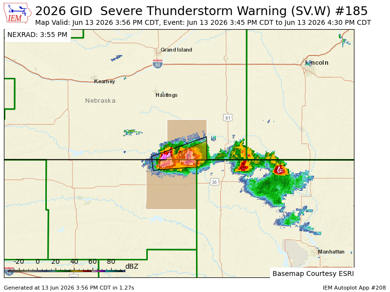
GID updates Severe Thunderstorm Warning [damage threat: CONSIDERABLE, wind: 60 MPH (RADAR INDICATED), hail: 1.75 IN (RADAR INDICATED)] (cancels Webster [NE], continues Jewell [KS] and Nuckolls [NE]) till 4:30 PM CDT mesonet.agron.iastate.edu/vt…
1
77
Tim Reith retweeted

Jun 13
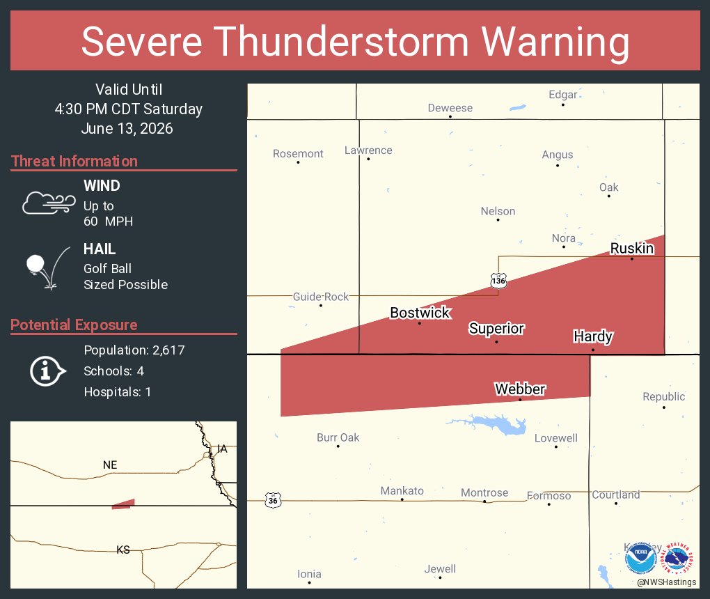
Severe Thunderstorm Warning continues for Superior NE, Hardy NE and Ruskin NE until 4:30 PM CDT. This storm will contain golf ball sized hail!
1
422
Tim Reith retweeted
Jun 13
I wouldn't be surprised to see some hail larger than quarters, especially around and just south of Superior.
1
192
Tim Reith retweeted
Jun 12
We have some cool and comfortable temps this morning with most of us in the 40s and 50s. The wind is pretty light right now, but later today, it will be 10-20 mph wind gusts around 25 mph for some. Highs will be mainly in the 80s with a few low 90s out west.
1
1
100
Tim Reith retweeted

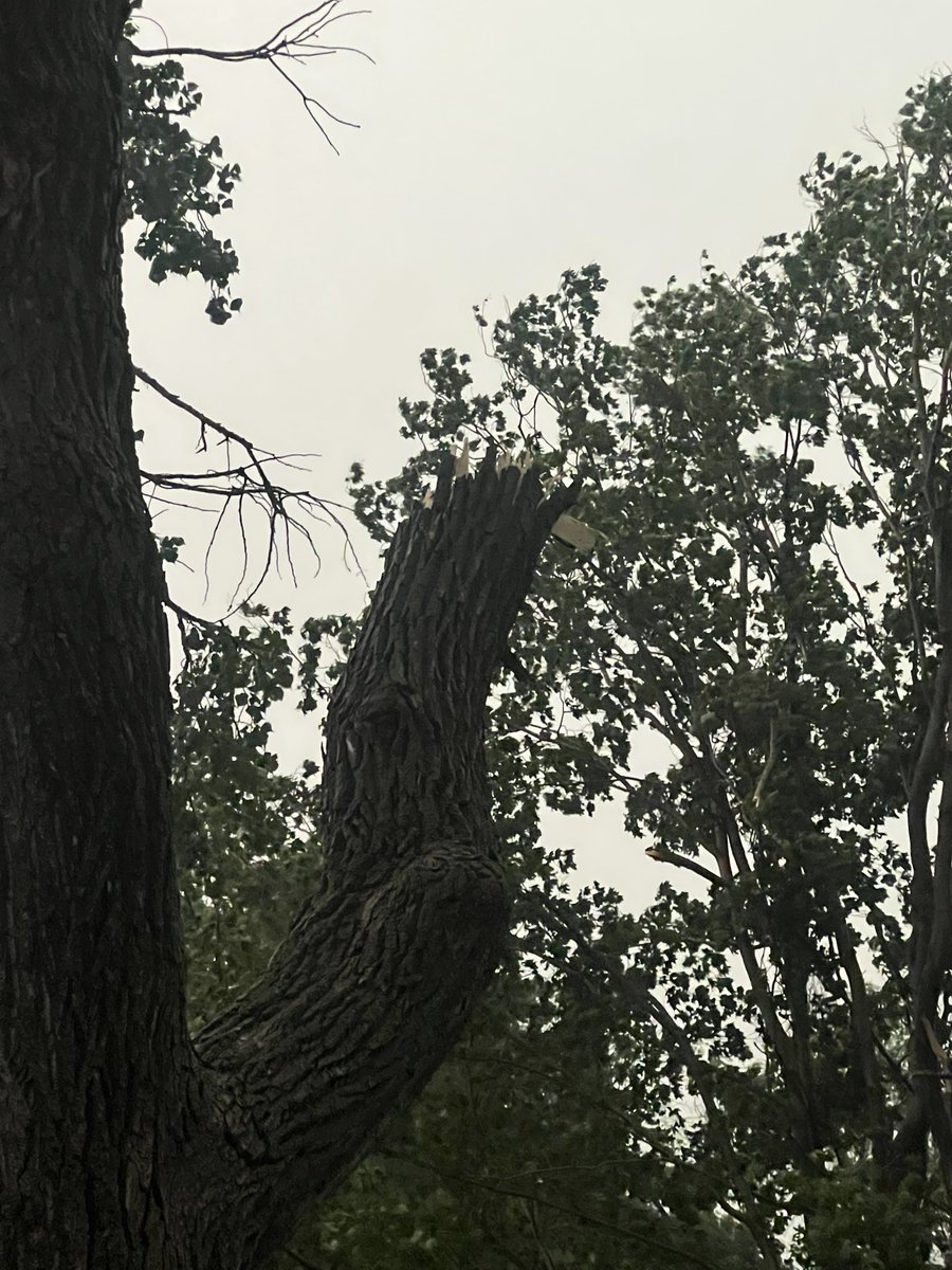
Jun 11
Little guy that touched down twice near Ipava Illinois a bit ago


2
2
13
636
Jun 11
Thursday evening forecast. Temps creep back up tomorrow but cool again by the weekend.
2
127
Tim Reith retweeted
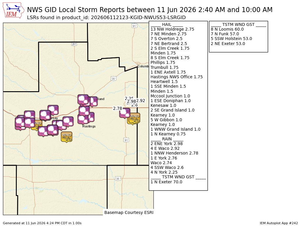
Jun 11
GID issues Summary Local Storm Report, 35 out of 35 reports were previously sent and not repeated here. mesonet.agron.iastate.edu/ls…
1
75
Tim Reith retweeted

Jun 11
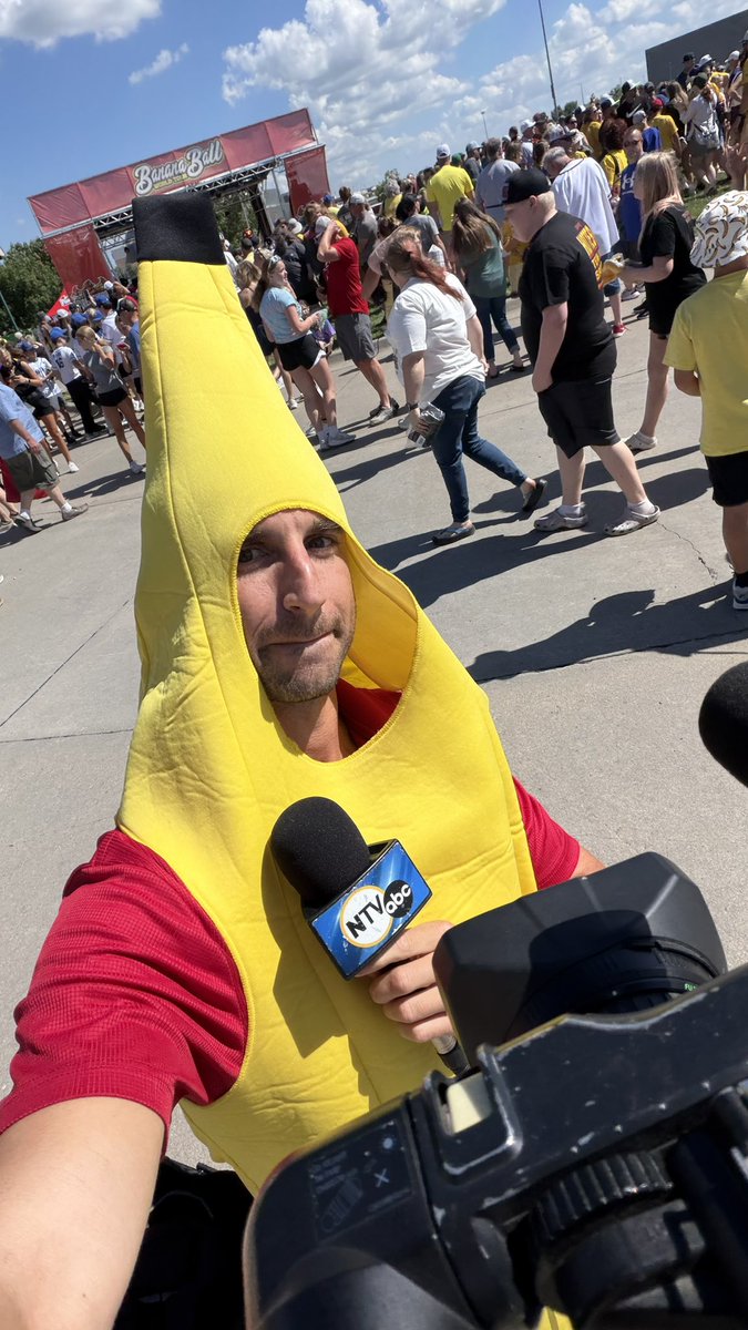
When banana ball comes to town, you have to dress the theme 🍌
Can’t wait for yall to see this report
@NTVNEWS

4
22
1,839
Jun 11
6/11/26 4:05 PM
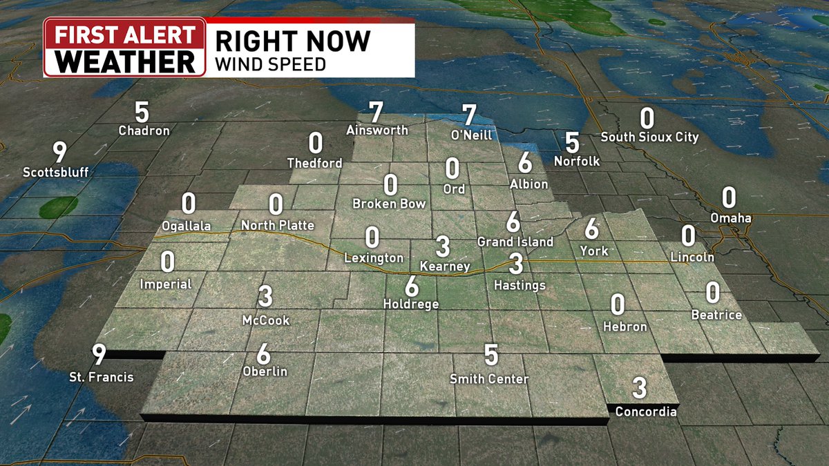
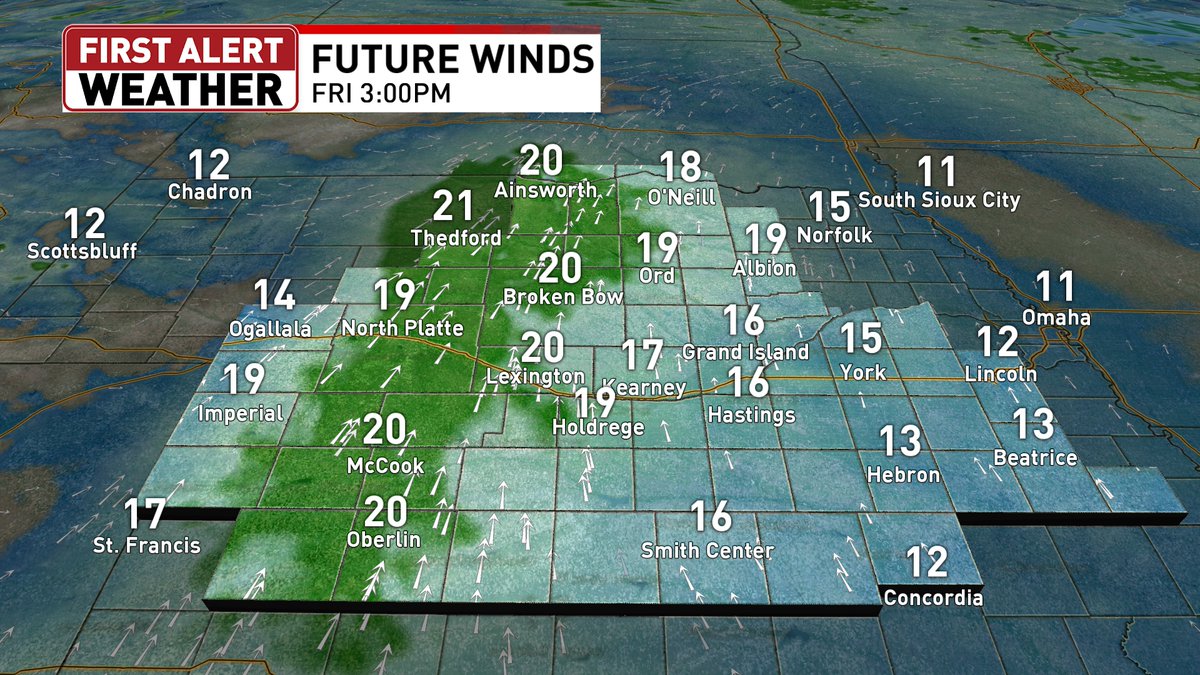
Temps are fantastic on our Thursday with most areas in the mid 70s but strong NW winds gusting 25-30 mph are a bit of an issue. A quiet night on the way with a bounce back in temps arriving for our Friday.

1
113
Tim Reith retweeted
Jun 11
At 2:40 AM CDT, 7 NE Bertrand [Phelps Co, NE] Public reports Hail of tennis ball size (E2.50 Inch). Report from Facebook of hail around 2.50 inches in diameter. Time estimated from Radar. #newx mesonet.agron.iastate.edu/ls…

1
1
130
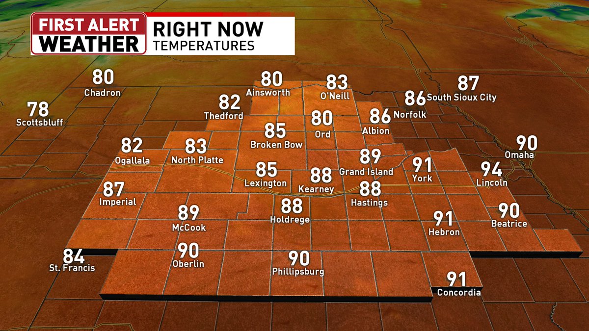
Jun 10
6/10/26 4:33PM
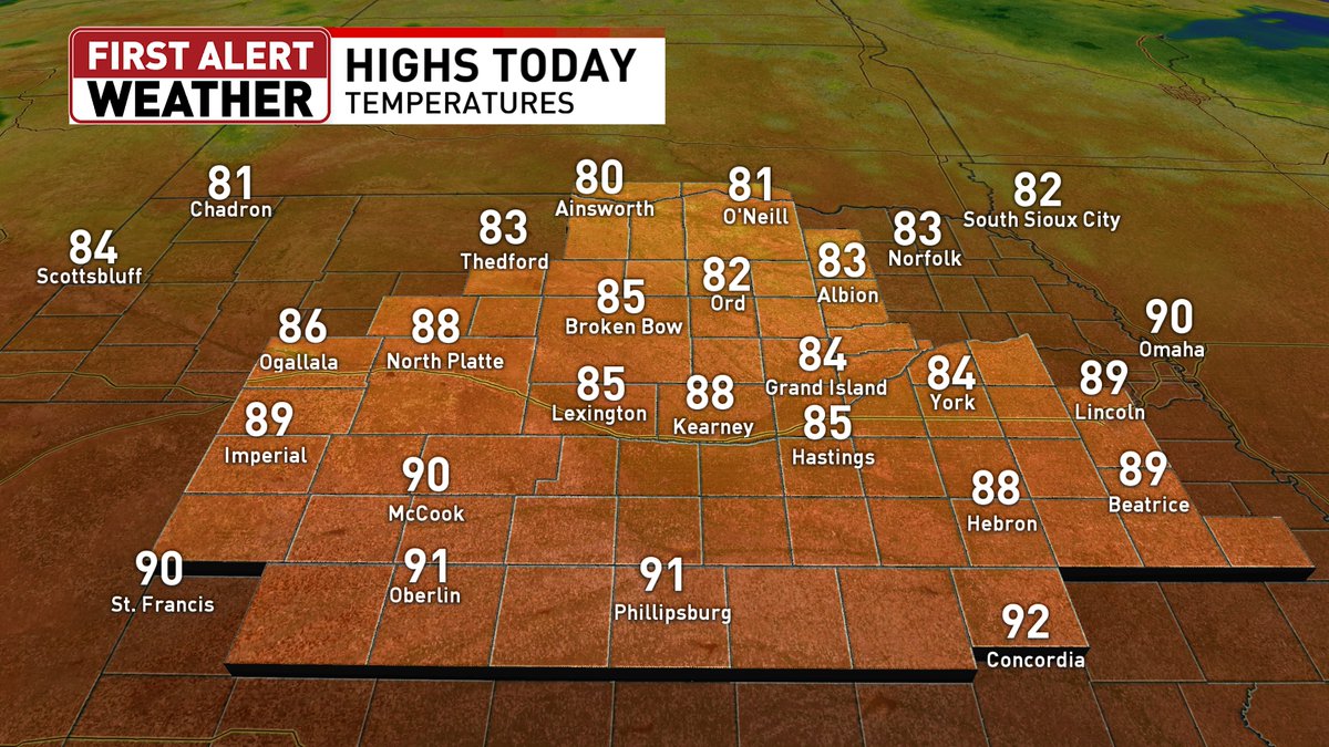
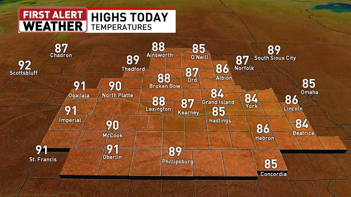
It's a hot one out there for Wednesday with 4:30 temps well into the 80's and 90's. Humidity values however much lower with drier air moving in. Tomorrow looks to be a much more comfortable day.

2
113