
Official X account for the National Weather Service Storm Prediction Center. Details: weather.gov/nws_x
Joined May 2012
- Tweets 138,399
- Following 163
- Followers 538,097
- Likes 176
87,110 Photos and videos
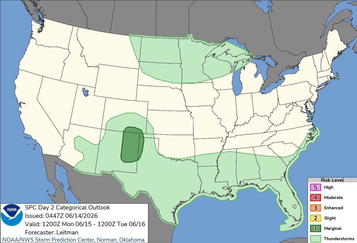


1:00am CDT #SPC Day2 Outlook Marginal Risk: across parts of eastern NM, southeast CO, and western parts of the OK/TX Panhandles spc.noaa.gov/products/outloo…
2
4
753
1
4
709
1
4
644
1:00am CDT #SPC Day1 Outlook Slight Risk: from northern Georgia northward into portions of southern New England spc.noaa.gov/products/outloo…
6
12
786
18
32
5,526
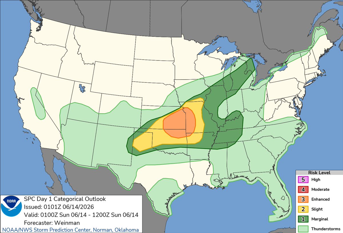
#SPC Jun 14, 2026 0600Z Thunderstorm Outlook spc.noaa.gov/products/exper/…
1
7
4,354
13
36
8,128
11
34
8,503
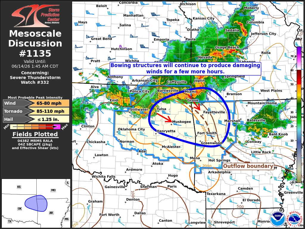
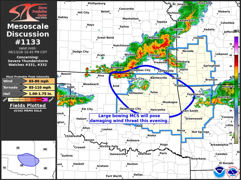
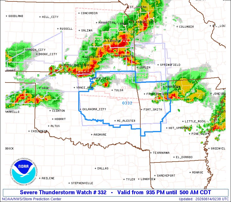
9:39pm CDT #SPC_Watch WW 332 SEVERE TSTM AR OK 140235Z - 141000Z, #arwx #okwx, spc.noaa.gov/products/watch/…
10
30
9,135
8:57pm CDT #SPC_Watch WW 331 SEVERE TSTM KS MO 140155Z - 140900Z, #kswx #mowx, spc.noaa.gov/products/watch/…
8
35
8,420
#SPC Jun 14, 2026 0100Z Thunderstorm Outlook spc.noaa.gov/products/exper/…
1
12
9,551
17
50
10,115
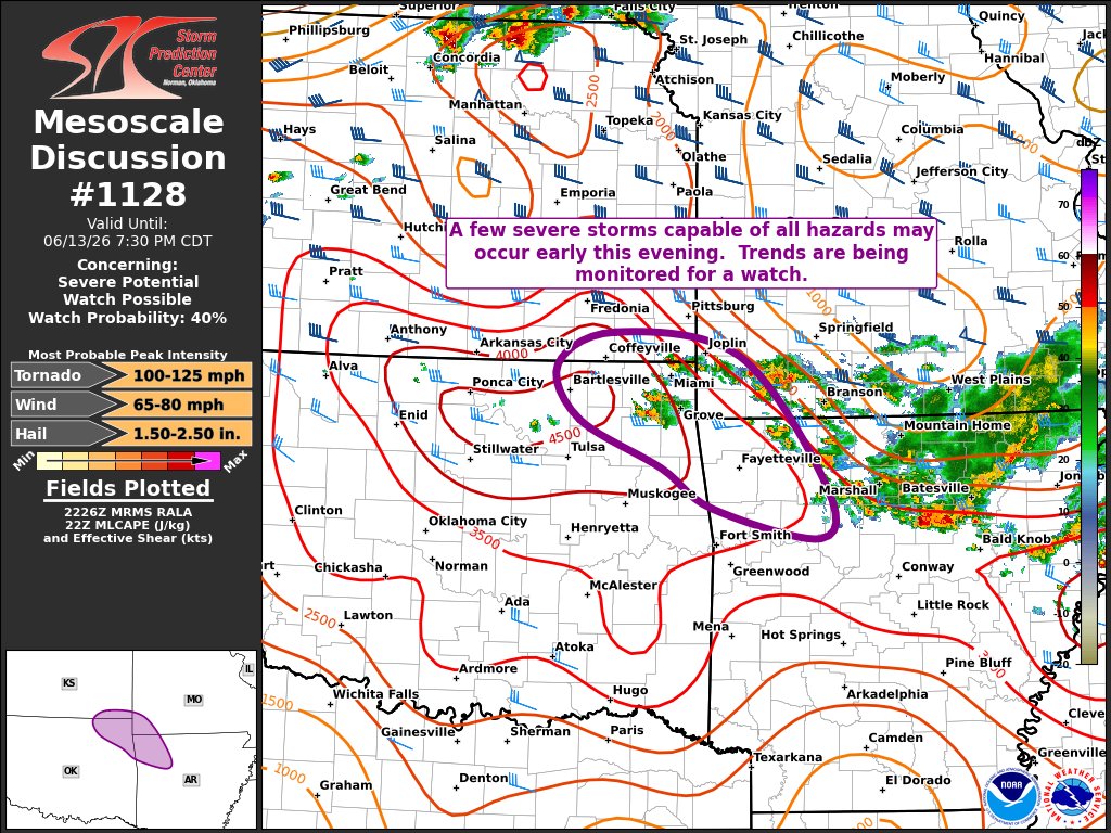
8:03pm CDT #SPC Day1 Outlook Enhanced Risk: across central/eastern Kansas, western/central Missouri, and adjacent portions of northeast Oklahoma and northwest Arkansas spc.noaa.gov/products/outloo…
3
38
160
15,178
16
48
8,273
12
43
8,473
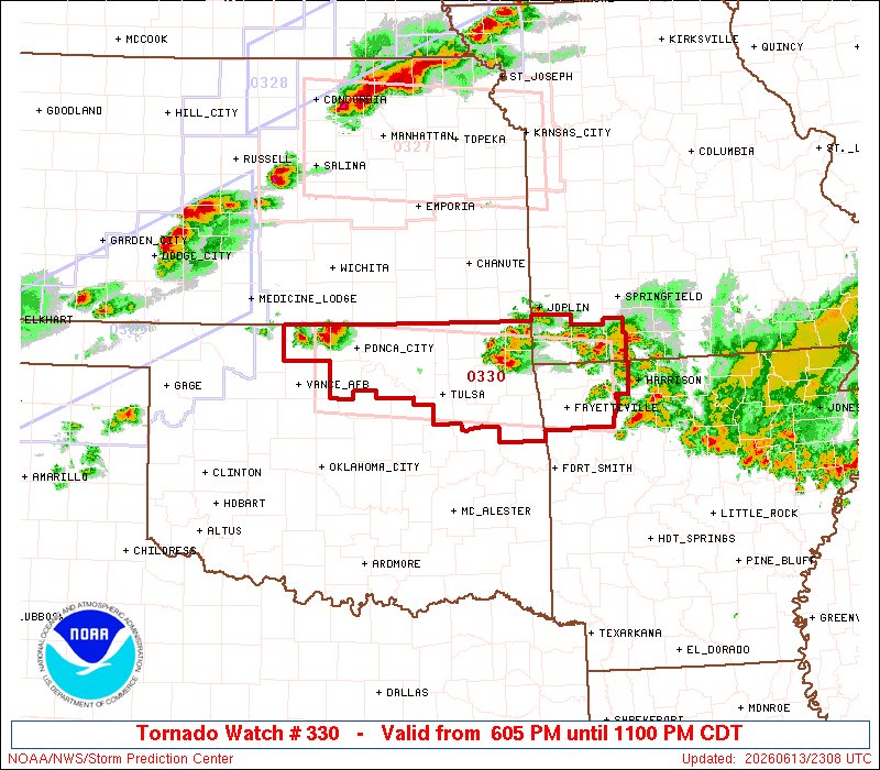
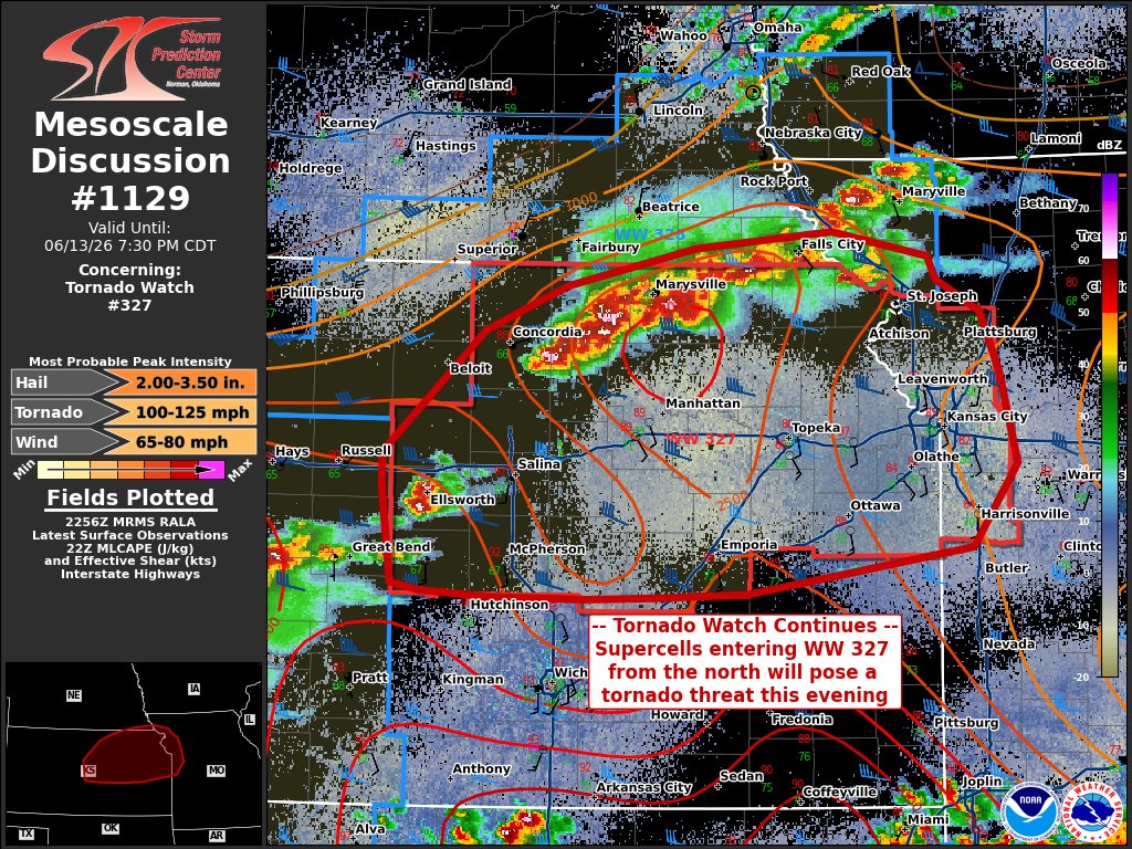
6:09pm CDT #SPC_Watch WW 330 TORNADO AR MO OK 132305Z - 140400Z, #arwx #mowx #okwx, spc.noaa.gov/products/watch/…
2
21
69
9,881
32
105
11,610
30
85
12,420
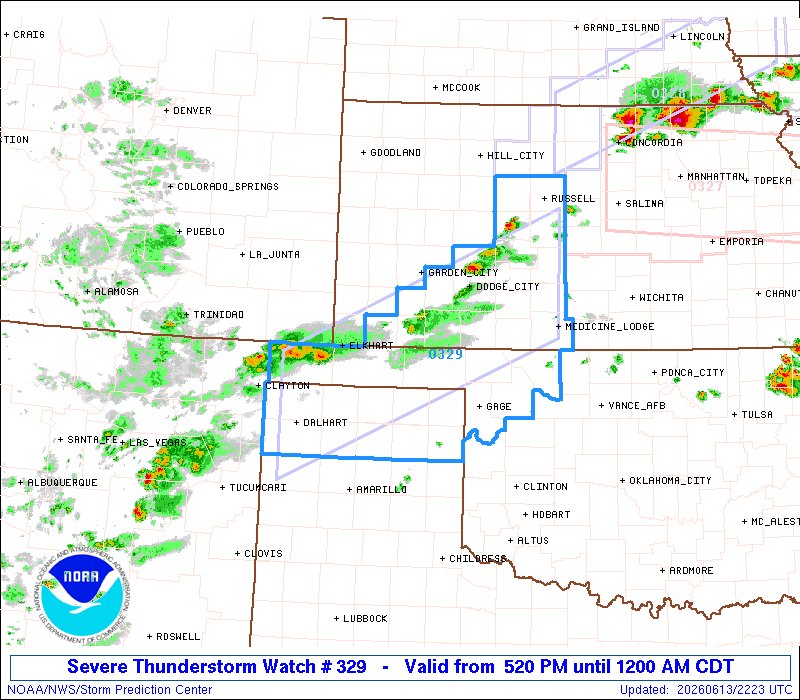
5:24pm CDT #SPC_Watch WW 329 SEVERE TSTM KS OK TX 132220Z - 140500Z, #kswx #okwx #txwx, spc.noaa.gov/products/watch/…
10
29
8,272
12
8,964