
Official Twitter account for the National Weather Service Seattle. Details: weather.gov/nws_x
- Tweets 47,237
- Following 428
- Followers 241,567
- Likes 17,948
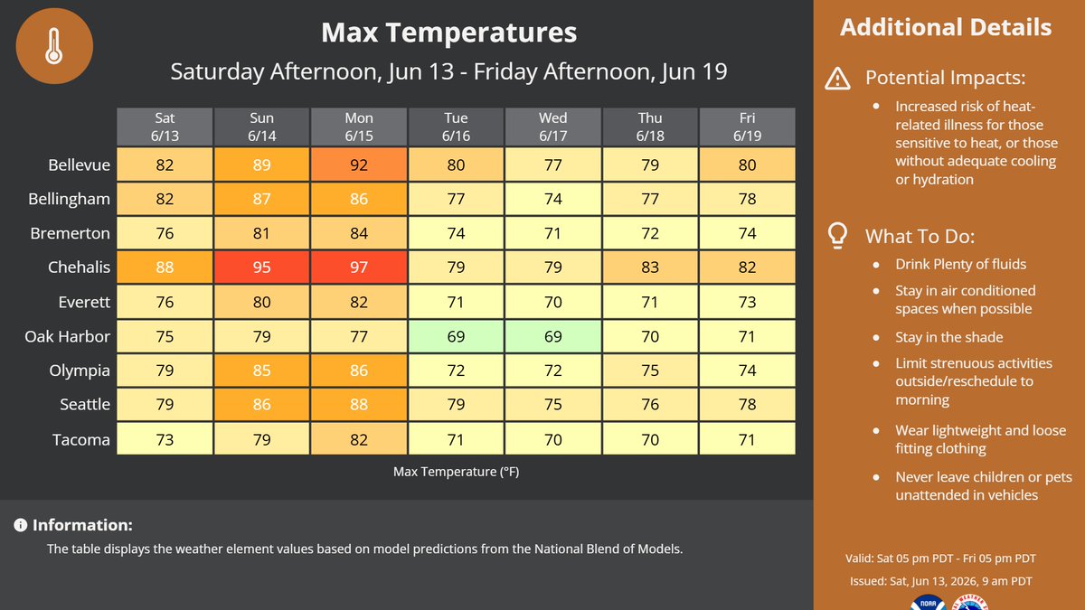


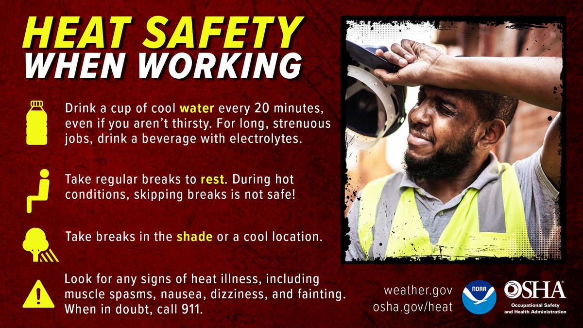
ALT Maximum temperature graphic for several cities in western WA. Highs Saturday through Monday range from the upper 70s to the mid 90s, with areas way from water and mountain tops having the highest temperatures. Cooler temperatures are expected Tuesday through Friday, with more highs in the 70s regionwide. Potential impacts for the weekend & Monday is increased risk of heat related illnesses for those sensitive to heat, or those without adequate cooling or hydration. To take precautions: spend time in air conditioning (when possible), stay hydrated, stay in the shade, reschedule strenuous activities to the morning, wear light clothing, and don't leave kids and pets in closed vehicles.


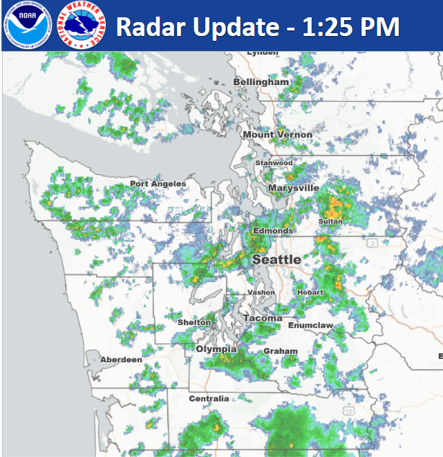
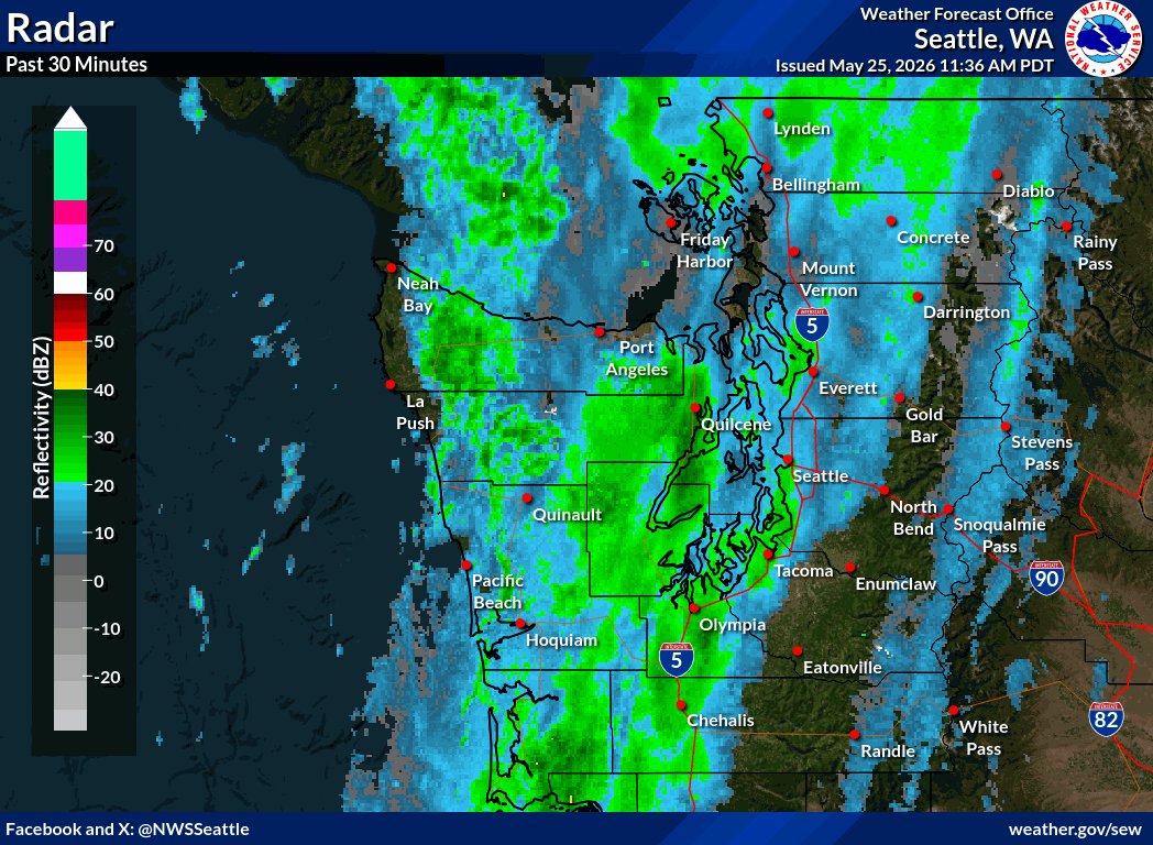
ALT radar imagery showing rainfall across western washington.
ALT A mix of orange and pink with the sunrise this morning over the Cascades, with clouds refracting the sunlight.
ALT HeatRisk map depicting Moderate HeatRisk on Tuesday primarily for areas south of Everett. Minor HeatRisk is primarily depicted elsewhere across the lowlands, with little to no HeatRisk across the mountains.
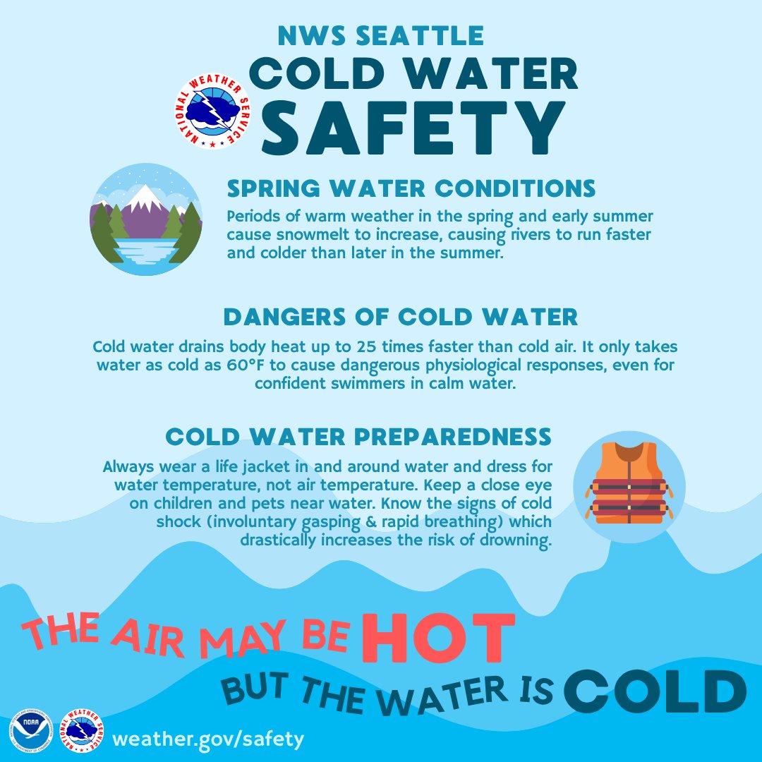
ALT The air may be warm but the water is cold! Always wear a life jacket & keep a close eye on children.
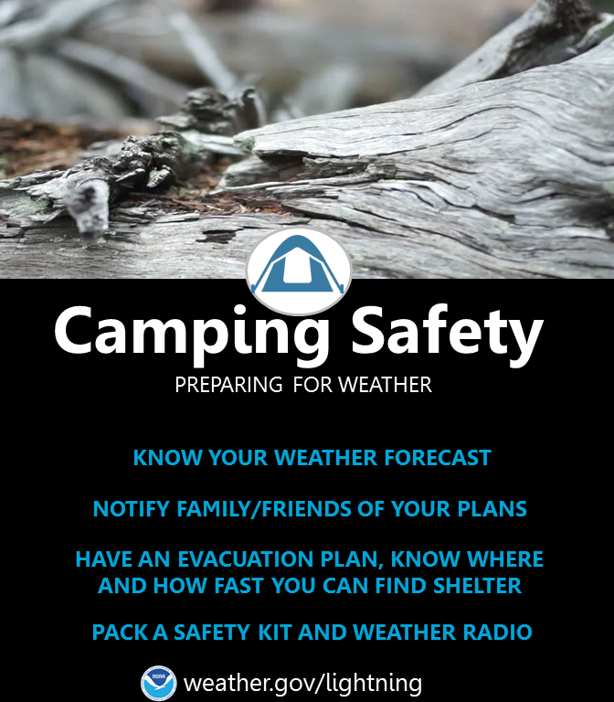
ALT Camping Safety - preparing for weather: Know your weather forecast. Notify family/friends of your plans. Have an evacuation plan, know where and how fast you can find shelter. Pack a safety kit and weather radio.

ALT Dense fog observed on the WSDOT camera along I-5 and 13th street in Chehalis, WA

ALT Dense fog observed on the WSDOT camera along I-5 and Scatter Creek.
