
Nantucket Police Department 4 Fairgrounds Rd Nantucket, MA 02554 (508) 228-1212 Call 9-1-1 for Emergencies. This account is not monitored 24/7
- Tweets 3,063
- Following 208
- Followers 6,006
- Likes 2,342


ALT Graphic showing Impacts from Major Winter Storm.

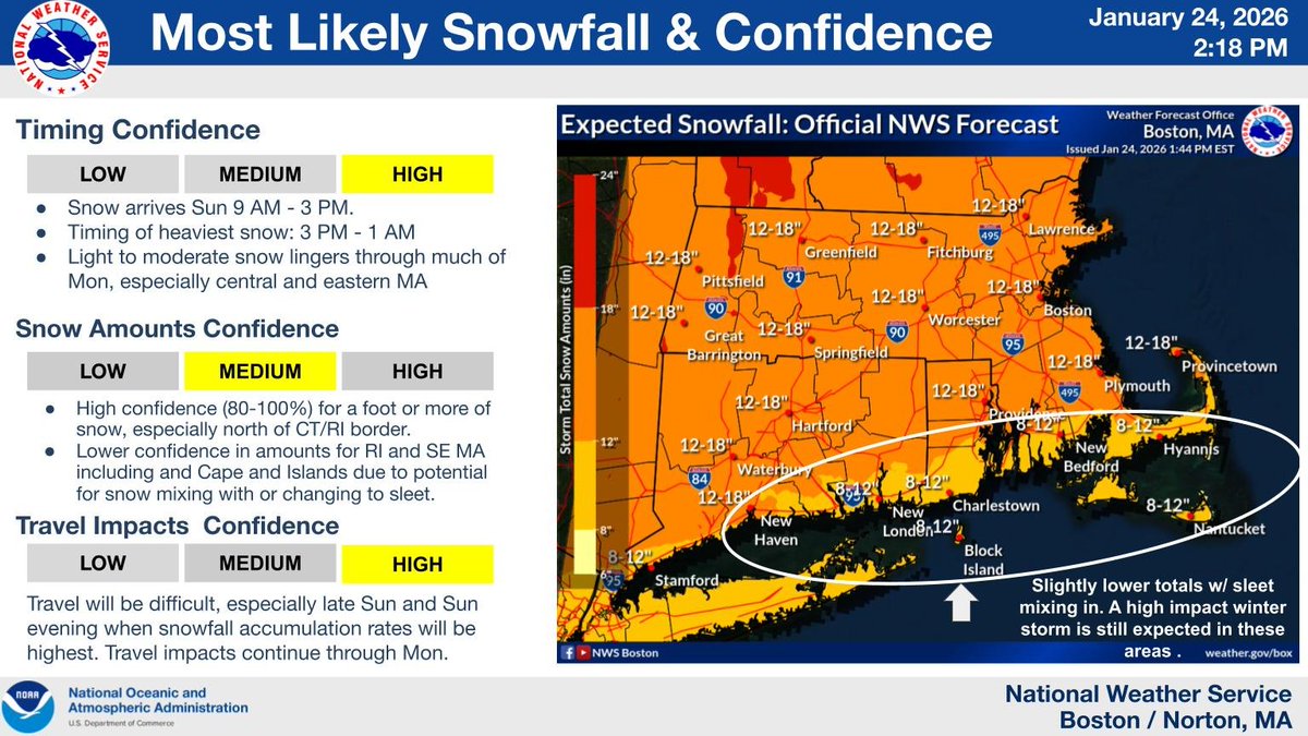
ALT snow storm details
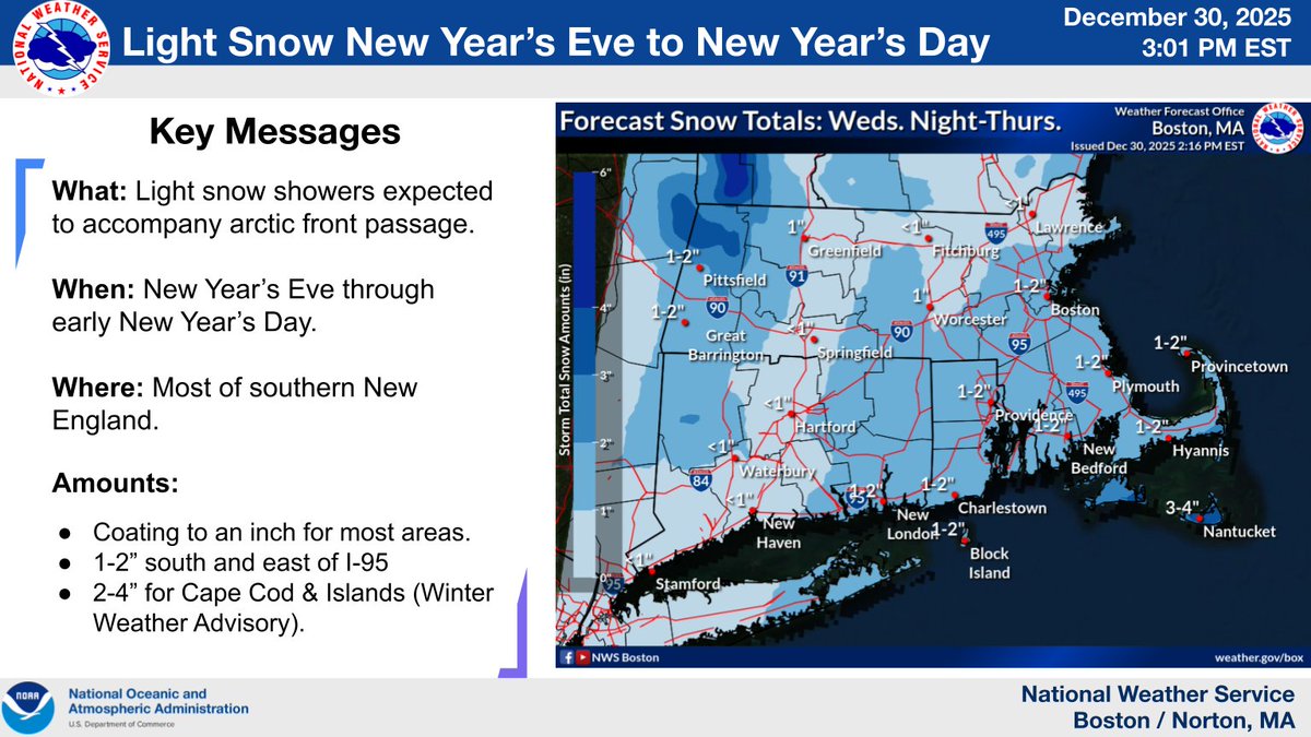
ALT graphic including an image of the current forecast snow amounts for new years eve into new years day for southern new england. Light accumulations. Left side of image displays text of timing and amounts for the light snowfall.
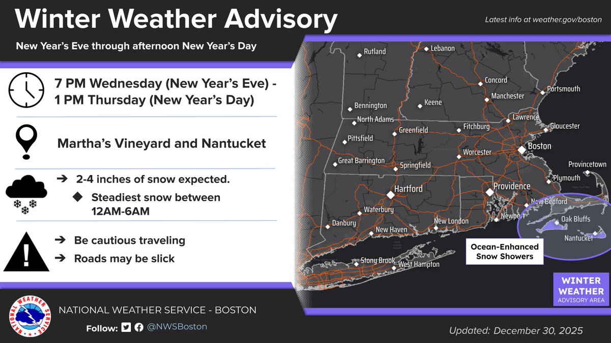
ALT image of winter weather advisory in effect for nantucket and martha's vineyard for new years eve into the first part of new year's day.


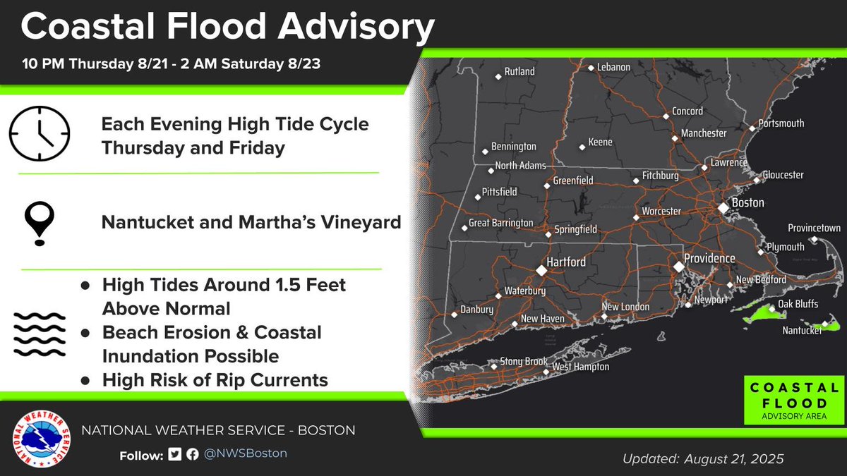
ALT Coastal Flood Advisories are in effect for Martha’s Vineyard and Nantucket late Thursday night and again late Friday night. Minor flooding is expected in Nantucket Harbor, Edgartown Harbor, Vineyard Haven, and Oak Bluffs with a storm surge of 1 to 1.5 feet and waves up to 8 feet on Nantucket Sound. A little more flooding is possible near Nantucket Harbor if the surge is closer to 2 feet. No significant flooding is expected elsewhere, though water levels could run higher than normal along both coasts. In addition, swell from Erin should result in dune and beach erosion on south facing shores late this week, especially on Martha’s Vineyard and Nantucket, which have had significant erosion over the past few winters from nor’easters.
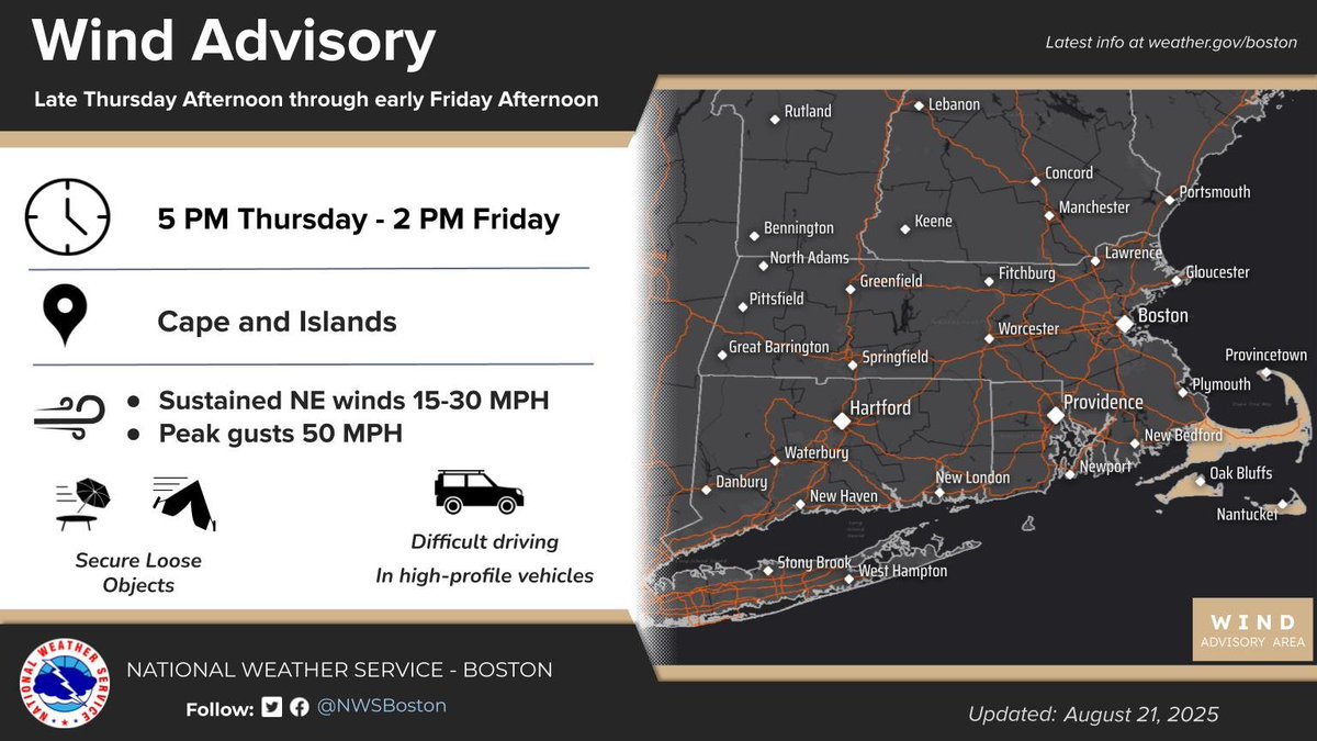
ALT Map of southern New England highlighting Cape Cod, Martha’s Vineyard, and Nantucket under a Wind Advisory. Advisory runs from 5 PM Thursday to 2 PM Friday with sustained northeast winds 15–30 mph and gusts up to 50 mph.

ALT Este gráfico muestra la localización en el mapa de un Aviso Especial Marítimo. El aviso estará en efecto hasta las 5:30 PM EDT. El aviso incluye a Aguas costeras desde Provincetown MA a Chatham MA a Nantucket MA hacia afuera 20 mn, Aguas Costeras desde Provincetown a Nantucket de 20 a 35 mn costa afuera, Pasaje de Nantucket y Pasaje de Rhode Island . Las amenazas asociadas a este aviso son: ráfagas de vientos de mayor de 34 nudos yno se espera granizo. Las trombas marinas no son esperadas. Alto oleaje. Busque un puerto seguro y tome medidas de precaución.
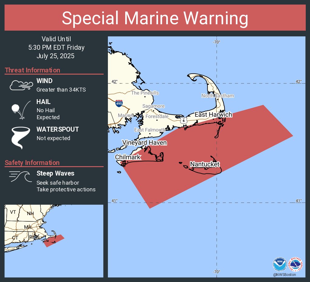
ALT This graphic displays a special marine warning plotted on a map. The warning is in effect until 5:30 PM EDT. The warning includes coastal waters from Provincetown MA to Chatham MA to Nantucket MA out 20 nm, Ocean waters from Provincetown to Nantucket from 20 to 35 NM offshore, Nantucket Sound, Rhode Island Sound and Vineyard Sound. The threats associated with this warning are wind gusts greater than 34kts and no hail expected.Waterspouts are not expected. Steep waves can be expected. Seek safe harbor and take protective actions.
