
Industry-leading Property Intelligence for P&C insurers.
Joined December 2014
- Tweets 1,920
- Following 666
- Followers 1,139
- Likes 524
515 Photos and videos


Pinned Tweet

20 Nov 2024
We’re excited to unveil our new report! We surveyed U.S. P&C insurers about the emerging risks they face and how AI-derived insights from aerial imagery can evolve risk management.
Read the full announcement, see the data, and get the report here: bit.ly/4fVzvGf
1
1
417
4 Apr 2025
Our thoughts are with those impacted by the recent tornado outbreak across the central U.S.
Nearmap ImpactResponse data is now available for Carmel and Brownsburg, IN, to help insurers and emergency teams assess damage quickly, safely, and accurately.
bit.ly/3N9Uzwp
1
1
551
18 Mar 2025
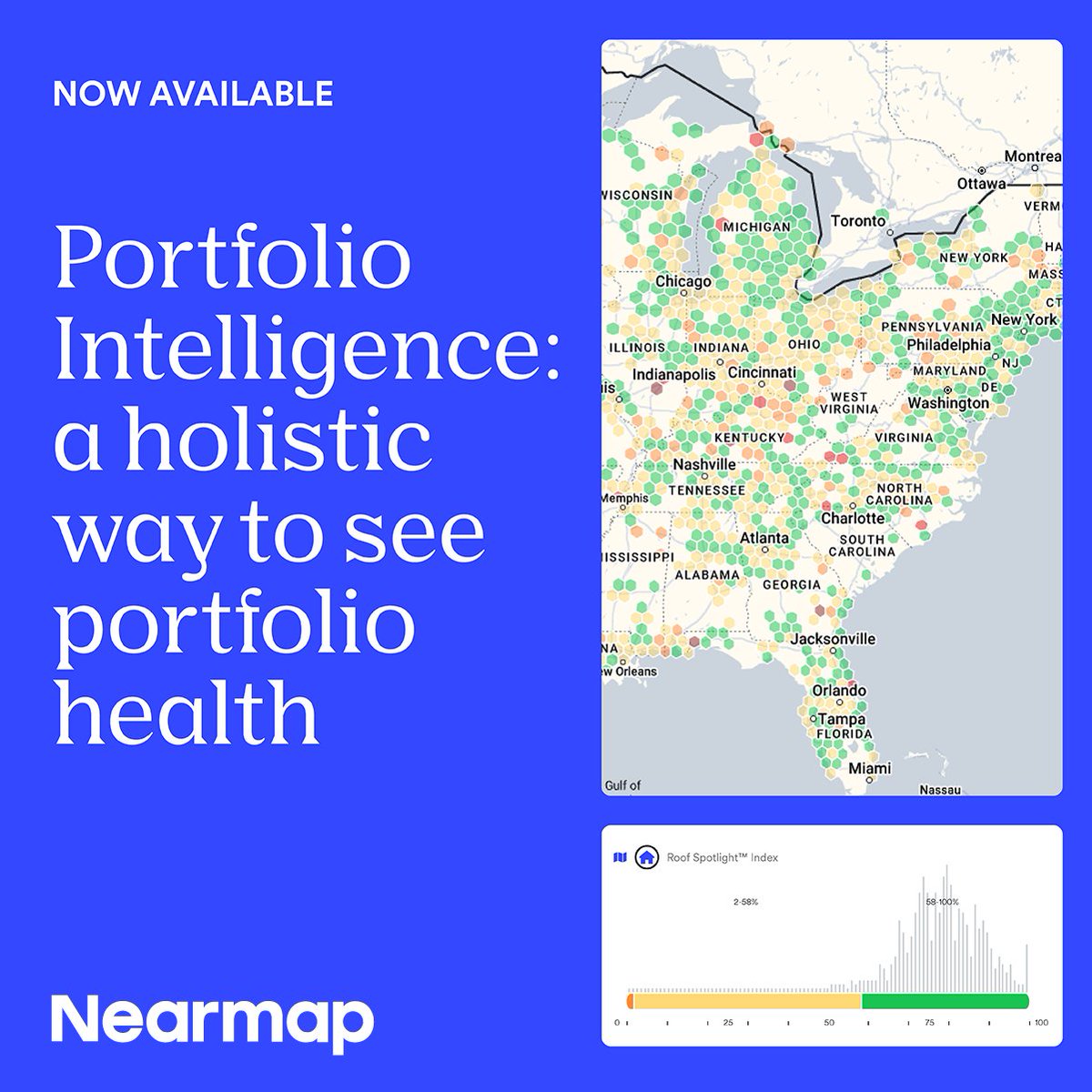
Insurance carriers need a smarter way to assess portfolio health – so we built a solution to help: Portfolio Intelligence.
Read the full announcement to learn more: bit.ly/43QXYd0
1
1
1
336
11 Mar 2025
Are you ready for #hurricane season? Our latest report in @cjournal — covering Beryl, Helene, and Milton — analyzed 7.5 million properties and assessed the extent of the damage.
We can't prevent storms, but let's look ahead now and prepare: bit.ly/41vGcdV
1
1
305

Damaging storms are set to hit SE QLD and northern NSW later today. #CycloneAlfred is forecast to make landfall late Friday between Maroochydore and Coolangatta.
The @nearmap team is monitoring closely and ready to respond. Stay safe.
1
984
5 Mar 2025
With seemingly nowhere immune to natural disasters these days, carriers must communicate the risks better and spur policyholders toward resilience. How? Check out our latest interview with @ITLupdates on the #LAFires, #PredictAndPrevent, and more: bit.ly/4h6w7IZ
1
1
248
4 Mar 2025
What do portfolio intelligence tools look like? And how do they help insurers drive smarter decisions at scale? Check out Dave Tobias's latest article in @PC_360 here to learn more: bit.ly/41AwMhp
1
1
218
3 Mar 2025
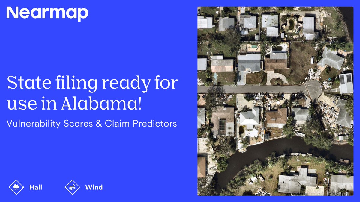
Great news for rate filings! Our #wind and #hail scores — available in the #Betterview platform by @Nearmap — are now approved in Alabama.
See how you can #PredictAndPrevent loss with our scores here: bit.ly/4d5A3sm #PropertyIntelligence
44
28 Feb 2025
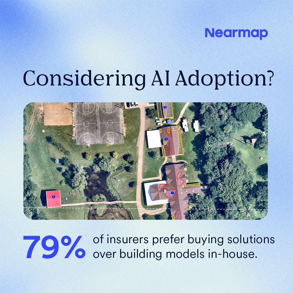
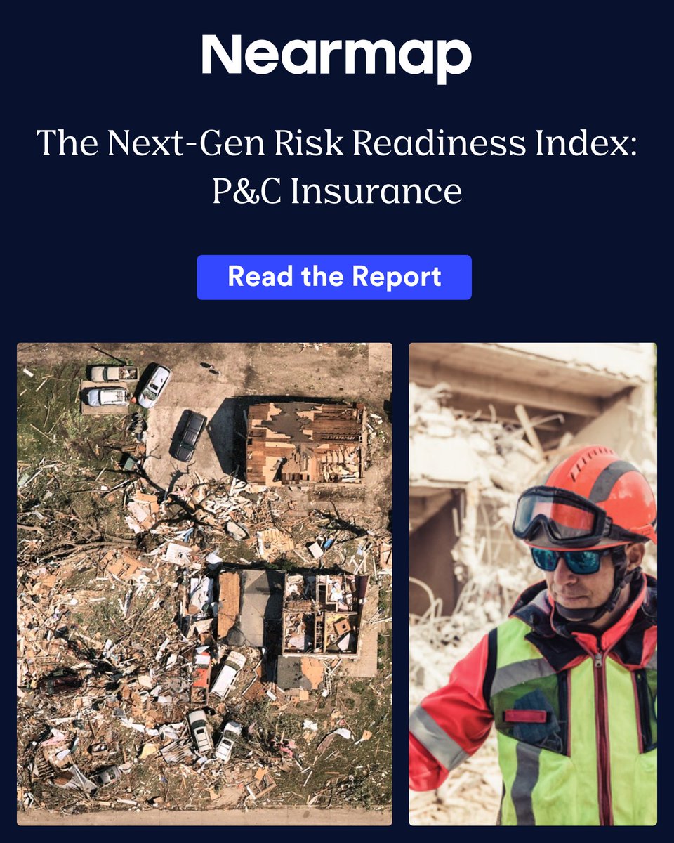
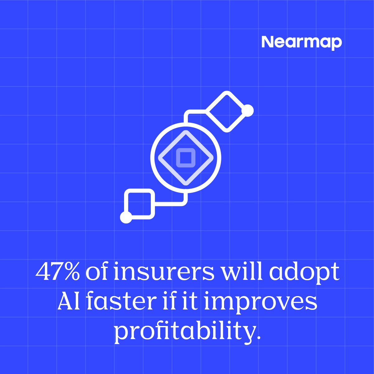
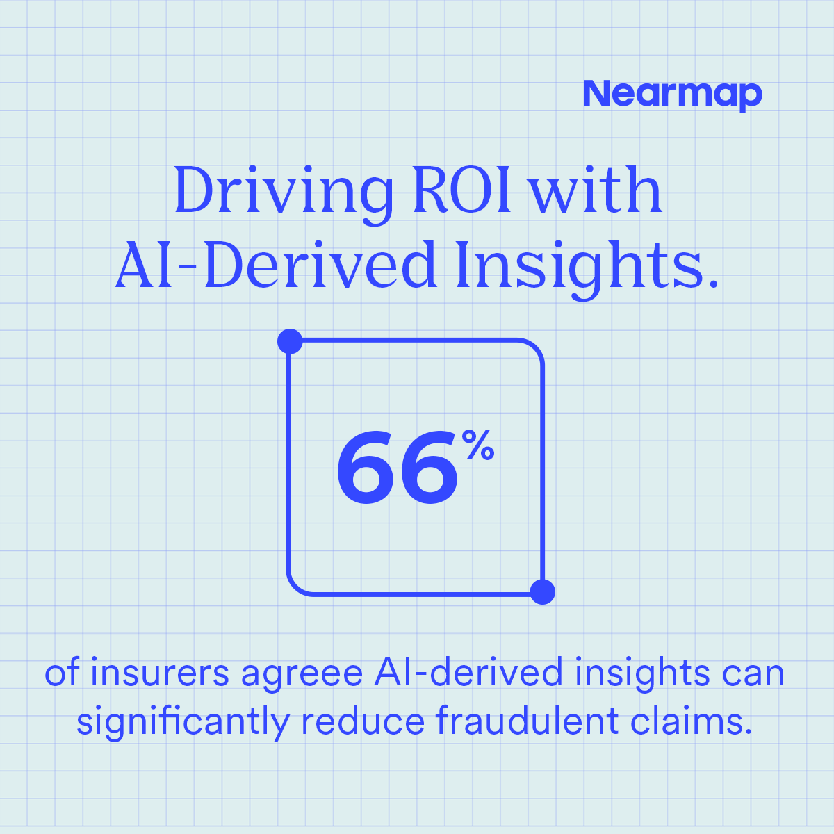
For insurers to adopt #AI, they need to see real impact. How can insurers become tech-forward, but smart, in selecting and implementing AI technology?
Read our Next-Gen Risk Readiness Index to find out: bit.ly/3WTDXhV #ROI #PropertyIntelligence
1
1
166
21 Feb 2025
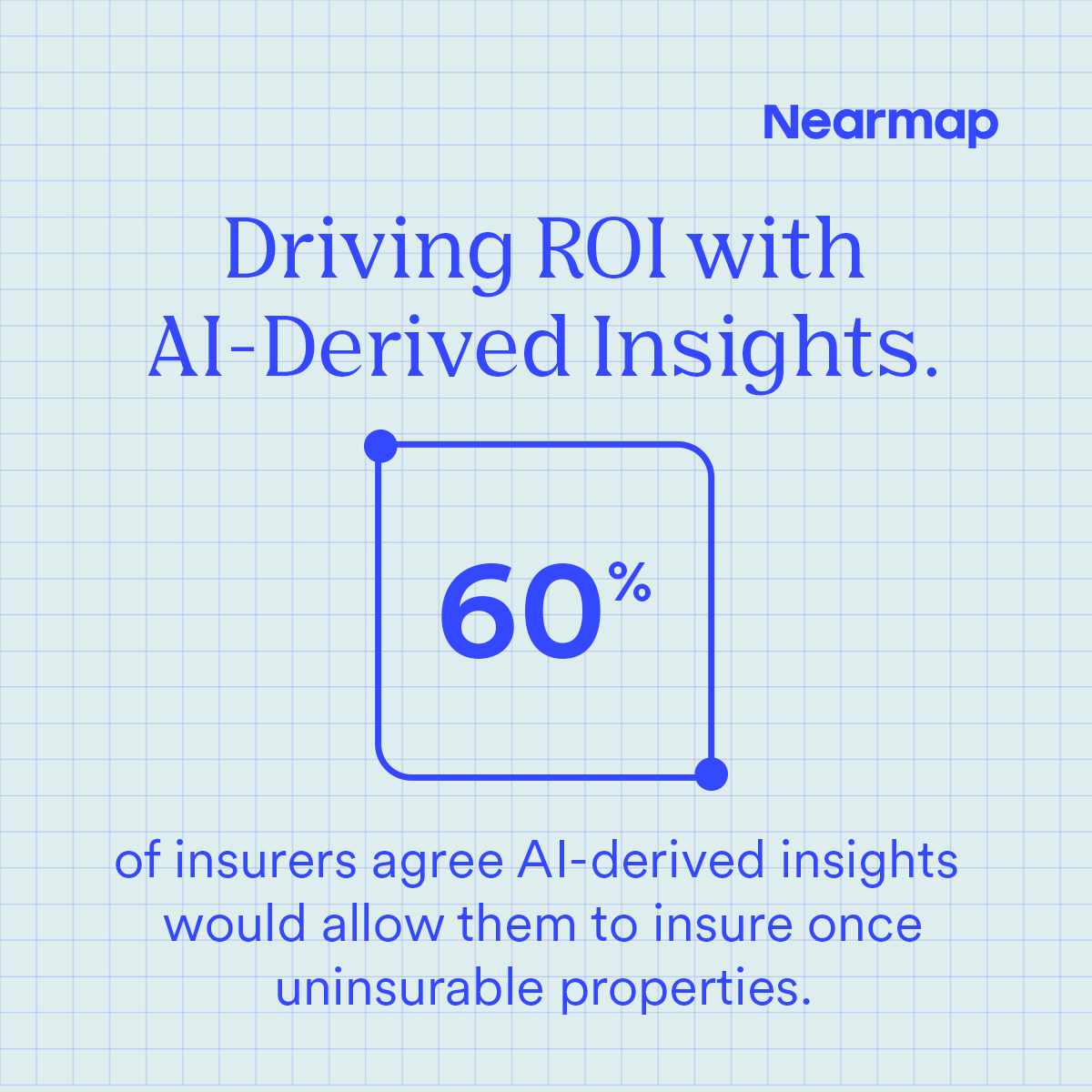
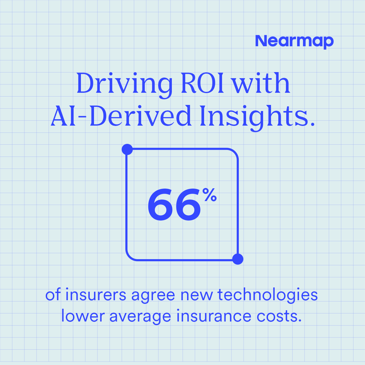
How do #AI and #AerialImagery drive ROI? Our survey of P&C insurers reveals many see it as a way to unlock new markets, refine pricing models, and accelerate #claims management. Explore the insights here: bit.ly/3WTDXhV #Underwriting
1
1
173
Earlier this month, Far North Queensland experienced unprecedented rainfall, with Townsville recording its highest ever February downpour—an extraordinary 1,033mm in just eight days.
Video: Surveys captured by @nearmap on February 13 show areas still inundated with floodwaters.
1
1
3
381
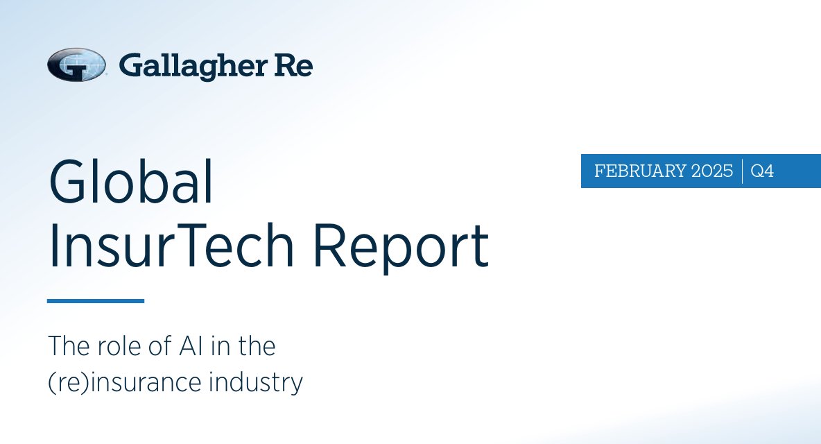
Check out the latest issue from @GallagherRe_ on #AI’s role in #claims and its value across the (re)insurance value chain! It’s a great report, and we’re glad to be included in this important discussion (page 34). See the full report here: bit.ly/4hU0bYV #Insurance
1
1
192
10 Feb 2025
Insurers need to see a positive impact from #AI before adopting it. In our Next-Gen Risk Readiness Index, learn how to take a tech-forward yet strategic approach to AI implementation: bit.ly/3WTDXhV #LocationIntelligence #ROI
1
2
191
6 Feb 2025
📅 Mark your calendars! Join @nearmap and @millimaninsight for a #webinar showing how #AerialImagery and #AI-driven insights help insurers strengthen underwriting and loss prevention.
Don’t miss it! bit.ly/4hqPv4e #InsuranceRating #PropertyIntelligence
1
1
246
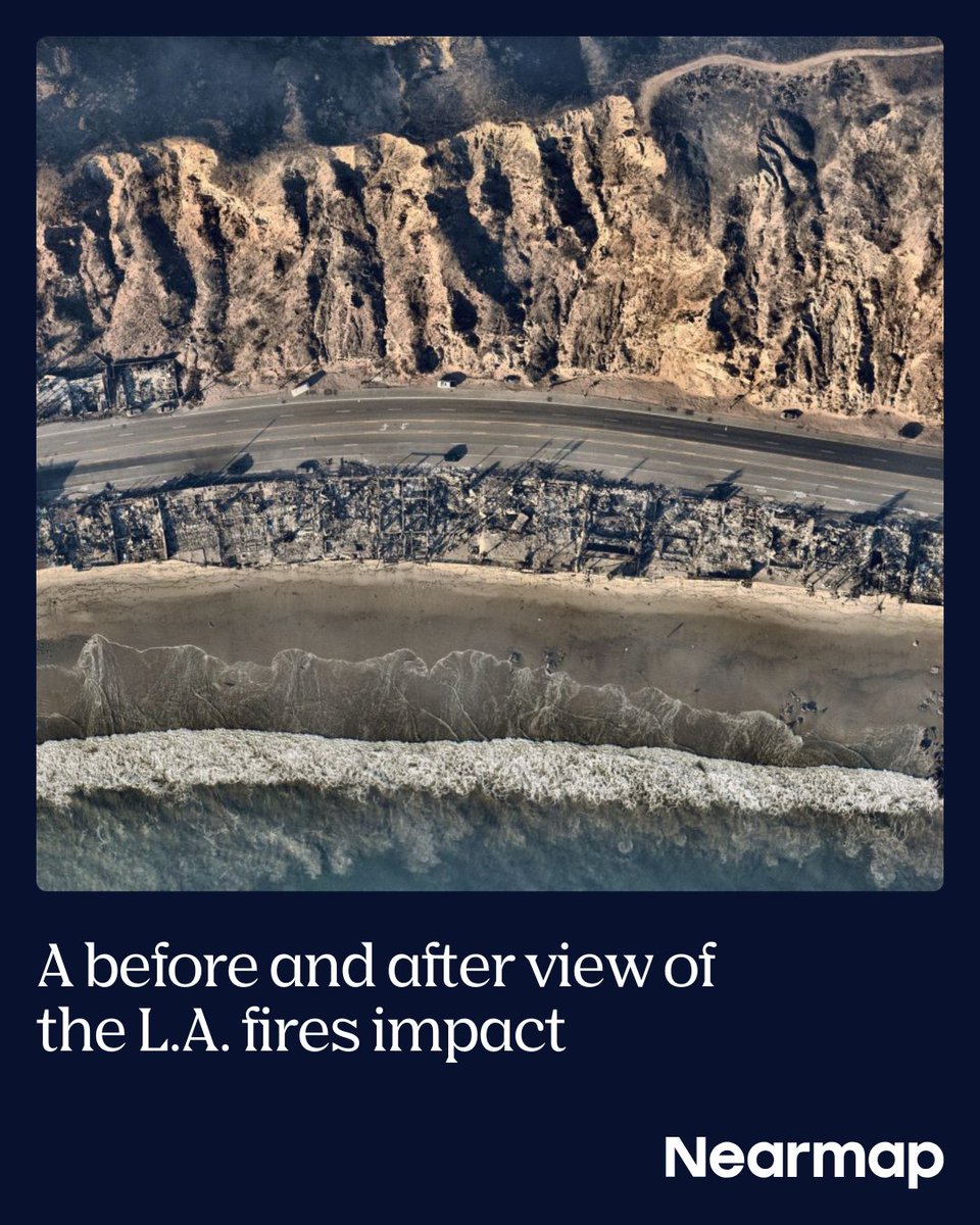
As soon as conditions allowed, our planes were in the sky to capture damage caused by wildfires across the L.A. area.
This visual story shows the before-and-after imagery and intelligence used to support response and recovery efforts.
View here → bit.ly/3WJ1S3A
1
1
257
Not all data is created equal. Its source, quality, and ownership determine whether it empowers or hinders decision-making. Read our blog to see how our full-stack model is built to better serve our customers: bit.ly/3CrhFwW #PropertyIntelligence #AerialImagery #AI

1
1
177
24 Jan 2025
Curious about what’s in store for the P&C Insurance industry in 2025? David Tobias of @Nearmap predicts the five trends that will shape the year ahead.
See his latest @_diginsurance article: bit.ly/4h64CQr #AI #LAFires #RiskManagement
1
1
219
22 Jan 2025
How can deeper transparency lead to more meaningful discussions between insurers and insureds? Get answers below.
Watch the full interview here: bit.ly/4gayc6j #AI #MachineLearning #Insurance
1
1
206
21 Jan 2025
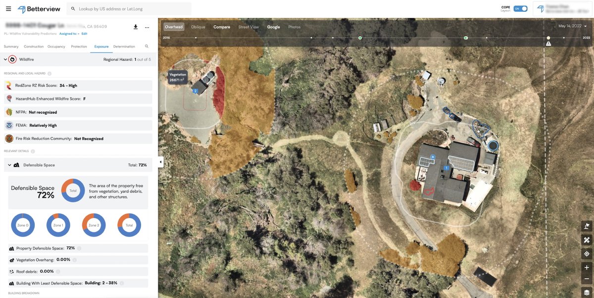
Get the full picture of #wildfire risk for underwriting. With the #Betterview platform by @nearmap, you can leverage our predictions to help prevent losses and protect the homes and businesses that need it most.
Read our white paper: bit.ly/40odr14 #AI
2
55
16 Jan 2025
What does the merging of @Nearmap and #Betterview mean for insurers? A full-stack solution combining high-resolution imagery, #AI-driven insights, and actionable answers for underwriters.
Watch the below, or learn more here! nearmap.com/blog/nearmap-and… #PropertyIntelligence
1
1
175
14 Jan 2025
We can't stop severe weather like #wildfires, but we can use technology to help protect communities before they happen—and scale #PredictAndPrevent strategies to enable proactive risk mitigation.
Learn more here: lnkd.in/g_UVQi3D #RiskManagement #PropertyIntelligence
1
1
212