
OWN, Inc. is an engineering firm that unleashes the power of true, 100% employee ownership.
Joined July 2015
- Tweets 956
- Following 272
- Followers 173
- Likes 603
692 Photos and videos
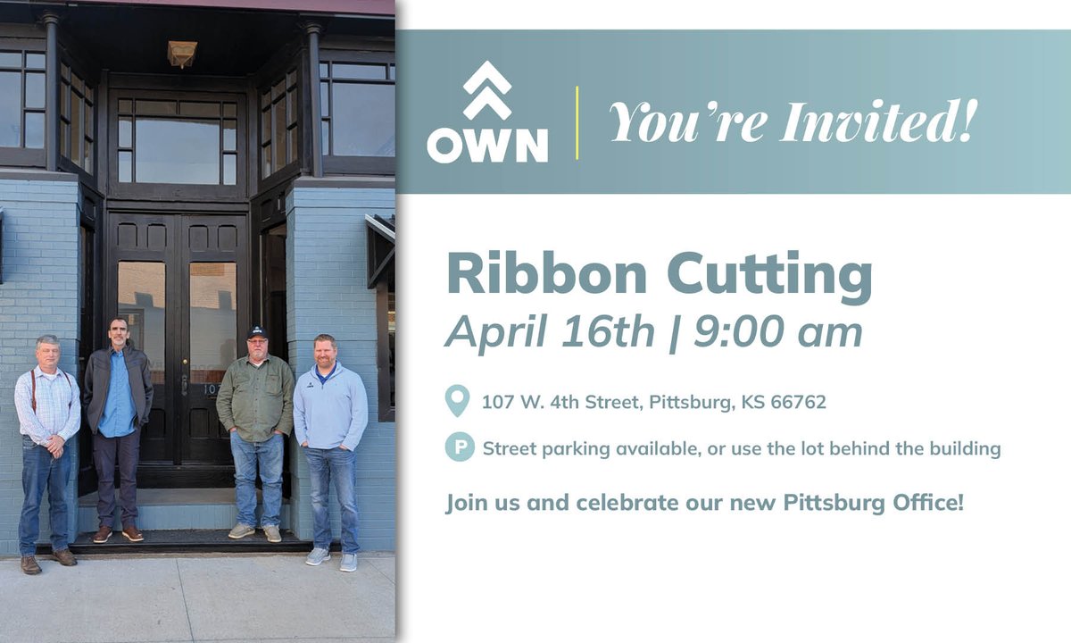


Apr 15
A new office, new connections, and a growing presence in southeast Kansas.
Join us tomorrow for our Pittsburg ribbon cutting as we celebrate with the community that makes it all possible! #EngineeringBeyond #PittsburgKS
86
Mar 26
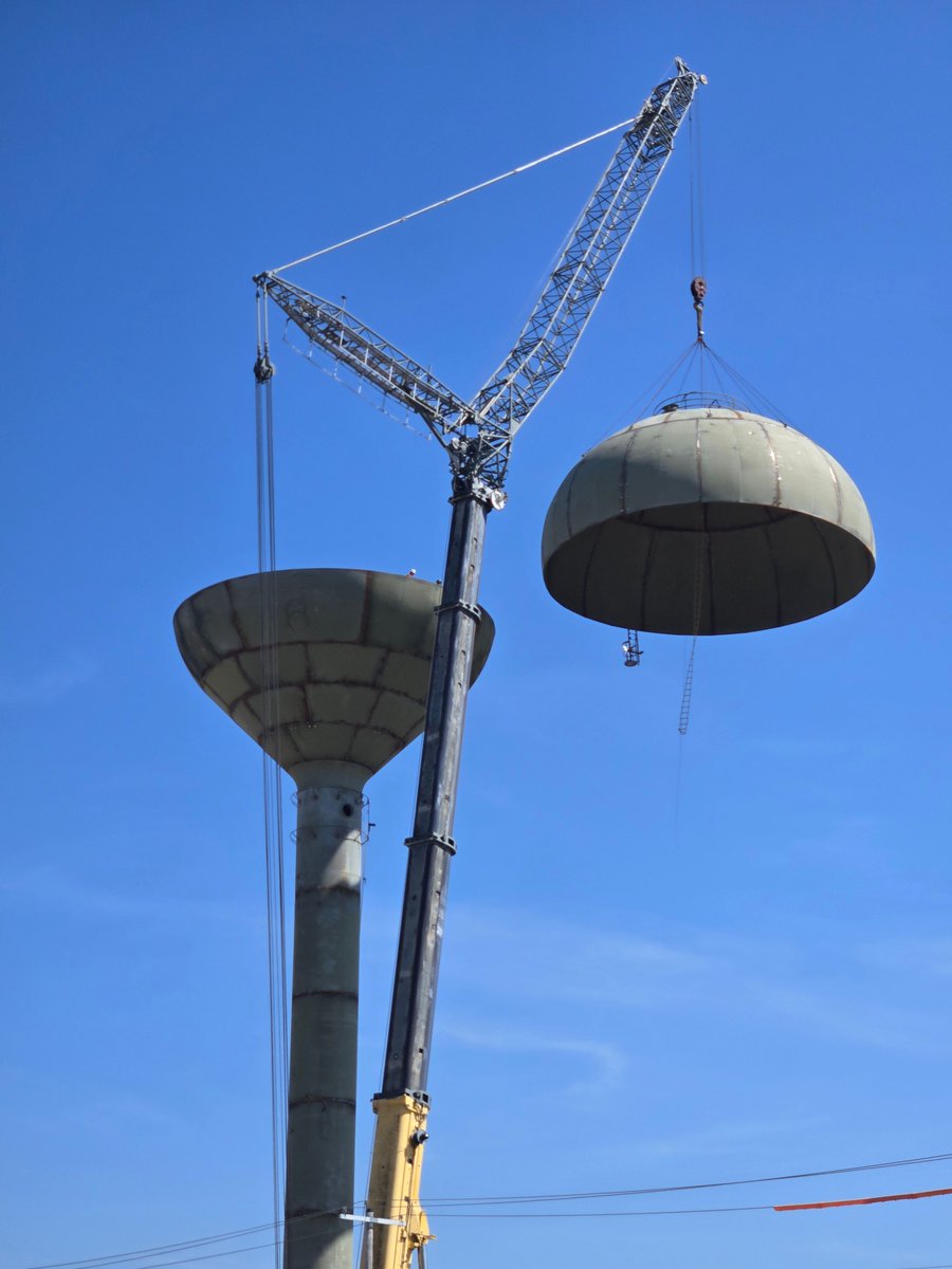
Watching a water tower come together piece by piece is a reminder of the scale and precision behind critical infrastructure. The new well and water tower in Miami, Oklahoma will ensure the community has access to a dependable water supply for years to come. #EngineeringBeyond
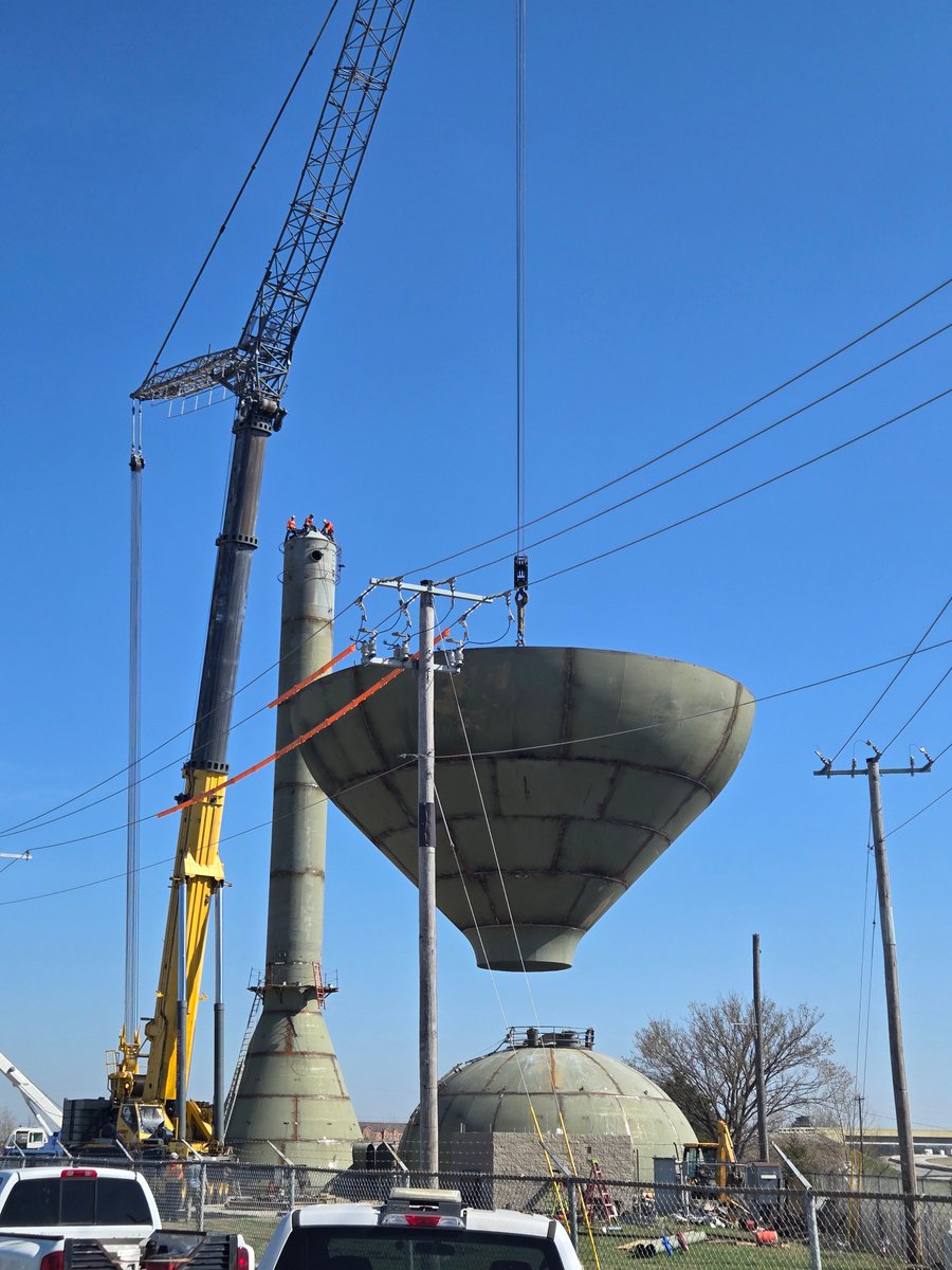
21
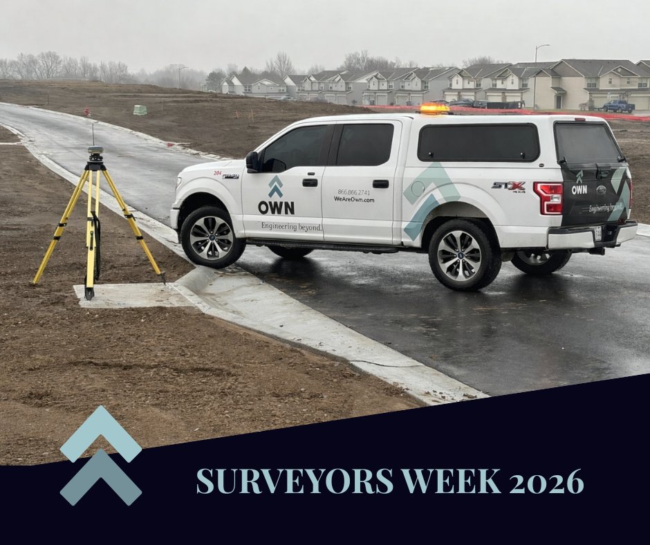
Mar 16
This #SurveyorsWeek, we’re celebrating the team members who help every project start on the right footing. Their work provides the accurate data our teams rely on every day, and we’re grateful for the expertise they bring to every project. Happy Surveyors Week! #WeAreOWN
14
Today on International Women’s Day, we celebrate the women who are helping shape the future of our communities. We’re proud to work alongside women who are building infrastructure, mentoring the next generation, and expanding what leadership in our industry looks like.
8
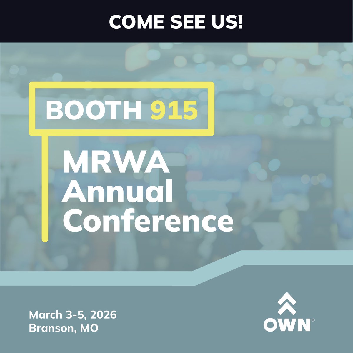
We're headed to MRWA this week! Come find us at Booth 915 to learn how we’re helping communities plan, protect, and strengthen the infrastructure they rely on every day. #WeAreOWN #OWNersDoItBetter #MRWA2026
2
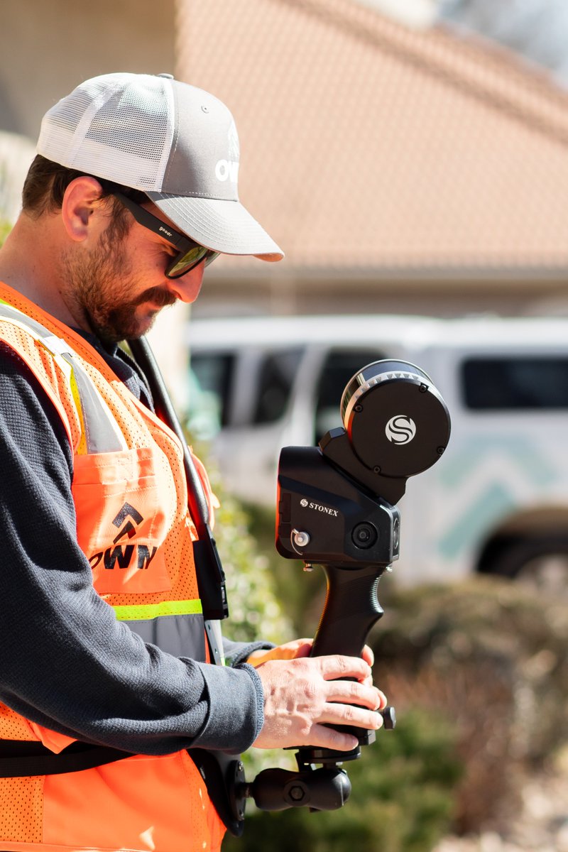
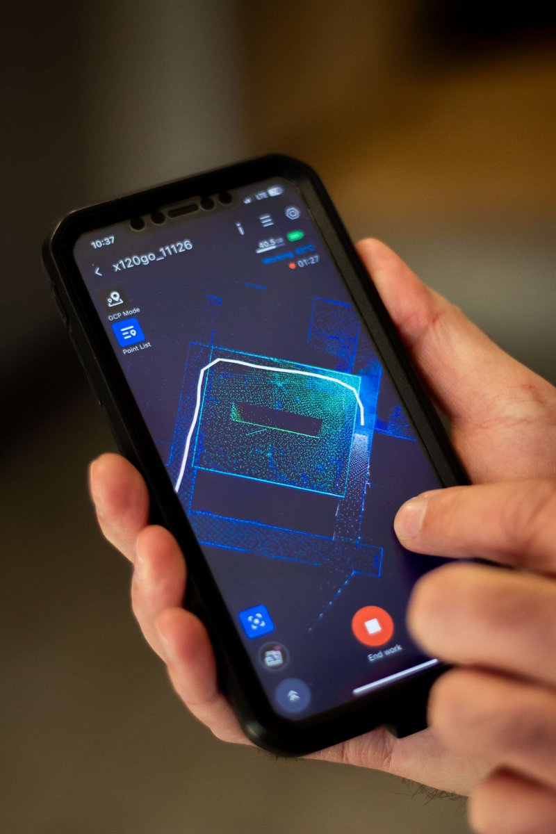
With SLAM technology, our geospatial team collects survey-grade topographic data quickly, safely and efficiently, cutting field time by up to 80% in some cases. The result? Faster turnaround to design, better decision-making, and stronger project outcomes from the very start.
2
Feb 18
Matthew Widman has officially earned his Professional Land Surveyor (PLS) license! This milestone reflects years of commitment to learning and serving our clients and communities with excellence. Congratulations on a well-earned accomplishment, Matthew! #OWNersDoItBetter
7
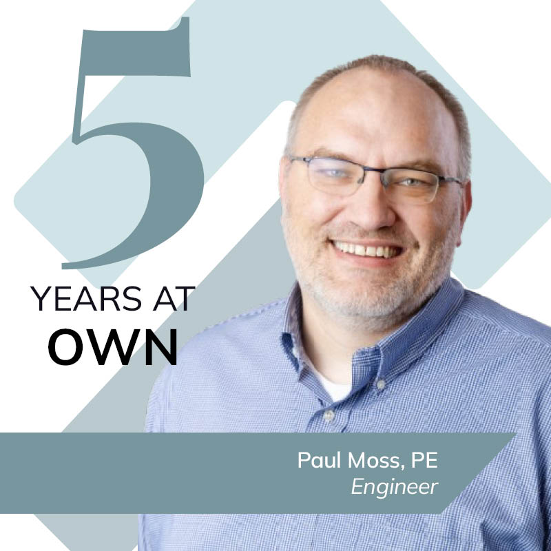
We’re celebrating Paul Moss and his 5-year anniversary with the team!🎉From day one, Paul has brought thoughtful design and a steady commitment to clients across every project he supports. Thank you, Paul, for five great years and the many more ahead! #WeAreOWN #OWNiversary
17
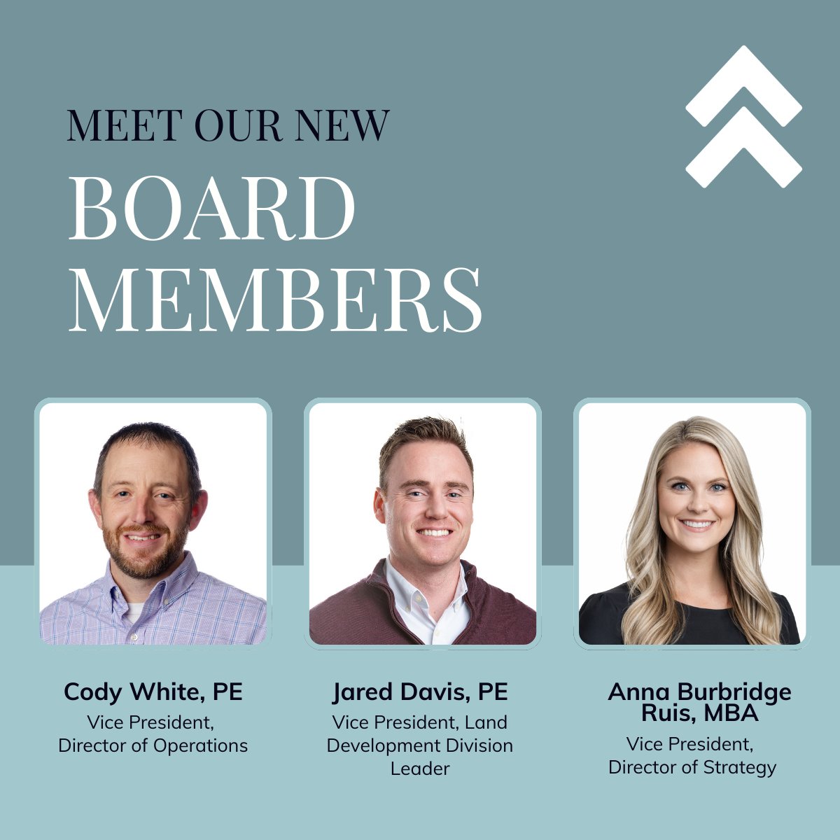
We are thrilled to announce the appointment of three new members to our Board of Directors - Cody White, Jared Davis and Anna Ruis. They will join existing board members Jerrod Hogan, Kathy VanWey, and Andrew Eckhart in supporting the firm’s strategic direction and growth.
70
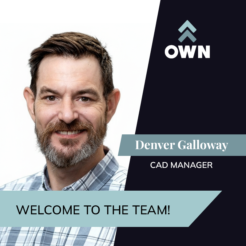
We’re excited to welcome Denver Galloway as our new CAD Manager at OWN! As we continue to grow, so does the need for strong systems, consistency, and support behind every successful project. Welcome to the team, Denver! #CADManager #OWNit #WeAreOWN
12
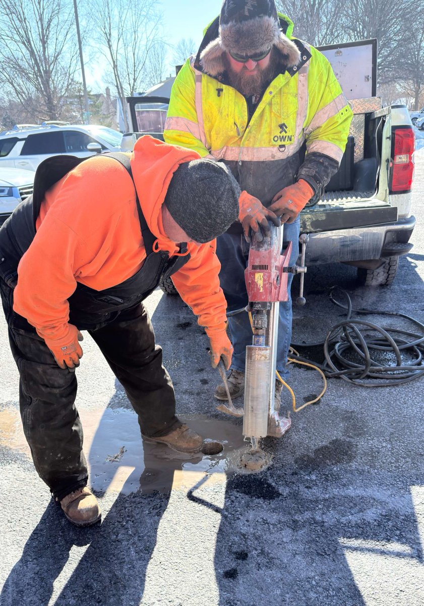
Jan 30
The cold weather doesn't stop this crew! Even in freezing temperatures, our team is out in the field performing testing and delivering the quality services our partners rely on. We're grateful for their commitment to getting the job done - no matter the conditions. #OWNit
18
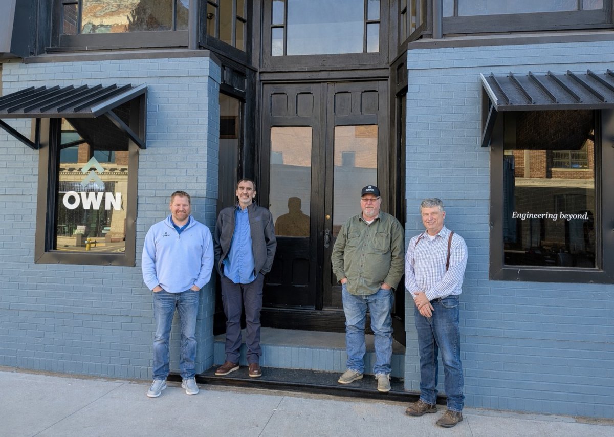
Jan 28
We’re proud to grow our presence in Pittsburg, Kansas and even prouder of the team leading the way! Here’s to new beginnings, strong partnerships, and continuing to serve the communities we call home. #WeAreOWN #OWNit #PittsburgKS
16
Jan 27
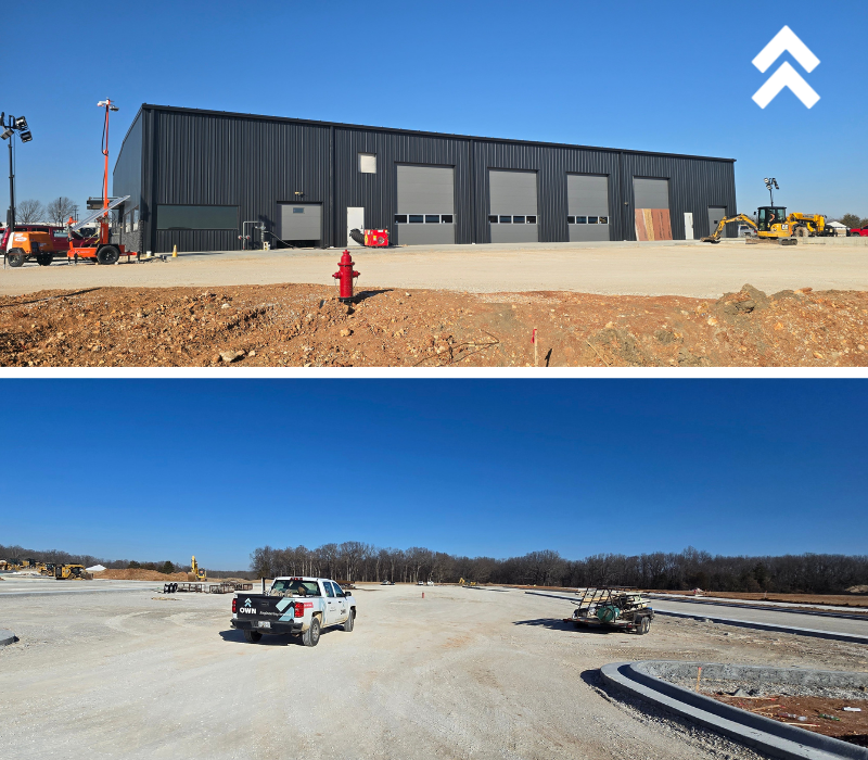
From materials testing to on-site support, our Field Services team is helping power the Wilson Logistics development - including a new logistics center, storage, truck parking, and supporting infrastructure. It’s the behind-the-scenes work that keeps projects on track. #OWNit
18
Jan 19
Today, we honor the life and legacy of Dr. Martin Luther King Jr. and reflect on his call to serve others, build stronger communities, and lead with integrity. May we continue to move forward with purpose, compassion, and a commitment to making a positive impact. #WeAreOWN
1
From day one, Cody has played a key role in helping OWN grow to where we are today by living out our principles. We’re so grateful for two decades of his dedication and steady leadership, and can’t wait to keep growing together! #OWNiversary #20years #OWNit
10
25 Dec 2025
Wishing you and your loved ones a joyful, restful, and bright holiday season. Thank you for being part of our community this year! #WeAreOWN #PeopleAreAtTheCenterOfItAll
30