
A personal weather station at the west end of Ottawa. | Une station méteorologique à l’ouest d’Ottawa. | #ONstorm #OttWeather #MétéoQC
Joined November 2020
- Tweets 499
- Following 23
- Followers 296
- Likes 626
243 Photos and videos


Don’t let the clear skies fool you!
⚠️⛈️ Yellow Severe Thunderstorm Watch is in place.
Thunderstorms possibly incoming at around the sunset hours in the #Ottawa area.
This will be followed by significant rainfall throughout the day on Sunday.
#ONstorm #OttWeather
2
3
510
4
139
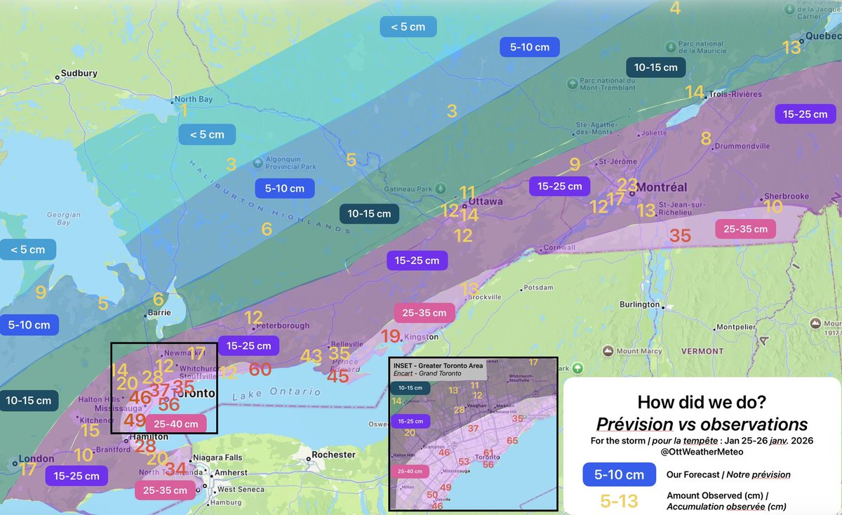
(10 h 00) As of 10 am, about 11 cm of snow has fallen at our station. More snow flurries this morning. Impressive for a late-season clipper!
102
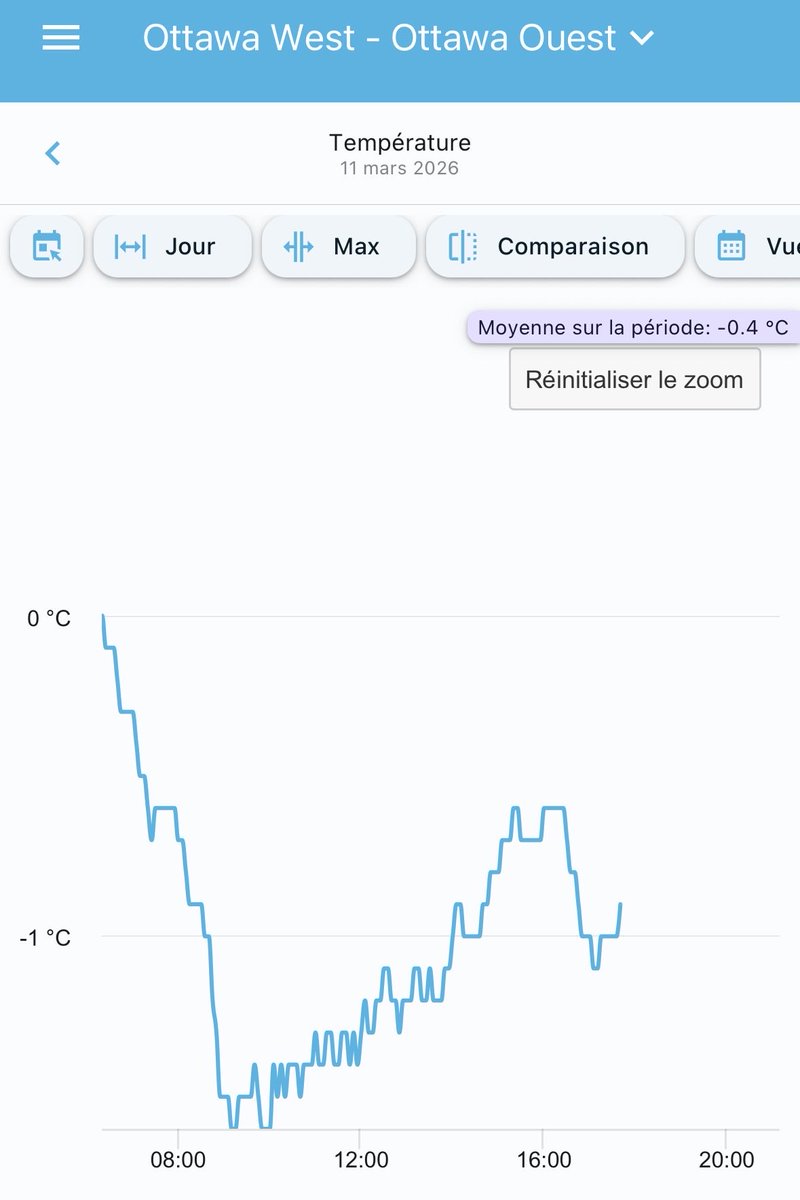
(0 h 15) Unlike what some models were suggesting initially, temperatures seem to refuse to climb above 0°, which might mean some ice accretion is here to stay for the morning commute.
🔶🧊 Orange Freezing Rain Warning is still in effect.
#OttCity #OttWeather #ONstorm
490
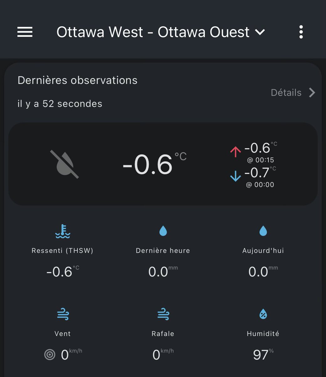
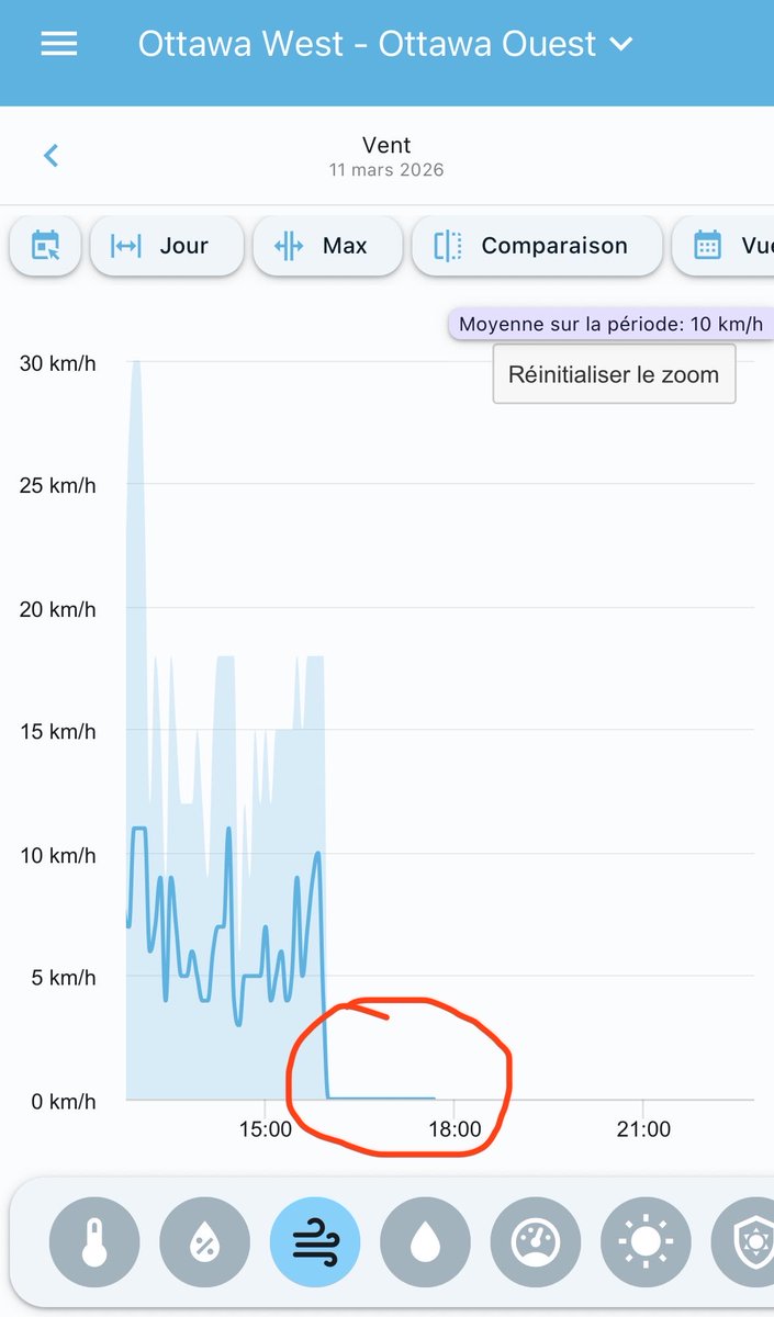
🧊Freezing Rain event ongoing in Ottawa
Temps consistently below 0°; 0 km/h wind readings due to ice build-up on anemometer (circled) are signature signs of a freezing rain event.
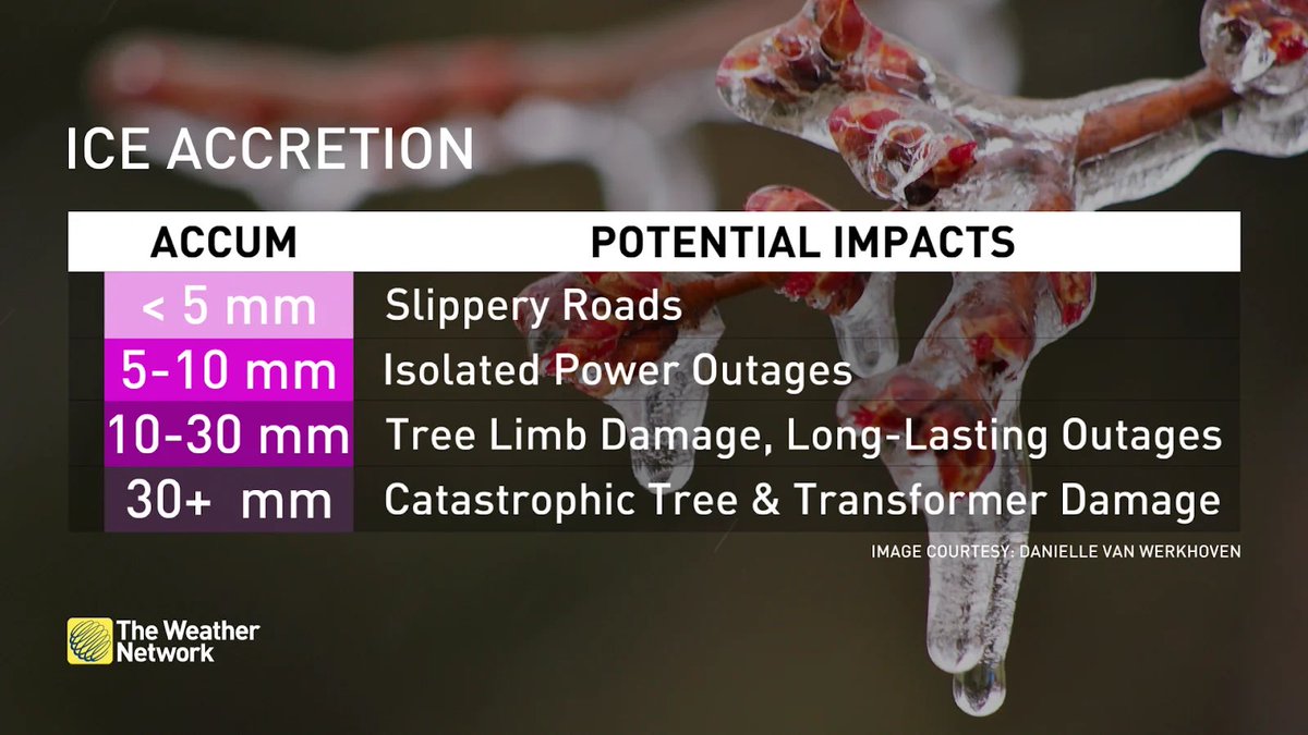
Accretion seem modest so far. Judging by formed icicles, on track for 10-20 mm as forecasted.
2
162
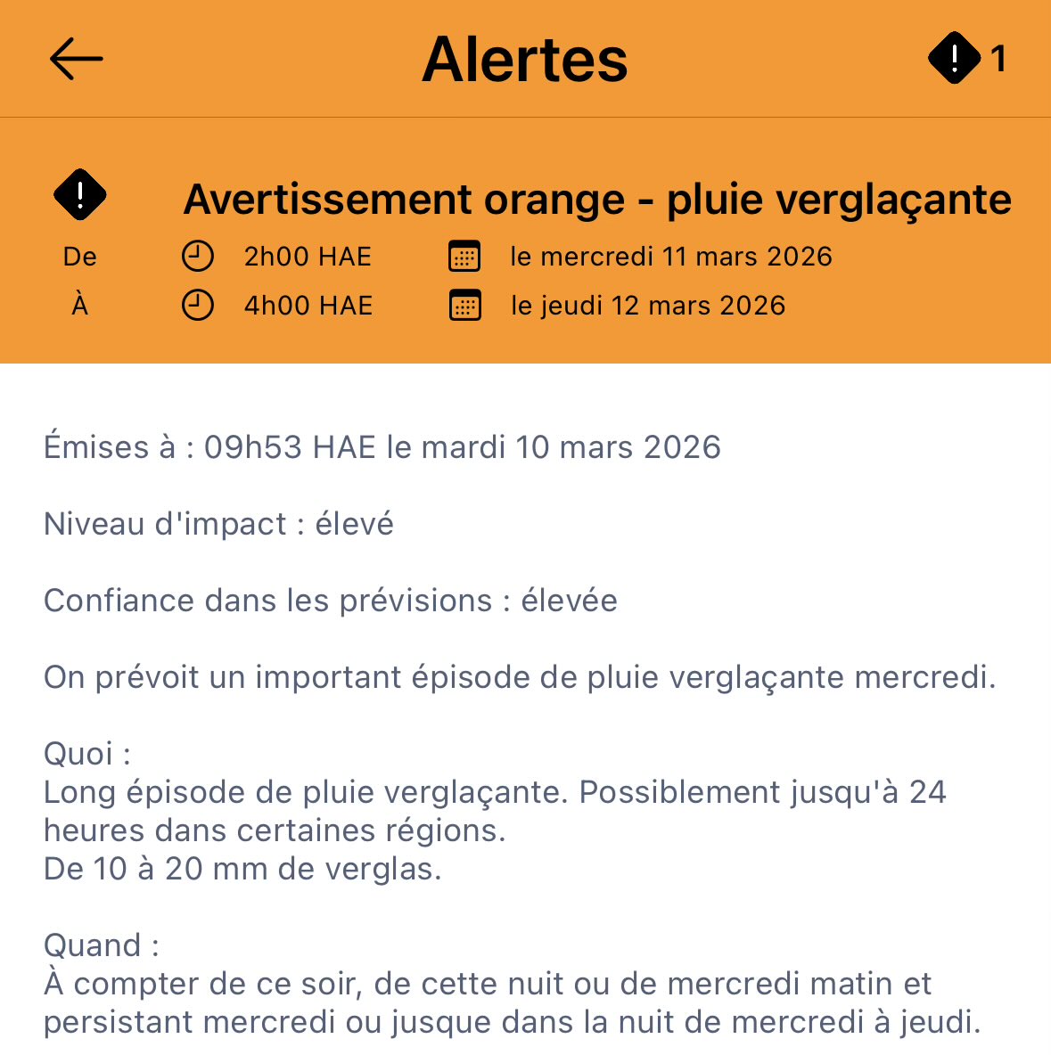
🔶🧊Orange Freezing Rain Warning is in place for Ottawa-Gatineau.
10-20 mm of ice possible for the region, beginning late tonight into the evening hours of tomorrow (Wednesday).
#ONstorm #OttWeather
1
520
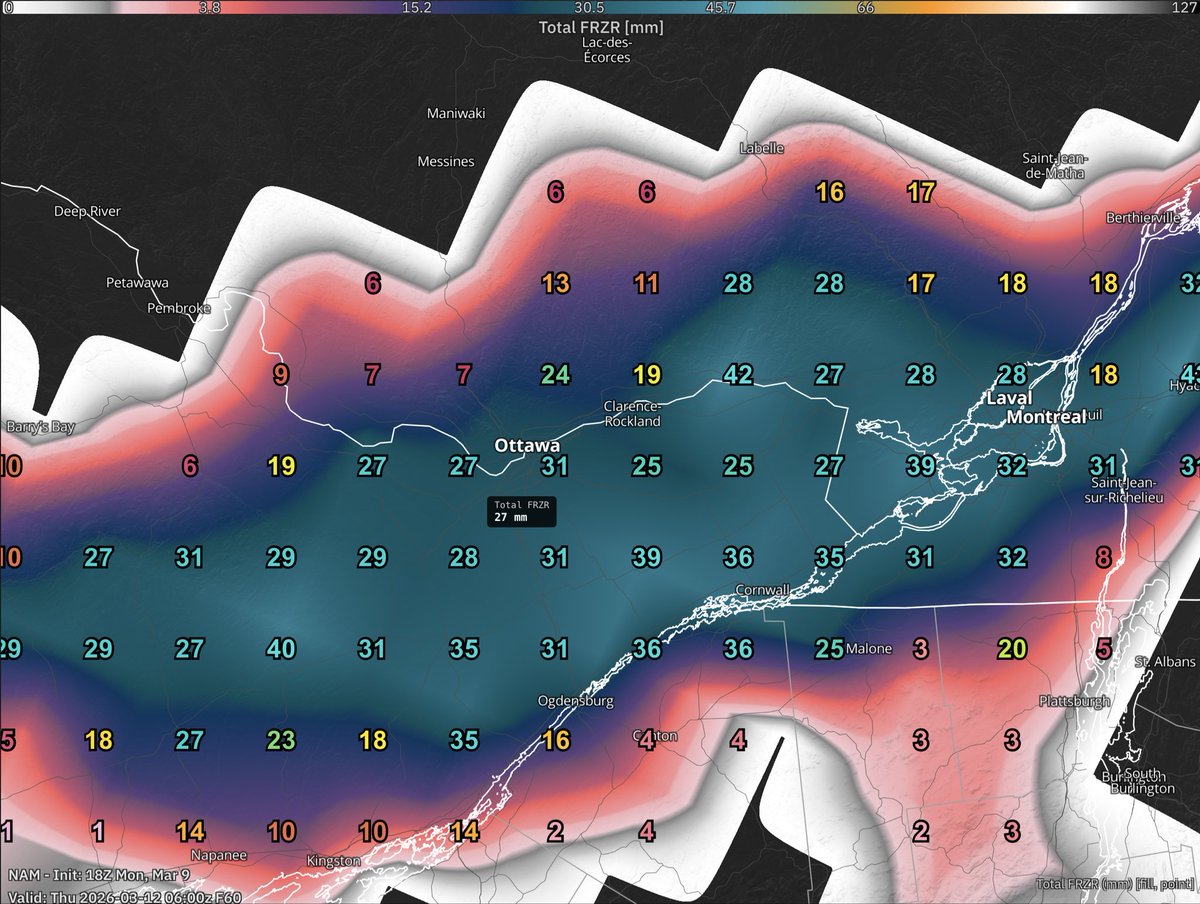
Significant ice risks in Eastern Ontario and southern Québec Wednesday.
Models consistently showing 15-30 mm of ice accretion for Ottawa, starting Wed morning into late evening.
Long duration high accretion wind, likely high impact event. Will monitor.
#OttWeather #ONstorm
2
1
692
At the forecasted ice accretion of 15-30 mm ice accretion, slippery roads, fallen tree branches, and power outages are all possible.
Consider rescheduling plans this Wednesday.
232
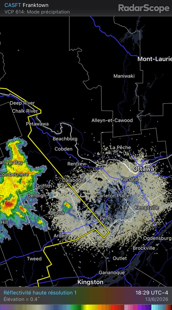
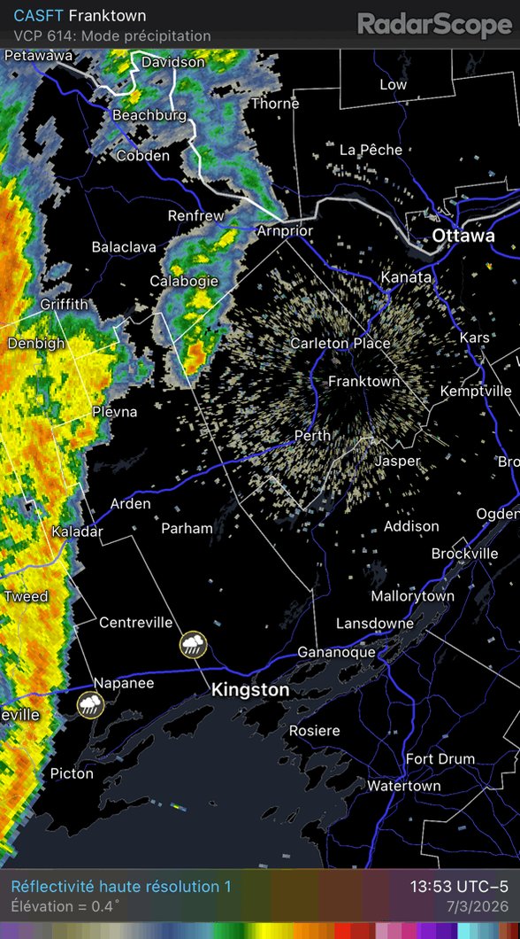
Line of moderate-to-heavy rain on its way for Ottawa arriving around 3pm.
We’ve received 23.6 mm of rain since midnight, and snow cover still resilient. Frozen ground, melting snow and heavy rain will cause water ponding on roads.
Yellow Rainfall Warning in effect.
#OttWeather
1
167
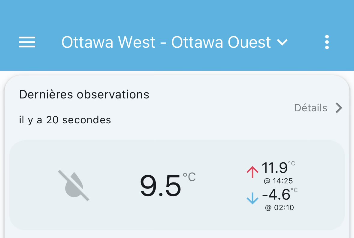
🌡️ 11.9° was observed within the past hour. We have reached our first double-digit of the year, and the first since December 19, 2025!
#ONwx #OttWeather #OttCity
105
🥵 For the first time in 27.5 days, temperatures are now above freezing at our weather station. The last time was at 22:45, January 17, 2026.
#ONstorm #OttWeather #OttCity #Ottawa
3
413
A shot of heavy snow will likely cause issues and delays during Tuesday’s afternoon rush hours.
Expecting 10-15 cm of snow for the Ottawa area, starting mid-morning, with the heaviest falling late afternoon, tapering off into the evening.
#ONstorm #OttWeather #OttCity
1
321
(09:00) Storm total of about 13 cm in Ottawa. Snow drifts made it difficult to measure new snowfall.
Temp. reached a low of -20.7° this morning, feeling like -32, with little signs of rebounding even after sunrise.
⚠️🥶 Yellow Cold Warning in effect.
#ONstorm #OttWeather
1
1
287
After the snowsqualls associated with the arctic front, temps begin to free fall, dropping 2℃ in just 15 mins.
Winds changed directions to NW and started to ramp up in Ottawa.
Expecting a low of -20℃ by tomorrow morning, feeling like -32.
#ONstorm #OttWeather #OttCity
1
3
364
Squalls associated with the arctic front imminent for the Ottawa area. Watch for heavy bursts of snow arriving in the next hour or so. Combined with strong NW winds, visibility could be near zero.
⚠️❄️🌬️ Yellow Snowsqualls Warning is in effect.
#ONstorm #OttCity #OttWeather
2
496
(19:00) About 4 cm has fallen at our station and at a decent clip. Snow squalls with the arctic front later this evening!
#ONstorm #OttWeather
233
It has been 14 days since temperature was last above freezing in Ottawa. Hog’s Back Falls is still running strong!
Temperatures reached a low of -17.7° overnight and should stay in the minus double digits today.
Some light flurries in the area, not picked up by radar.
#OttCity
3
125
❌⚠️🥶 Yellow Cold Warning ended.
As expected, our station has reached a low of -22.7° overnight. Minimum wind chill of -33 recorded.
#ONstorm #OttWeather #OttCity

1
300