
Weather enthusiast and hobbyist who loves tracking and following the weather! Tropics, local and National weather.
Joined February 2013
- Tweets 11,752
- Following 1,223
- Followers 1,815
- Likes 824
10,783 Photos and videos
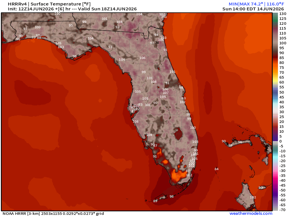


🔥🌡️ Florida is HOT this afternoon! 🌡️🔥
The latest HRRR model is showing surface temperatures soaring well above 100°F across much of the Sunshine State, with some areas of South Florida potentially reaching 105°–108°F at the ground surface! 😳
While air temperatures may be lower, these surface temperatures highlight just how intense the June sun is becoming. Pavement, sand, and other surfaces can heat up rapidly and become dangerous for:
🐾 Pets' paws
👶 Children playing outdoors
🚗 Vehicle interiors
🥵 Anyone spending extended time outside
💧 Stay hydrated, take frequent breaks, and never leave children or pets unattended in vehicles.
How hot is it where you are right now?
#Florida #FLwx #HeatWave #SummerHeat #HotWeather #FloridaWeather #StayCool #SunshineState #WeatherUpdate 🌴☀️🌡️
13
Showers and storms that develop this afternoon will look to favor areas of South FL, North FL and generally the Eastern side of the State. West Central FL....no cigar!
1
24
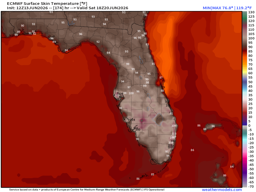
If you thought today or this weekend was hot....wait until next weekend.
Skin surface temps per the EURO look to hit near 120 degrees. THIS IS NOT the actual temp but what the temp will feel like to your skin while outside. The later part of next week and into the weekend, the actual skin surface feel like temps are all over 100 degrees!
What's causing it? High pressure. High pressure is looking to dominate over the Gulf/Upper Caribbean and over FL into the later part of next week.
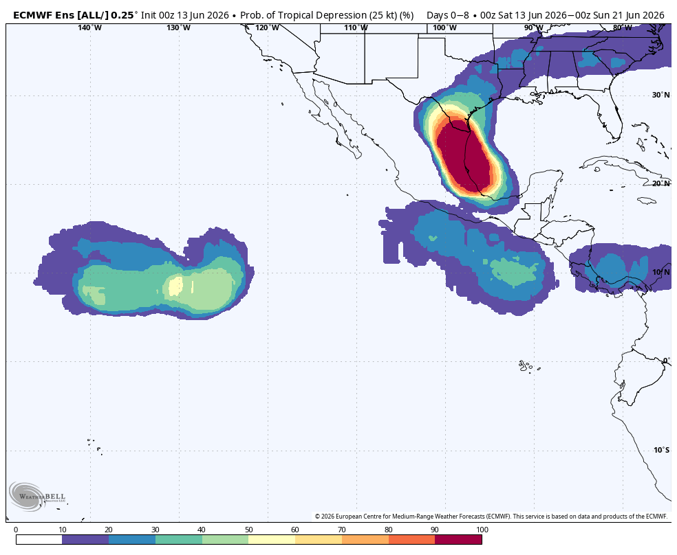
This same high pressure is what is helping to steer this broad low pressure system in the BOC that the NHC is monitoring into the Mx/Tx area.
1
2
12
413
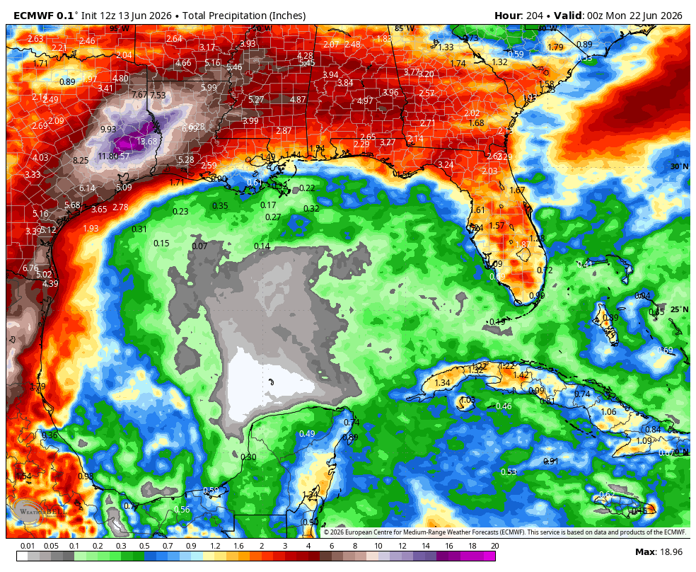
A pretty stout rain signal coming in the later part of next week for the Tx and La areas from tropical rains and showers from this broad low pressure area the NHC is monitoring. Purple areas are 18" !
2
2
34
1,445
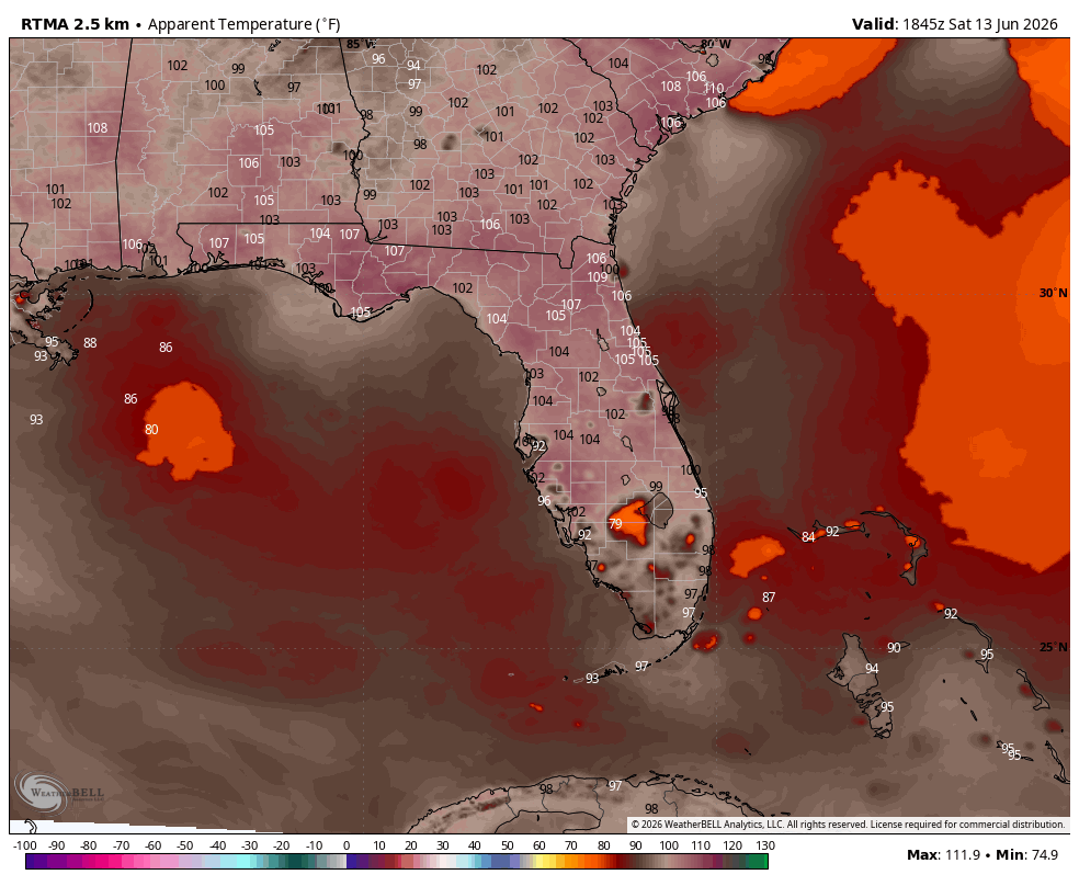
🥵🔥 Florida is feeling the heat this afternoon! 🔥🥵
"Feels Like" temperatures have surged into the 100° to 108° range across much of the state, with a few locations along the First Coast and Southeast Florida flirting with 110° heat index values!
The combination of hot temperatures and Florida's signature humidity is making it feel downright oppressive outside. If you're spending time outdoors today:
💧 Stay hydrated
🌴 Take frequent breaks in the shade or A/C
👕 Wear lightweight, light-colored clothing
🐶 Don't forget about pets and never leave children or animals in vehicles
Summer hasn't officially started yet, but Florida is already putting on a full-season performance! ☀️🌡️
#Florida #FLwx #Heat #HeatIndex #SummerHeat #FloridaWeather #StayCool #Weather #SunshineState ☀️🥵🌴
1
4
188
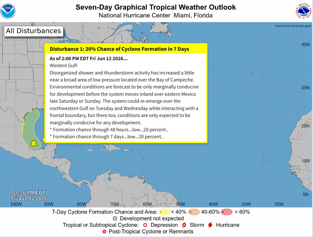
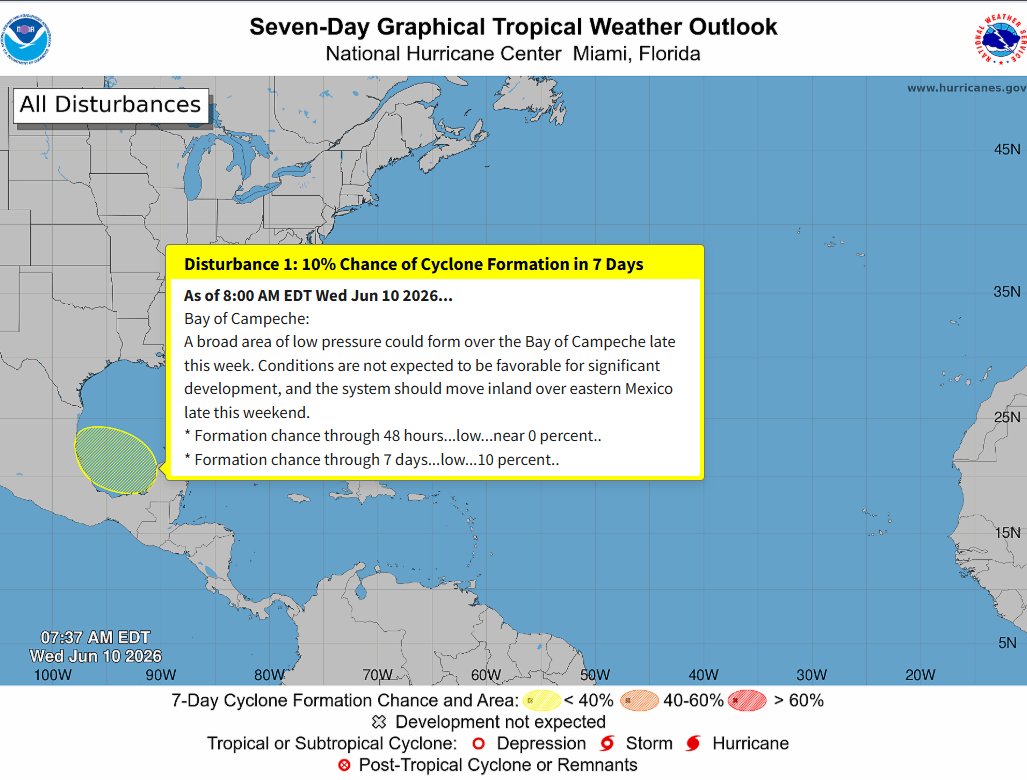
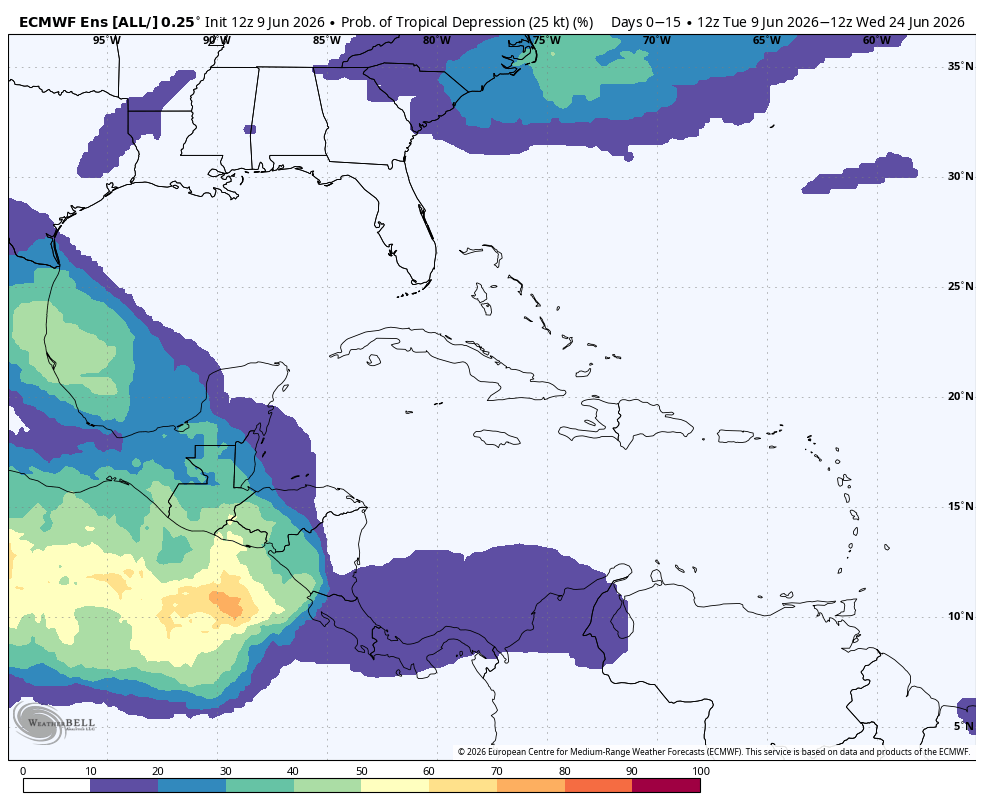
NHC still keeping development chances at 20% this afternoon with this wave we are watching in the BOC.
EURO ensembles still liking the idea of a TD developing by the end of the weekend. We shall see...
4
36
1,667

Jun 12
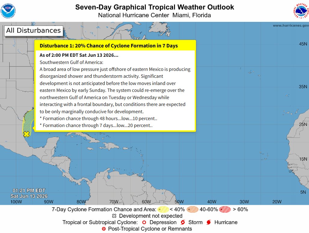
As of 2pm, the NHC has increased development chances of this area in the lower Gulf to a 20% chance of development with in the next 7 days.
As what is still being forecasted by the EURO and its ensemble members, we may likely see a TD by the end of the weekend.
1
2
210
Jun 12
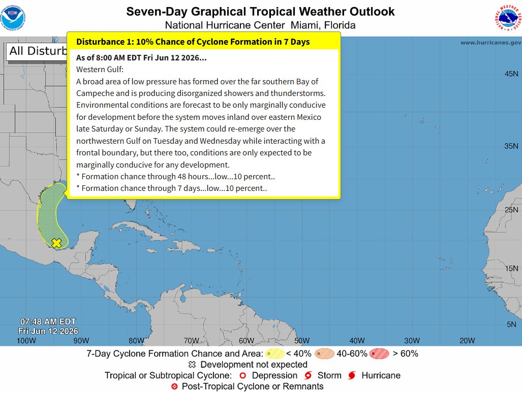
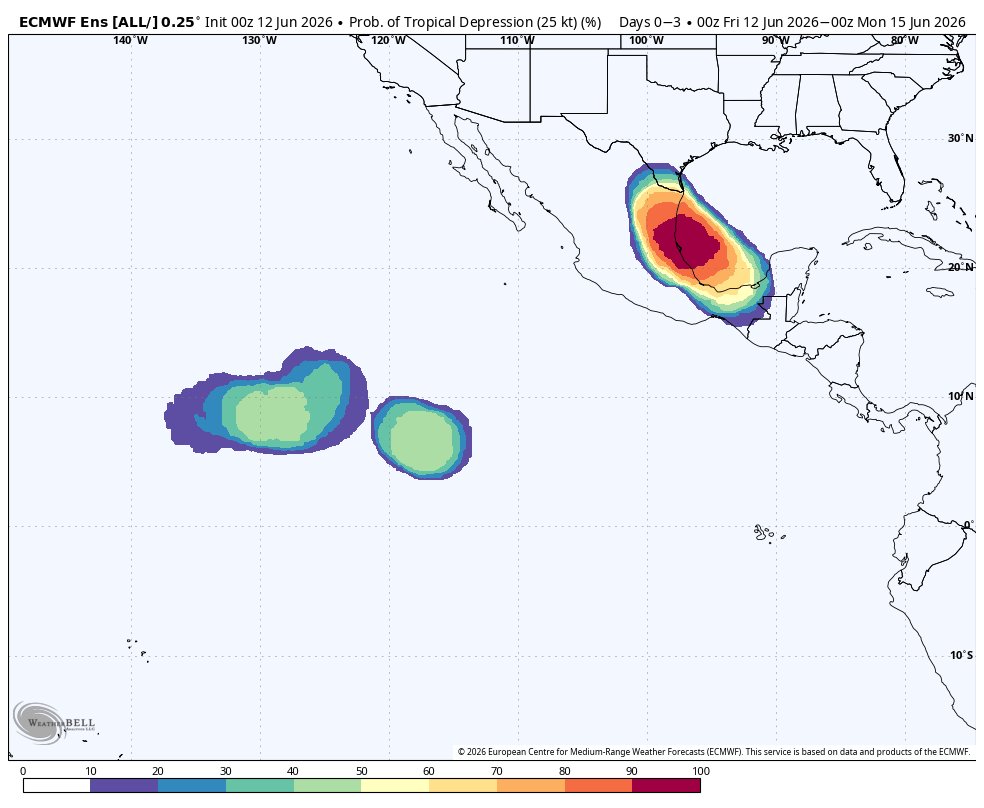
8am NHC map this morning still giving this low pressure in the BOC/lower Gulf a 10% chance of development thru the next 7 days.
EURO ensemble going all in showing a likely Depression to develop by the end of this weekend.
3
21
919
Jun 11
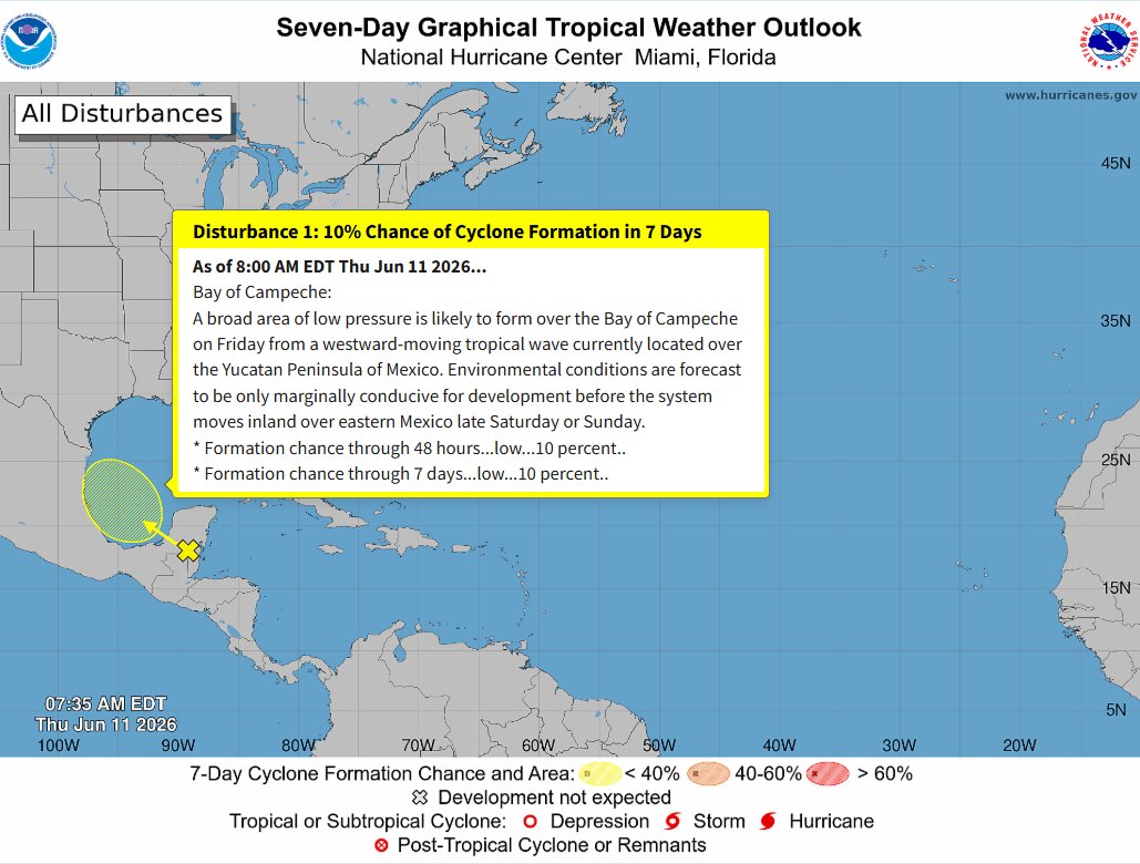
8AM NHC map this morning still keeping this wave to move into the BOC at a 10% chance of development over the next 7 days.
Likely going to see increased chances as we get into the weekend. EURO EPS data is giving this area between a 50-60% chance of development over the weekend and into next week.

3
25
1,356
Jun 11
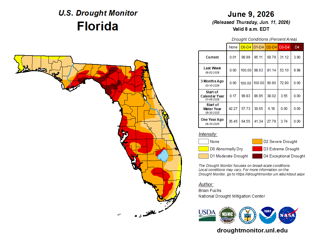
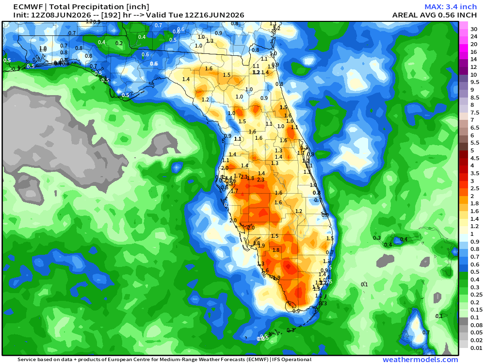
You can tell the rainy season has started...some what...cause this map is a pretty good improvement over all from what we have been seeing with this drought across FL.
Still a ways to go yet!!!
1
1
140
Jun 11
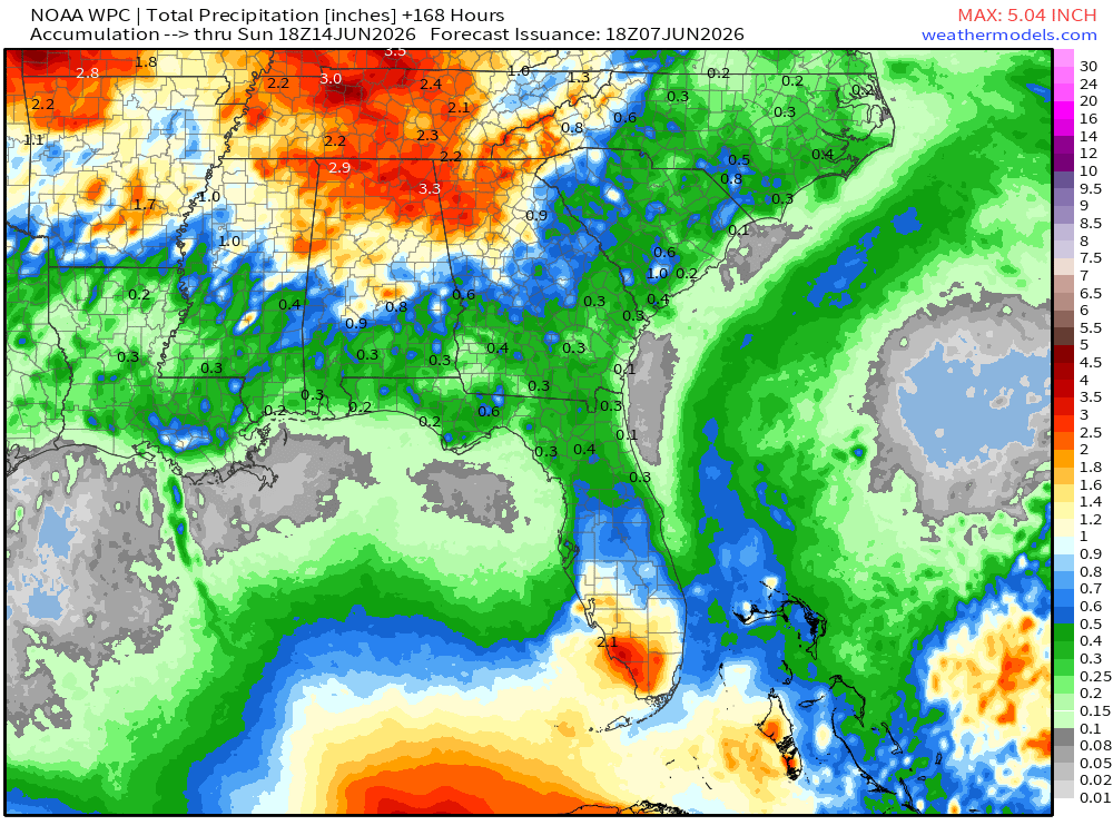
Check out the rain coverage from the rains yesterday!
Not all saw rain but there were several spots getting 2" or more and few with 3-4". All trending in the right direction with this on going drought.
1
1
93
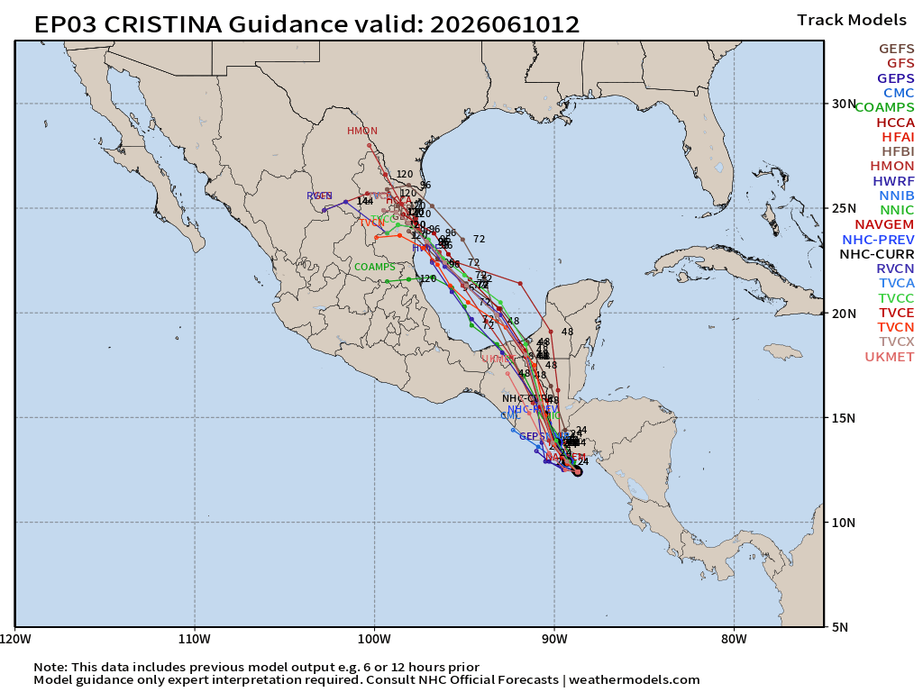
Jun 10
Will be an interesting set up and forecast for sure as all spaghetti models now bring Cristina over from the EPAC the BOC/lower Gulf with in the next 48-72 hrs.
4
17
537
Jun 10
Not really surprising....but the NHC out with with lemon this morning giving this area in the BOC a 10% chance of development as energy from the EPAC looks to cross over.
Still not seeing any cause of concern for FL or the upper Gulf coast with this.
1
3
182
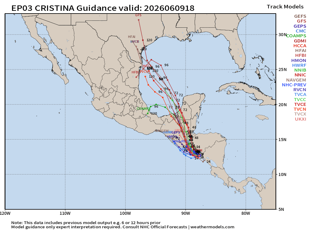
Jun 9
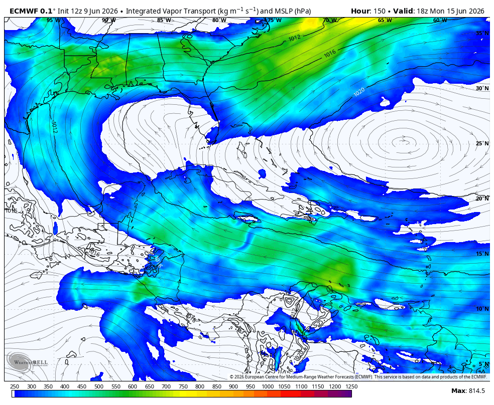
Cristina from EPAC looks to be the cross over system into the BOC/Gulf.
Rain chances looking to go up next across the SEAST thanks to this system crossing over. Integrated vapor transport loop from the EURO showing the direction of the moisture plume.
2
1
25
1,314
Jun 9
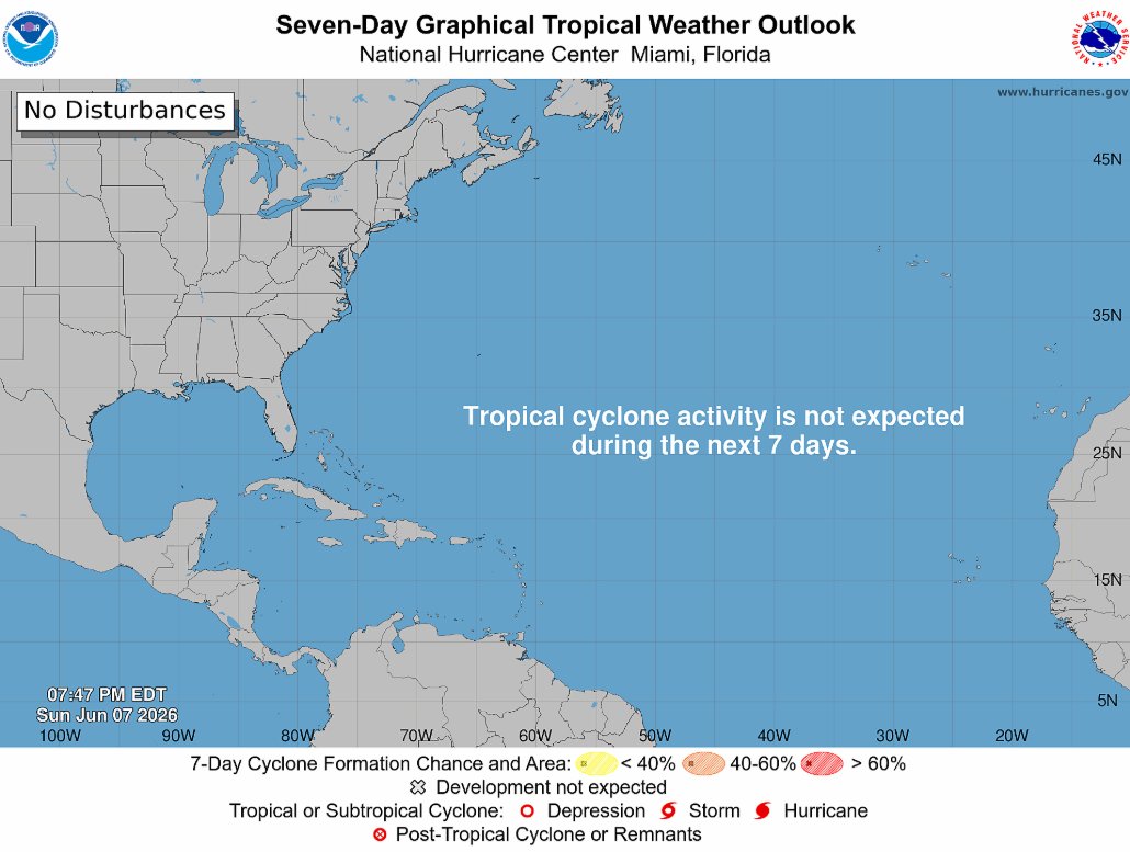
NHC map still quiet through the next 7 days.
EURO EPS long range maps keeping things generally quiet as well but showing some of that cross over action from the EPAC into the BOC/Lower Gulf area. Nothing for the upper Gulf or for FL to worry about.
2
12
561
Jun 9
The rainy season finally looks to come back out of hibernation starting Wednesday of this week. The next 7 days looks to be rather wet in the afternoon to evening hours with FL's typical 4pm rainy weather pattern.
1
7
321
Jun 8
🚨M 6.1 - 104 km WNW of Mantua, Cuba🚨
If your in FL and you felt and shaking or rumbling...your not imagining things...There was just a 6.1 magnitude EQ near Cuba which was felt in portions of FL.

1
1
7
342
Jun 8
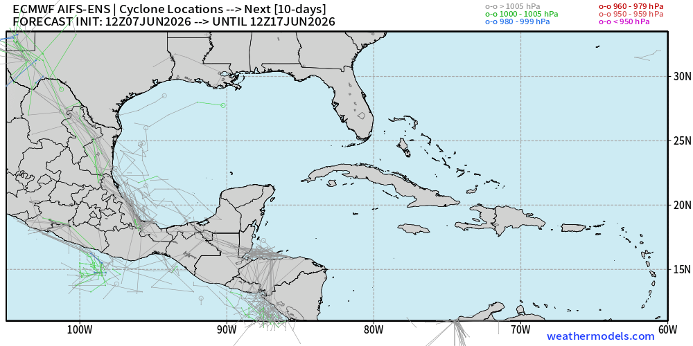
Latest NHC map showing nothing to be concerned with in the Gulf through the next 7 days.
And honestly...the latest EURO EPS data is showing the same. There are potential signs of cross over energy from the EPAC making it into the Bay of Campeche. IF...BIG IF...this were to occur...any developments would move off to the WEST.

2
15
1,678
Jun 6
More African dust is on the way this coming week for the Caribbean and looks to enter FL as we get into next weekend....could inhibit any rain chances or development in the Gulf.
1
1
20
1,352