
Supplier of value-added #geospatial data, high quality PlanetSAT #satelliteimagery basemap, PlanetDEM global #elevation data and a full range of VHR data.
Joined March 2014
- Tweets 882
- Following 175
- Followers 580
- Likes 217
655 Photos and videos


Pinned Tweet

18 Apr 2024
Discover the beauty of our planet with #PlanetSAT 2024 10-meter Global Imagery #Basemap! 🌎
The video below gives you a peak at PlanetSAT 2024, offering a behind-the-scenes look at our global mosaic, updated with new #Sentinel2 imagery!
Check it out now!
#SatelliteImagery
148
18 Dec 2024
Celebrating #QatarNationalDay with this beautiful #SatelliteImage of Doha from our #PlanetSAT #Basemap.
Doha, a city known for its modern skyline and rich cultural heritage, showcases the dynamic spirit of Qatar.
#GeospatialData #EarthObservation
35
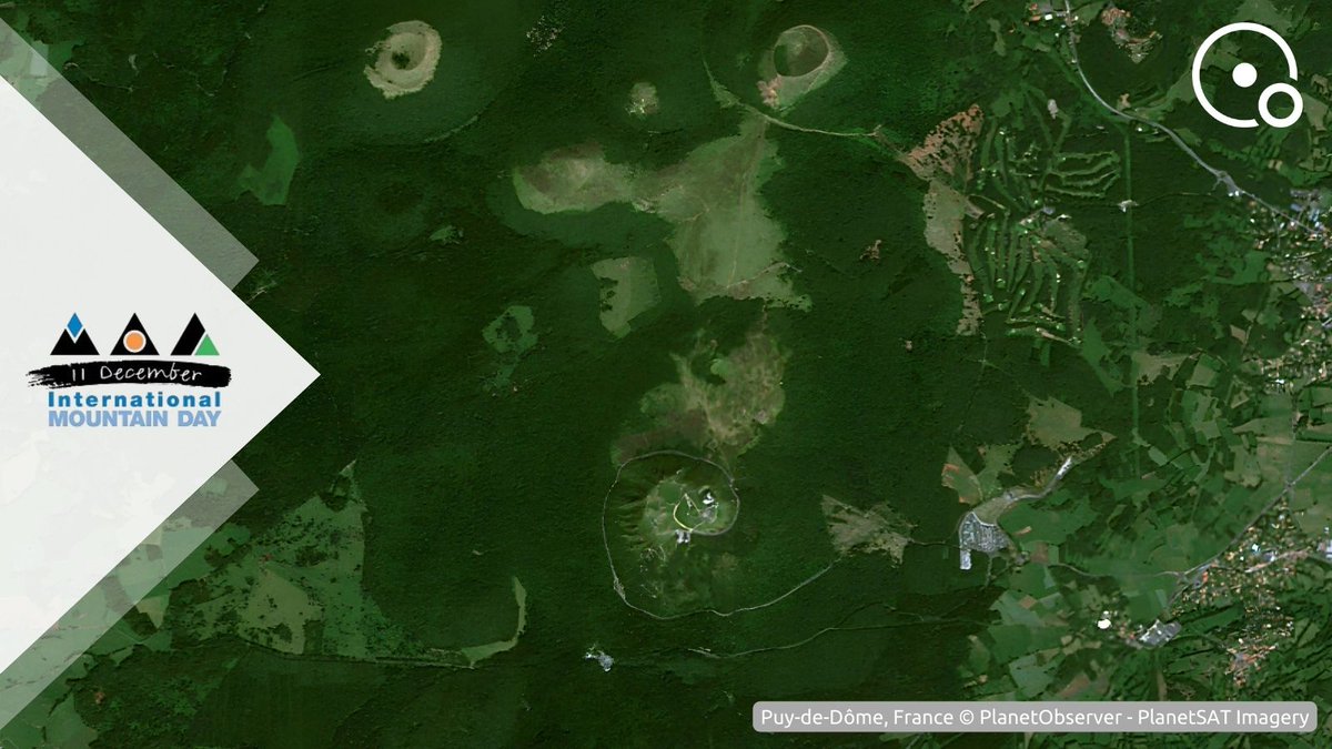
11 Dec 2024
🏔️ Celebrating #InternationalMountainDay with this beautiful #SatelliteImage of Puy de Dôme in France from our 5m Basemap generated with AI from our 10m #PlanetSAT #Basemap.
At 1465 meters, Puy de Dôme is a UNESCO World Heritage site and a Grand Site de France.
#Copernicus #GIS
37
3 Dec 2024
🌍 Celebrating #EarthInformationDay with this stunning #SatelliteImage of our planet from our #PlanetSAT #Basemap.
Satellite imagery provides crucial data for #EarthObservation and tracking to understand environmental changes and protecting our world.
#Copernicus #GIS
30
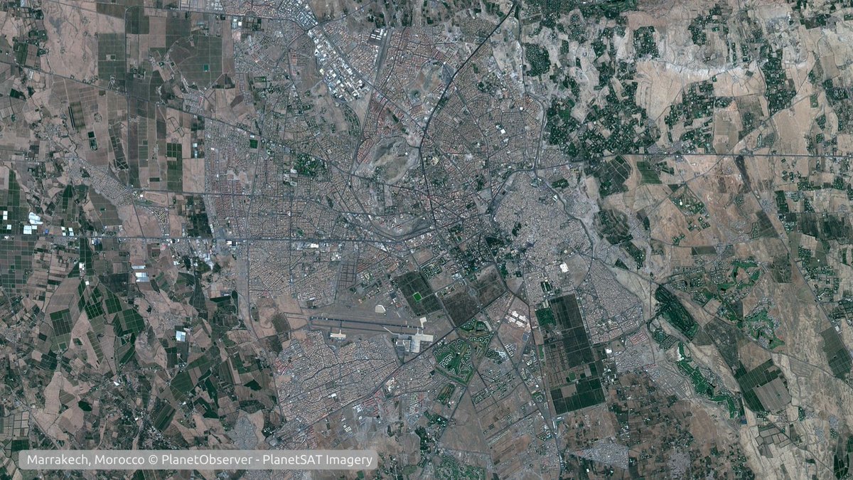
18 Nov 2024
🇲🇦 Celebrating #MoroccoIndependenceDay with this beautiful #SatelliteImage of Marrakech from our #PlanetSAT #Basemap.
Marrakech, a world-renowned tourist destination, embodies the vibrant spirit of Morocco with its rich history and culture.
#Copernicus #GIS #EarthObservation
56
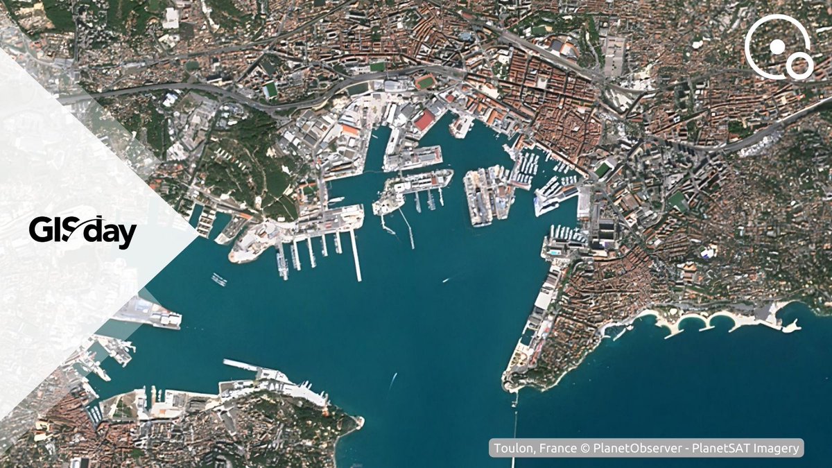
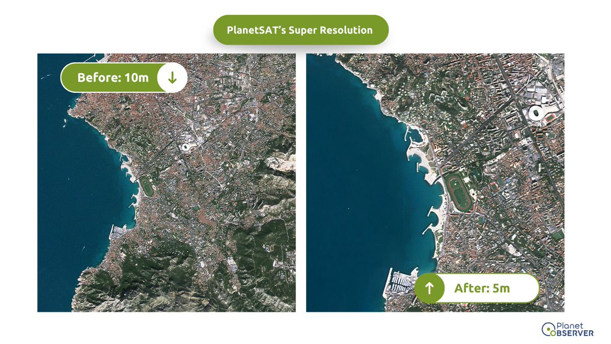
15 Nov 2024
Celebrating #GISDay with this detailed 5m resolution #SatelliteImage of Toulon, France from our 5m Basemap generated with AI from our 10m #PlanetSAT #Basemap.
5m resolution satellite images are invaluable for regional mapping, providing detailed & accurate data.
#GIS #Mapping
46
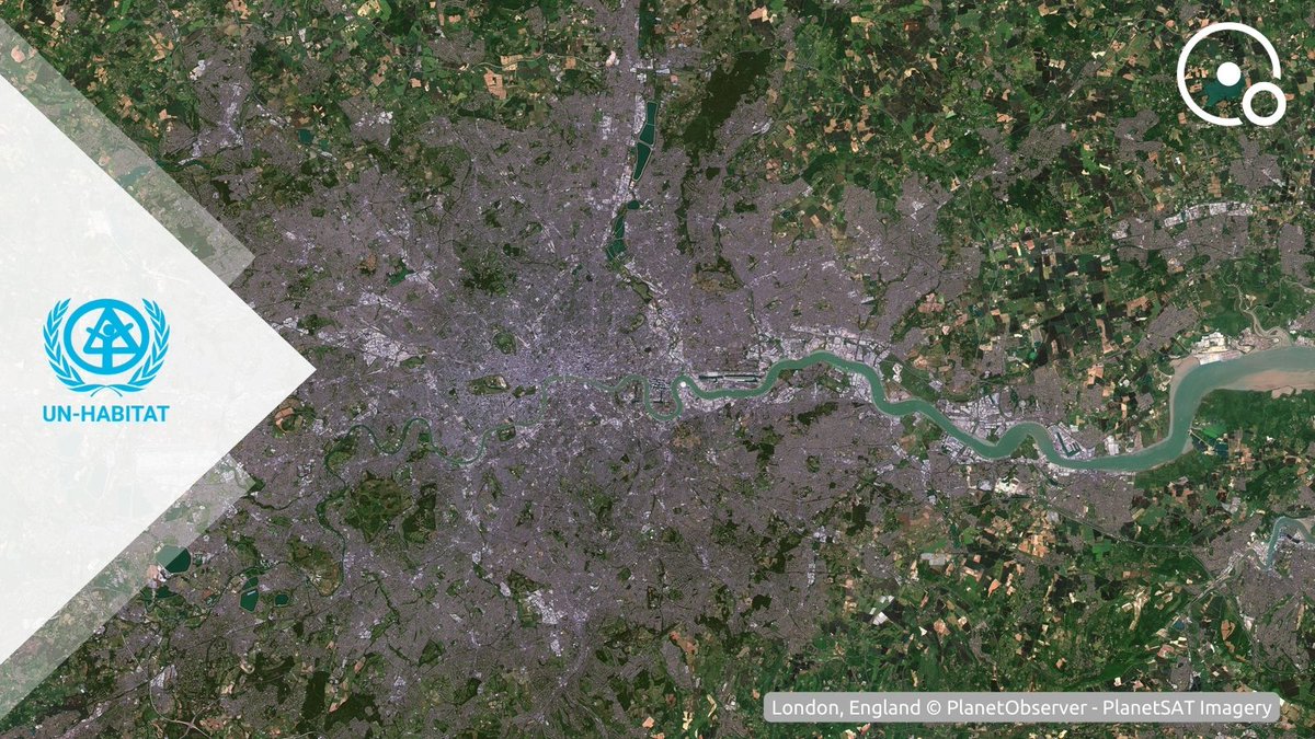
31 Oct 2024
Celebrating #WorldCitiesDay! 🌆
This satellite image of London, a city where over 300 languages are spoken, highlights its incredible diversity and vibrancy.
Let's honor our urban spaces and work towards sustainable and inclusive cities for all.
#Copernicus #GIS #PlanetSAT
43
1 Oct 2024
Celebrating China's National Day with this #SatelliteImage of Jinchang from our #PlanetSAT #Basemap.
Known for its vibrant development, Jinchang is near the Jinchuan Solar Park that represents the region's efforts to promote renewable energy.
#EarthObservation #viewfromabove
48
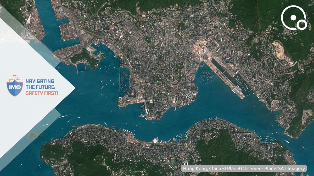
30 Sep 2024
Celebrating #WorldMaritimeDay! ⚓️
This #satelliteImage of Hong Kong Port, a global container leader and gateway to Southern China, highlights maritime security, and marine environment protection.
Let's honor the maritime industry and promote sustainability!
#viewfromabove
42
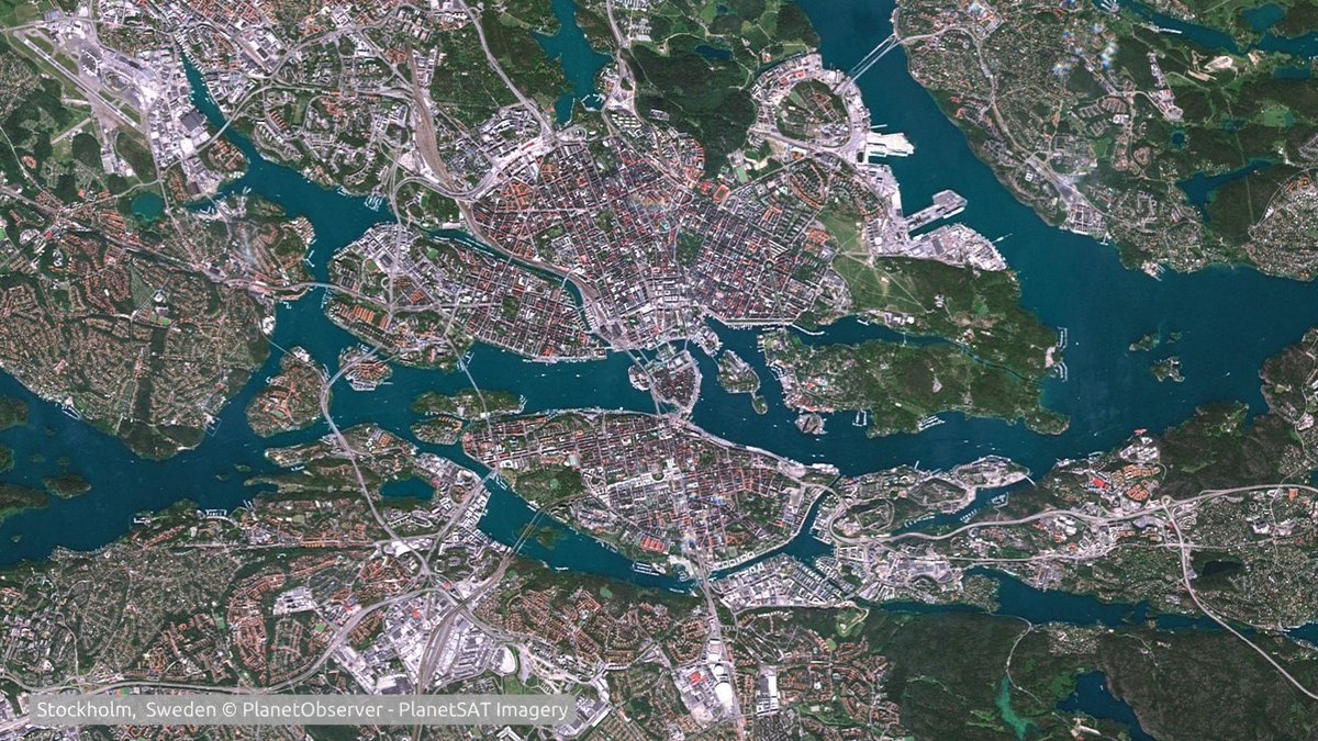
18 Sep 2024
#EuropeanSustainableDevelopmentWeek🌍
As we celebrate #ESDW, we spotlight Sweden through this #SatelliteImage of Stockholm, Sweden’s capital.
Ranked 2nd in Europe for #sustainability, Sweden symbolizes an example to follow and the potential for a sustainable future.
#EarthObs
35
18 Sep 2024
Celebrating #WorldWaterMonitoringDay! 💧
This #SatellitImage of Montreal, Canada's 2nd largest city, showcases Canada's comprehensive regulations from water preservation and filtering processes to distribution.
Let's raise awareness & ensure clean water for all!
#EarthObs
29
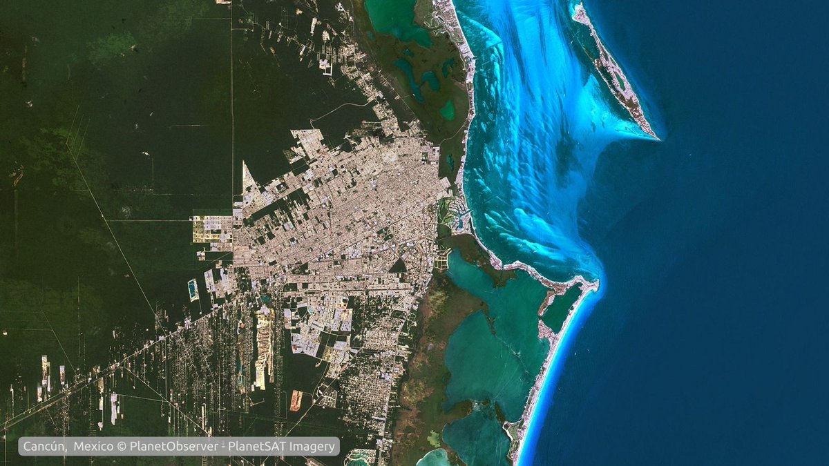
16 Sep 2024
Celebrating #MexicanIndependenceDay with this beautiful #SatelliteImage of Cancun from our #PlanetSAT #Basemap.
Cancun, known for its stunning beaches and vibrant culture, embodies the spirit of Mexico.
#EarthObservation #viewfromabove
1
97
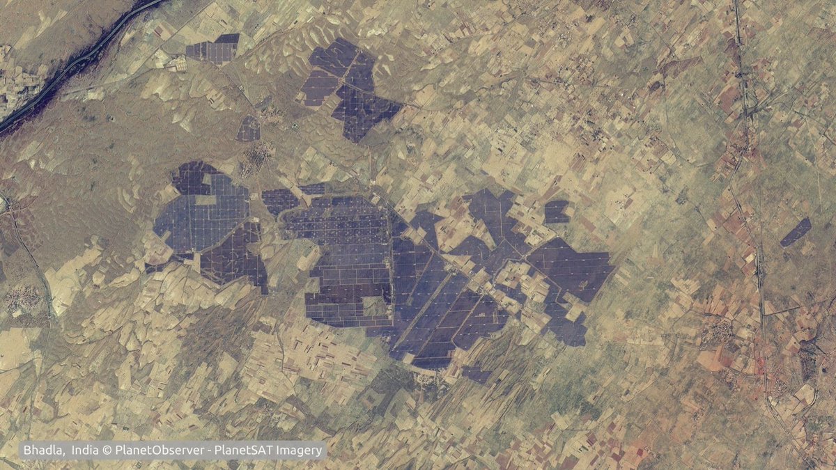
15 Aug 2024
Celebrating #IndiaIndependenceDay with this stunning #SatelliteImage of Bhadla Solar Park, Rajasthan from our #PlanetSAT #Basemap.
At 56 sq km and 2,245 MW, it's the largest solar park in the world, showcasing India's commitment to sustainable energy☀️.
#EarthObservation
32
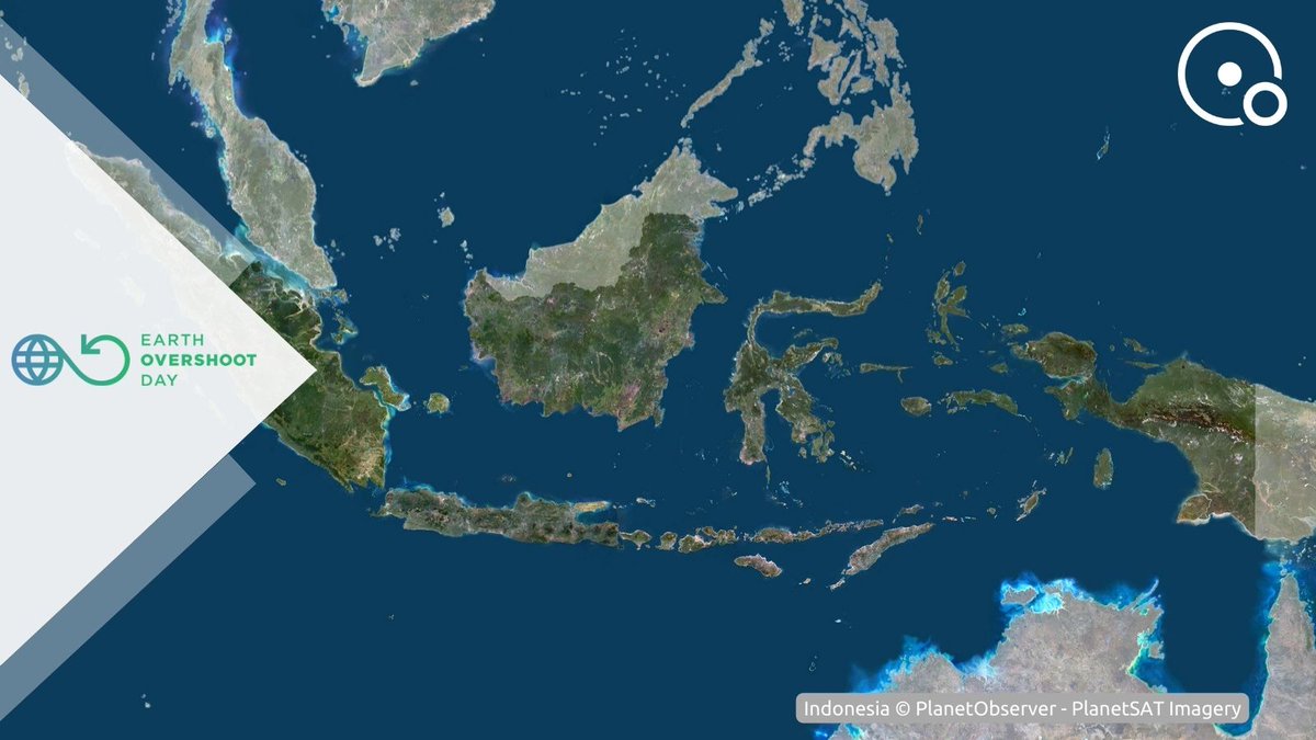
2 Aug 2024
Today, August 1st, 2024, we mark #EarthOvershootDay🌏, when humanity's demand exceeds Earth's yearly resources.
This #satelliteImage of Indonesia, with its Overshoot Day on Nov 24, highlights the importance of sustainable practices by consumer countries to #MoveTheDate🌿
65
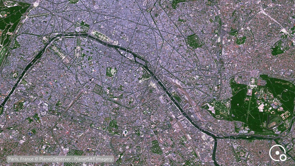
14 Jul 2024
Celebrating #BastilleDay with a #SatelliteImage of Paris, France from our #PlanetSAT refreshed #Basemap.
This image displays the city center and la Seine, where the 2024 #Olympic Games will be launched.
#EarthObservation #GeospatialData #viewfromabove #Paris2024
67
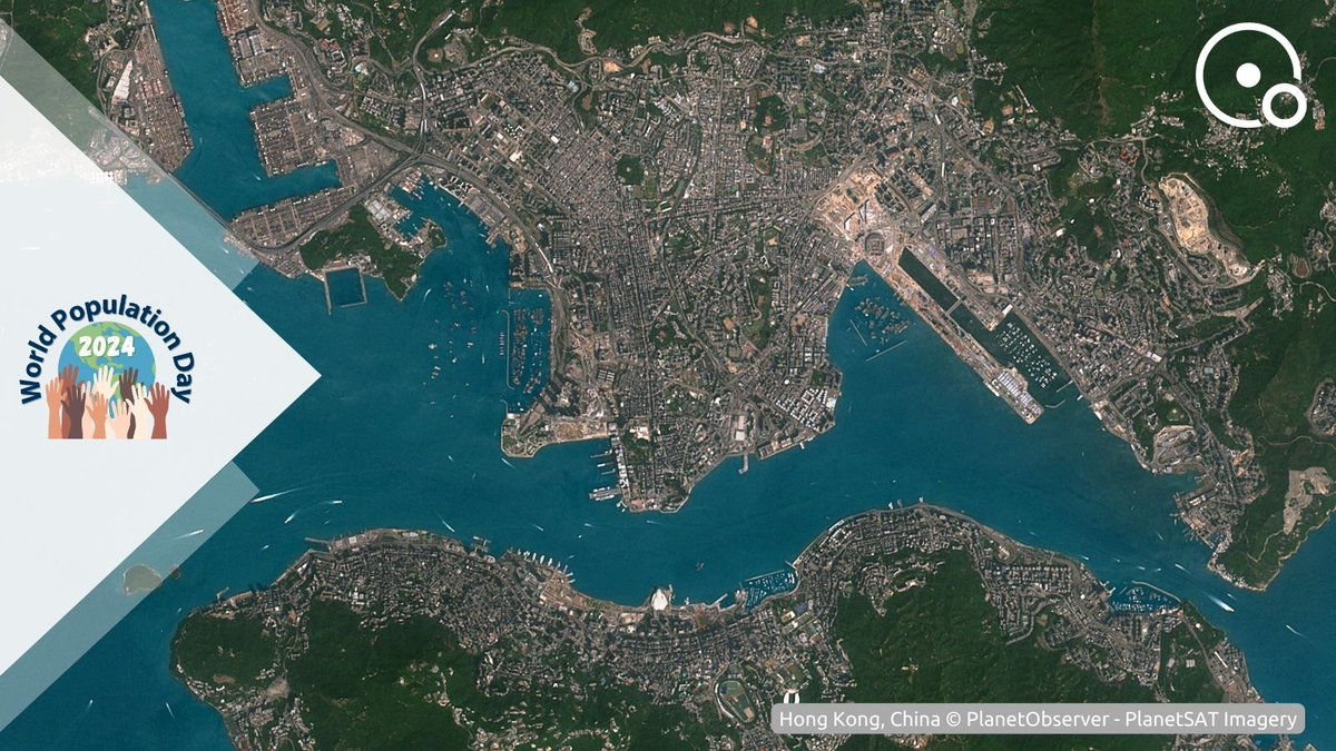
11 Jul 2024
On #WorldPopulationDay, we showcase Hong Kong, China, through our #PlanetSAT #SatelliteImage.
With a population of 7.346 million, Hong Kong is a vibrant metropolis highlighting the challenges and opportunities of urban living.
#EarthObservation #GeospatialData #Urbanization
1
34
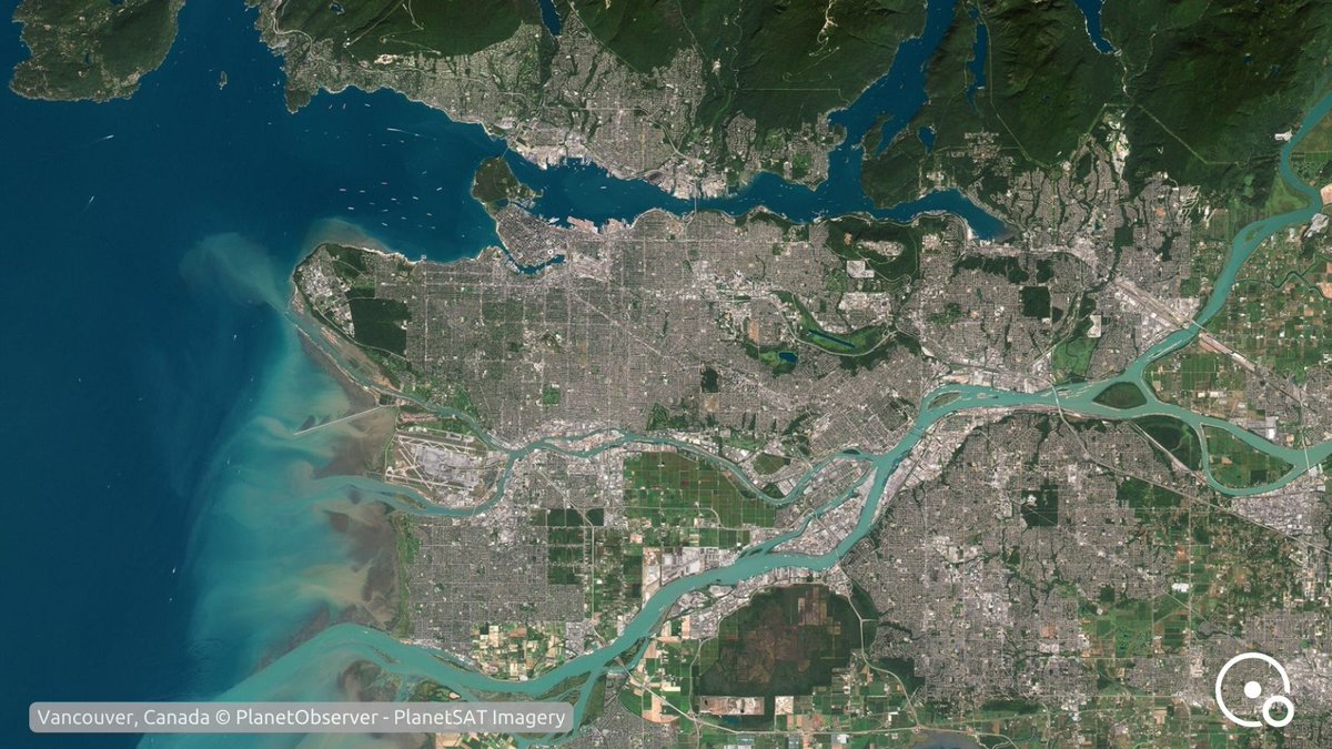
1 Jul 2024
Celebrating #CanadaDay with a this stunning #SatelliteImage of Vancouver, Canada from our #PlanetSAT refreshed #Basemap🍁
Vancouver, a vibrant city known for its beautiful landscapes and diverse culture, embodies the spirit of Canada.
#EarthObservation #viewfromabove
2
44
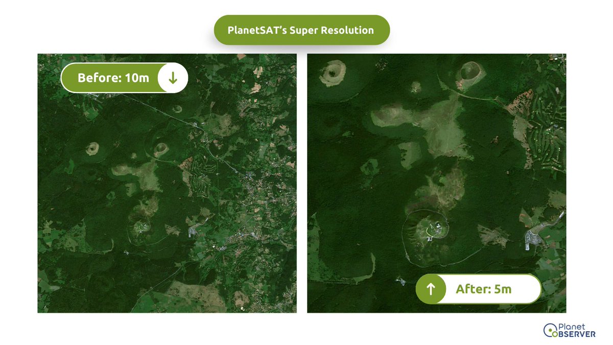
27 Jun 2024
Scaling the heights of Puy de Dôme! ⛰️
In our final installment, witness how our new AI-enhanced 5m satellite imagery captures the natural beauty of mountainous areas.
#satelliteimagery #EarthObservation #Sentinel2
22
25 Jun 2024
Discovering the coastal charm of Cassis and Les Calanques! 🌊
Our third installment reveals how our new AI-enhanced 5m satellite imagery captures the stunning details of coastal areas.
More comparisons coming your way!
#satelliteimagery #EarthObservation #Sentinel2
38
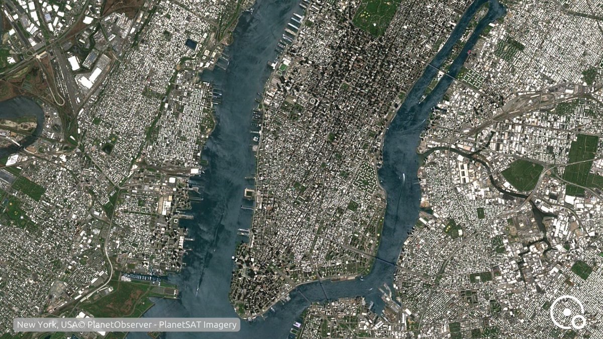
23 Jun 2024
Happy 9th #Sentinel2 launch anniversary! 🛰️
Since June 23, 2015, it has captured stunning 10m resolution #satelliteimages like this one of NYC.
We thank @esa & @CopernicusEU for this invaluable imagery used in our #PlanetSAT basemap! 🌍🛰️
#Copernicus #EarthObservation
42
20 Jun 2024
Next stop: Champagne cultivated fields in eastern France! 🌾
Witness how our new AI-enhanced 5m satellite imagery enhances details in agriculture areas.
Stay tuned for more insights!
#satelliteimagery #EarthObservation #Sentinel2 #AI

31