
RIEGL delivers Smart Waveform technology in unmanned, airborne, mobile and terrestrial laser scanning solutions. rieglinternational.com
Joined July 2009
- Tweets 11,822
- Following 2,287
- Followers 5,428
- Likes 1,965
2,716 Photos and videos


🎥 New Video: #RIEGL miniVUX vs VUX: How Much Detail Do You Need?
Preview our latest #RIEGL Video Lab episode from the #RIEGL USA team featuring Tyler Shriver as he explains how to match your #RIEGLLiDAR system to your application.
👉 Watch full video
youtu.be/teRSphurZWY
75
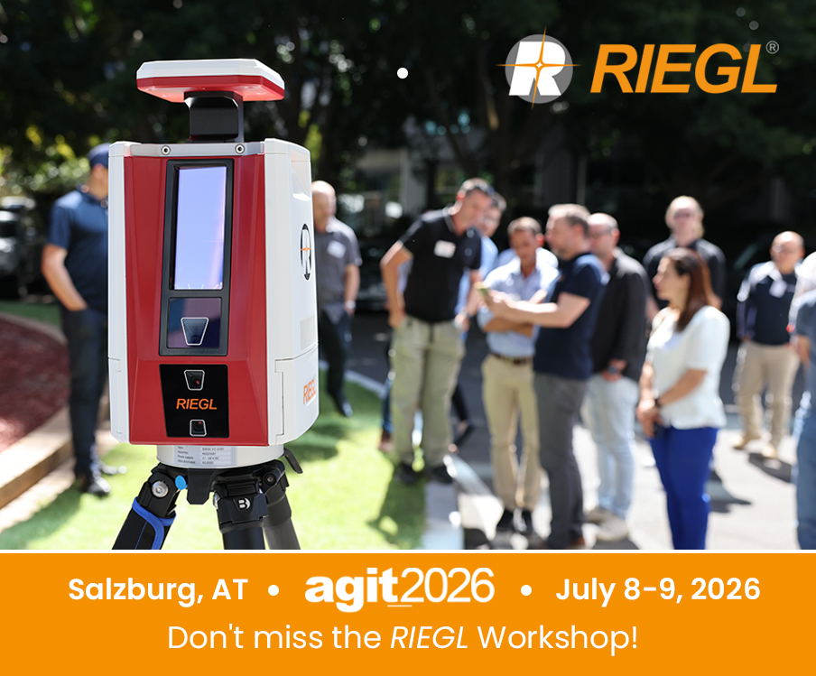
#RIEGL will be hosting a workshop during the 2026 AGIT Conference (@agit_team) taking place July 8-9th at the Faculty of Natural and Life Sciences in Salzburg, Austria.
For more information: loom.ly/8SANPvQ
#agit2026
1
30
Organized by the Department of Geoinformatics - Z_GIS, within the Faculty of Digital and Analytical Sciences at the Universität Salzburg, this established User Forum provides a platform for the exchange of knowledge, innovations, and practical applications in #geoinformatics.
1
34
🌍 World Environment Day 2026
What we measure accurately, we can better understand - and protect in the long term.
With innovative #LiDAR technology, #RIEGL supports users worldwide in this task.
UN Environment Programme:
loom.ly/HsRTMpw

1
105
The challenges of our time call for well-informed decisions. Whether it’s environmental monitoring, resource management, or ecosystem observation - reliable #geospatial data provides the foundation for making changes visible and documenting developments over the long term.
1
92
📖 Learn more about environmental monitoring and sustainable #geospatial data capture:
🔗 loom.ly/bKJLAMo
🔗 loom.ly/4xv-2SM
🔗 loom.ly/-1MHSAQ
#WorldEnvironmentDay #RIEGLLiDAR #iLiDAR #Laserscanning #GeoData #EnvironmentalMonitoring #ForNature
38
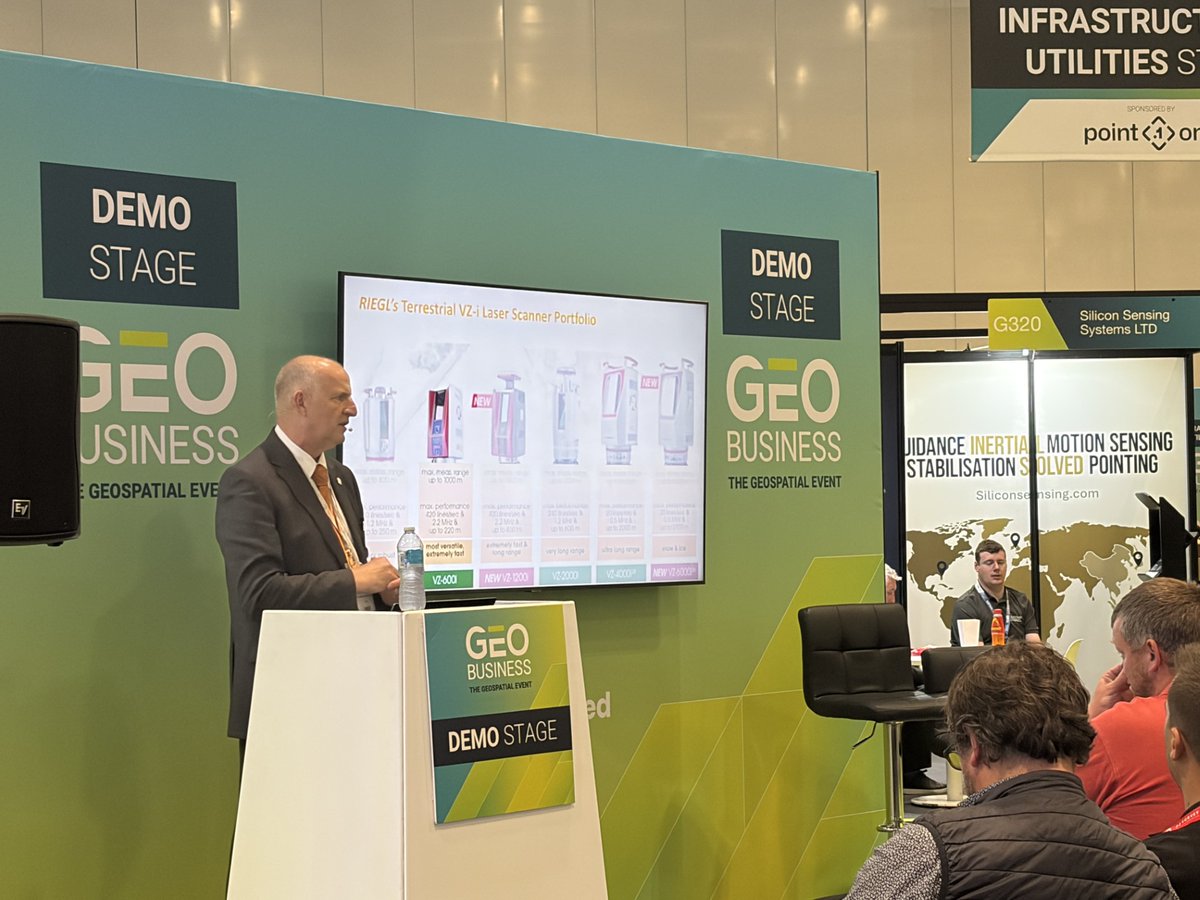
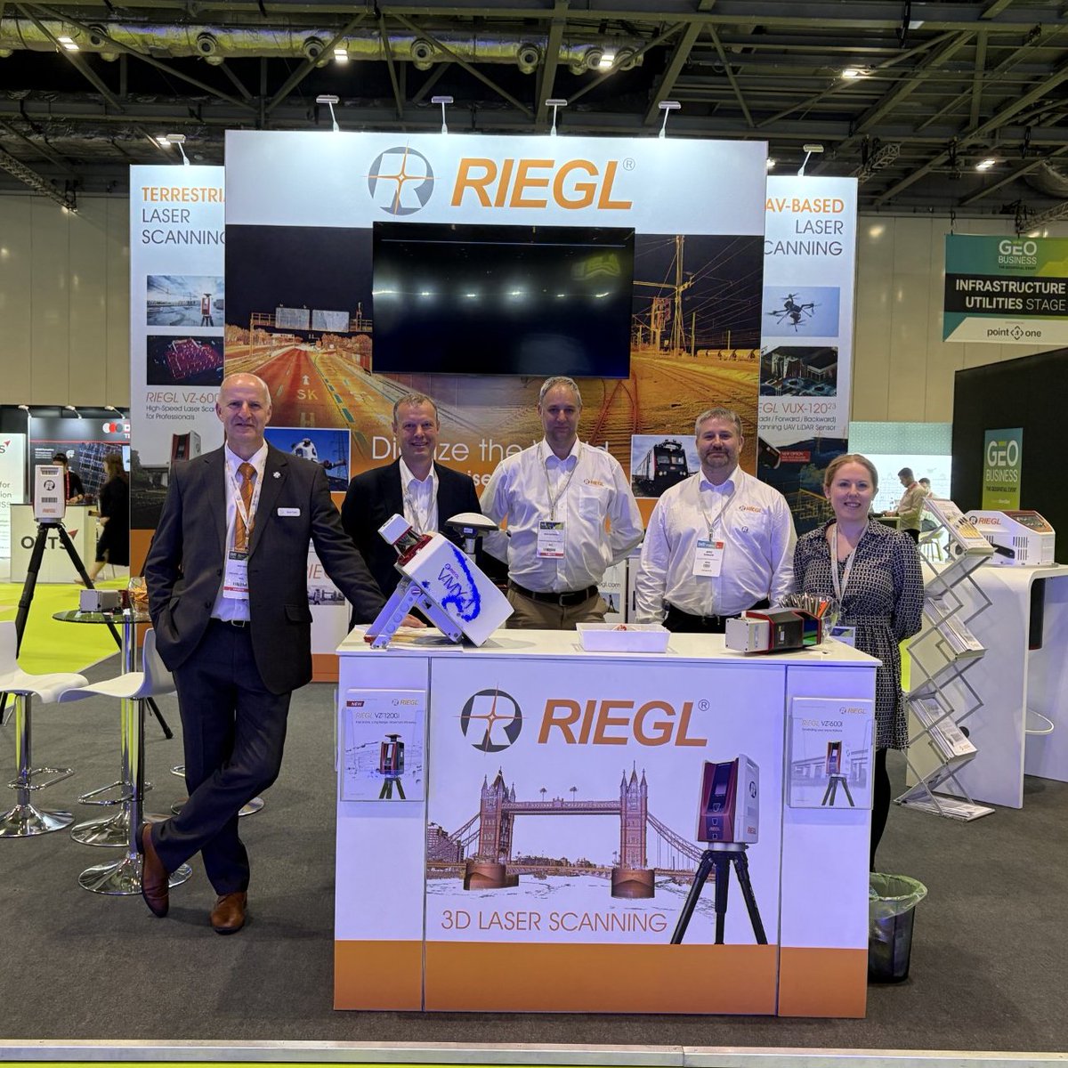
Highlights from #GEOBusiness2026 - #RIEGL at Booth G232
#GEOBusiness2026 at ExCeL London has been an exciting and productive event, with the #RIEGL UK team on-site representing #RIEGL and showcasing the latest innovations in high‑performance #LiDAR technology.

1
104
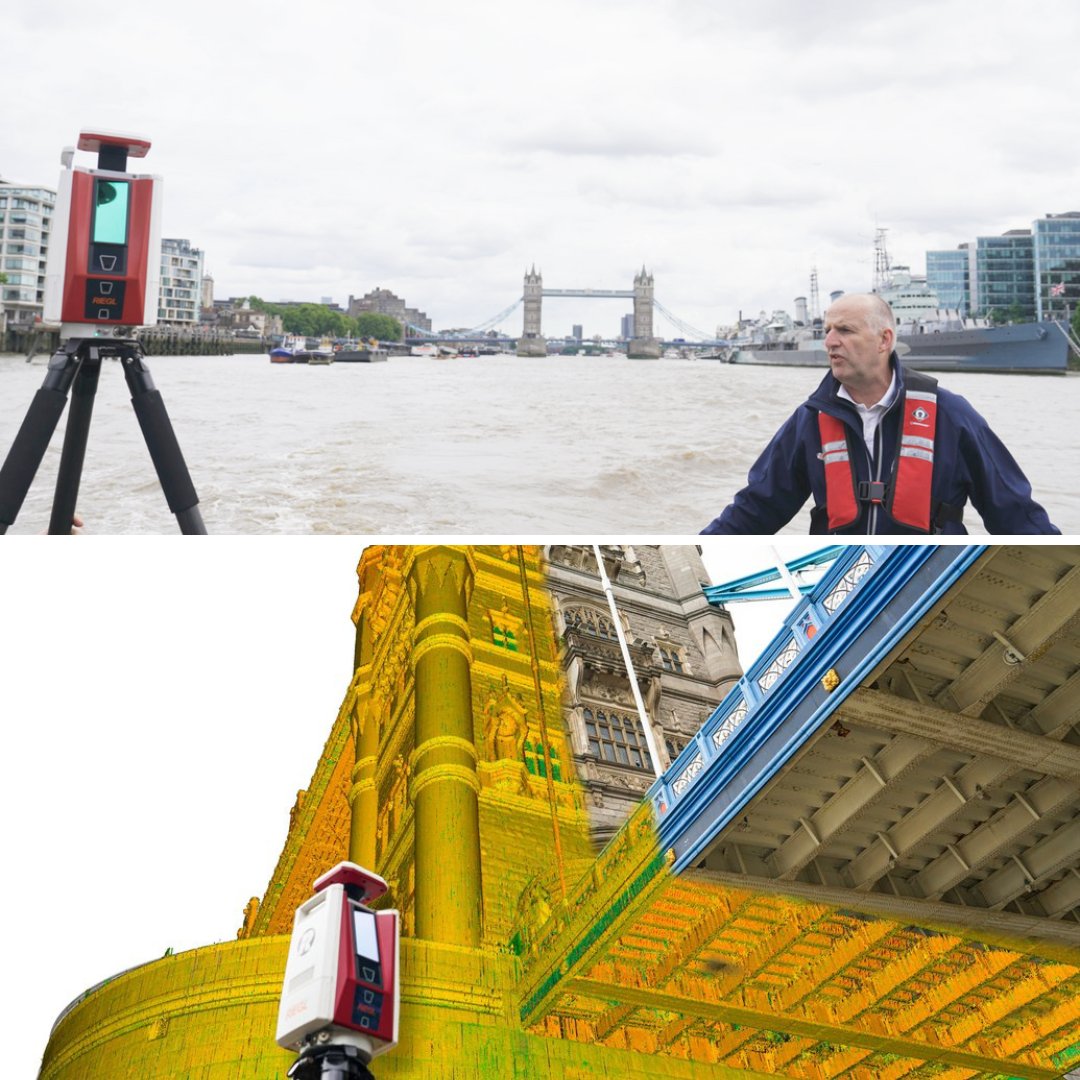
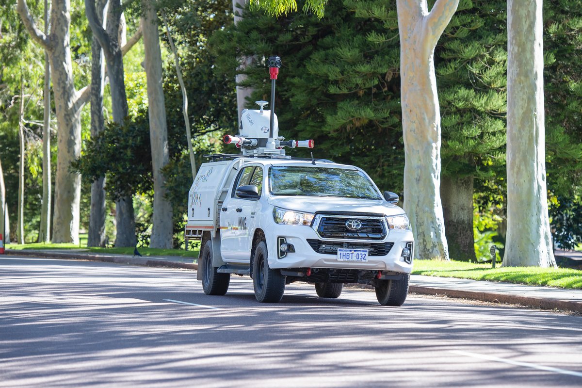
Kinematic Terrestrial Laser Scanning of the River Thames.
Read article ⬇️
loom.ly/95-Sm34
A recent article in GIM International highlights how #RIEGL #terrestrial #LiDAR is being applied in a kinematic workflow to capture high-quality data in dynamic environments.
1
36
👉 “Want to learn more? At #GeoBusiness2026, discover how these workflows translate into real-world solutions and meet the #RIEGL UK team starting tomorrow at Excel London, booth G232. For more information: loom.ly/Xf5qVx4
20
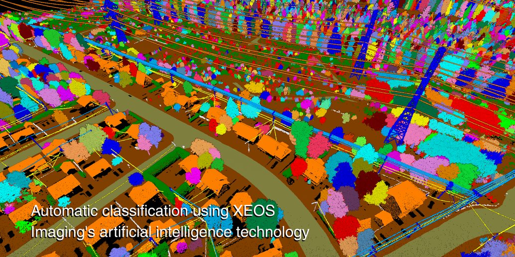
Reducing Power Outages with #Airborne #LiDAR and #AI: A Scalable Approach to Vegetation Management in Eastern Canada.
Read article⬇️
loom.ly/a0Q3TK0
Featuring #GeoWeekNews, #EAASI & #XEOS, powered by #RIEGLLiDAR with the VQ-1460.
42
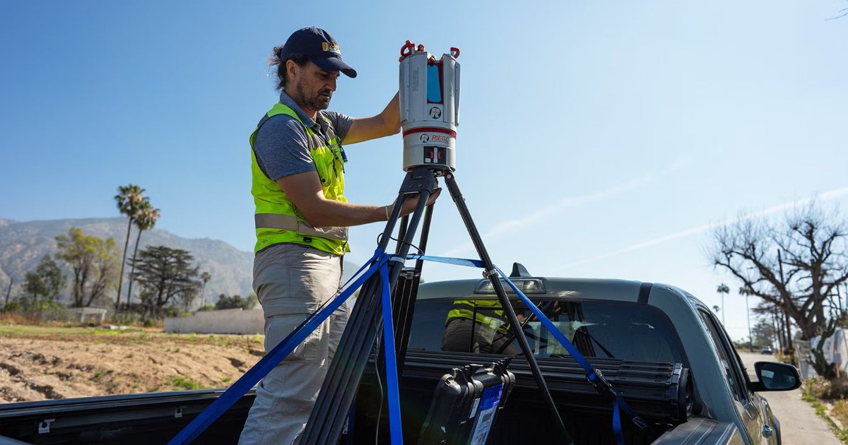
After the Fires: Protecting LA’s Trees While Learning Lessons for the Future. Utilizing the #RIEGL VZ-400i Terrestrial Laser Scanner.
🎥 Watch the video to see how #LiDAR technology is being used to capture fire-affected landscapes in precise 3D detail: youtu.be/wMVZ7T15d78?si=mj78…
1
141
📖 Read the full article to explore how this research is shaping strategies for urban forestry, wildfire mitigation, and climate resilience: ucdavis.edu/climate/news/aft…
18