
Southern Oregon and Northern California weather updates. My website links to weather data live from Medford, Oregon. Hourly weather updates 24/7/365.
Joined April 2009
- Tweets 141,857
- Following 128
- Followers 2,236
- Likes 1,206
8,329 Photos and videos


Air Quality and Smoke Mapping 6/15/26
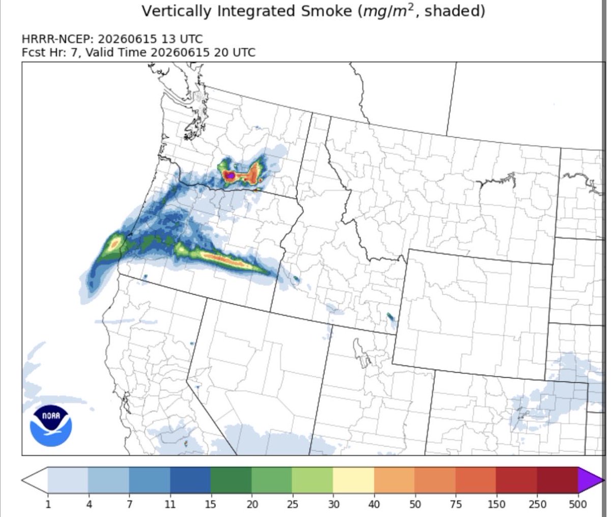
With new fires burning across the region it is time to start publishing daily air quality and smoke density maps. We can expect to see a drop in air quality near new fires and anywhere downwind of active smoke generating incidents.

2
3
48
NWS Medford: “With warmer temperatures on the way, it’s good to remember that area waterways remain cold and rivers are swift. Wear a life jacket, limit time in cold water, never swim alone and have a flotation device that can be thrown to someone in need.”
2
7
101
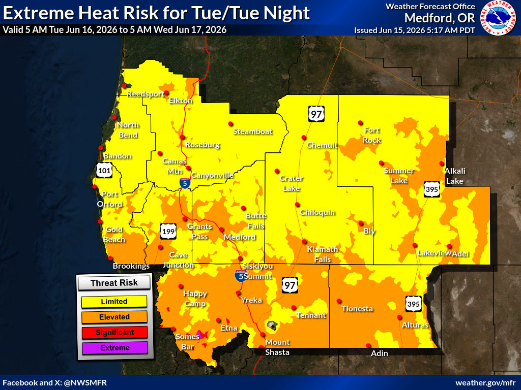
Today and Tuesday will feature the highest potential for heat related illnesses due to exposure to high temperatures. Overnight lows will also not cool off a lot resulting in more risk of heat exhaustion and heat stroke in extreme cases. Make sure you hydrate and seek cooling.
2
5
50
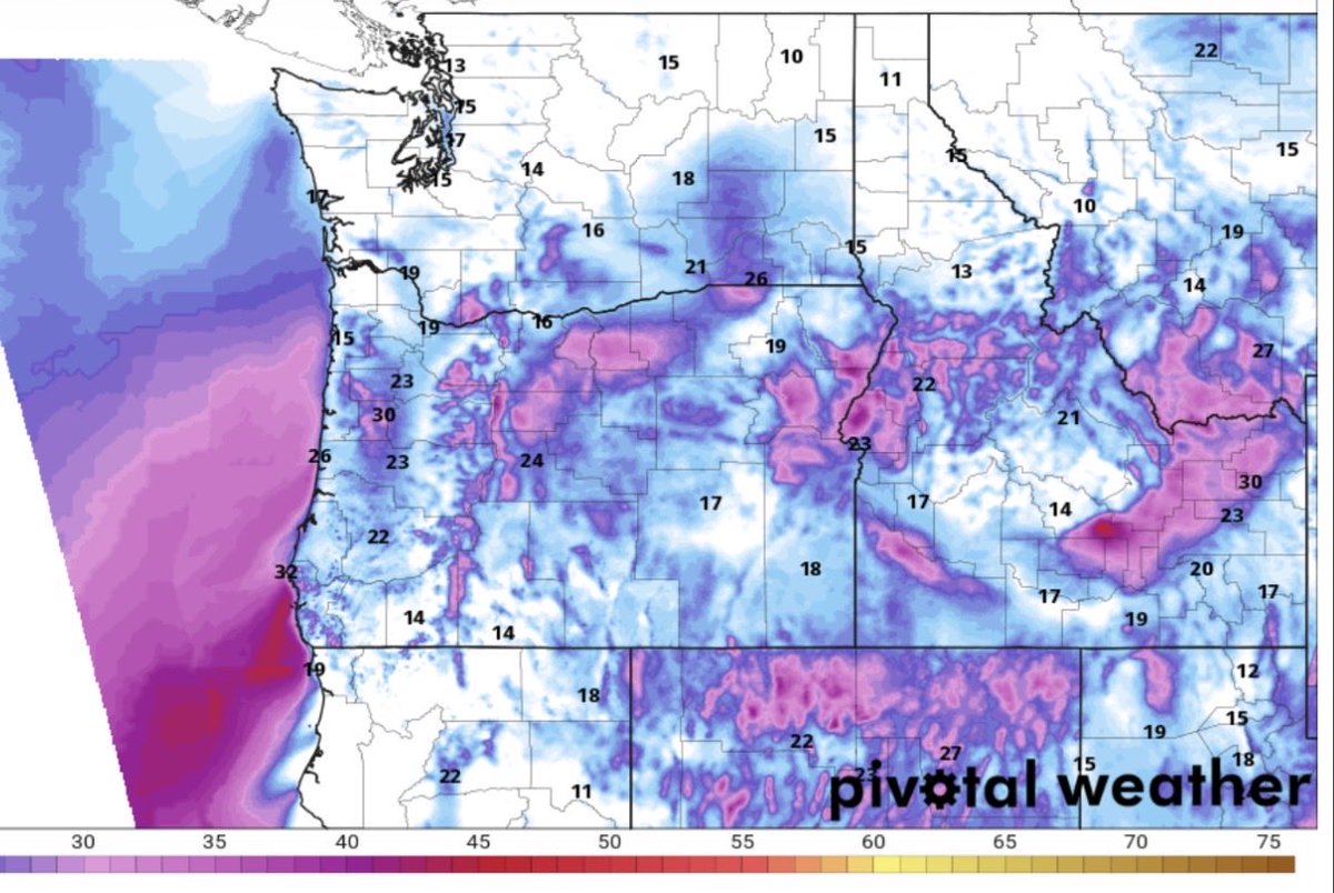
Here is a look at the latest GFS model run projected high temperatures across the region. We will see more well above normal temperatures for our entire forecast area.
1
2
7
81
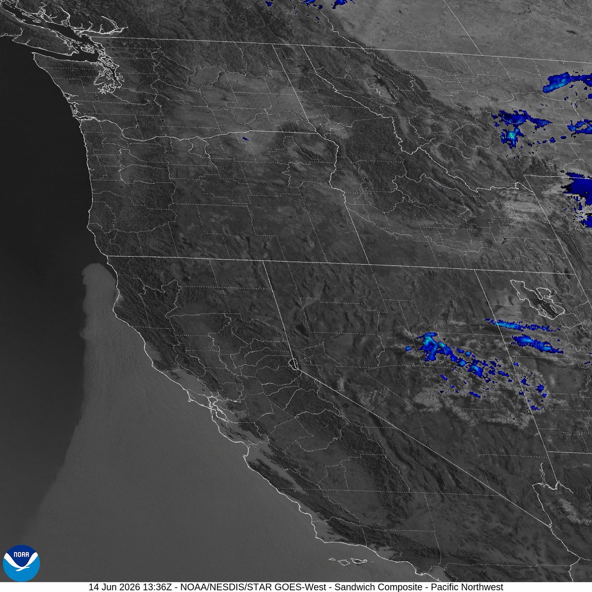
Visible satellite imagery this morning shows a very similar upper level pattern. We can see high pressure is the dominant weather feature with clear skies for most areas. It will be another hot day across the region. Some areas of fog and low clouds are along the coast.
2
6
57
Here is a look at maximum temperatures observed as of 3:45 PM. We still have plenty of time of additional heading this afternoon and evening.
3
2
5
189
We can maintain 72 degrees all day with a standard AC unit that is nearing 20 years old.
2
68
Lightning potential will increase on Friday for areas in yellow on the graphic below. Some of these storms could become strong in nature with frequent lightning, gusty outflow winds and hail. I will be monitoring this closely over the coming days.
2
5
93

Jun 14
It is a beautiful blue sky day across Northern California. Here is a look at Mt. Shasta from the Soda Ridge webcam. We can expect more melt off with high temperatures forecast to develop today.
1
7
75
Jun 14
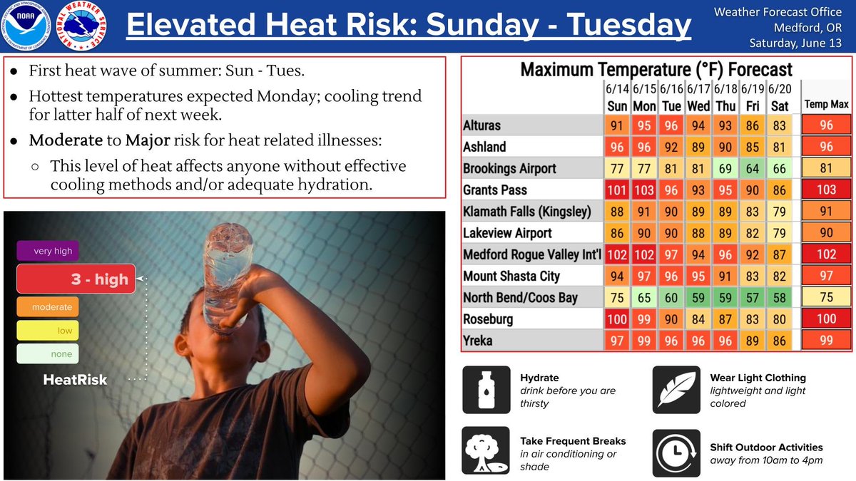
Heat risk graphics have been updated by the NWS in Medford. This shows where heat related illness risk is highest from today into Monday. We will start to cool slightly on Tuesday and reach the mid to upper 80’s for western interior valleys late next week.
4
7
129
Jun 14
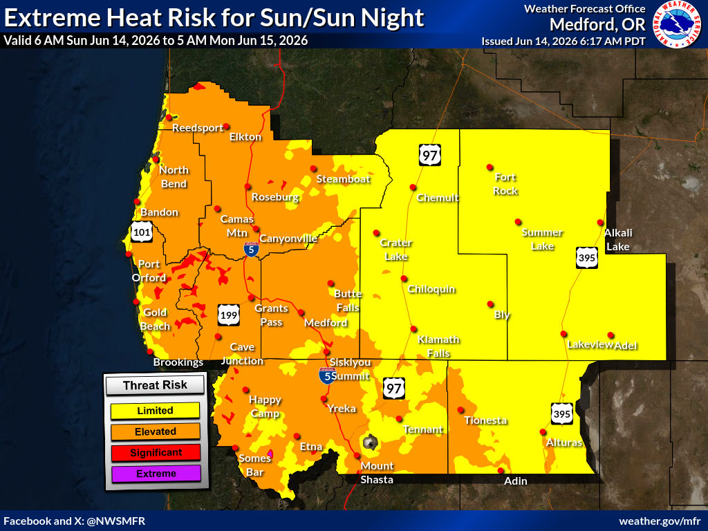
NWS Medford: “The first warm up for summer is expected this weekend with triple digits expected for West Side Valleys and 90s for the East Side. There will be a moderate risk for heat related illnesses Sunday and Tuesday, with a major risk of heat related illnesses expected Mon.”
2
6
69
Jun 14
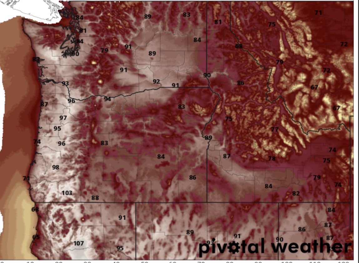
Here is a look at the forecast high temperatures across the region today based off the GFS model run. It will be a hot day for almost all of our forecast area with west side valleys reaching well over 100 degrees.
2
10
116
Jun 14
Infrared satellite shows another morning with almost entirely no cloud cover across the region. This is a sign that the ridge of high pressure is firmly in control. We will certainly see triple digits develop across the western interior valleys.
4
8
138
Jun 14
It for sure hotter today than just 24 hours ago. Here are the latest surface temperatures across the region as of 5 PM this evening.
1
2
6
220
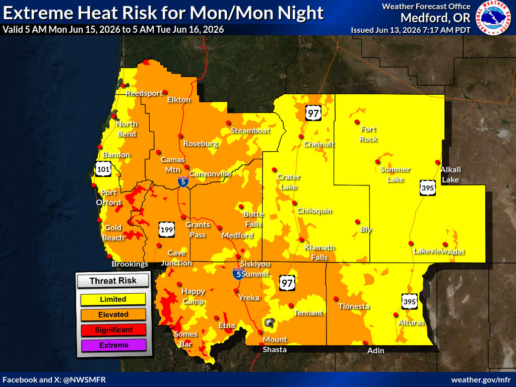
Jun 13
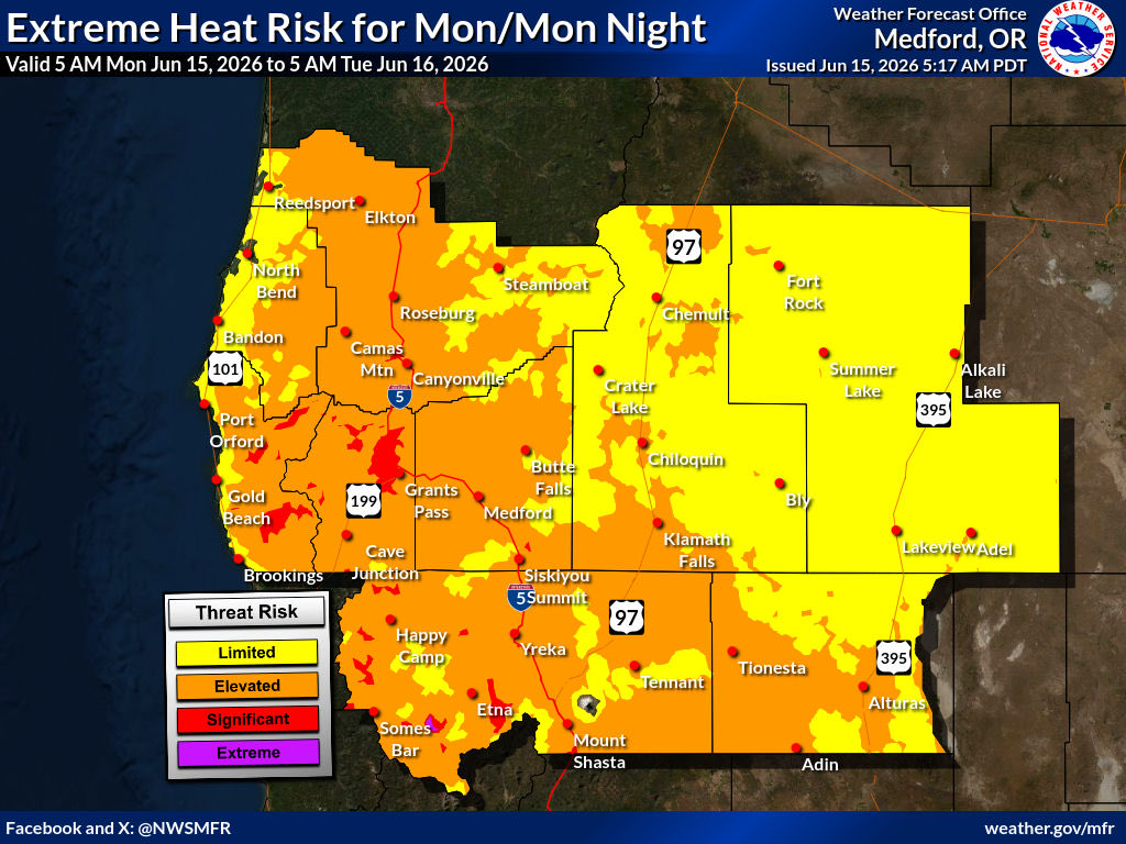
Here is a look at the extreme heat risk across the forecast area from today through Monday. Please make sure you seek shade during the hottest part of the day or an air conditioned environment if possible. Hydration will be critical over the next few days to avoid heat illness.

1
2
4
76
Jun 13
If you want to escape the heat and enjoy the sunshine you need to head up to Crater Lake National Park. The always enjoyable Sinnott Overlook webcam sure makes it look amazing this morning.
1
10
99
Jun 13
Winds will continue to remain gusty along the coast as offshore flow strengthens and the ridge of high pressure builds inland. Winds will also remain gusty across the higher elevations as well.
2
7
81
Jun 13
The heat is on over the next few days as we reach triple digits across the western interior valleys. Here is a look at the latest GFS modem run projected high temperatures across the region.

2
5
81
Jun 13
Another beautiful morning across the region with plenty of sunshine. The only clouds are along portions of the coast. We can expect to see daytime high temperatures climb even more.

2
5
49
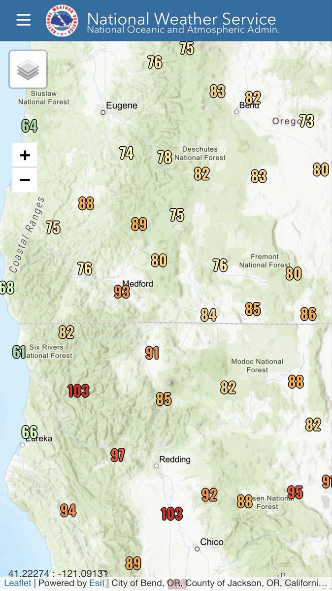
Jun 13
The heat is moving north as we can see from these maximum temperature readings across the region. As high pressure strengthens we will see temperatures at least 20-25 degrees above normal heading into this weekend into early next week.
2
9
96