This rinse and repeat pattern (literally) continued today. Watch for developing dark clouds, or rumbles of thunder in the distance this evening and tonight.
Isolated to scattered storms are possible with torrential downpours, lightning and gusty winds. A separate line of showers and storms moves through overnight. The best chance to see anything will be in across the foothills and mountains.
A Heat Advisory posted for areas inland 🥵🥵
Here's a look at the 11:00 AM heat index across the region. It will be humid everywhere today, however, areas in the Heat Advisory will see the heat index values climb to 95-100° this afternoon and evening. Stay cool!
I hate everything about this humidity that we are dealing with... It sticks around for Friday before a somewhat drier airmass moves in for the weekend.
Intense flash flooding occurred last night in central NH, with the highest totals around Madison and Albany.
This is an important reminder to take Flash Flood Warnings very seriously as major destruction can occur, as you see here.
Courtesy: Madison NH Police Department
We will run the risk for showers and storms to develop this evening through tonight.
The best chance to see one will be across interior Maine, especially after 5 PM. However, every town runs the risk through the night, so keep this in mind if you are headed outdoors.
I'm declaring Monday a "top ten weather day" of the entire year! Lots of sunshine with a few high clouds in the afternoon, and 70s to low 80s.
The humidity will be low as well. Enjoy it because it will be on the increase starting Wednesday.
Improving conditions this evening! A scattered shower is possible through 6 PM. Otherwise, the skies will start to clear making for a nice night. Enjoy!
Occasional showers and even a passing thunderstorm is possible at any point on Sunday, with some peaks of sun at times as well.
Any rain ends by Sunday evening and skies start to clear. This will set us up for a sunny Monday with low humidity and 70s!
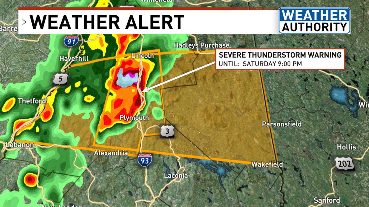
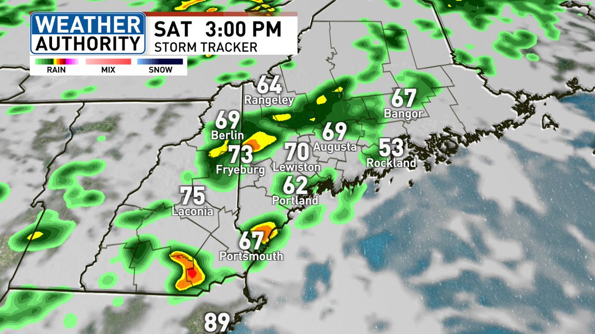
3:45 PM SATURDAY UPDATE:
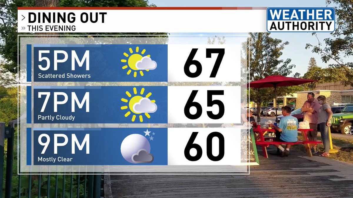
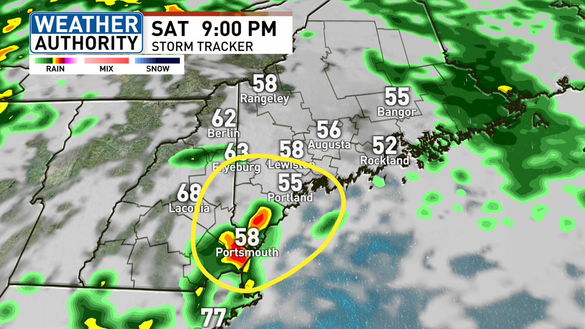
Scattered showers and some steadier light rain throughout Maine. As we head into this evening, 7PM to 11 PM, we will run the risk for scattered downpours and some rumbles of thunder in southern Maine. Most/any severe storms should stay to our west.
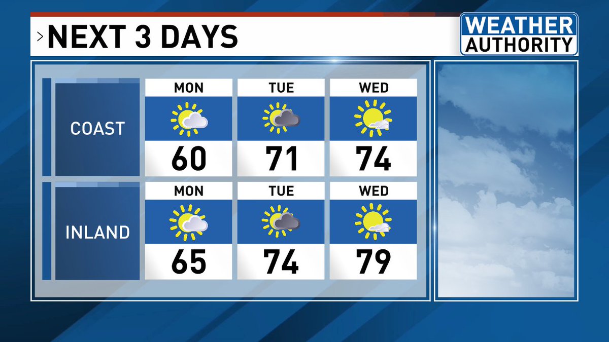
Outdoor plans on Saturday? Keep a watchful eye to the sky.
It will not be a washout, but scattered showers and storms will develop for the afternoon and evening, with an isolated severe storm possible. Certainly a day where you'll want an indoor backup plan if you'll be outside.
NORTHERN LIGHTS POSSIBLE TONIGHT:
The northern lights may be visible after dark tonight with scattered high clouds. We will see a KP-Index of a 7 so a moderate geomagnetic storm expected.
You'll want to get away from all city lights, look to the north, and closer to the horizon. Also, if you are taking pictures with your phone, it's best to use the night vision mode.
Were you a fan of today's weather? Well, Thursday will be a rinse and repeat.
Warm temperatures expected in the 80s and lots of sunshine with a few high clouds in the afternoon. Enjoy!
Any showers and downpours this evening will continue at times overnight. A quick early morning shower in southern Maine on Monday, followed by sunshine.
Most areas stay dry Tuesday, but a pop-up shower or storm is possible. Notice the warming trend into the middle of the week with highs approaching the 80s in spots inland.