
SPH Engineering is a global provider of UAV software solutions, integration services, consulting and custom development to expand drone applications.
Joined March 2013
- Tweets 640
- Following 313
- Followers 778
- Likes 279
386 Photos and videos

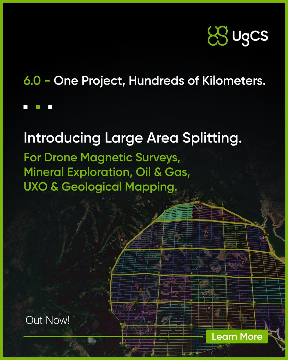


#UgCS 6.0 is here. Join our free live Zoom demo on June 16
See Large Area Splitting, project-wide tie lines, Shift Right for aligning to legacy surveys, and Smart AGL 2.0 terrain following.
7 PM Riga / 12 PM NY / 9 AM LA Register: zurl.co/Xhb02
#drones #geophysics #UAV
39
New video: full walkthrough of #UgCS 6.0 zurl.co/qD2v3
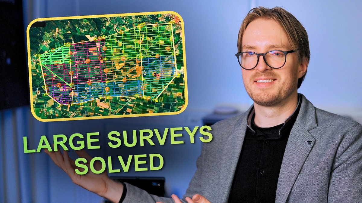
Plan large-scale drone magnetic surveys in one project: draw a polygon, UgCS splits it into flyable sub-areas with consistent line spacing. Plus Tie Lines, Shift Right, and Smart AGL 2.0.
20
#UgCS 6.0 Out Now!
Our biggest update in years. Large Area Splitting for drone magnetic surveys to a scale of several dozen km².
Available now in UgCS Expert and Enterprise. Test for free in UgCS Open.
Learn more: zurl.co/DWcMi
22
#UgCS 6.0 arrives June 9.
Large Area Splitting for drone magnetic surveys to a scale of several dozen km².
Learn more: zurl.co/ThDTU
20
Italy had this landslide filed as dormant. A drone flying 1m over the grass disagreed. UAV-mounted #GPR, antenna held at 1 meter AGL the whole way by #UgCS Enterprise True Terrain Following the altimeter through #SkyHub. Read about the results: zurl.co/nMm19
42
29
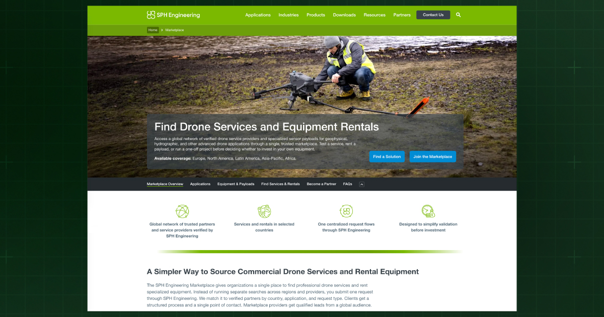
The @SPHEngineering Marketplace is live: sphengineering.com/marketpla…
We are eliminating the CapEx barrier for industrial drone data.
Source verified local operators or rent specialized payloads (#GPR, #LiDAR, #magnetometers) on demand for your specific project window.
#Geophysics
43
43
Adjust the units to your liking with latest #ugcs update 🤯 #dronemapping
51
Explosive s.c. ran a 302-hectare UXO survey on the northern Polish coast using our stack: #DJI M350, #SENSYS MagDrone R4, #UgCS, #SkyHub, True Terrain Following on the sensor.
The site was classified as low-risk.
In reality, it wasn't.
Learn more: zurl.co/UCb5x
35
LiDAR rewards precision and punishes everything else I Zoom Webinar on Wednesday, 27 May.
#LiDAR in #UgCS: the toolset, IMU calibration, what #DJI rigs do that non-DJI rigs don't, and a real point cloud example.
Register: zurl.co/XZaPX
69
1
50
51
66
Snapshot from Demo Day in #Riga. The field is packed.
Live flights. Hands-on equipment—real conversations about where the industry is heading.
The energy out here speaks for itself. Watch below.
#DemoDay #SPHEngineering #UgCS #SkyHub
49
🔍 Find the Missing Person FASTER Drone's Expanding Square Search Pattern
#searchandrescue #dronemissions
1
24
1
38
1
49
Researchers at the University of Alaska Anchorage mounted a methane sensor on a DJI M300, planned low-altitude grid surveys in #UgCS, and flew over three real abandoned wells in Alaska.
The results just passed peer review in Sensors. zurl.co/FzKX6
42