
Helping businesses to leverage big data and location analytics in their planning, decision-making, and operations regardless of their size.
Joined January 2017
- Tweets 3,760
- Following 935
- Followers 1,574
- Likes 70
602 Photos and videos


Pinned Tweet

9 Oct 2021
Spatiality is running a campaign for the adoption of ArcGIS Online. In this first blog post, we give you 5 compelling reasons for using ArcGIS Online from today.
#ArcGIS #CloudComputing #Spatiality buff.ly/3FuA9sS
3
6
5 Oct 2022
Esri's MOOC on Spatial Data Science started today. Come and join in the fun! #geospatial #DataScience
1
22 Sep 2022
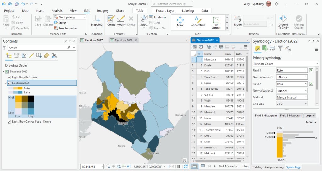
Here's an interactive map on the results of Kenya' s 2022 presidential elections by county #kenya #electionske2022 #ArcGIS #geospatial bit.ly/3C1Zb38
15 Sep 2022
We have started to analyze the results of Kenya's recently held elections. We know who won, but there is so much more to be learned! #geospatial #DataScience #ArcGIS #electionske2022
2
11
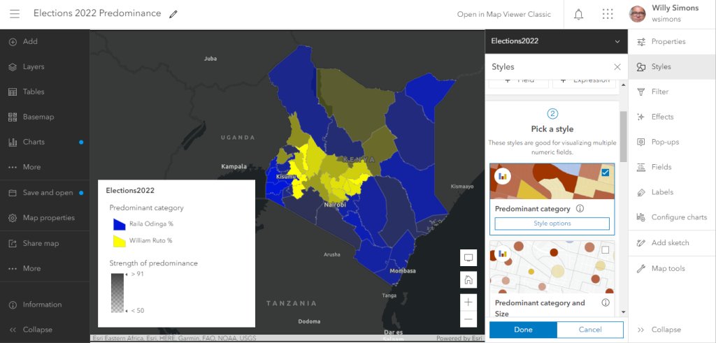
19 Sep 2022
This predominance map shows for each county which candidate won and by what margin. #geospatial #DataScience #ArcGIS #electionske2022
4
4 Aug 2022
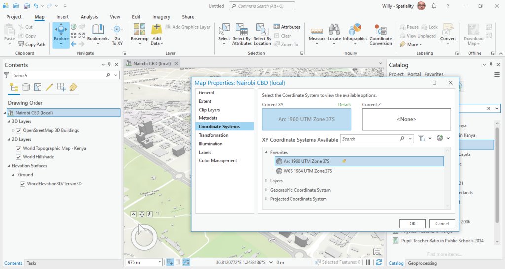
I plan to do some serious mapping in Kenya. Should I use WGS 1984 or Arc 1960 as the datum? #geospatial #ArcGIS #mapping
1
1
27 Jul 2022
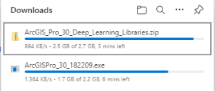
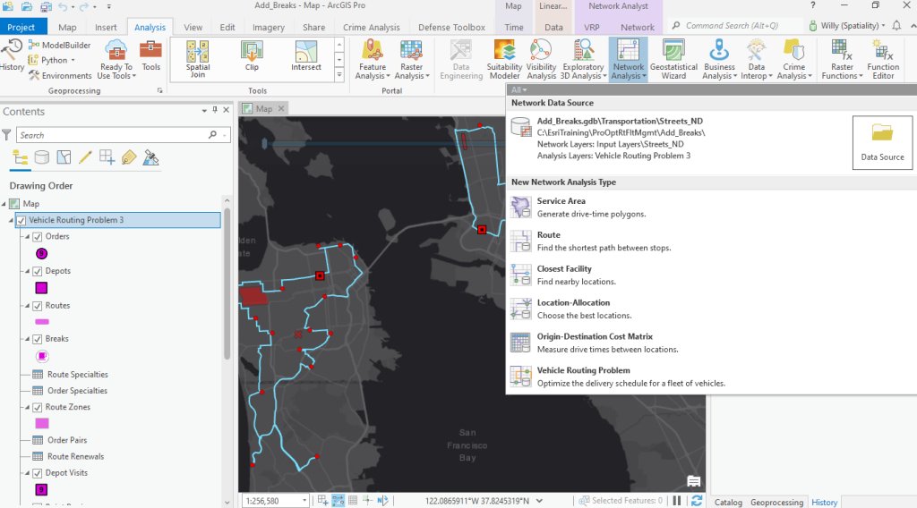
The Deep Learning libraries for ArcGIS 3.0 are now available for download #ArcGISPro #deeplearning
2
4
13 Jul 2022
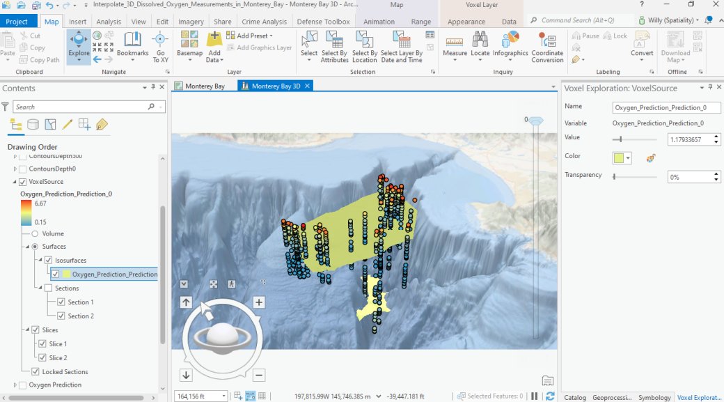
Working with a multi-dimensional voxel layer in ArcGIS Pro is truly fascinating. Go and check it out! #ArcGIS #GIS #geospatial #DataAnalytics
2
5
7 Jul 2022
3D buildings from OpenStreetMap are now available through ArcGIS Living Atlas #OpenStreetMap #ArcGIS #3D #GIS
1
6
30 Jun 2022
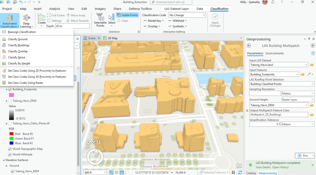
ArcGIS Pro has excellent tools for classifying Lidar data and extracting 3D buildings. County Governments can leverage these capabilities for development control and revenue collection #ArcGIS #lidar #geospatial #3D
2
30 Jun 2022
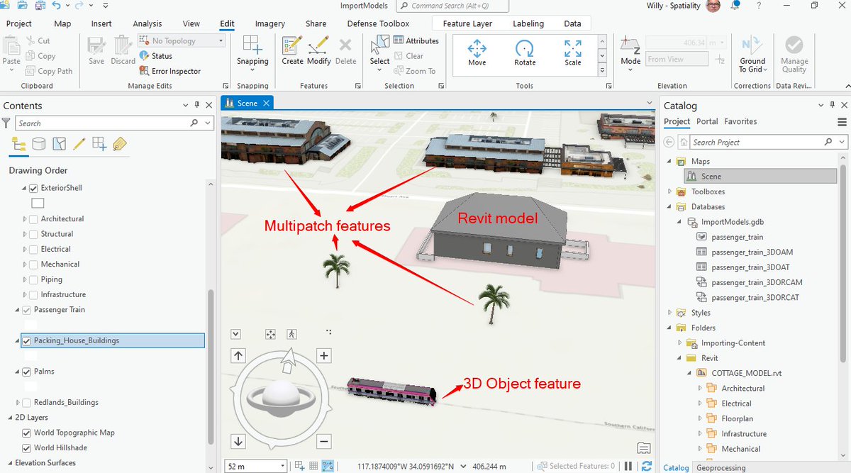
Revit models can be added to ArcGIS Pro without conversion. Other 3D formats can be added to Multipatch or 3D Object feature layers #ArcGIS #AEC2022 #geospatial
1
2
27 Jun 2022
Esri's pre-trained deep learning model for building footprint extraction in Africa is doing a reasonable job in Kisumu, Kenya #DeepLearning #ArcGIS #geospatial
2
3
22 Jun 2022
6
9 Dec 2021
I just had my ArcGIS Dashboard experience updated. An early Christmas gift? #ArcGISOnline
1
4
Spatiality retweeted

18 Nov 2021
🙏We appreciate your presence during #5thAfriGEOSymposium today.
Join us tomorrow same time ⏲️1:00Hrs EAT. To register, click here bit.ly/3oCgTCb
You missed the sessions? Click here; youtube.com/watch?v=SBzGOb5T… -Food & Agriculture and youtube.com/watch?v=AhpgiDDz… Industry Track

1
8
15
18 Nov 2021
Are you using ArcGIS AppStudio to build cross-platform mobile applications? Contact us if you need help in getting started.
#ArcGIS #Mobile #applications #GIS buff.ly/30cDgpk
2
18 Nov 2021
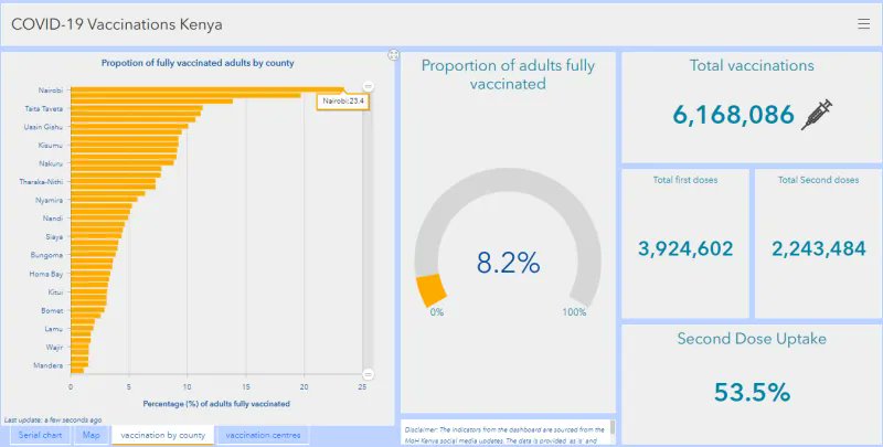
At Spatiality we are keeping tabs on the jabs! Nairobi's full vaccination rate is nearing 25%.
#COVID19 #vaccination #Nairobi #Spatiality buff.ly/3BJ9x5b
1
18 Nov 2021
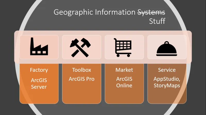
Fewer organizations and individuals buy and use GIS as a system. Our suggestion is to interpret the S in GIS as stuff. Your thoughts?
4
17 Nov 2021
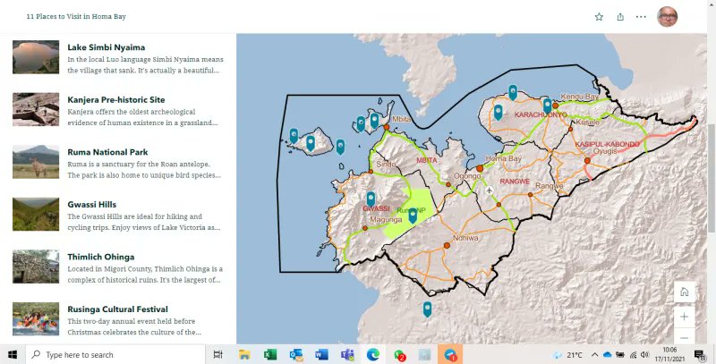
I really enjoyed working with the Explorer Map Tour in the new ArcGIS StoryMaps. Development is very intuitive and the presentation is very slick.
#ArcGIS #storytelling #Kenya #Kenya #tourism
3
11
17 Nov 2021
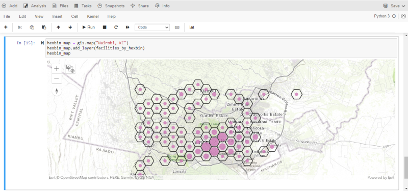
This analysis performed in an ArcGIS Notebook shows the uneven distribution of health facilities across Nairobi. It appears that Kasarani is underserved.
#geospatial #arcgisonline #HealthForAll
6