
Joined October 2017
- Tweets 542
- Following 42
- Followers 539
- Likes 176
88 Photos and videos


Jun 12
Built something with Stadia Maps? Drop it in our Discord. Simple, wild, your first attempt, we want to see it. One random sharer gets a sticker pack at the end of the month.
discord.gg/eJGbCZPW
ALT Photograph of five Stadia Maps stickers
22
Jun 10
Some municipalities have 100 miles of legally regulated golf cart paths. Routing them means encoding ordinances like "no LSVs over 35 mph" into the engine itself. We built the profiles for it.
#routing
stadiamaps.com/blog/beyond-t…
31
Jun 8
Pick a style, set a viewport, get sample code for an interactive web map or a static image for simple integrations.
stadiamaps.com/build-a-map/?…
#maps
ALT Stadia Maps map builder with controls for style, coordinates, and export.
62
Jun 5
We fixed a class of water rendering artifacts in our basemaps: rivers disappearing, coastlines shifting, islands flickering. The root cause was mixing two data sources at different zoom levels. One unified Overture Maps dataset end-to-end.
stadiamaps.com/blog/fixing-m…
1
34
Jun 4
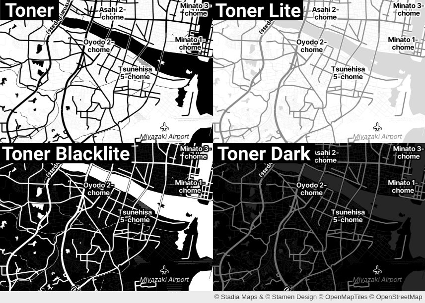
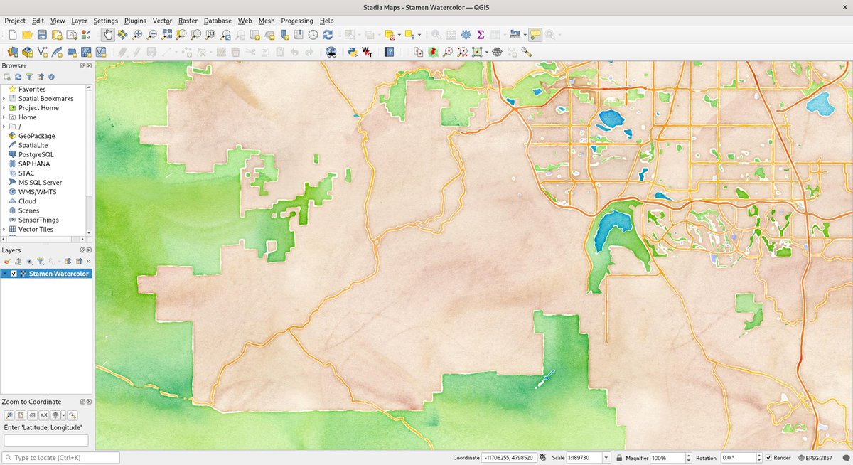
8 styles for any use case: Clean, dark, satellite, terrain, Stamen watercolor, and more. All on our free tier. Custom styles too.
docs.stadiamaps.com/themes/?…
1
25
Jun 3
We shipped a lot since mid-2024 and let the changelog slide. That's on us. It's current now: traffic-influenced routing, Geocoding v2, a 37M km² sat imagery update, new mobile SDKs, and an RSS feed to stay current.
stadiamaps.com/blog/we-updat…
26
Jun 2
weeklyOSM 827 is out. We think it's one of the best places to go for everything happening in the OpenStreetMap world. Data, tools, community, all in one place.
weeklyosm.eu/archives/18600
39
Jun 1
Most routing APIs weren't built for cars by accident. It's a design assumption baked into the graph. How we fixed it: stadiamaps.com/blog/beyond-t…
#routing #maps
stadiamaps.com/blog/beyond-t…
69
May 29
Kicking off a series on our most popular docs.
First up: Interactive Web Maps. React, Vue, or Vanilla JS, every stack has a quickstart and a recommended library.
Free signup & free tier to get started.
docs.stadiamaps.com/maps-for…
54
May 28
For the first time, HDX is releasing disaster-specific OSM datasets with HOT. 440 downloads during Madagascar and Mozambique disasters, including from within affected countries. Open data, real human impact.
openstreetmap.org/user/SColc…
31
May 27
Our blog now has an RSS feed 📡
stadiamaps.com/blog/rss.xml
Recent ships you may have missed:👇
➡️ Traffic-influenced routing (public preview)
➡️ 75M new rooftop-accurate addresses
➡️ 30cm satellite imagery global freshness refresh
Details: stadiamaps.com/blog/
62
May 25
Predicting traffic for Tuesday at 8 am by knowing what usually happens Tuesdays at 8 am.
That's predictive routing built on historical profiles. OSM alone can't deliver it.
Here's how:
stadiamaps.com/blog/why-osm-…
1
46
May 19
OSM is designed for stable ground truth, not live conditions.
That works for routing engines until it doesn't.
How we layered TomTom traffic on top.
#OpenStreetMap
stadiamaps.com/blog/why-osm-…
1
76
May 13
Our 2026 #SatelliteImagery update is live. Same tile endpoints, sharper, fresher data. No migration, no API changes.
And no end-user tracking sitting between your app and the tiles.
stadiamaps.com/news/2026-sat…
82
May 12
OSM way IDs just passed 1.5 billion, and the BCP 47 proposal for consistent Latin-script transliteration tags (name:<language>-Latn) closes voting today.
weeklyosm.eu/archives/18565
#OpenStreetMap #Geospatial
weeklyosm.eu/archives/18565
63
May 11
deck.gl-raster added a COG comparison slider. Two sources, client-side, no server needed. Good pattern for before/after imagery or dataset comparisons.
developmentseed.org/deck.gl-…
#deckgl #WebGIS
57
May 8
If your data is already structured, your geocoder shouldn't have to re-parse it.
house_number, street, and unit are now first-class fields on the v1 geocoding API. Skip the parsing step. Better matches, faster responses.
#OSM #geocoding
stadiamaps.com/news/75-milli…
62
May 5
30cm satellite imagery, scaled.
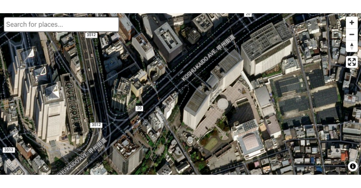
37 million km² of high-resolution coverage, plus new country-wide mosaics for Japan, Nigeria, Mexico, the UAE, and Eastern South Africa. No visible tile boundaries, no abrupt seasonal shifts.
#Geospatial #SatelliteImagery
stadiamaps.com/news/2026-sat…
2
127
Apr 30
📦 Our largest geocoding dataset expansion yet:
- 75M new addresses from OpenAddresses (rooftop-level, not interpolated)
- 25M each in France and the US
- 3M new POIs
- New structured fields on the v1 search APINo user profiling required.
stadiamaps.com/news/75-milli…
1
63
Apr 20
Most traffic-influenced routing solutions use the traffic provider's road network, because it's a lot easier. We kept OpenStreetMap and layered TomTom's data on top.
Why? Because our users can directly fix issues in OSM and routes stay perfectly aligned with our basemaps.
1
63
Apr 20
Try Traffic-influenced routing today: two traffic tiers (adaptive and premium), multiple routing profiles, all built on the open road network you already know.
👉 stadiamaps.com/news/traffic-…
#OpenStreetMap #Valhalla #Routing
stadiamaps.com/news/traffic-…
44