
Survey Drones Ireland is Training Facility for drone operations in the Survey, Construction, Film and Surveillance industries.
Joined October 2018
- Tweets 435
- Following 152
- Followers 133
- Likes 210
410 Photos and videos
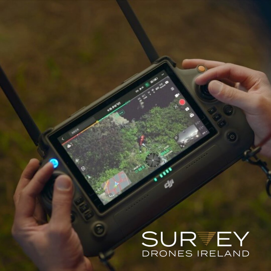


10 Oct 2025
With the latest update, FlightHub 2 now integrates Intelligent Algorithms and a Multimodal Large Language Model (LLM), bringing advanced automation and smarter analytics to every mission.
Contact #SurveyDronesIreland info@surveydrones.ie
#DJIFlightHub2 #DroneManagement
16
7 Oct 2025
#Pix4DFields combines drone and satellite mapping to give Irish farmers fast, accurate insights into crop health and growth.
Whether in the field or office, you can generate maps offline.
info@surveydrones.ie
#PrecisionAgriculture #SmartFarming
9
3 Oct 2025
At #SurveyDronesIreland, we make it easy by offering flexible hire options so you can test, train, and work with professional-grade equipment before making long-term decisions.
info@surveydrones.ie
#DJIEnterprise #DroneHire #Surveying #Mapping #DroneSolutions
13
30 Sep 2025
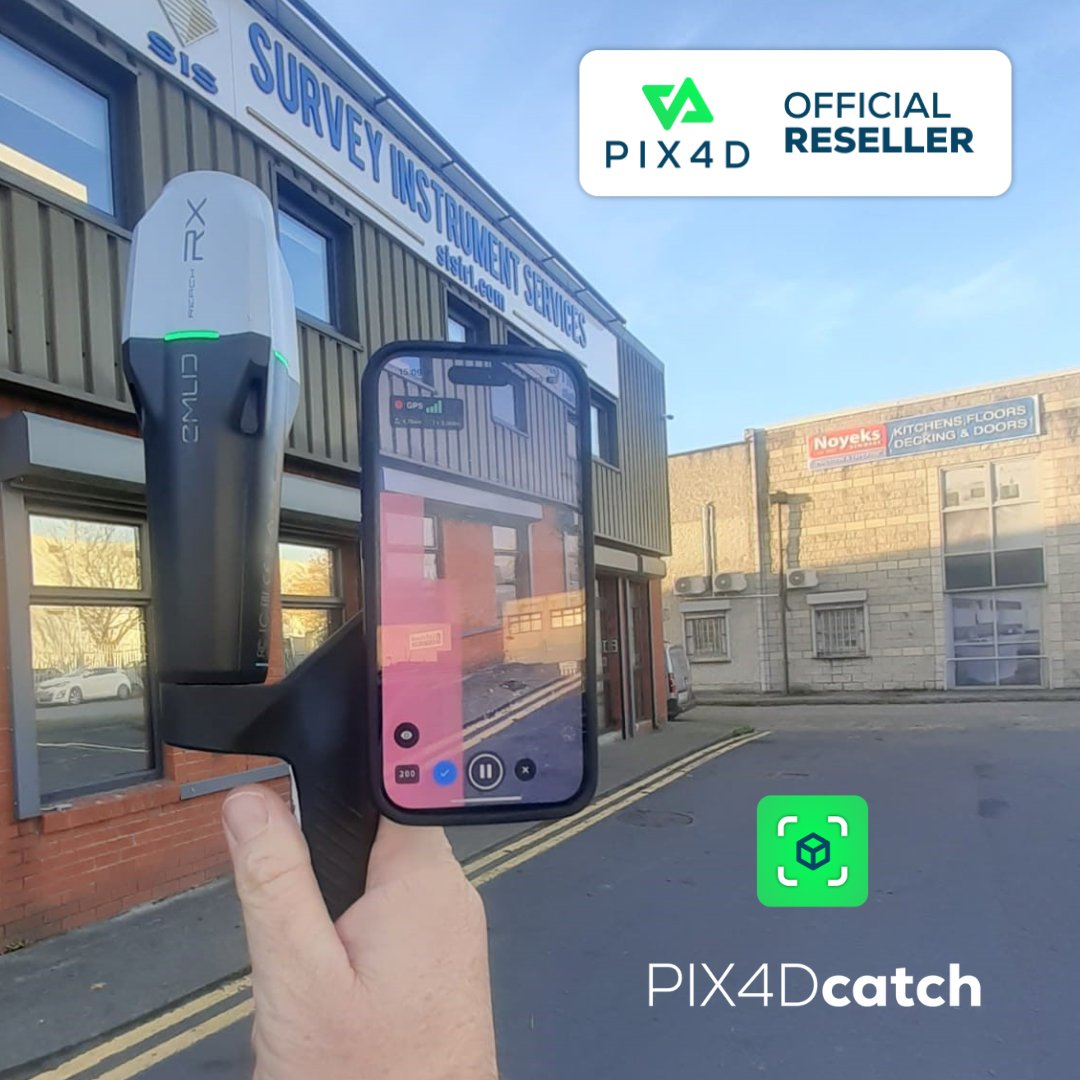
With just your mobile device, Pix4Dcatch captures detailed ground-based images and transforms them into accurate 3D models. Perfect for surveying, construction, and inspection work.
info@surveydrones.ie
#Pix4Dcatch #3DScanning #SurveyDronesIreland
14
26 Sep 2025
The #ZenmuseV1 is compatible with the #DJIM350 RTK and #M300 RTK (when paired with the #DJIRC Plus controller).
📩 For pricing and a free quote, get in touch at info@surveydrones.ie
#DJIEnterprise #PublicSafety #SearchAndRescue #DronePayloads #SurveyDronesIreland
11
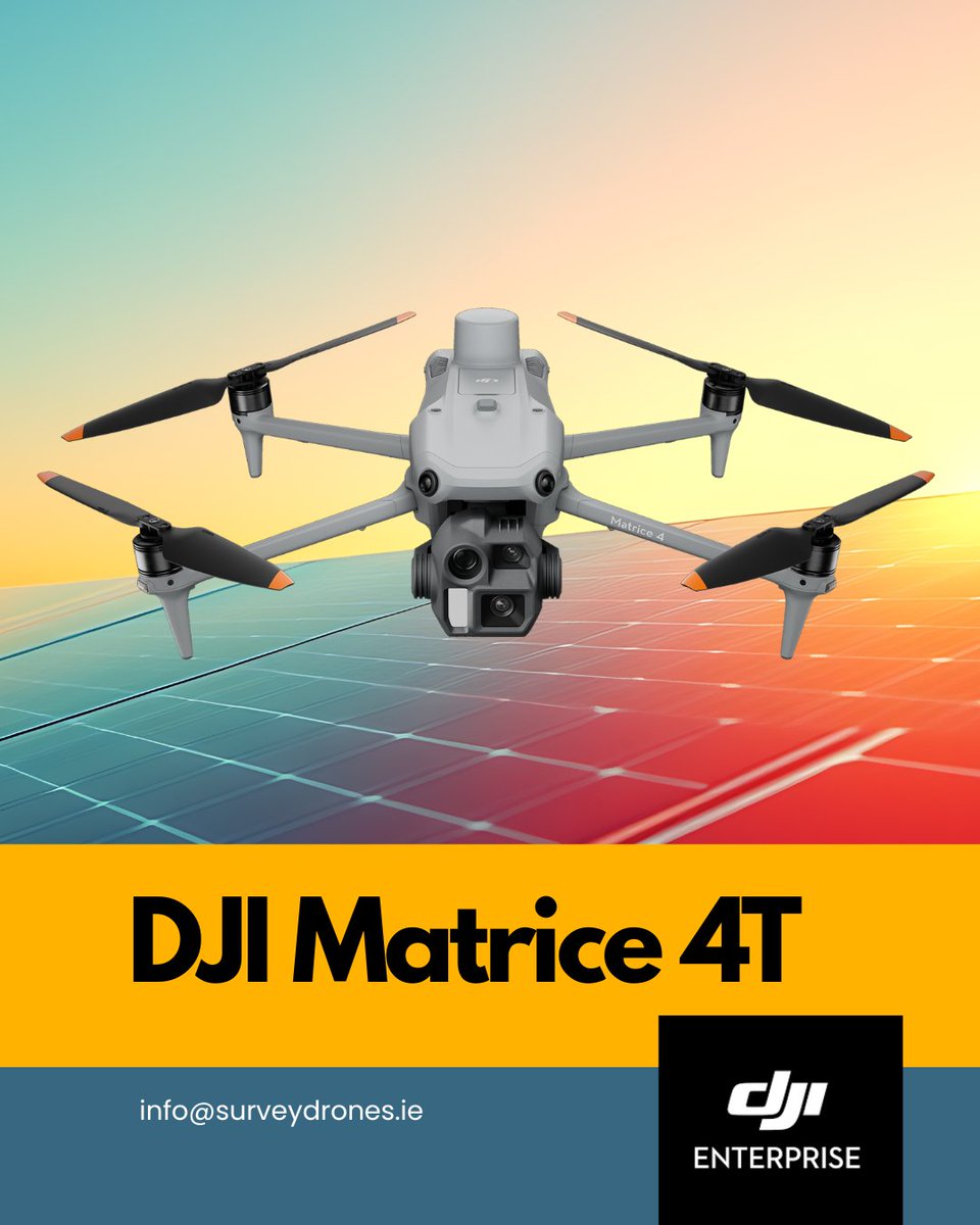
23 Sep 2025
With its advanced thermal imaging and real-time temperature measurements, the DJI Matrice 4T empowers teams to detect issues instantly!
Info@surveydrones.ie
#SolarEnergy #Matrice4T #DroneInspections #DJIEnterprise #SurveyDronesIreland
47
19 Sep 2025
All #DJITerra licences are available through #SurveyDronesIreland. Just send us an email at 📩 info@surveydrones.ie and we’ll help you find the licence that best suits your operations.
#DroneMapping #Surveying #ConstructionTech
8
16 Sep 2025
Flying a #DJIEnterprise drone isn’t just about powerful hardware—it’s about mastering the technology. At #SurveyDronesIreland, we make sure you’re confident in the air!
info@surveydrones.ie
#DJITraining #Matrice400 #Matrice4 #Matrice350
15
10 Sep 2025
From quick ground scans to professional 3D models, #Pix4Dcatch makes high-accuracy data collection simple and accessible.
👉 Check our latest licence options today!
Info@surveydrrones.ie
#Pix4D #3DScanning #SurveyDronesIreland #DroneMapping
1
17
2 Sep 2025
At #SurveyDronesIreland, we offer professional DJI Enterprise drones available for hire across Ireland.
DJI Matrice 300 RTK
DJI Mavic 3 Multispectral
DJI Mavic 30 / 30T
info@surveydrones.ie
#DroneHire #DJIEnterprise
29
29 Aug 2025
Training matters—especially when you're flying high-value drones like the DJI #Matrice400 or #Matrice350 RTK.
Master your drone before you take off.
📩 Book your session now: info@surveydrones.ie
#SurveyDronesIreland #DJIEnterprise #IAA
70
26 Aug 2025
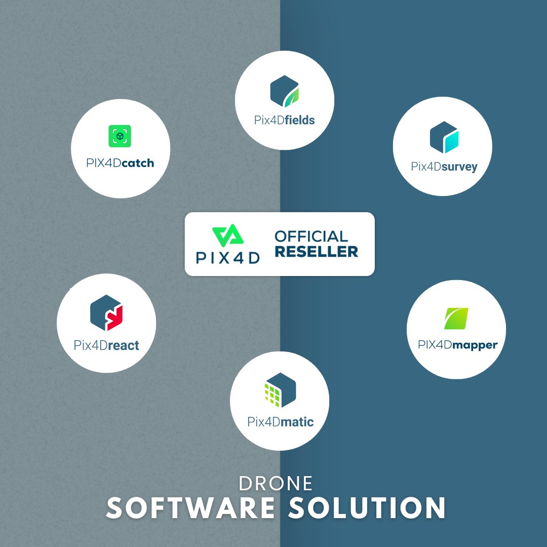
As an official #PIX4D reseller, we provide the full range of industry-leading software to support surveying, mapping, and inspection professionals.
Unlock the full potential of their tools.
📩 Contact us for details: info@surveydrones.ie
#SurveyDronesIreland
2
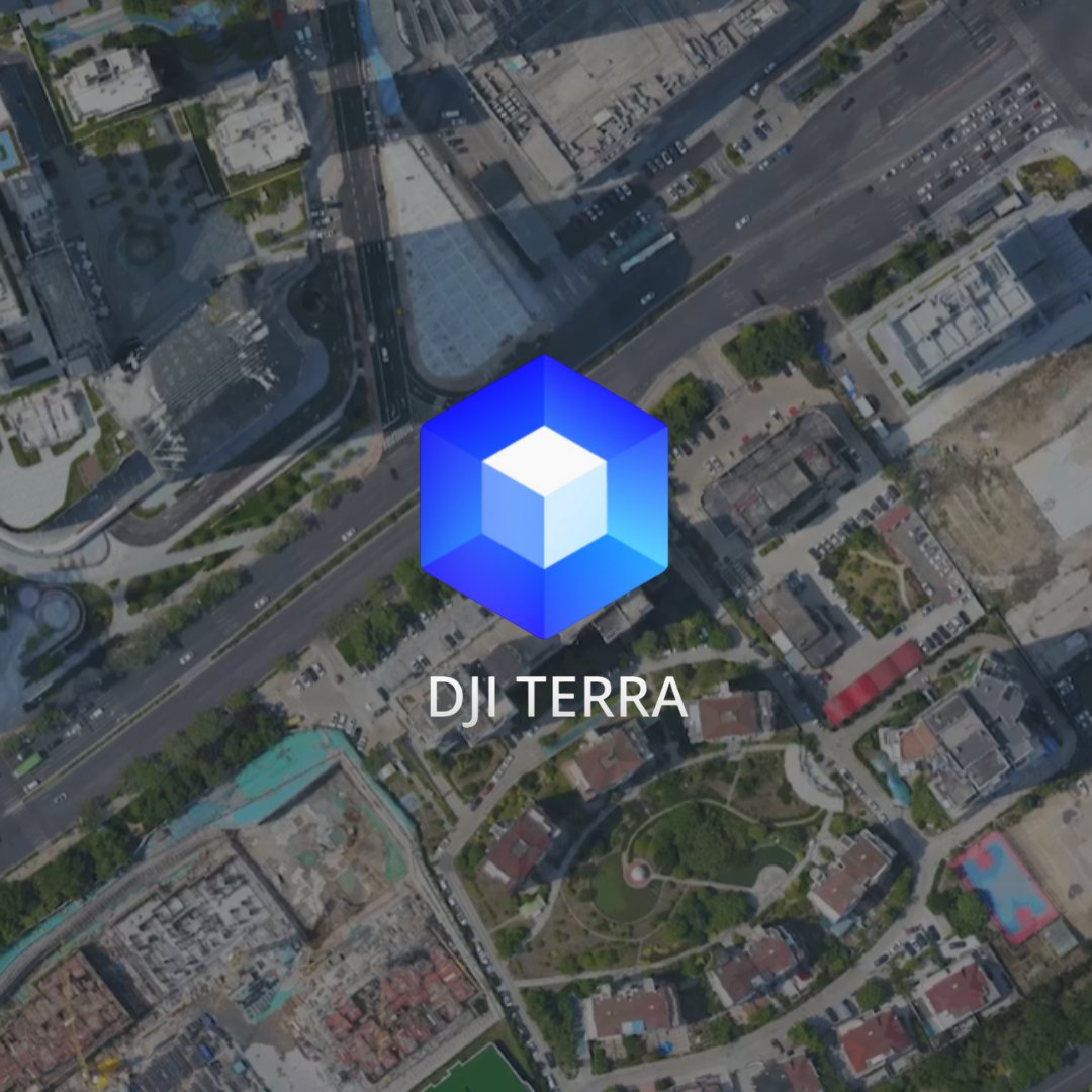
22
22 Aug 2025
The latest version 5.0.0. now support photorealistic Gaussian Splatting for visible reconstruction projects, providing both 2D and 3D outputs.
surveydrones.ie/blog/dji-ter…
#SurveyDronesIreland #DJITerra #DJIEnterprise
37
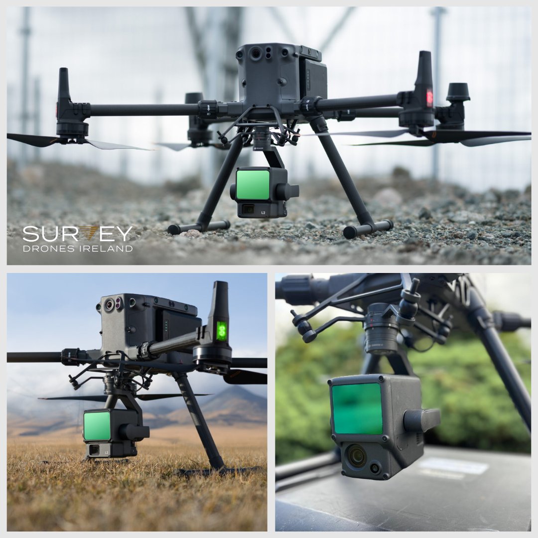
19 Aug 2025
Pair the #ZenmuseL2 sensor with your DJI #Matrice350 or #Matrice300 RTK and step into the next level of aerial data collection.
📩 Get expert advice and drone pairing support at info@surveydrones.ie
#SurveyDronesIreland #DJIEnterprise #RTK
1
24
15 Aug 2025
From construction zones to mine sites, the DJI #Matrice400 Series covers it all with ease.
Ideal for:
📍 Construction site mapping
📍 Stockpile measurements and volumetric analysis
info@surveydrones.ie
#SurveyDronesIreland #DroneSurveying #DJIEnterprise
29
12 Aug 2025
#PIX4Dcatch brings professional 3D data collection to your fingertips. From ground-based scanning using your smartphone to seamless cloud uploads, this app makes reality capture easier than ever.
#SurveyDronesIreland #DroneSurvey #RealityCapture #DroneIreland
28
9 Aug 2025
With the DJI #Matrice4 Series – surveyors engineered for high-speed aerial mapping and professional-grade accuracy.
info@surveydrones.ie
#SurveyDronesIreland #DroneSurvey #DJIEnterprise #DroneIreland #AerialSurveying

31
6 Aug 2025
Some zones—near airports—are classed as controlled airspace, and flying there without approval is prohibited. Tools like the MySRS platform and drone safety maps help identify these zones in real time.
info@surveydrones.ie
#DroneIreland #SurveyDrones #IAA #EASA

19
1 Aug 2025
From high-accuracy 3D mapping to rapid site assessment and agricultural insights, #PIX4D software is transforming how professionals collect, process, and analyse data.
info@surveydrones.ie
#SurveyDronesIreland #Pix4Dmapper #Pix4Dfields #Pix4Dcatch
1
37
28 Jul 2025
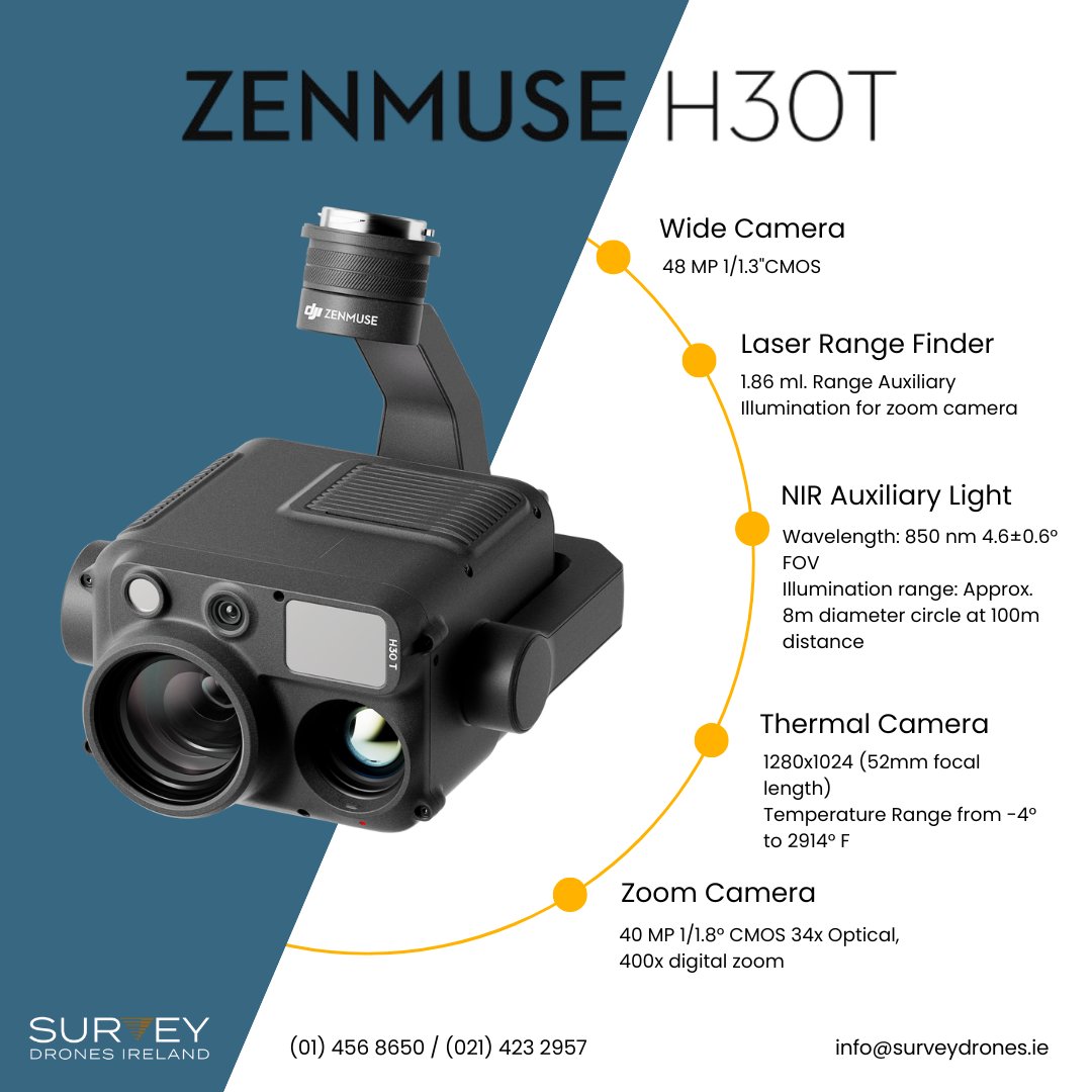
The #ZenmuseH30T, #DJIEnterprise latest multi-sensor payload, is built to elevate your drone operations. Mounted on the #Matrice350 RTK or the all-new #Matrice400, the H30T combines a high-resolution and thermal imaging.
info@surveydrones.ie
#SurveyDronesIreland
30