
Politics Writer and Editor for Deseret News | @deseret
Joined October 2012
- Tweets 4,122
- Following 1,685
- Followers 1,439
- Likes 30,351
22 Photos and videos


Suzanne Bates retweeted

Jun 14
“Are Latter-day Saints Christians?” thedispatch.com/article/are-…
102
30
160
30,832
Suzanne Bates retweeted

Jun 13
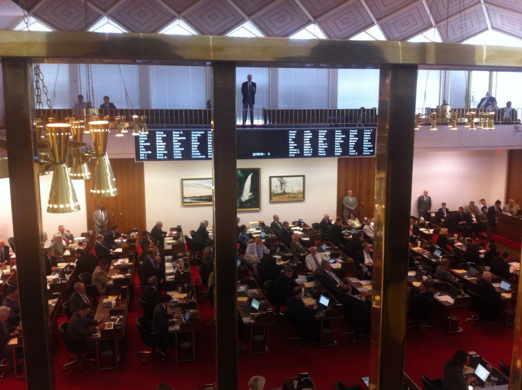
Gearing up for a Fight
Celebrating his 80th birthday and American’s 250th, President Donald Trump and Washington D.C. are getting ready for fight night at the White House and the Deseret News is there.
Between the massive guest list, a potential diplomatic ticket crisis and unpredictable D.C. storms on the horizon, this weekend is shaping up to be absolutely wild.
✏️: @aaronshill, Deseret News
4
2
5
1,302
Suzanne Bates retweeted
Jun 6
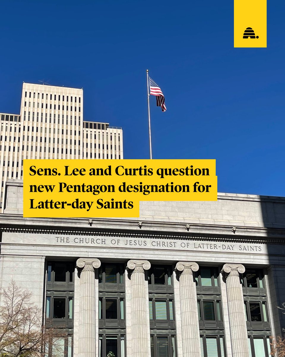
Sens. Lee and Curtis question new Pentagon designation for Latter-day Saints.
Sens. Mike Lee and John Curtis questioned why the term "Christian" was left off of the designation for The Church of Jesus Christ of Latter-day Saints, sometimes referred to as "Mormon." | By @SuzeBates
21
4
76
6,547
Suzanne Bates retweeted

Jun 3
In the words of my dad after reading about @RainmakerCorp, “I love all these young men doing what they do to make the world a better place.”
Thank you @ADoricko, @UtahDNR, @johnptesmer, and @parkercardwell for helping me tell this story!
deseret.com/environment/2026…
1
6
32
3,538
Suzanne Bates retweeted

This is really lovely, and I hope my kids feel this way about me one day: thefp.com/p/ben-sasse-parent…
16
163
1,145
190,975
Suzanne Bates retweeted
May 25
The Grand Canyon Lodge Is Gone. What Comes Next?
The Dragon Bravo Fire destroyed the historic Grand Canyon Lodge on the North Rim in 2025. Now, nearly a year later, park staff are walking through the ruins while imagining what a future lodge could become.
4
6
20
7,653
Suzanne Bates retweeted

May 23
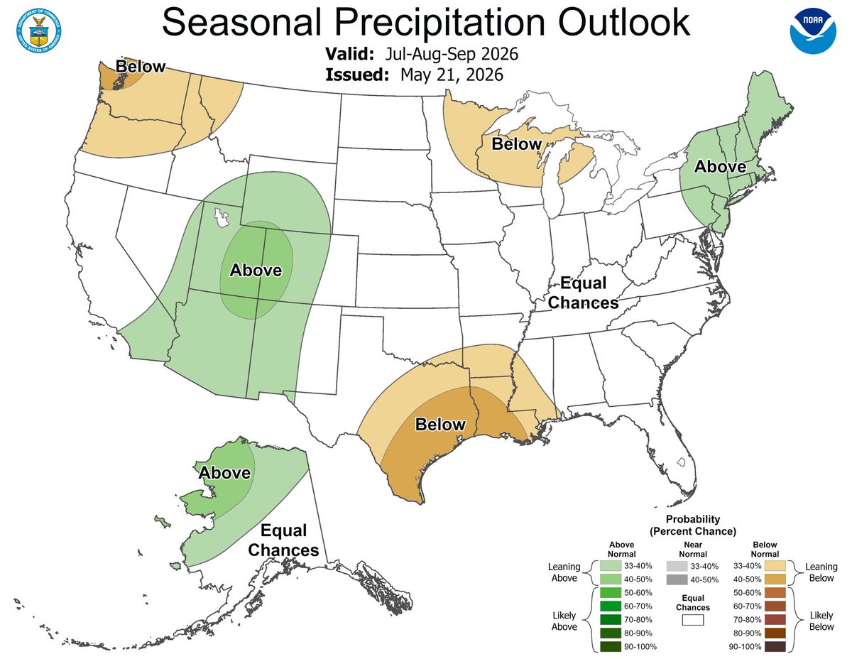
ACTIVE MONSOON: The latest seasonal outlook from NOAA is starting to paint a pretty interesting picture for Utah this summer. The July-August-September precipitation outlook is leaning wetter than normal across much of the Great Basin and Four Corners region…a signal that could point toward a more active monsoon season for Utah.
That doesn’t guarantee nonstop storms or an end to drought concerns, but it does suggest the atmosphere may be more favorable for moisture surges out of the south later this summer. More monsoon moisture would mean increased chances for afternoon thunderstorms, localized flash flooding, and a little more cloud cover during the hottest part of the season.
What really catches my attention is the bigger climate setup developing in the Pacific. We’re heading away from ENSO-neutral conditions and trending toward El Niño by late summer and fall. While El Niño has a stronger influence on Utah during the winter season, it can also subtly reshape the summertime jet stream pattern and moisture transport across the Southwest.
After a few quieter monsoon seasons recently, the long-range pattern may finally be tilting back toward a more active summer thunderstorm setup across Utah. We’ll see if the atmosphere follows through over the next couple of months.
25
23
352
32,949
Suzanne Bates retweeted

May 22
I almost hesitate to promote this, because it wasn't really intended to be a piece. I just sort of sat down and it came out. Maybe someone else out there has the same type of day today, and it'll speak to them.
realclearpolitics.com/articl…
643
945
6,358
2,345,966
Suzanne Bates retweeted

May 21
NEW POLL: Deseret News poll found a majority of Utah voters oppose Kevin O'Leary's AI data center.
53% somewhat (12%) or strongly (41%) oppose it.
30% somewhat (19%) or strongly (11%) support it.
85% of Democrats, 62% of independents & 36% of Republicans oppose it. 45% of GOP support it.
52% of urban residents, 20% of suburban & 22% rural support it.
deseret.com/politics/2026/05…
3
15
44
8,124
Suzanne Bates retweeted

May 20
Here’s full PSA with @SenJohnCurtis and @SenMarkKelly for the Disagree Better campaign encouraging work across the aisle
Curtis: To disagree is human
Kelly: But to disagree better is American
youtu.be/3qU3bXAOVgo?si=8NMc…
8
14
19,029
Suzanne Bates retweeted
May 19
Idaho Gov. Brad Little’s top opponent in today's GOP primary is Mark Fitzpatrick, who has drawn backlash over past comments regarding members of The Church of Jesus Christ of Latter-day Saints.
On Sept. 28 — the same day a gunman rammed into a church meetinghouse, lit the building on fire and started shooting, killing four individuals and wounding eight others — Fitzpatrick took to social media to express his distaste for the faith.
“Dear (President Donald Trump), Mormons aren’t Christian. Stop saying otherwise,” Fitzpatrick posted in response to Trump’s statement on the shooting. Fitzpatrick posted that same day he planned to “expose the evil of the LDS church.”
Ahead of Tuesday’s election, Fitzpatrick’s social media footprint has been increasingly devoted to insisting he does not hold bigoted views toward Latter-day Saints. But he has not distanced himself from his earlier comments, despite requests from voters.
Multiple accounts based out of Idaho, who said they were conservative Latter-day Saints, told Fitzpatrick they aligned with him on many issues but could not bring themselves to vote for him if he did not retract his previous comments about the church.
Latter-day Saints make up roughly one-quarter of voters in Idaho and around one-third of state lawmakers. This ratio is higher in the southeastern corner of the state, where some counties boast the highest share of Latter-day Saints in the country.
deseret.com/politics/2026/05…
21
13
83
4,670
Suzanne Bates retweeted
May 14
Jason Chaffetz confirms w/ Deseret News he is considering a run for Utah governor in 2028.
Top GOP consultants/donors across the conservative spectrum say he's doing a lot more than considering. He's trying to secure a lead before the race even begins.
deseret.com/politics/2026/05…
38
13
110
36,756
Suzanne Bates retweeted

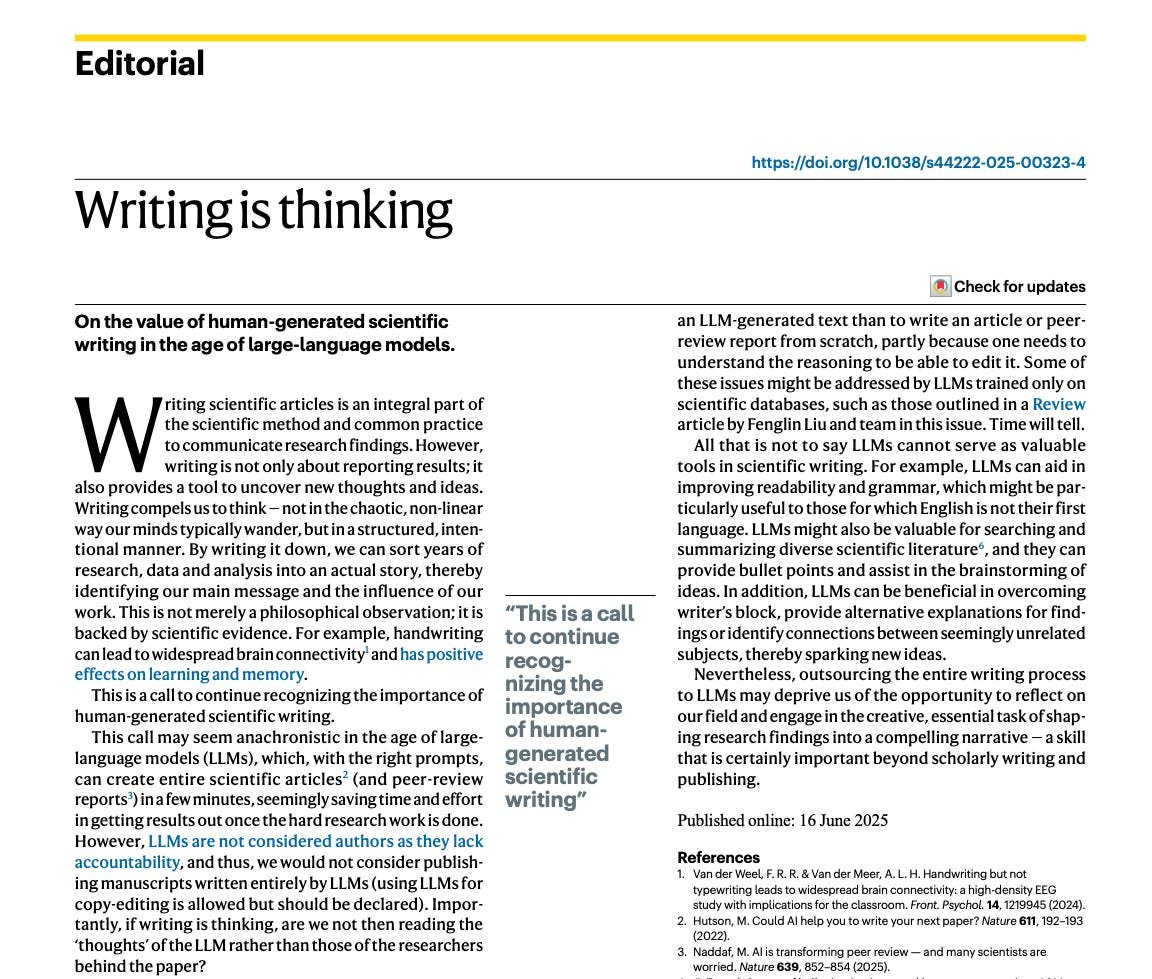
So it turns out that writing is thinking. It's the same process.
"Writing compels us to think — not in the chaotic, non-linear way our minds typically wander, but in a structured, intentional manner."
Outsourcing writing to LLMs is THE SAME THING as outsourcing thinking.
183
1,534
5,663
222,771
Suzanne Bates retweeted
Apr 15
Democratic CD1 candidate Nate Blouin posted a series of extremely offensive comments against members of The Church of Jesus Christ of Latter-day Saints a decade ago on platforms like Reddit. Story by @cami_mondeaux. 1st reported by Punchbowl News.
deseret.com/politics/2026/04…
16
13
93
6,553
Suzanne Bates retweeted
Apr 3
Here’s the budget line confirming my scoop that Trump wants $1 billion for Great Salt Lake in his budget request

Apr 2

Scoop: Trump is carving out $1 billion in his annual budget request to "restore and protect the Great Salt Lake"
Trump is expected to send full budget request to Congress on Friday, and the president vowed earlier this year to help save the shrinking lake levels
deseret.com/politics/2026/04…
3
7
19
4,328
Suzanne Bates retweeted
Apr 2
Scoop: Trump is carving out $1 billion in his annual budget request to "restore and protect the Great Salt Lake"
Trump is expected to send full budget request to Congress on Friday, and the president vowed earlier this year to help save the shrinking lake levels
deseret.com/politics/2026/04…
2
30
99
28,534

Apr 2
RT @BrighamTomco: OK, so what's the truth about Latter-day Saint political affiliation?
Over the past two decades, the share of Latter-da…
1
6
Suzanne Bates retweeted

Cheering on the astronauts and crew of Artemis II from America’s Front Yard. Out of this world!
🚀🇺🇸🏛️🌳🌕
457
6,600
42,846
1,099,720
Suzanne Bates retweeted
Mar 26
Utah's Prop 4 repeal petition fell below threshold in 1 state Senate district Wednesday after signature removal campaign.
It will not appear on ballot despite $4.35 million for professional gathering, Turning Point Action support & Trump endorsement.
deseret.com/politics/2026/03…
9
10
42
12,188
Suzanne Bates retweeted
Mar 25
Chris Klomp, the Utah entrepreneur RFK Jr. asked to run the Department of Health, decided he wanted to become a doctor before graduating from Boise High. So he started pre-med at BYU. But while on a mission for the Church of Jesus Christ he expanded his scope to reforming the entire health care system.
Here's why the dad of four, who now lives in Park City, chose to answer the call to serve in the Trump administration, and how he plans to be a unifying figure while overseeing $2.6 trillion in taxpayer funds at DHHS. deseret.com/politics/2026/03…
6
23
239
16,020