The Official Terrebonne Parish Office of Homeland Security and Emergency Preparedness Twitter. Call 911 for emergencies. This account is not monitored 24/7.
Joined April 2009
- Tweets 5,528
- Following 156
- Followers 3,057
- Likes 195
514 Photos and videos


Terrebonne Parish OHSEP retweeted

6 Feb 2024
‼️🌀 A new experimental cone graphic will be available to the public later in 2024.
This will help to emphasize the inland wind hazards that tropical systems bring and provide more context of the size of the storm's wind field beyond the cone.
More info: nhc.noaa.gov/pdf/NHC_Cone_Gr…
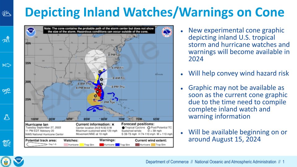
ALT Headline: Depicting Inland Watches/Warnings on Cone. Key points: New experimental cone graphic depicting inland U.S. tropical storm and hurricane watches and warnings will become available in 2024. Will help convey wind hazard risk. Graphic may not be available as soon as the current cone graphic due to the time need to compile complete inland watch and warning information. Will be available beginning on or around August 15, 2024.
10
32
7,943


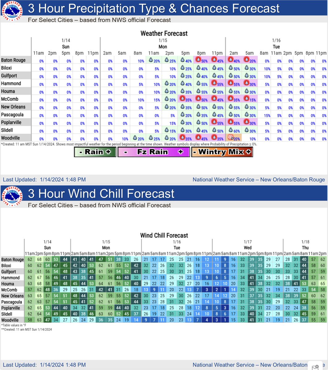
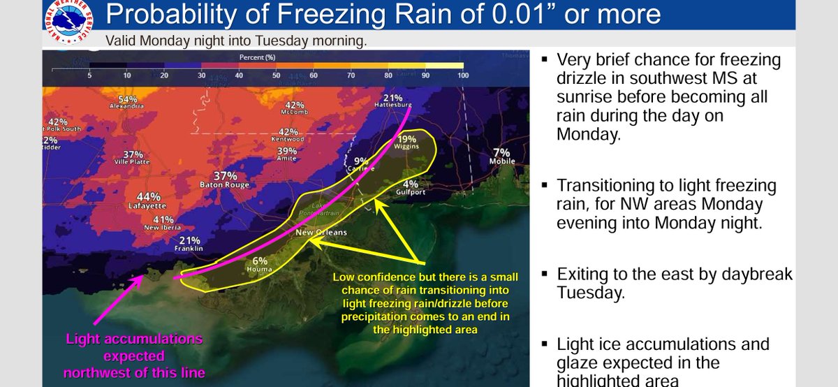
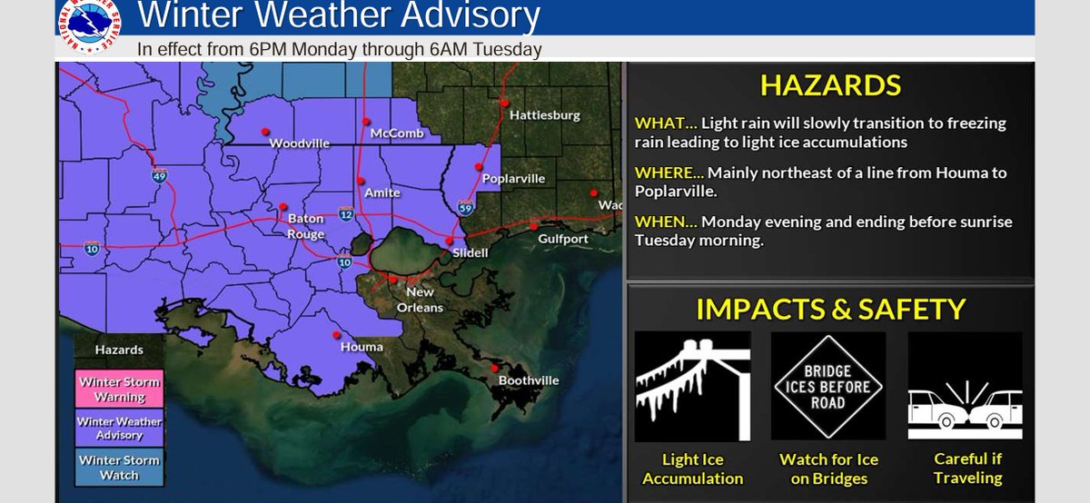
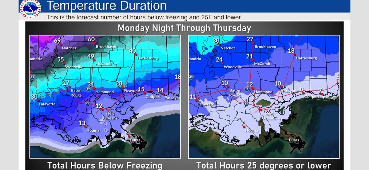
14 Jan 2024
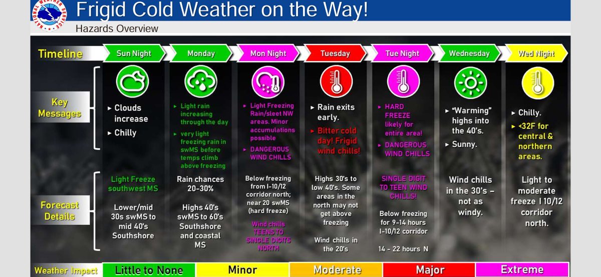
Cold Weather (Monday through Thursday) Update -- Jan 14th, 2024: 1030AM CST ocv.im/xh5AVhj
103