
Manager of Meteorology Operations at Xcel Energy - focused on wildfire mitigation while powering society.
Joined March 2012
- Tweets 18,103
- Following 1,531
- Followers 15,897
- Likes 17,365
3,941 Photos and videos


Pinned Tweet

28 Jul 2017
This is possibly my favorite time-lapse that I've ever taken. Watching the colors explode then transition thru the spectrum is spectacular.
94
3,360
8,511
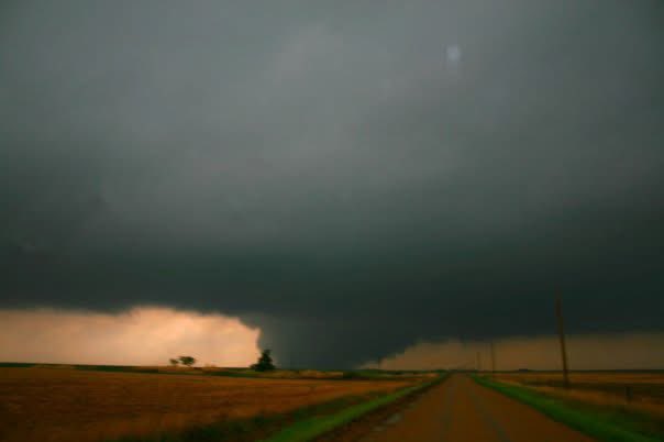
Jun 12
The southernmost supercell has an opportunity to produce a strong to violent tornado given the near-storm environment coupled with the impinging bow echo. The pressure perturbation associated with the bow should further enhance backing winds and associated 0-1km srh ahead of the bow which would be constructive for tornadogenesis/maintenance within an already incredibly supportive environment.
Yhis is an interactive to observe closely.
1
2
7
1,871
Jun 12
Constructive and a signature closely associated with strong to violent tornadoes.
1
2
1,297
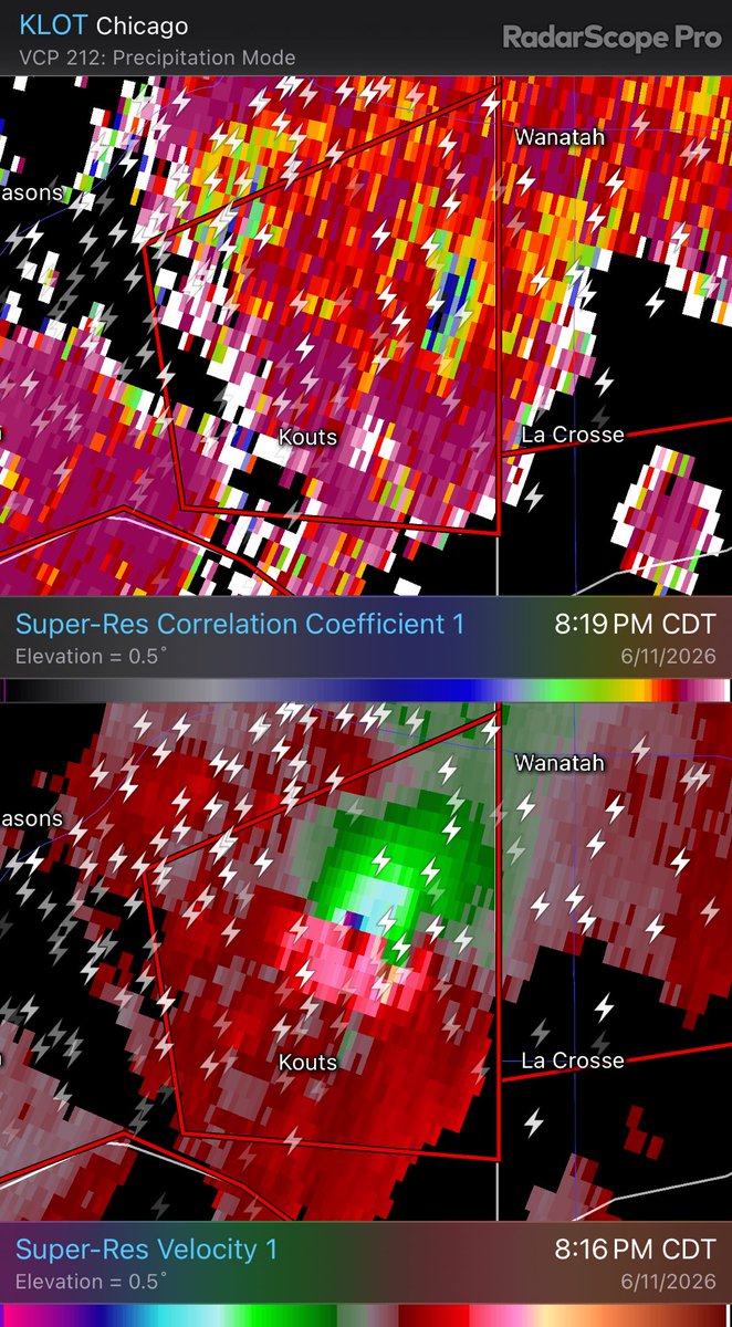
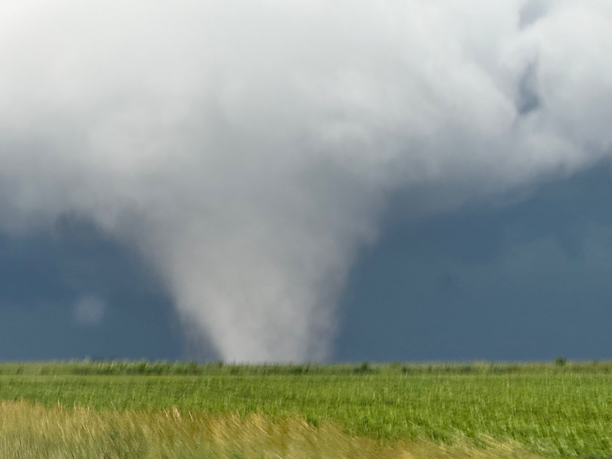
Jun 12
This was the tornado:
Jun 12

Likely violent #tornado (EF3 ) destroyed multiple homes, twisted high tension power lines, and left significant ground scaring north of Kouts, Indiana.
@MyRadarWX #inwx
1,211
Taylor Trogdon retweeted

Jun 11
Sorry for radio silence, nonstop, filming tornadoes with my jaw on the floor in North Central Illinois.
49
467
3,131
185,488
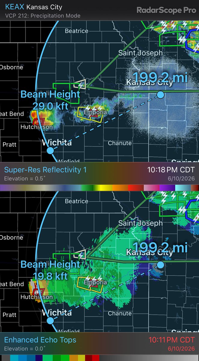
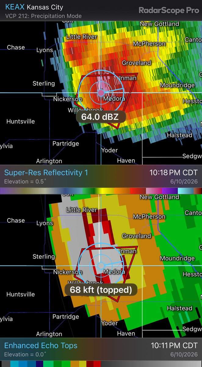
Jun 11
A testament to the storm environment and instability — this supercell, as viewed from the radar near Kansas City, MO, almost 200 miles away, is displaying “Flying V” structure at incredible distance. This storm is 70k feet tall, or >13 miles high in the atmosphere. This is uncommon and is likely able to be observed from a LONG ways away.
I don’t tweet often anymore but this is one worth bookmarking. I’m going to assume ahead of time that this one will be well documented by both chasers and the general public.
7
39
1,876
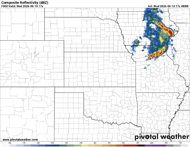
Jun 10
I would not at all be surprised if a localized but extreme flash flooding risk developed somewhere around or west of the Kansas City metro this afternoon/evening on the edge of the cap further southwest. Intense, convective rain rates with backward-propagating supercells could produce net zero storm motions. Wherever this sets up could receive jackpot precip totals with rain rates of 3-4” per hour.
1
1
3
516
May 20
13 years since the Moore tornado of 2013. I’ll never forget watching the terminal Doppler data in real-time as it captured incredible detail of this EF-5 tornado.
5
562
May 17
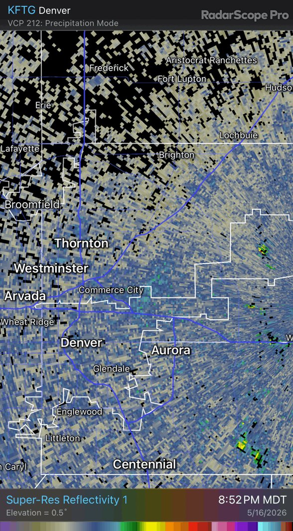
Rapid updraft development just northeast of Denver. Charge separation happening before you would feel rain.
Impressive lightning strikes with a likely strong storm developing.
Life on the front range.
1
2
16
1,191
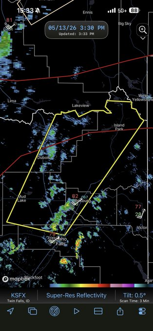
May 13
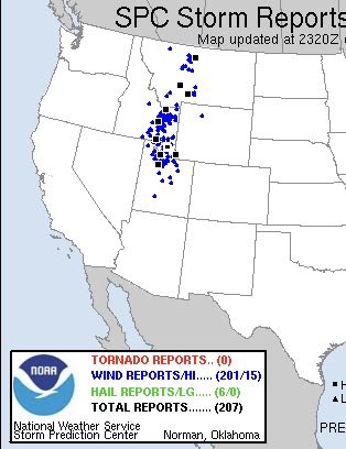
This is a case where I don’t need to provide a narrative.
~200 wind damage reports
~15 sig wind reports
Subject matter experts still matter.
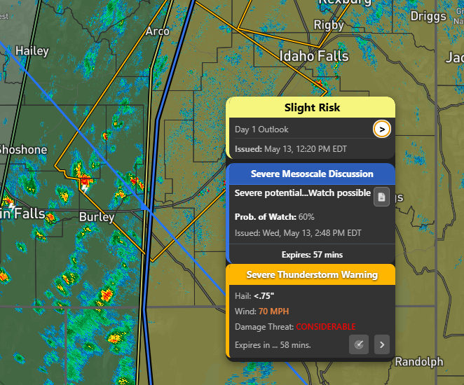
May 13

we flame the nws for putting out tornado warnings on storms with no rotation or svr tstorm warnings for a 50dbz storm but we dont say anything when they pull this out
3
90
9,335
Taylor Trogdon retweeted

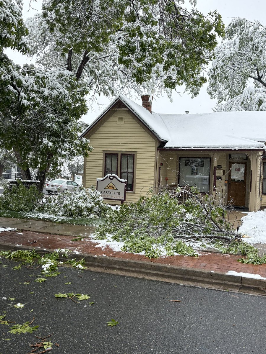
May 5
Radar: 3:47 PM 5/5/26
Precipitation is increasing in coverage this afternoon with rain switching to snow in many locations across the urban corridor including at our office in Boulder. Thunder snow is occurring in the mountains as shown by the lightning symbols. #cowx
2
14
64
9,198
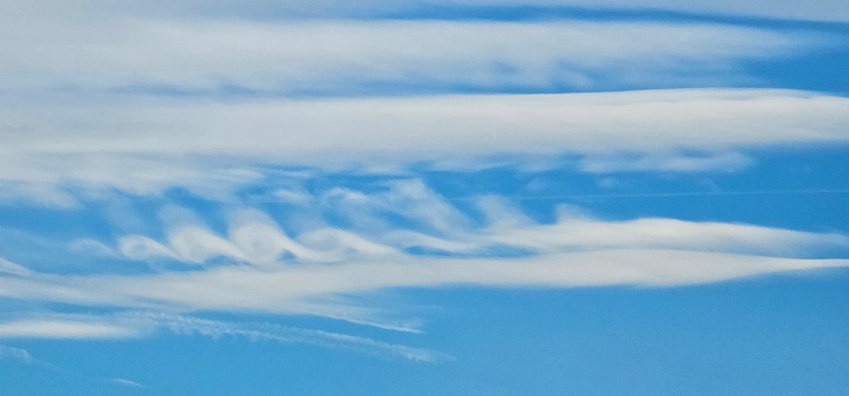
May 5
Incredible example of wind shear in the atmosphere over the Colorado front range today. Convective precipitation is moving east to west in a lower layer of the atmosphere as stratified precipitation moves west to east above. This is a relatively rare visual of a wind shear profile traced through precipitation echoes on radar.
1
19
158
13,047
Apr 28
Meteorologists that just comment on the event busting without having a single comment on the science will always reinforce who I choose to listen to in the field.
It’s ironic because they (should) know how difficult this is but choose airtime over meaningful contribution and that’s generally a good proxy for where we’re at in the social era.
All while there are still significant impacts to communities, no less.
— Written by a meteorologist that understands public perception, the challenges of science and still on this platform (out of hope?) to advance science and communication.
4
3
73
5,914
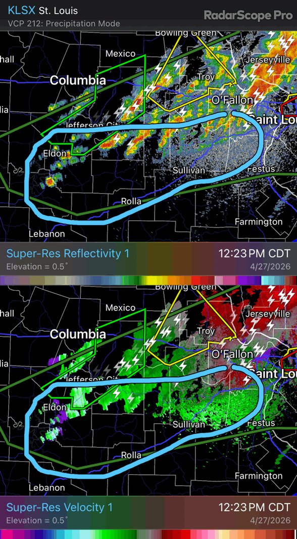
Apr 27
Extremely concerned about the (admittedly crudely) drawn area. Significant warm advection has been acting on the cold pool-reinforced boundary for several hours with new upstream development already evident on radar.
Significant tornado potential should maximize in the mid to late afternoon hours, perhaps peaking in around the STL metro. All trends are indicating damaging tornado potential increasing as the afternoon unfolds.
6
41
3,711
Apr 27
If the warm front that’s currently being reinforced by outflow from morning storms is modified as depicted by the 16Z HRRR, this is one of the more dangerous setups on paper for the immediate St. Louis metro that I’ve observed in quite some time — specifically with respect to strong to damaging tornadoes.
0-1km srh will be maximized along this modifying/retreating boundary coupled with continued rapid moistening. Any supercell maturing within this environment, concentrated in and around STL, will favor tornadogenesis.
5
54
5,586
Apr 25
Today’s environmental setup favors very large to giant hail. I think theres a high likelihood of observing a 5 ” stone today in south-central/southeast Oklahoma. Tornado threat is certainly there but today’s main character is hail.
1
3
31
2,225
Apr 24
Every so often, a tornado video surfaces that reaffirms why I study weather.
A mentor once told me, “always be a student of the weather. If you ever feel like you’ve learned all there is to learn about it, then you’ve failed, because that’s an impossibility.”
Even without any data collected, there is so much to observe physically about how the strongest tornadoes on earth are maintained.
This video left me speechless and I know there’s still more to learn.
Filmed by @DanielShawAU, who is an incredible journalist.
youtu.be/rdiTXgUw_XY
1
14
1,101
Apr 12
Well the west Pacific is starting out with a bang this year. Sinlaku is astoundingly powerful this morning currently in a nearly ideal state.
4
12
1,397
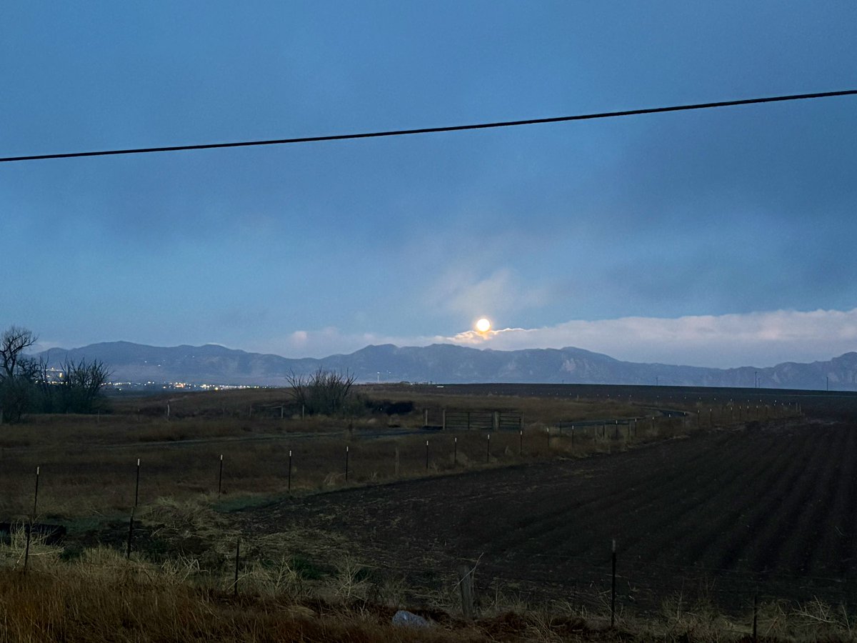
Apr 2
Moon set over the flatirons through the fog made the early drive to work with it today, even though the phone camera did not do just to the scene.
1
1
15
558
Apr 1
You heard it here first. Airplanes are banned. Only travel by foot, rail or car henceforth.
Mar 31

As Governor, I would sign legislation into law, like Florida and Tennessee, to ban chemtrails.
Supporting legislation to protect the air we breathe is just common sense.
South Carolina STRONG: nancymace.org/nancy-mace-bac…
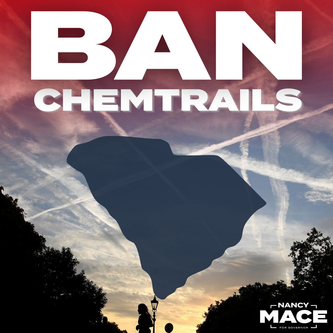
Community note
Chemtrails do not exist; the trails are contrails formed by water vapor from aircraft exhaust. Florida and Tennessee bills prohibit geoengineering experiments, not chemtrails. epa.gov/regulations-em… en.wikipedia.org/wiki/Chemtrail… nbcnews.com/science/enviro…
1
13
1,356