
Joined March 2018
- Tweets 1,687
- Following 354
- Followers 169
- Likes 1,073
749 Photos and videos


new AI powered form designer (also builds forms based on ESRI FeatureServer, GPKG, other data) xlsformgen-d2jlagnq.manus.sp… creates XLSForms for ESRI Survey123 and ODK apps and JSON Form Designs for Tech Maven Geospatial iOS, Android, Windows and Web Apps. We are sell this for self hosting for one-time payment of $499. Link to purchase will be added soon.
42
geoq.techmaven.net/ Cloud Native Geospatial Discovery/Searching/Querying/Analysis/Derivative Products and AI Agent Enabled and AI Chat Bot (CLI, Web App, API) Access COG GeoTIFF Rasters, COPC LAZ 1.4 Point Cloud, Vector GIS Data, Databases, Catalogs (STAC, CSW, OGC API Records, CKAN, others)
104
powerlinegis-djfogdcg.manus.… Powerline PLS-CADD Conversion to ESRI UN - Utility Network or PostGIS Database. With support for CDC Change Data Capture and Data Conflation
31
GeoLake Gateway - geospatial data serving from S3 Bucket hosted cloud native/optimized data as ESRI equivalent mapping services without the ESRI ArcGIS Enterprise licensing. geolakegw-ywd4nat8.manus.spa…
35
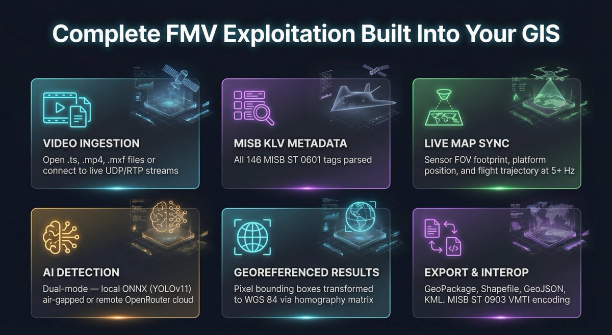
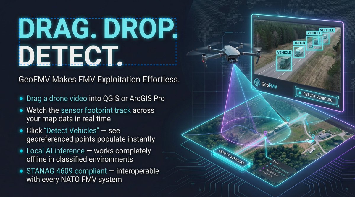
Add Video Feeds from UAS/Drones and Helicopters and Aircraft to QGIS Desktop and ArcGIS Pro (without image analyst) and perform AI powered analysis. Display platform and sensor and field of view on the map and be able to extract geospatial data from video geospatialvideo-ai.techmaven…
56
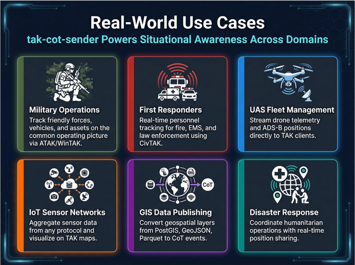
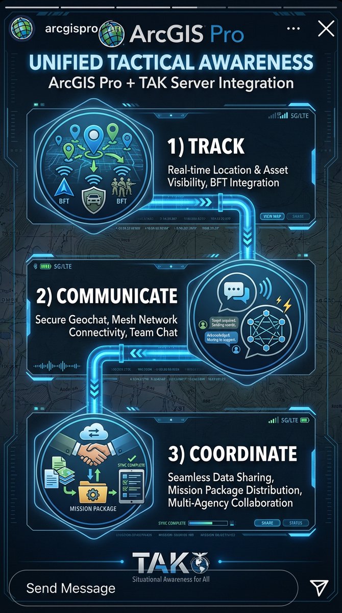
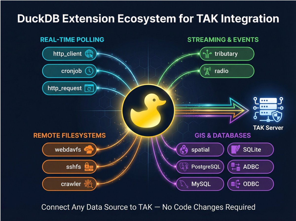
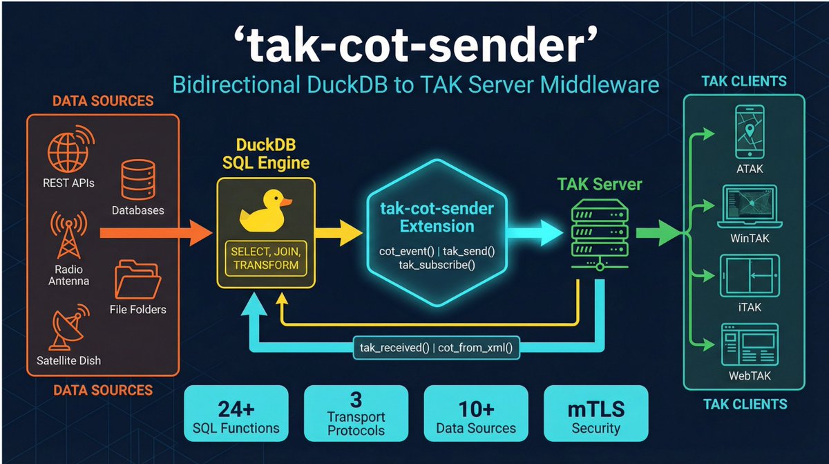
takgateway.techmaven.net/ We've developed a powerful flexible solution that is a TAK Gateway as a Duckdb Extension (supporting bi-directional data to/from TAK Server) Support ATAK, iTAK, WinTAK, WebTAK and Other TAK Clients. This means you can use duckdb to pass through any supported data by any of the duckdb native features and extensions.
70
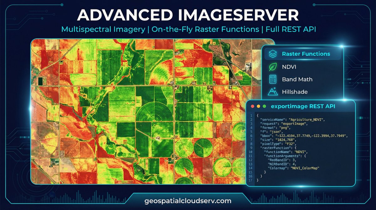
GeoLake Gateway - store your geospatial data in a S3 bucket (data lake) and offer ESRI equivalent mapping services with full compatibility with apps (ImageServer and MapServer from COG GeoTIFF, SceneServer from COPC LiDAR LAZ 1.4, FeatureServer and VectorTileServer from any GIS Vector Format, StreamServer from movement/event-driven data feeds)
49
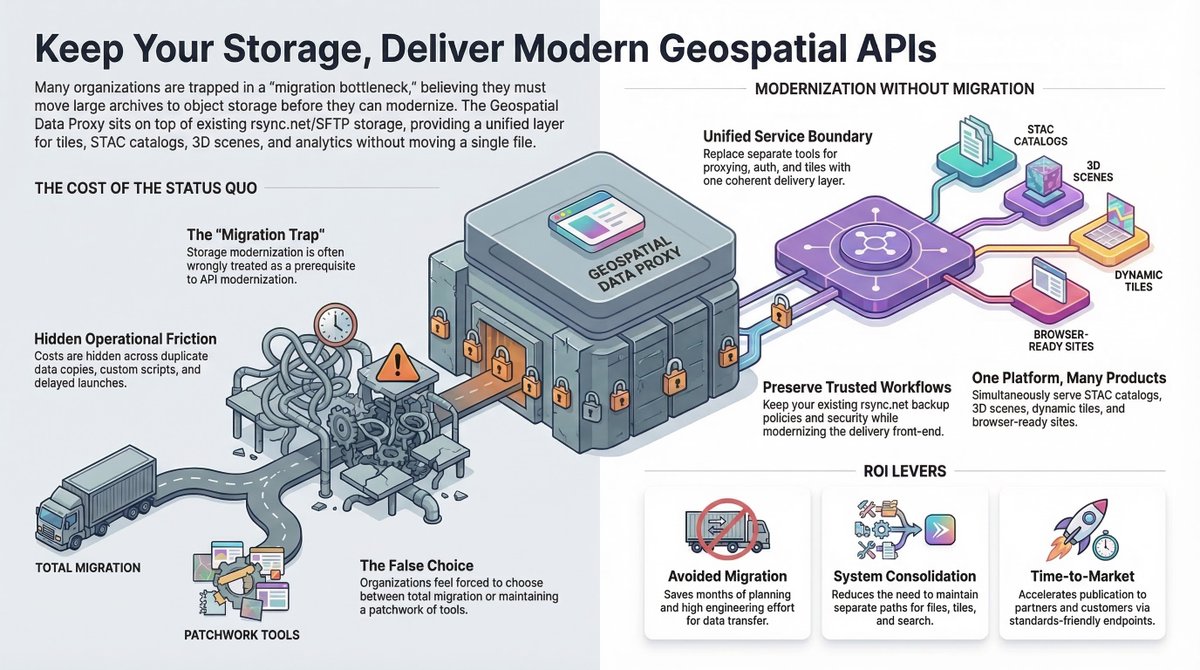
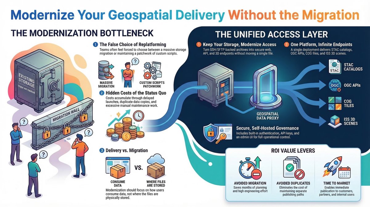
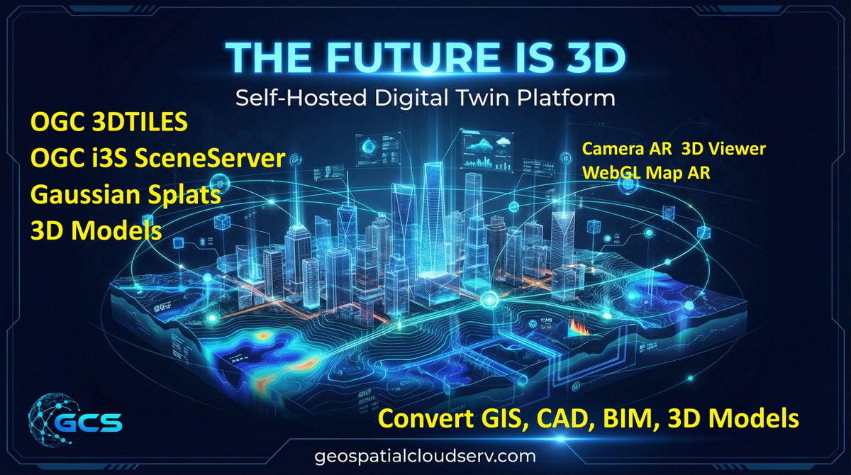
handle massive petabyte scale geospatial data hosting in rsync.net ( no affiliation with them) and offer both cloud native optimized http URL's and modern mapping services geospatialdata-rsyncdotnet.t… Upload your UAS/Drone Data and big orthophoto-imagery and LiDAR Point Cloud Collection and efficiently serve it and have integrated viewer and spatial analysis. Including 3D Geospatial Digital Twin data (i3S SceneServer and 3DTILES, Gaussian Splats, GLB 3D Models)
1
44
Full transactional editing support equivalent ESRI FeatureServer and OGC WFS-T
14
handle massive petabyte scale geospatial data hosting in rsync.net ( no affiliation with them) and offer both cloud native optimized http URL's and modern mapping services geospatialdata-rsyncdotnet.t…
1
34
geospatialdata-rsyncdotnet.t… looking to store petabytes of geospatial data efficiently we've developed a solution that uses RSYNC.NET and offers proxy (range request headers http URL) and OGC API Features, OGC API Tiles and cached map tiles (XYZ/WMTS) and COG Tile Server as XYZ and WMTS with full STAC Spatial Temporal Asset Catalog. We are selling this as one-time payment of $2,500. Comes with an advanced maplibre gl js map viewer with full cloud native file format support and a no code form builder.
77
We've developed a super advanced MapLibre GL JS Geospatial Viewer/Editor that fully works inside the ESRI ArcGIS Enterprise or AGOL space. Can interact with ESRI Services and perform edits and analysis, consume all the ESRI services and configure the map with WebMapId or WebSceneID or CatalogLayerJSON Config. It supports all the cloud native/cloud optimized file formats. It has duckdb web assembly for client-side analysis maplibre-esri-arcgis.techmav…
1
58
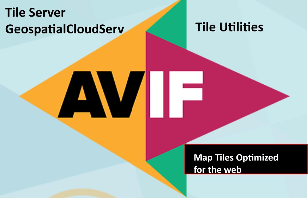
We've updated some of our apps to create and serve AVIF Raster Images which are much more lightweight than JPG or WebP images. All modern browsers support this format so there is no change for web apps.
We can serve MBTILES and PMTILES raster tiles with AVIF imagery with the correct encoding/headers as well as convert PNG or JPG to AVIF with Tile Utilities. For mobile your best bet is WebP since AVIF adds too much overhead on mobile mapping apps to decode and will drain battery. tileserver.techmaven.net geospatialcloudserv.com portfolio.techmaven.net/apps…
41
Geospatial AI revolution for Airport Operations - spatial real-time intelligence platform airport-operations.techmaven… Fusion of GIS, CAD, BIM, iOT Sensor Data, Enterprise Systems into one platform for rapid insights, analytics, analysis, visualization, SA, COP, C2
1
75
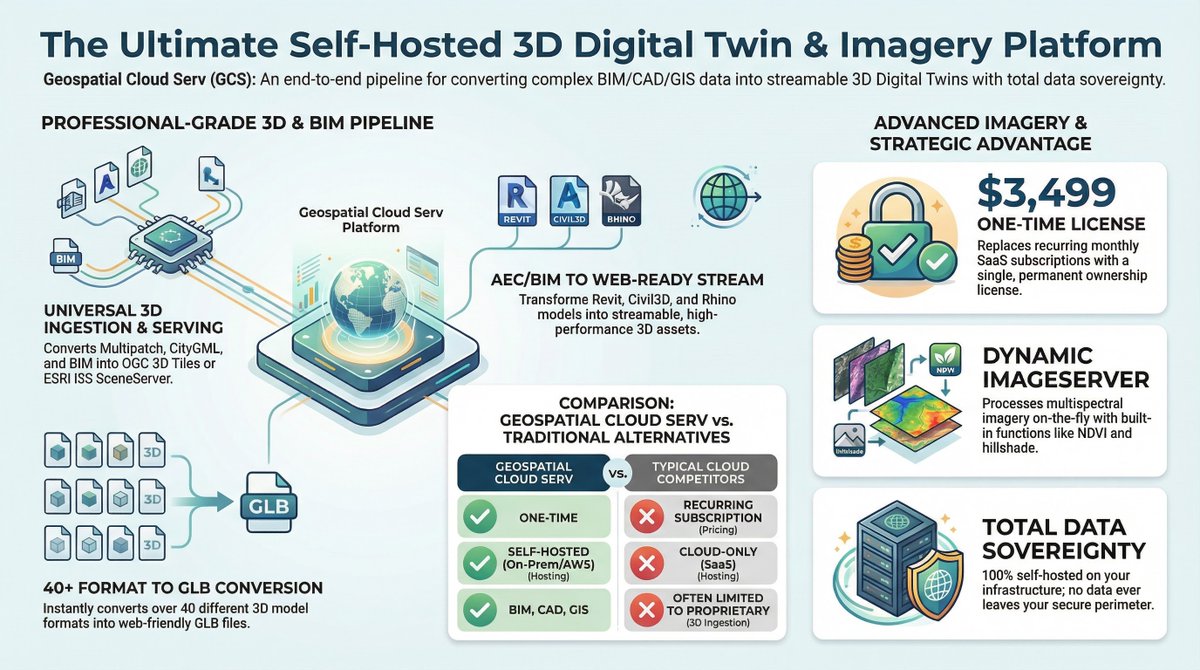
GeospatialCloudServ geospatialcloudserv.com a true 3D/4D Intelligence Platform (self-hosted) ready for your advanced digital twin visualizations and analysis
2
70
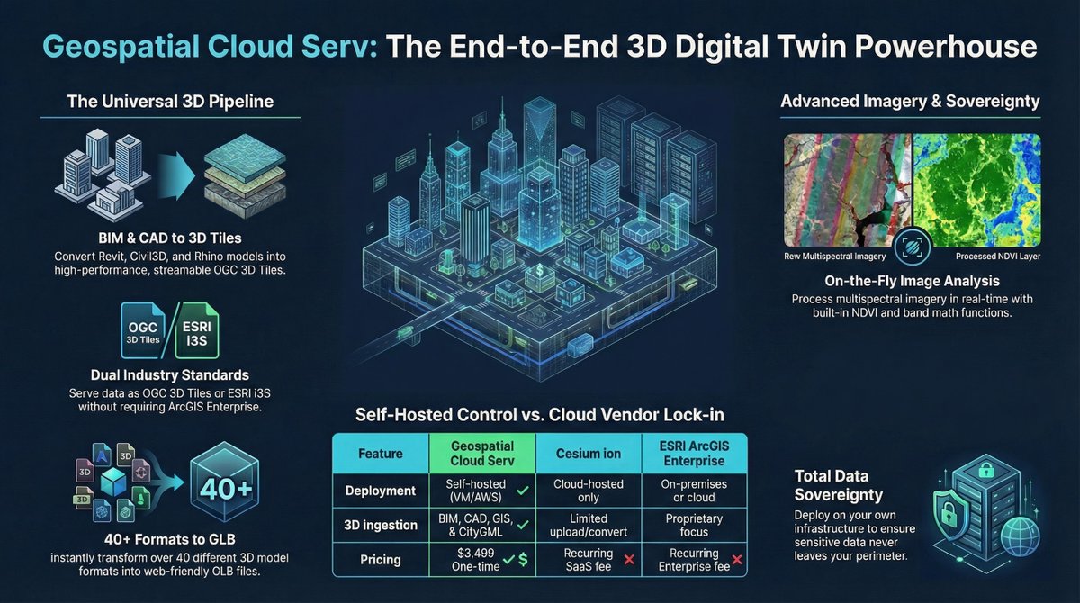
Advanced comprehensive geospatial visualization and analysis solution - GeoSpatialCloudServ geospatialcloudserv.com (affordable self-hosted on-prem, edge, cloud) ESRI SceneServer and ImageServer without the ESRI ArcGIS Online or Enterprise Pricing and No Per User Pricing. Powerful microservices to convert and transform and publish data. Plus QGIS Plugin and ArcGIS Pro Add-on. We are having a promo at $3,500 one-time payment and $500/year for maintenance and support and quarterly updates.
1
39
Real-Time Intelligence Digital Twin Platform - GeospatialCloudServ geospatialcloudserv.com a powerful self hosted comprehensive solution

1
38
AI powered Airport Operations management solution - real-time Situational Awareness Common operation picture and Command and Control
26
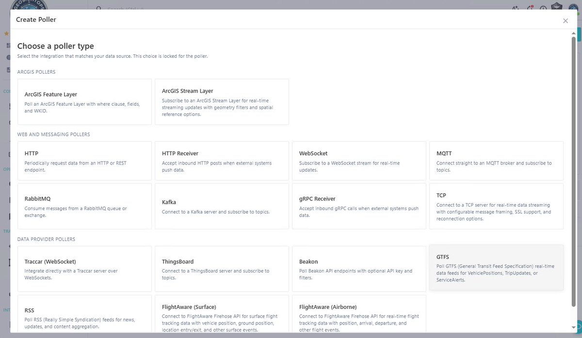
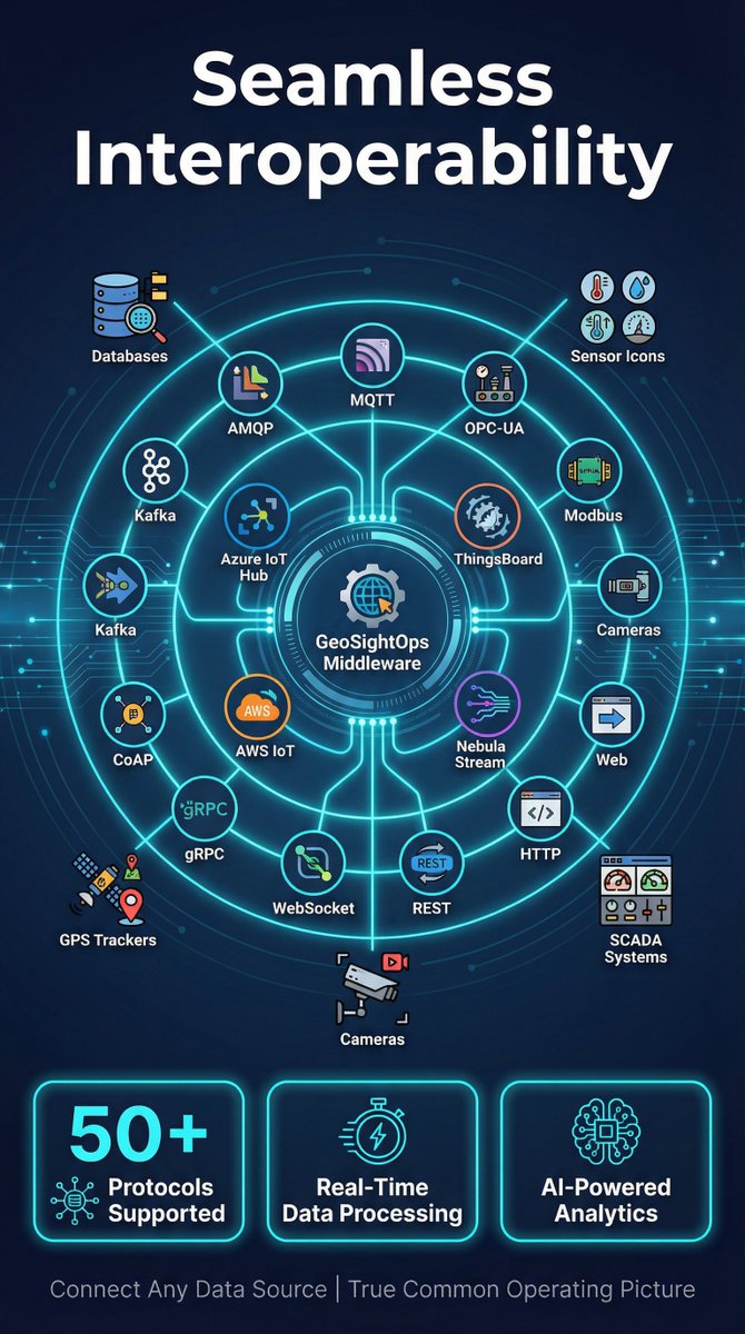
GeosightOps is a real-time intelligence platform with support for nearly any Camera/Video Feed and tied to location and viewable on the map. (RTSP, RTMP, Dash, HSL, WebRTC, YouTube, and much more) geosightops.com
1
47
Easily configure real-time feeds, attribute field mapping, business rules and logic engine and triggers/alerts

19