
Husband. Father. Smartass. Stuff like that. Trump sucks!
Joined June 2025
- Tweets 11,550
- Following 1,542
- Followers 1,836
- Likes 27,931
1,177 Photos and videos


This reads like a manifesto you leave behind after a successful 200 yd kill shot on a civilian
1
1
16
Ed Blake retweeted

who will melania’s next husband be?
235
11
203
9,076

Jun 13
50 million uninsured people watching guys jump motorcycles on the White House lawn
Jun 13

God Bless America 🇺🇸
First look at the historic Freedom Jump.
@blckriflecoffee
@TravisPastrana @mmgeneral @Jeremymcgrath__ @RickyCarmichael @twitchthis
5
3
25
1,000
Jun 12
Cover those flock cams with garbage bags to keep them safe from rainy weather. Have a heart
20
Ed Blake retweeted

Gotta appreciate how Gwyneth Paltrow does something everybody hates and then lays low for a few years until everyone forgets only to come back and do something everyone hates even more
55
362
6,438
1,680,386
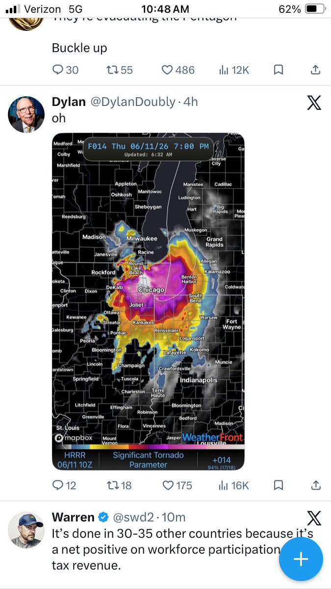
Jun 11
Storm blowing through Illinois. Would someone in Michigan please return my patio furniture?
2
51
Jun 11
Even the grass hates him

Breaking news: U.S. Park Police, the D.C. fire department and members of the National Guard were seen responding to what appeared to be an anti-Trump message “86 47″ etched into the grass on the National Mall. wapo.st/3SgFcbh

1
3
18
561
Jun 11
Lindsey Graham is super excited hearing about Trump’s nipple fetish
2
36
Jun 11
Pentagon is locked down. Mysterious substance found on one of Kristi Noems sex toys
112
Ed Blake retweeted

If you hear MAGA ranting about this word, I want you to know it was me.

293
511
16,442
3,149,963
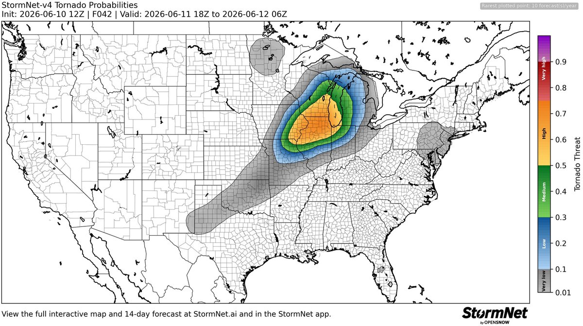
Jun 11
All these models point directly at my house. It was great knowing yall. Thanks for all the laughs
Jun 10

The computer tornado probabilities are showing very elevated to high chances for tornadoes across northern Illinois and surrounding areas for Thursday afternoon and evening.
Looking at the latest computer models, we will have an environment extremely favorable for both prefrontal and embedded qlcs tornadoes tomorrow some likely strong and long tracked.
This is in addition to the widespread destructive wind threat associated with the likely intense MCS/squall line that develops.
Storms will be already ongoing at daybreak across western Iowa and those will be the storms to watch as they evolve throughout the morning hours. Expect pretty nasty storms across northern Illinois from west to east starting around 11am-12pm and continuing through the evening hours.
Tomorrow at this moment looks like the real deal for an ideal severe weather setup with very little failure modes. Be prepared and have shelters in place. #ilwx

1
1
3
329
Jun 11
Smoothgroins? 🤣🤣
Jun 10

Smoothgroins in shambles.
What Platner's victory means:
kenklippenstein.com/p/platne…
2
112
Jun 11
Graham Platner sent me a dick pic and the tip of it was a nazi death skull. And his balls were oysters. Nazi oysters
2
55
Jun 11
It’s great if you enjoy being screamed at

66