
Northeast Tennessee coverage on short and long range weather, 7-Day forecasts for the Tri-Cities, model discussion, etc. Snow is the best kind of weather.
Joined December 2020
- Tweets 26,660
- Following 896
- Followers 4,793
- Likes 19,496
8,162 Photos and videos


Pinned Tweet

Mar 18
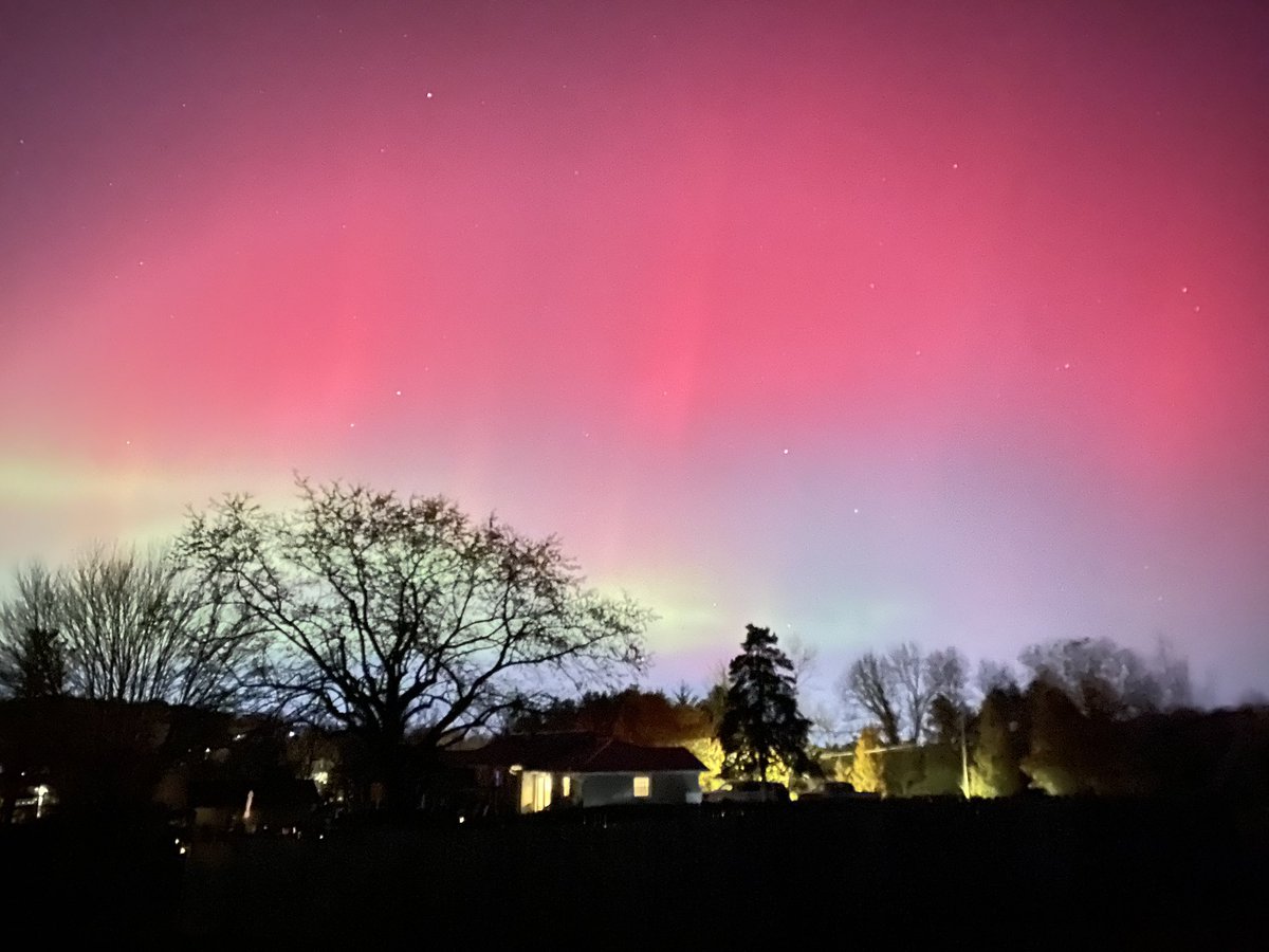
🍁❄️November ‘25 through March 26’🌸❄️
Autumn snow, spring snow, record snow, and the northern lights! What a fun ride!


1
1
16
5,059
StormTrackerSacher retweeted

Cooler and dry Monday and Tuesday. Warmer on Wednesday with very low rain chances.
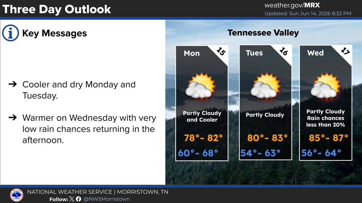
ALT Cooler and dry Monday and Tuesday. Warmer on Wednesday with very low rain chances.
3
9
868
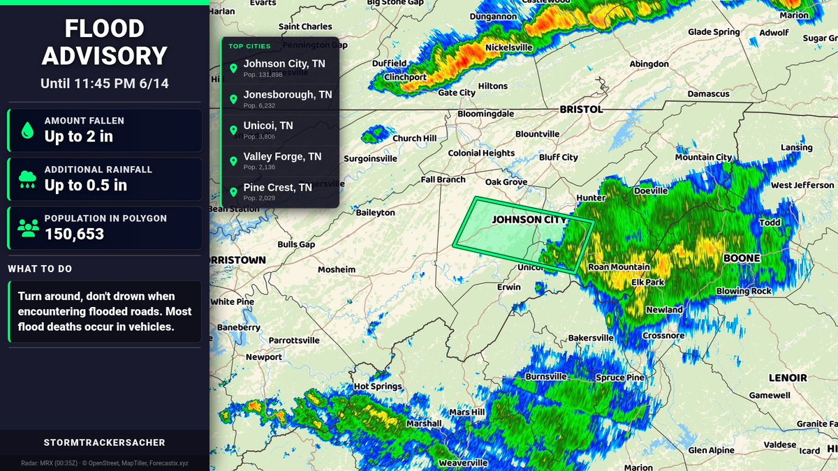
A Flood Advisory has been issued for Carter, TN, Unicoi, TN, Washington, TN | Amount Fallen: Up to 2 in | Additional Amounts: Up to 0.5 in | Expires at 11:45 PM 6/14.
2
179
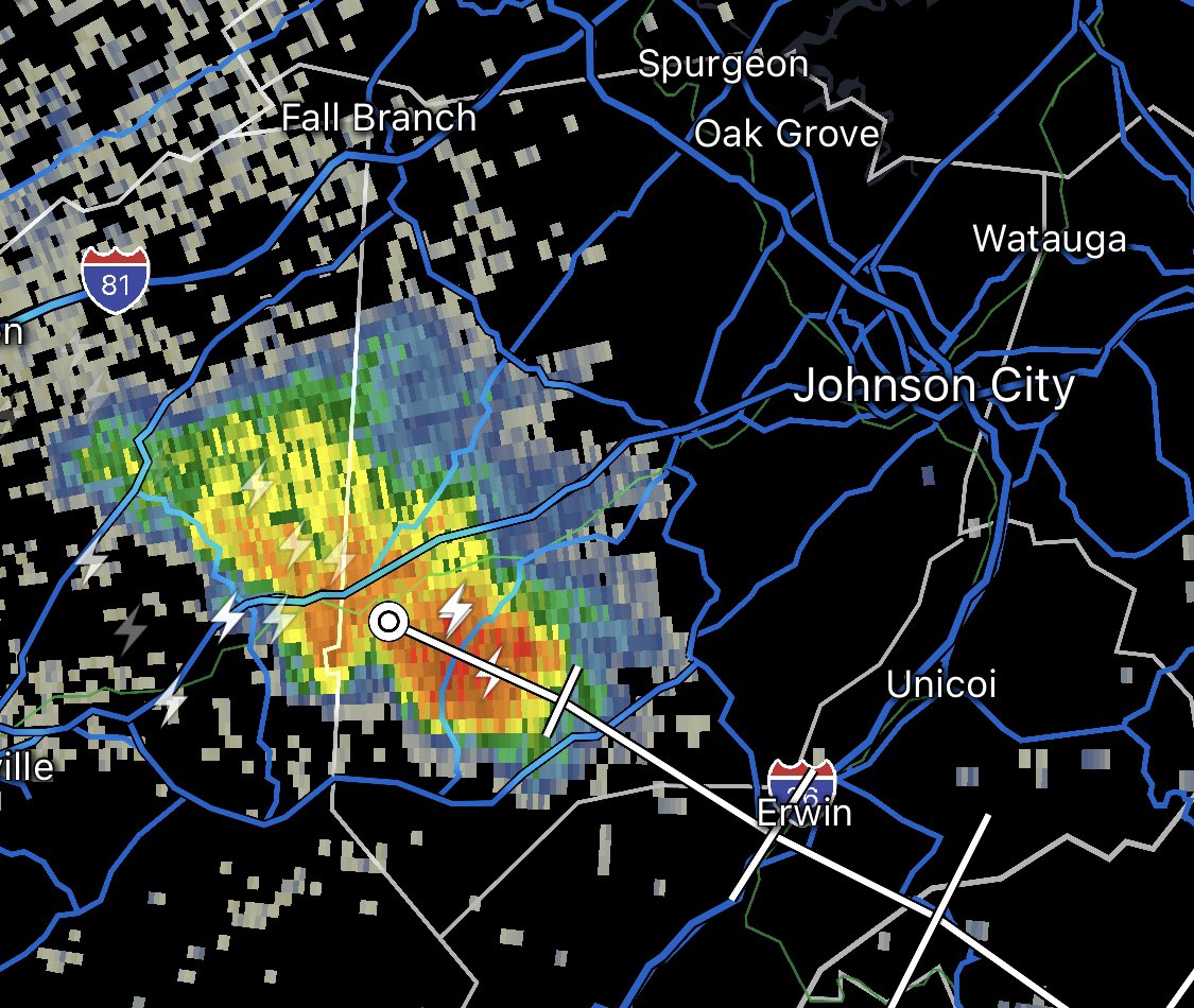
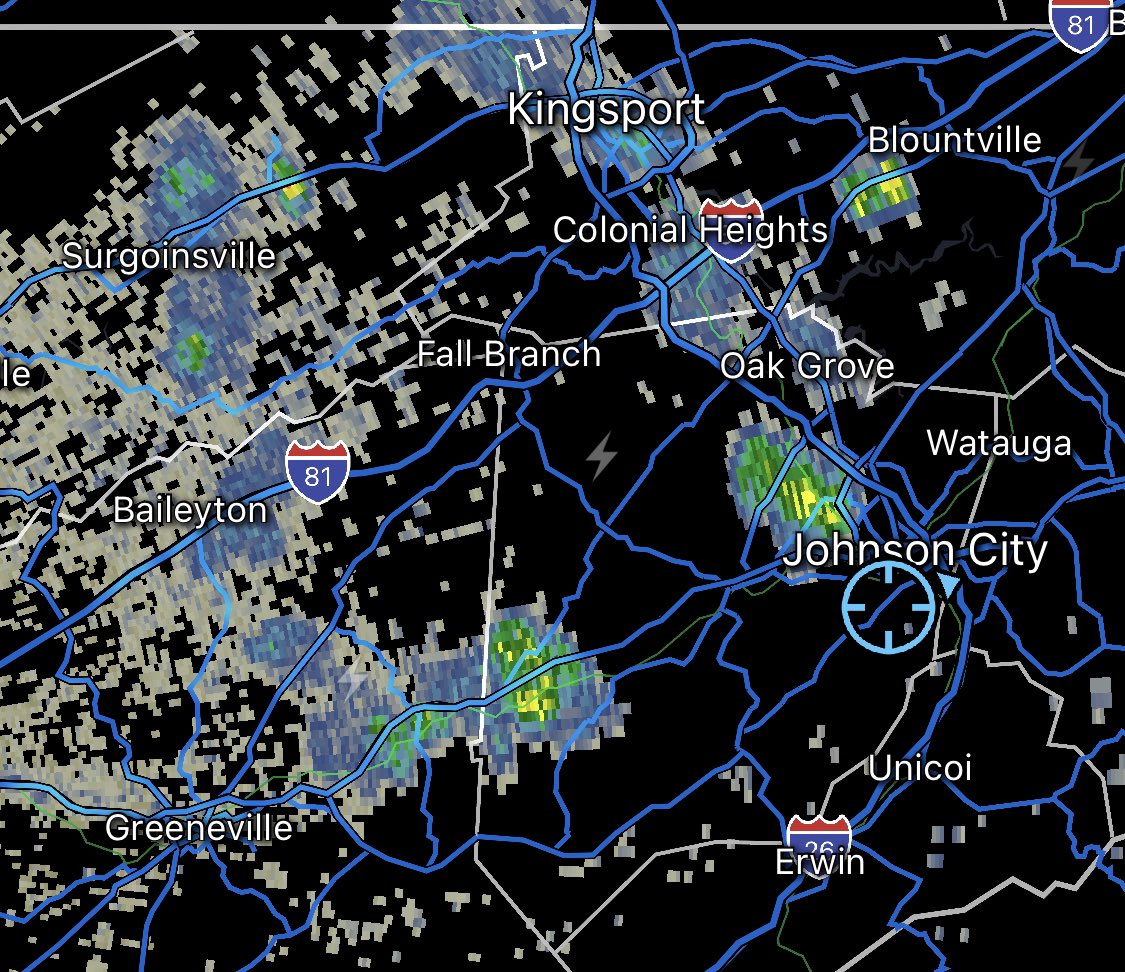
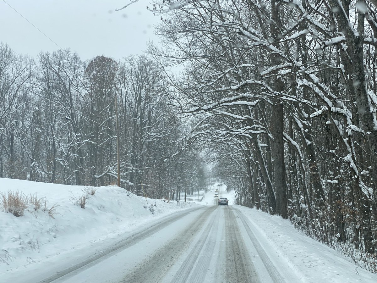
⚠️5:45 PM: This storm cell is dropping particularly torrential rainfall right over the Johnson City metro and areas north and east. I had to pull over. Be advised to a tremendous reduction in visibility, ponding on roadways, and imminent areas of flash flooding.


1
2
273
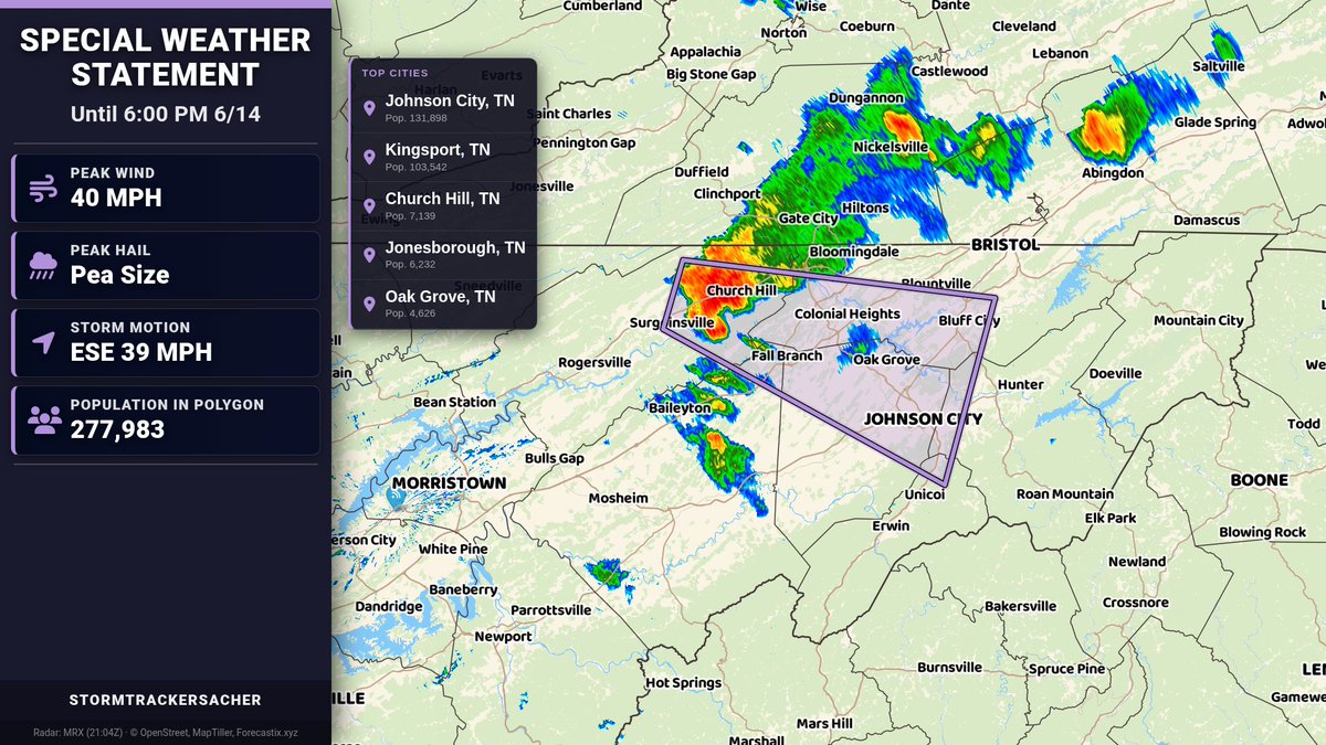
A Special Weather Statement has been issued for Hawkins, Sullivan, Northwest Greene, Washington, Unicoi, Northwest Carter until 6:00 PM 6/14 | Hail: 0.0 inches | Wind: 40 MPH
1
161
5:05 PM: Watching a storm over Church Hill that’s getting a bit interesting. Standby.
2
151


It’s pretty infuriating that I just took a whole week off from work and now we have the chase-able setup we do for later this week when I do have to work. Why is life like this.
1
312
StormTrackerSacher retweeted
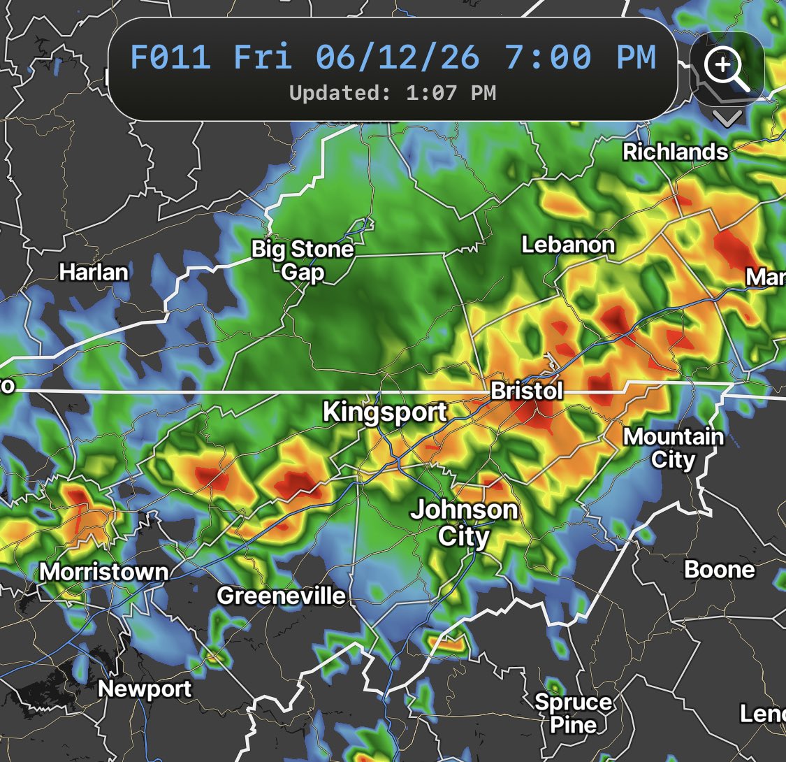
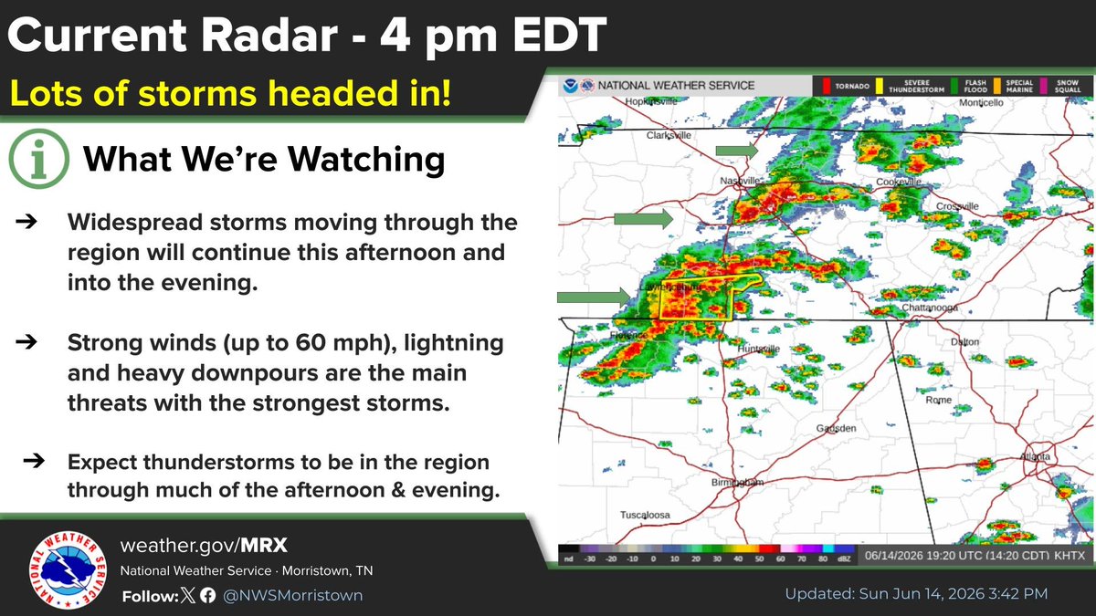
LOTS of storms moving through Middle Tennessee will eventually move into the southern Appalachian Region this afternoon and evening. Still looking at strong gusty winds, heavy downpours, and lightning as the main threats.
When thunder roars, go indoors!!!
ALT Showers and Thunderstorms
1
7
21
1,079
Lmbo so real


1
1
192
StormTrackerSacher retweeted

Numerous thunderstorms have developed just west of the plateau, moving east. Some of these have become strong to severe with 40-60 MPH winds. These will move into our area over the next few hours.
1
1
11
452
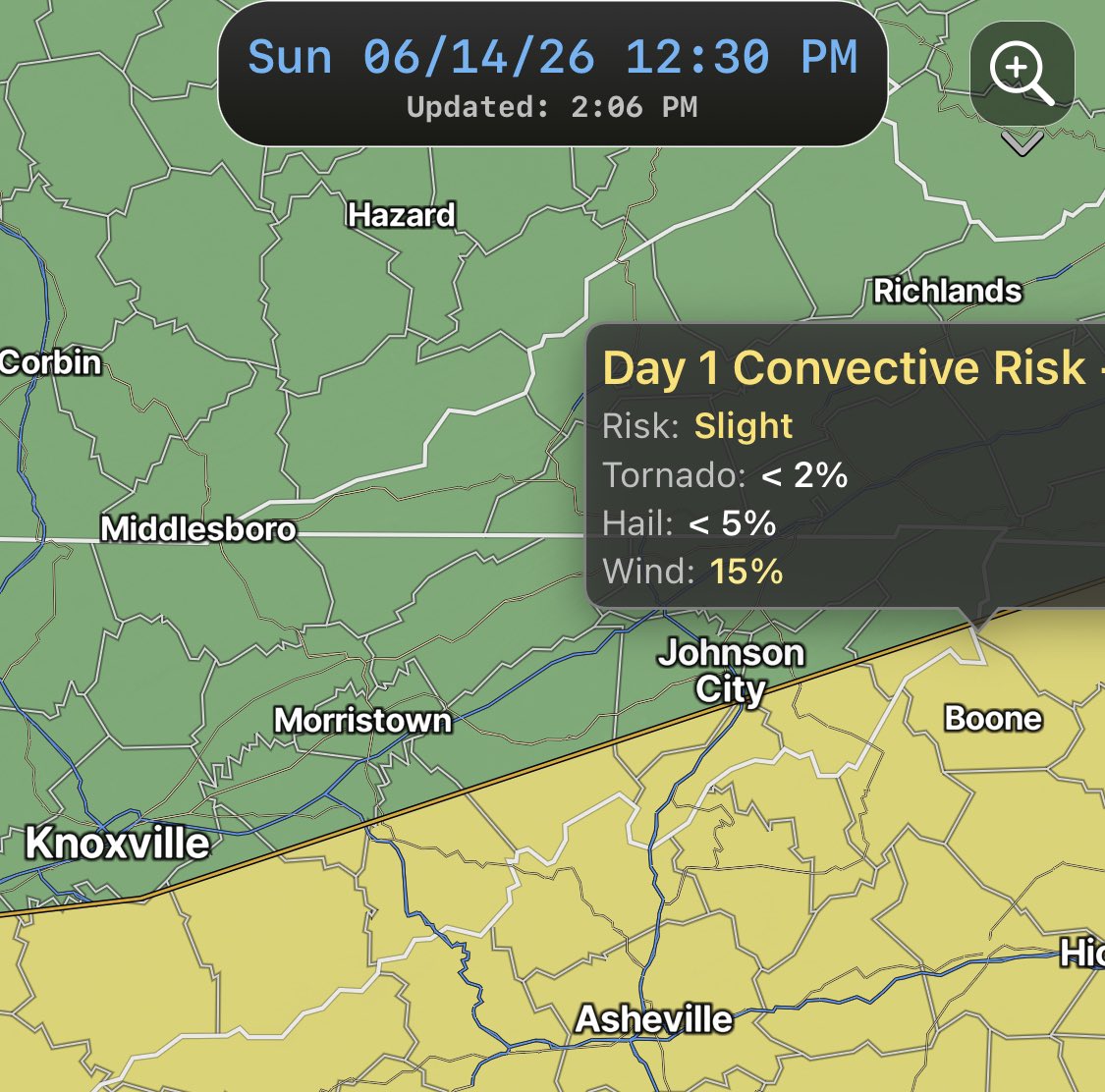
Scattered showers and storms remain possible into early tonight. There is a conditional level 1-2/5 risk of severe weather across the region so 1 or 2 storms may contain gusty winds or hail. The tornado risk isn’t zero, but is fairly low. Downpours and localized flooding are possible.

2
230
StormTrackerSacher retweeted
Let's talk about tomorrow's severe weather setup.
The general consensus right now seems to be that tomorrow will flop because the last few setups have. And honestly? It could. But let's get into the specifics.
Showers and thunderstorms are expected to develop ahead of a cold front during the afternoon hours, right around peak heating. Models are showing dew points well into the 70s by this point (aka humid as hell), which translates into some pretty healthy instability in the 2,000 J/kg range. In simple terms: storms would have plenty to feast on.
The problemo with this forecast is the morning convection. The models don't have a great handle on it, and they probably won't until it actually starts happening. If we end up with widespread showers and storms during the morning, the atmosphere could become stabilized and significantly reduce the severe weather threat. However, if we only see some scattered "meh" showers that aren't widespread, then the atmosphere will have plenty of time to recover and build up the fuel storms need later in the day.
If the forecast stands as it is right now, then our main threat will be collapsing thunderstorms that produce 40-60 MPH winds.
There's also another fork in the forecast that could take us in the opposite direction. Some models want to develop a mesoscale convective system (MCS), or in simpler terms, a wind bag and more widespread damage. If that happens, then damaging wind issues could become much more widespread than currently forecast.
So could the forecast flop? yes.
Could it overperform? Also yes.
What should you do? Have a way to receive warnings and keep an eye on updated forecasts as the day goes on.

5
3
28
2,256
StormTrackerSacher retweeted

Jun 13
Don’t fall for this guys! It’s getting a ton of people!
In the meantime, give this guy a follow to get his following back!


DO NOT CLICK THE LINK AND FALL FOR IT LIKE I DID! #wxtwitter
2
1
17
3,606
Jun 13
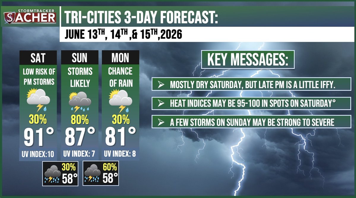
Another conditional 1-2/5 risk of severe weather is in the cards for Sunday. High wind gusts will be the primary risk with hail a secondary risk and a very low tornado risk. Heavy rainfall and lightning are of course likely.
6
355
Jun 13
Craziest take I’ve ever seen on this app
Jun 12

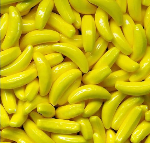
The worst candy in the history of mankind is the Runts banana.
There is nothing that comes close.
1
4
471