
Accurate, timely information on the latest forecast from the @wavy_news meteorologists for the Hampton Roads, Virginia & North Carolina areas.
Joined April 2009
- Tweets 22,348
- Following 87
- Followers 25,823
- Likes 496
7,079 Photos and videos


WAVY Weather retweeted

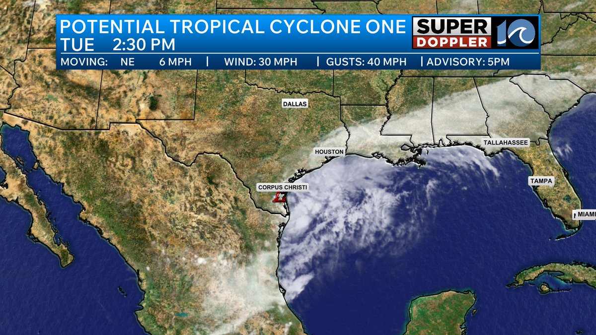
Potential Tropical Cyclone One has formed in the northeastern Gulf and has the potential to become Arthur in the next 24 hours. The system will provide widespread heavy rain across the deep south as we head through the end of the work week. Flash flooding may be a problem for some areas. The storm will stay away from Hampton Roads.

1
4
349
WAVY Weather retweeted
TROPICS UPDATE!
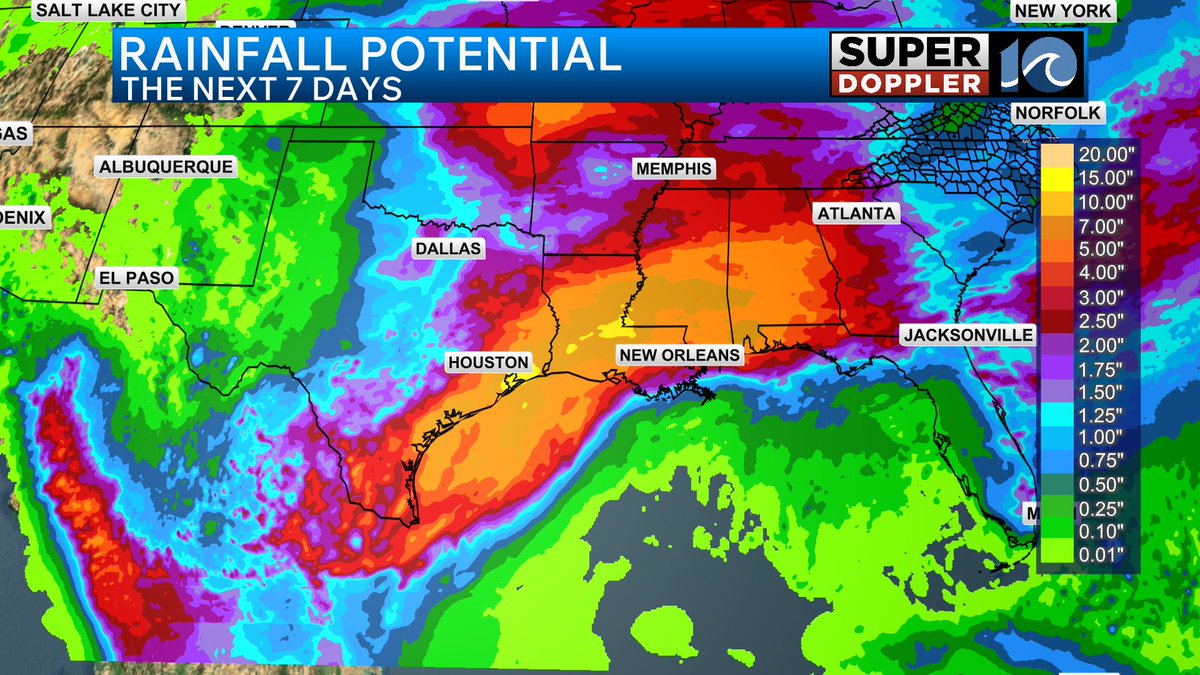
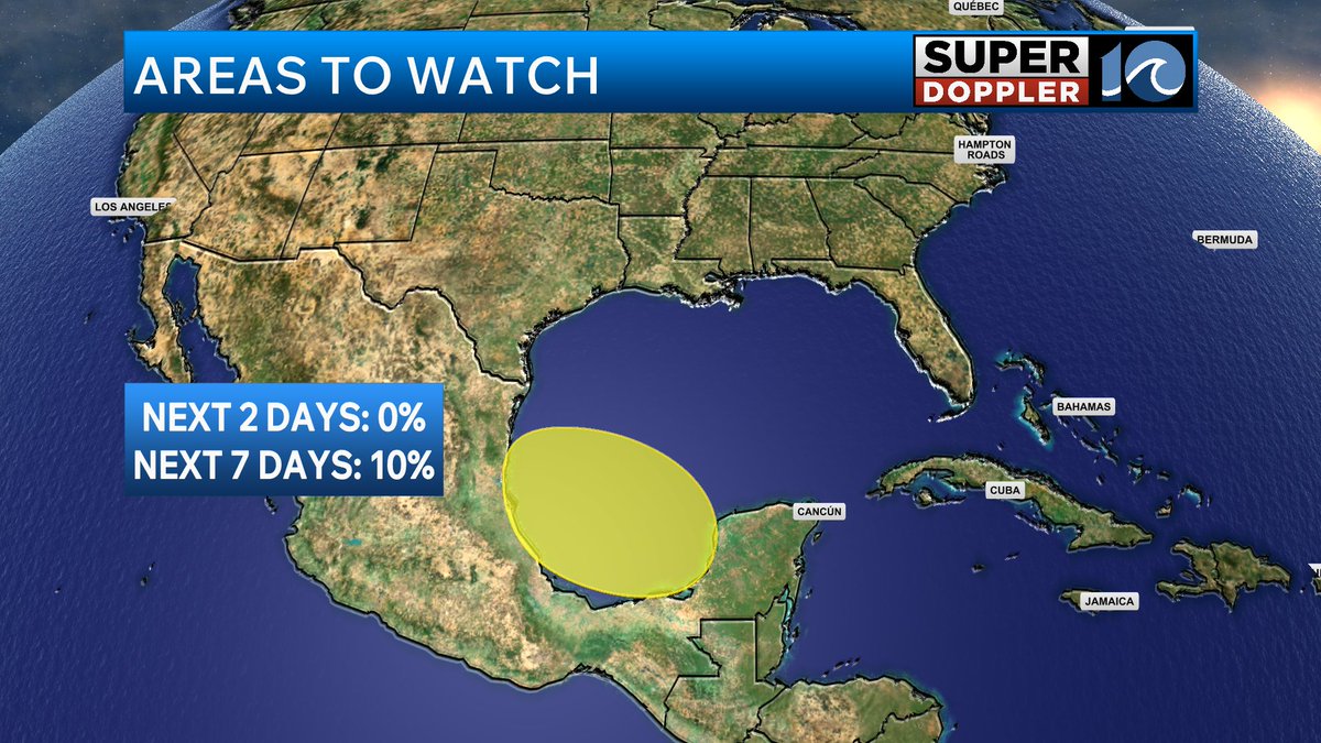
A system bringing disorganized showers and storm to northeastern Mexico and southern Texas may reemerge into the Gulf this week where the environment could be conducive for development. While this system is of no threat to Hampton Roads areas across the Texas coast and into the deep south will see heavy rainfall over the next week which may lead to flash flooding.

1
1
294
WAVY Weather retweeted

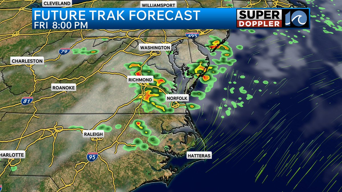
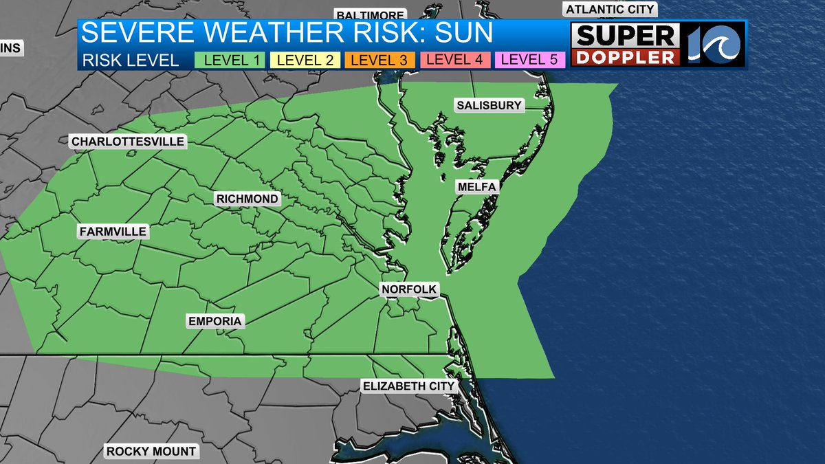
Hot and muggy today ahead of strong to severe thunderstorms this evening. Here's everything you need to know to prepare. Be weather aware starting 5pm today (Sunday). wavy.com/blogs/weather-blog/…
1
2
602
WAVY Weather retweeted
A Severe Thunderstorm Watch is in effect for all areas shaded in yellow until 11pm. This includes Williamsburg, Newport News and Gloucester. Damaging straight line winds may lead to power issues across the area and heavy rainfall could lead to street flooding.

1
3
389
WAVY Weather retweeted
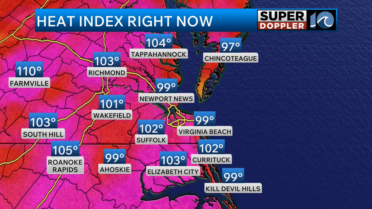
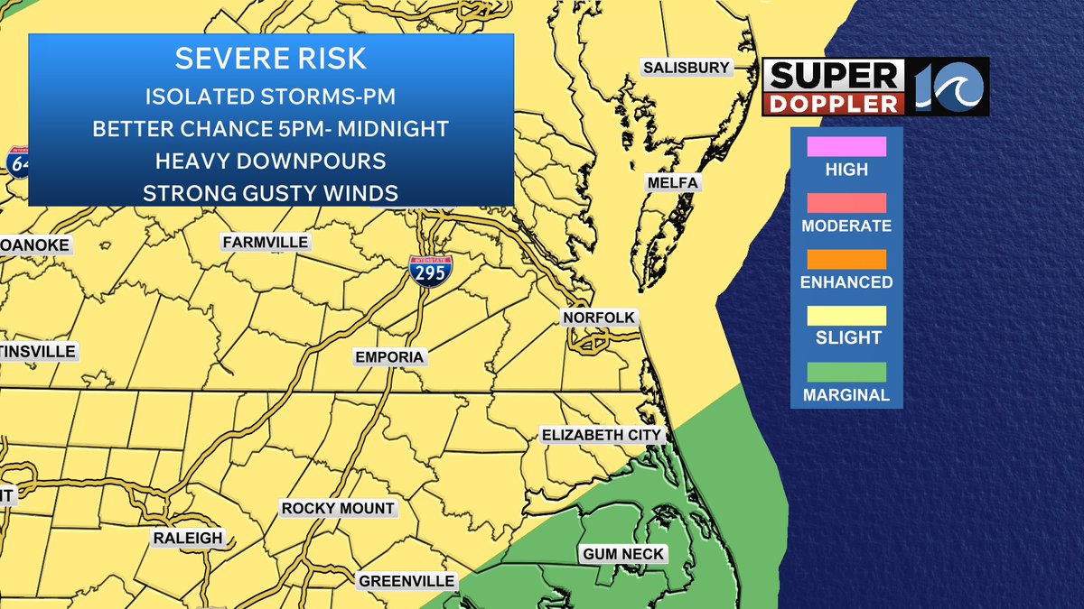
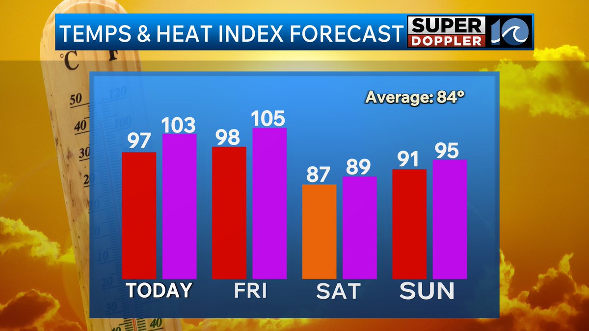
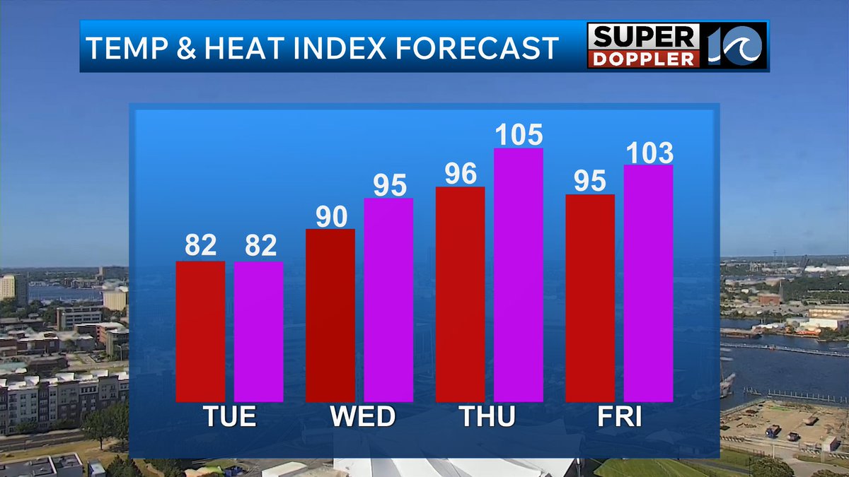
It is VERY hot out there again today across Hampton Roads with heat indices over 100! This heat will help fuel strong thunderstorms as we head into the evening with damaging straight line wind gusts of 60 mph and frequent lightning being the primary threats. Watch out for street flooding as well with any heavy downpours.

3
5
396
WAVY Weather retweeted

Heat advisories are in effect again today. Highs in the 90's. Heat indices in the 100's. Isolated showers or storms this afternoon, but a cluster of showers and storms is forecast this evening. Could be a few strong to severe storms. Full update on WAVY News 10!
2
3
288
WAVY Weather retweeted
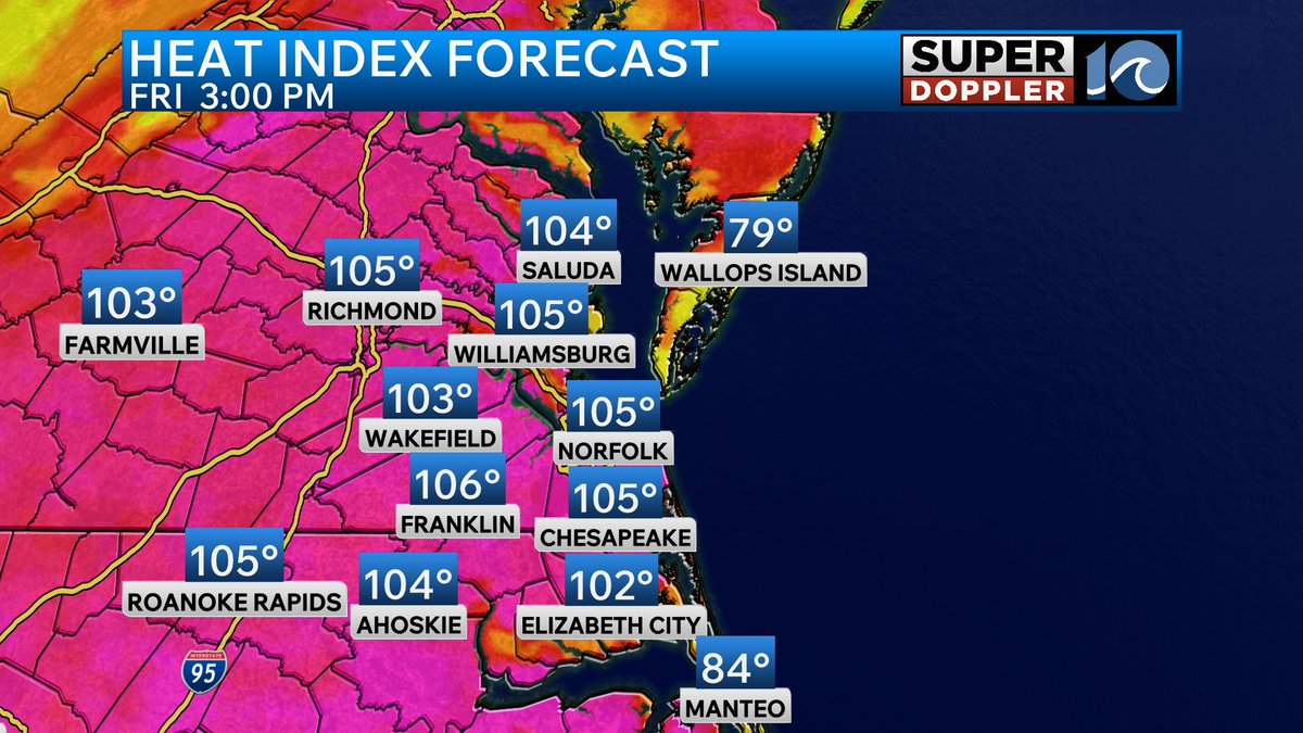
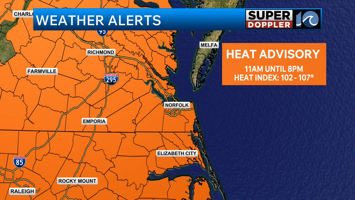
It is VERY hot out there across Hampton Roads. Heat Indices are already around 100 degrees. A heat advisory remains in place until 8pm for much of Southeast Virginia. It'll be hot again tomorrow with highs back in the upper 90s.

3
8
567
WAVY Weather retweeted
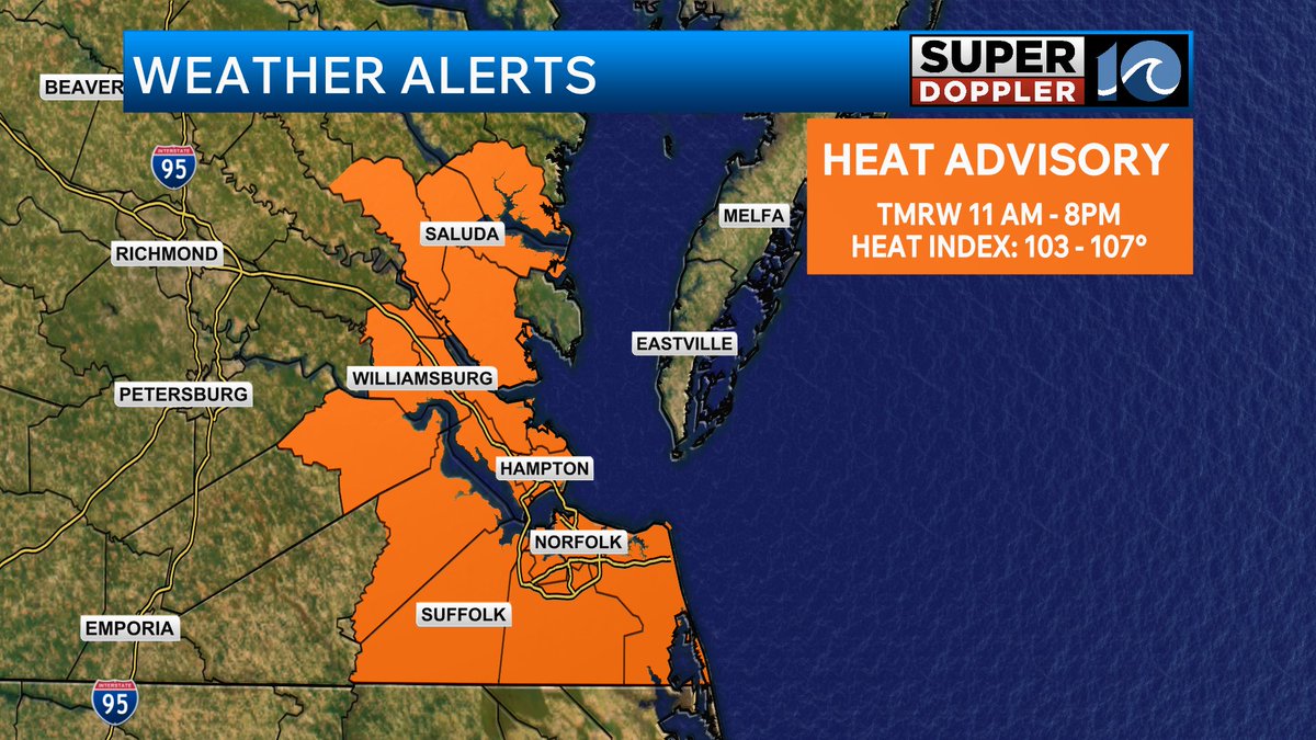
Heat advisories today from 11am until 8pm for most of southeast VA. Highs in the 90s. Heat index 100-105. We'll be partly cloudy with isolated PM showers or storms. Better chance this evening and tonight. Some strong to severe.


1
1
277
WAVY Weather retweeted
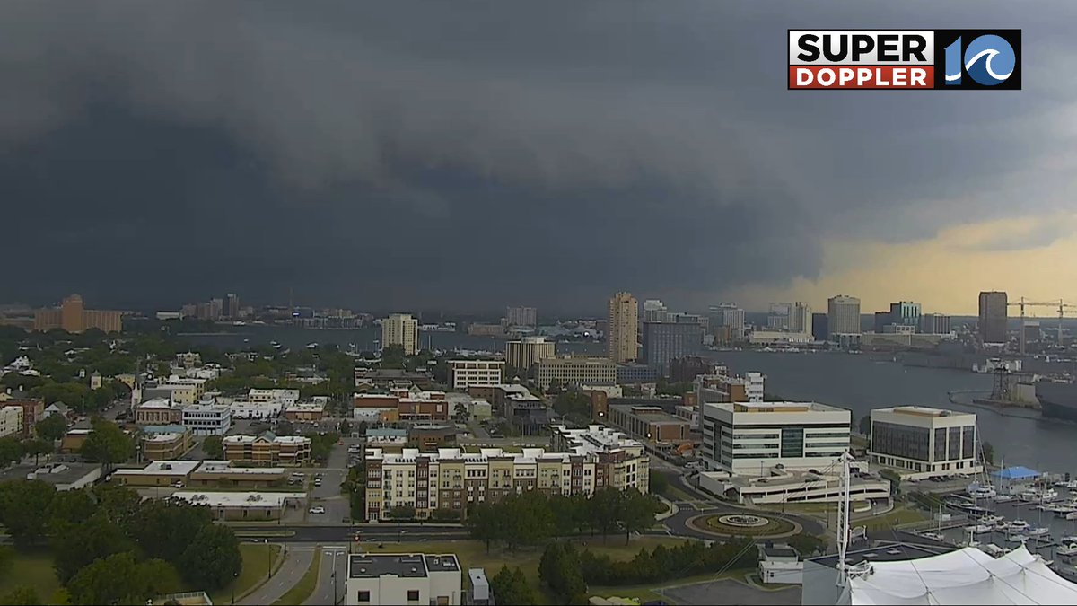
Incredible shot from Tower Cam 10 as storms move into Hampton Roads.
1
3
32
1,770
WAVY Weather retweeted
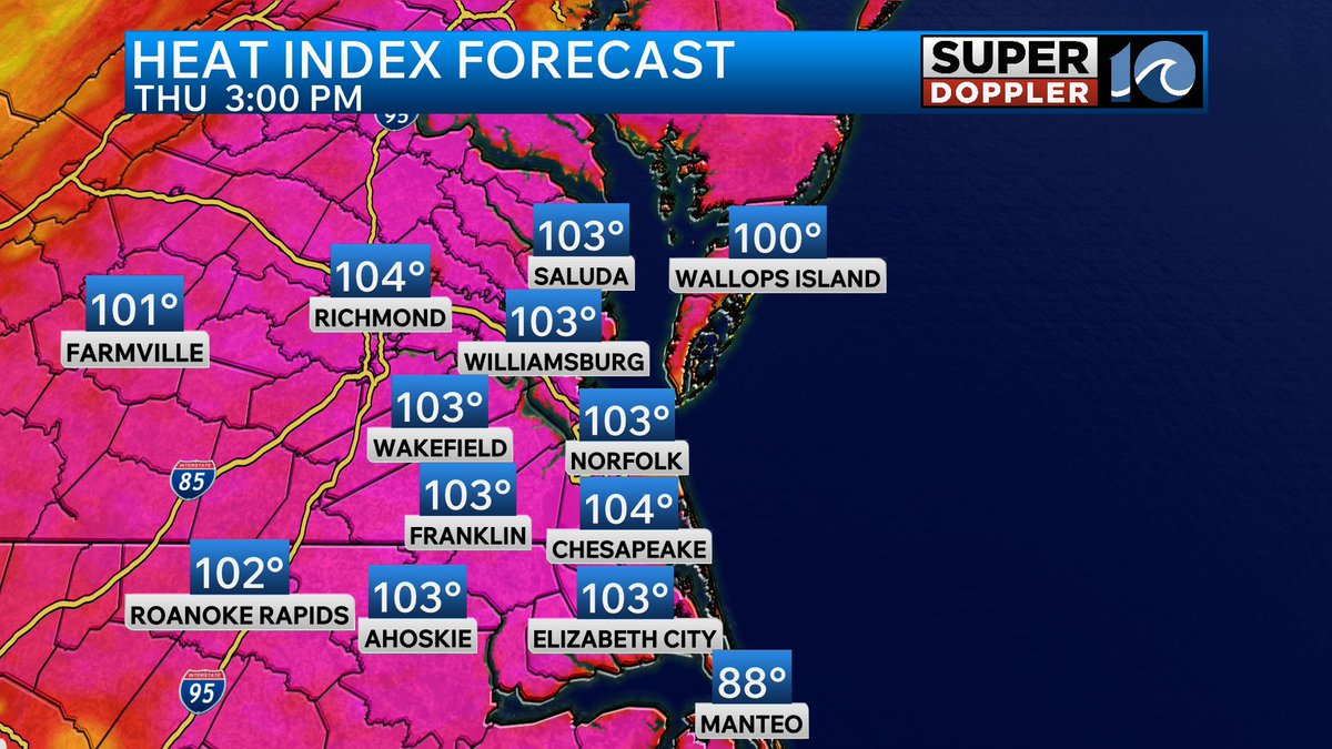
A Heat Advisory will go into effect for the Peninsula, the Middle Peninsula and the Southside tomorrow starting at 11am and lasting until 8pm tomorrow evening. High temperatures and humidity will push heat indices into the 103 to 107 degree range for some areas.
1
3
284
WAVY Weather retweeted
Over the next few days the moisture from Tropical Storm Cristina in the Eastern Pacific is expected to drift into the Southwestern Gulf. When this happens a broad area of low pressure may form bringing increased rain chances to Eastern Mexico. Significant development is unlikely due to the hostile environmental conditions but we will keep an eye on it. The rest of the Atlantic Basin remains quiet and will be for quite some time.
1
1
345
WAVY Weather retweeted
Get ready Hampton Roads! We will start getting much warmer tomorrow with a big increase in dew points. This will make things feel very sticky outside for the next few days. We will also have to watch for pop-ups storms during the afternoons heading into the weekend.


1
3
338
WAVY Weather retweeted
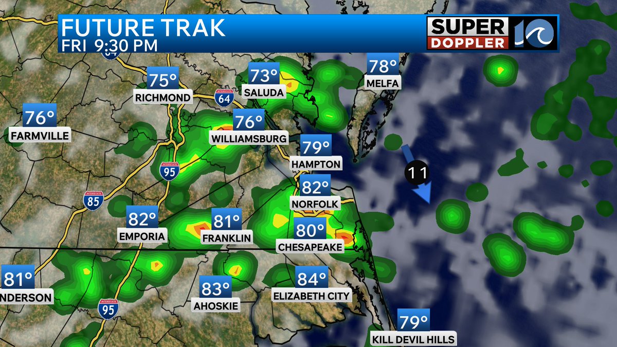
Tomorrow will be dry before daily rain chances finally return to southeast Virginia and North Carolina.

1
2
321
WAVY Weather retweeted
Mother Nature is TURNING UP THE HEAT this week in Hampton Roads! Very humid air is forecast to move in sending heat indices into the triple digits!

1
4
512
WAVY Weather retweeted
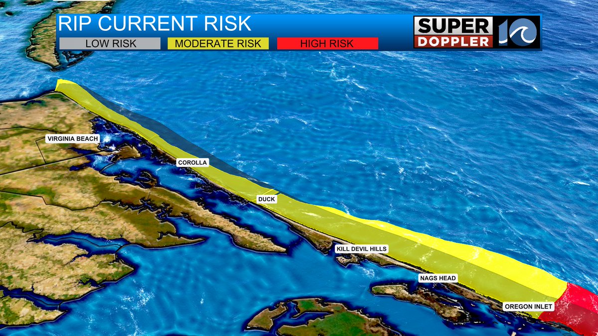
The rip current risk remains elevated for southeast Virginia and Outer Banks beaches today. Be sure to swim near lifeguards!

2
3
494
WAVY Weather retweeted
Keeping an eye on the chance for strong storms Sunday afternoon and evening across southeast Virginia. The primary threats will be damaging wind gusts and frequent lightning if storms are able to form.
2
6
324
WAVY Weather retweeted
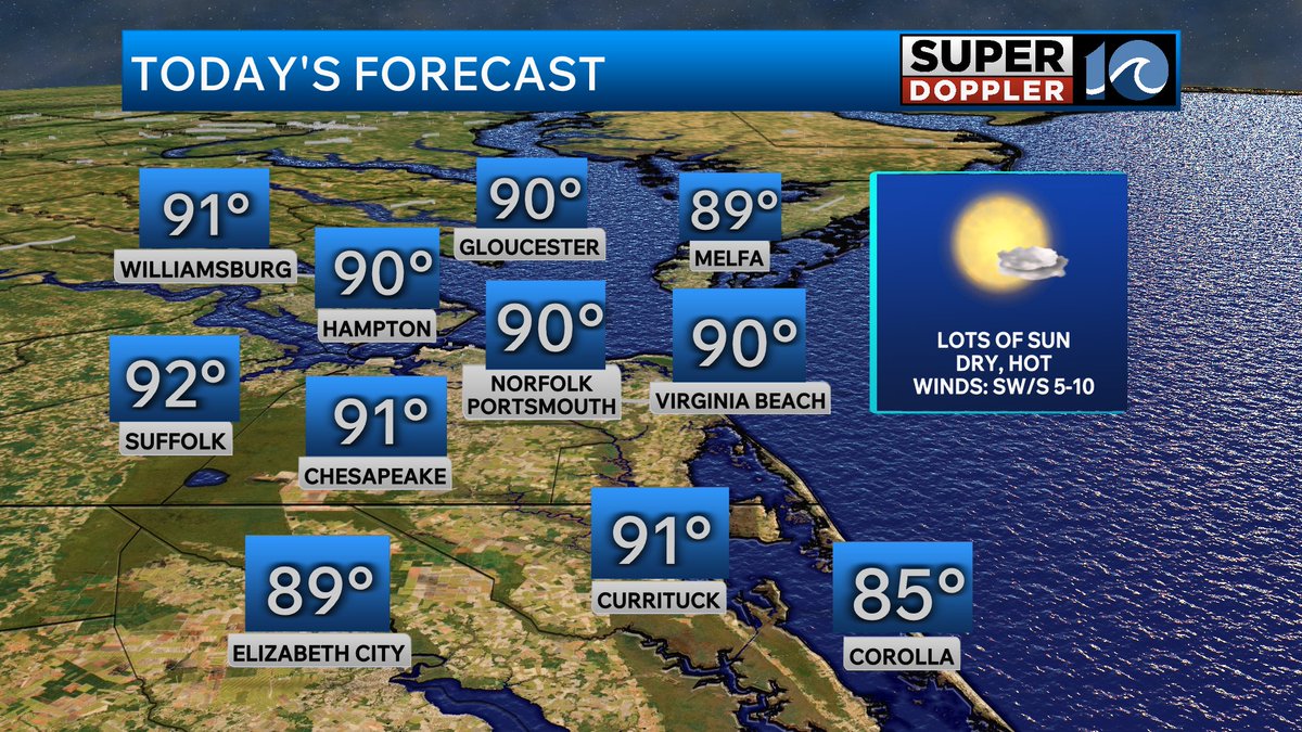
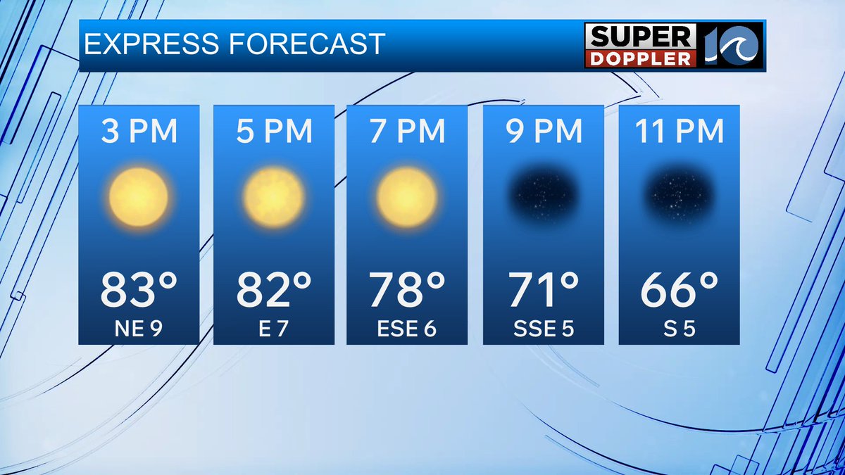
We are in for a hot one today across Hampton Roads. A light sea breeze will keep the coast slightly cooler so if you want to cool off the beach won't be a bad idea.
1
5
301
WAVY Weather retweeted
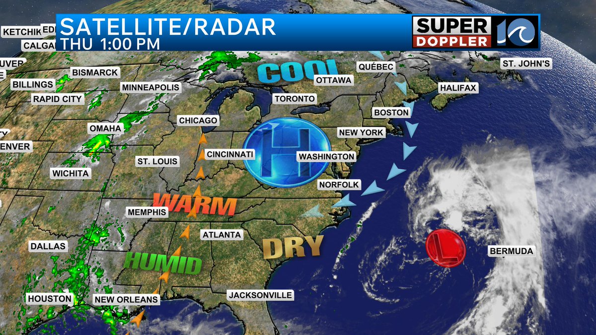
High pressure remains overhead for the rest of today which means beautiful weather is in store for Hampton Roads! Are you outside enjoying this nice weather?
1
1
3
298
WAVY Weather retweeted
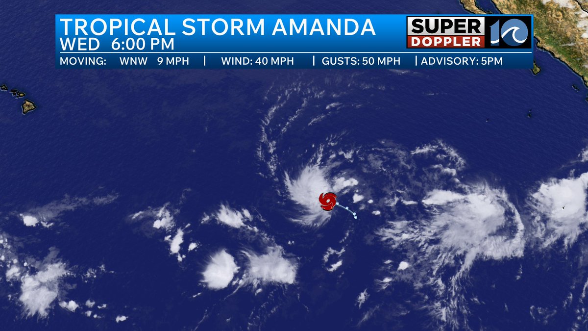
While the Atlantic Basin remains quiet in terms of tropical activity the Eastern Pacific has its first named storm of the season. Tropical Storm Amanda is no threat to land and will be on a weakening trend this weekend.

1
2
363
WAVY Weather retweeted
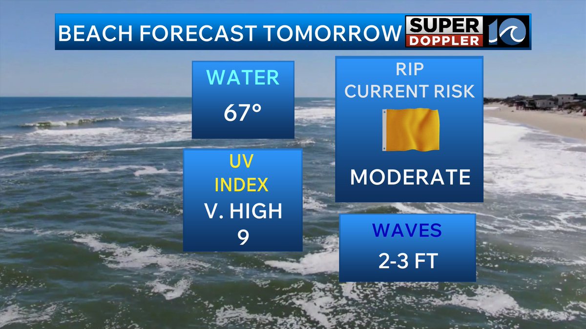
The rip current risk remains elevated tomorrow due to onshore winds. Be careful if you are headed to the coastline and if you plan on swimming make sure you listen to what lifeguards are telling you. The rip current risk for the Outer Banks will be higher tomorrow due to larger surf.
1
3
274