
Botanist, Zoologist, Environmental Scientist based in Geraldton, Western Australia
Joined May 2017
- Tweets 1,319
- Following 84
- Followers 72
- Likes 1,841
103 Photos and videos


19h
#AFLFantasy Are there any concerns for Brent's role with Coniglio coming back into the side? @DTTALK
24%
Yes
76%
No
72 votes • 4 hours
260
Jun 4
#AFLFantasy I would have preferred Fitzgerald over Kentfield... oh well. Beggars and choosers.
328
Jun 4
I know there's always #rangeanxiety #evs. But the job I do is 80% gravel roads often >800 km before the next #diesel fuel station (with a full jerry too). With remote and regional communities powered by diesel gennies there's no sense to charge an EV out there. #pastoral vs #city
7
May 31
#foreverfreo a champion team will always beat a team of champions. Love the way we are sharing the load across the board.
44
FossilOz retweeted

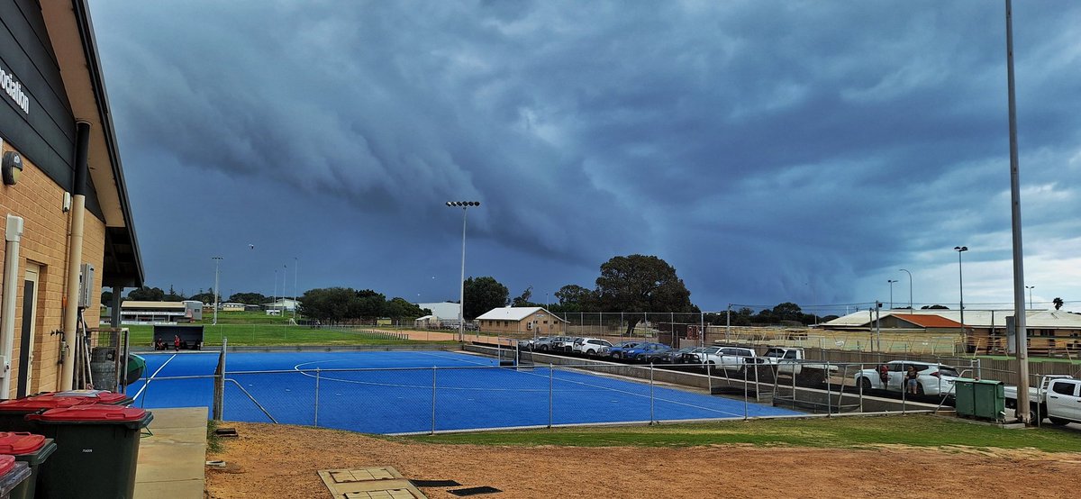
Fast moving short lived TORNADOES possible
From later today, Saturday the 30th of May, the Central West should start to see thunderstorms initiate along the leading edge of an incoming front. This severe weather is forecast to gradually extend into the Lower West and South West through the evening.
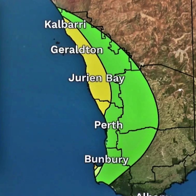
Models are signalling that these cells have a very solid chance of becoming severe, due to a few important ingredients, ample instability, a lifting mechanism being the front, high dew points, great bulk wind shear and the presence of high values of Storm Relative Helicity. (SRH).
In simple terms, SRH measures how much spin is available in the atmosphere for a thunderstorm to ingest, especially in the lower levels. It’s one of the key ingredients looked at for rotating thunderstorms (supercells) and tornado potential.
We have been chasing storms for 25 years throughout the state, and have not seen a setup like this before. Even the Energy Helicity Index is on the charts which we rarely see, in particular at these levels. It’s used to assess the potential for rotating thunderstorms (supercells) and, in stronger environments, tornadoes. It combines INSTABILITY (CAPE) and SRH.
Needless to say residents in the highlighted areas in particular the yellow regions, should remain vigilant later today and into tonight as these cells will go nocturnal.
We may chase this setup later today and live stream for anyone interested.
Please share this information to loved ones if they reside in these areas. Please be SAFE.
1
4
17
1,248
May 24
1
262
May 18
#AFLFantasy double down this week out wait till byes?
0%
Double down
100%
Wait for byes
3 votes • Final results
1
2
391
May 10
#AFLFantasy 2133 last round. Going out on a limb as rage trades
Steele Grlj -> Rankine Budarick.
Crazy?
80%
Yes
20%
No
5 votes • Final results
313
May 7
#AFLFantasy which combo in? @DTTalk @AFLTraders
18%
Petracca Burton
82%
McCluggage Cumming
17 votes • Final results
1
397
May 7
#AFLFantasy With Jai Serong out, which #rookie stays? I'm holding Smith anyway
63%
Farrow
37%
Grlj
30 votes • Final results
560
Apr 24
#AFLFantasy i have Kosi VC.
To loop, I need ZZ or Blamires to not play. Both are Emergencies. Which one will not play.
38%
ZZ
62%
Blamires
21 votes • Final results
2
547
Apr 25
At least we'll know very early Sunday for ZZ as Brisvegas has the early VFL game
38
Apr 17
#aflfantasy who on ground in fwds:
75%
Lombard
12%
Dovaston
12%
Gallop
24 votes • Final results
452
Apr 9
#AFLFantasy Hold or fold Ed Richards. He's been named, but...
74%
Hold
26%
Fold
39 votes • Final results
1
786
Apr 7
#AFLFantasy
Have English and Richards to move on. Have Jackson and McAndrew (and Steene and ZZ) already. So covered for Rucks. My FWDs are crap. Who to bring in?
0%
MacDonald
50%
Kossie
0%
McInerney
50%
Bailey
4 votes • Final results
339
Mar 30
#AFLFantasy R3 Results
Score: 1,774
RR: 32,388
OR: 17,152
OUT: Bruhn, Windhager
IN: Bontempelli, Steene.
Targets at R6: Fwds...
1
375