
Door County's local & live radio station since 1951.
- Tweets 32,139
- Following 89
- Followers 1,061
- Likes 245


ALT This graphic displays a severe thunderstorm warning plotted on a map. The warning is in effect until 3:00 PM CDT. The warning includes Kewaunee WI and Pilsen WI. This warning is for Eastern Brown County in northeastern Wisconsin and Southwestern Kewaunee County in northeastern Wisconsin. The threats associated with this warning are wind gusts up to 50 MPH and quarter sized hail. There are 7,438 people in the warning along with 6 schools and 0 hospitals.
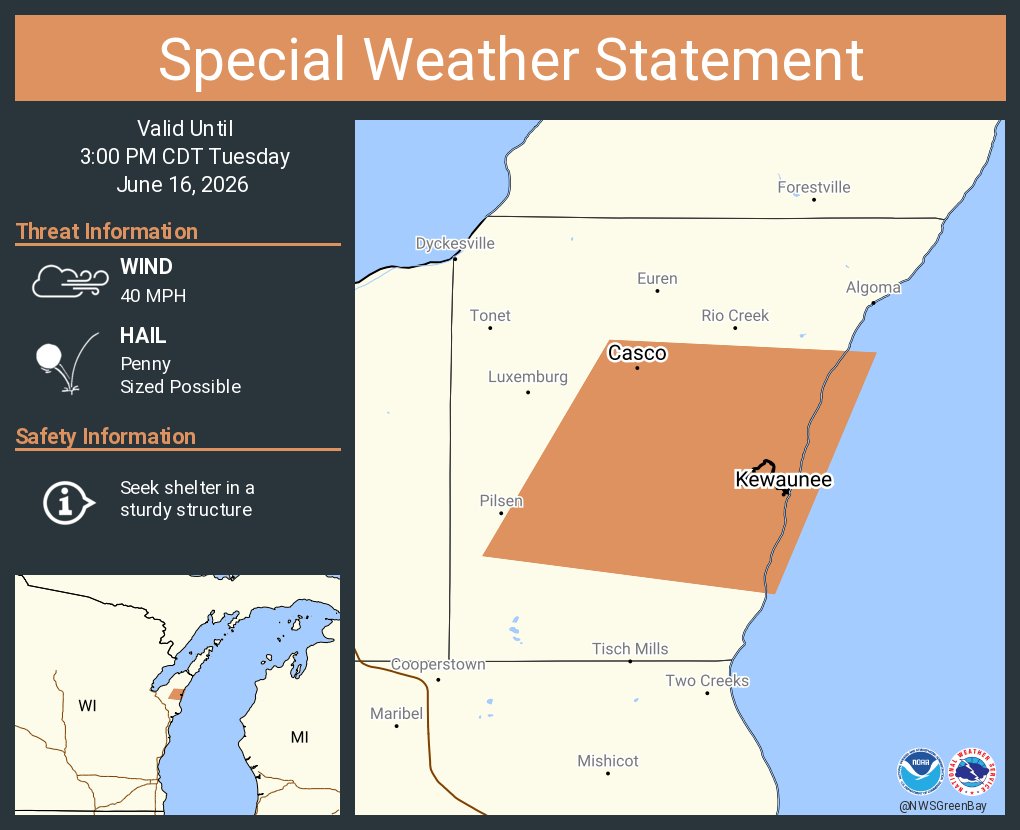
ALT This graphic displays a special weather statement plotted on a map. The statement is in effect until 3:00 PM CDT. The statement includes Kewaunee WI and Casco WI. A STRONG THUNDERSTORM WILL IMPACT CENTRAL KEWAUNEE COUNTY THROUGH 300 PM CDT. The threats associated with this storm are wind gusts up to 40 MPH and penny sized hail. Seek shelter in a sturdy structure until the storm passes.

ALT This graphic displays a special weather statement plotted on a map. The statement is in effect until 2:00 PM CDT. The statement includes Algoma WI, Casco WI and Forestville WI. A STRONG THUNDERSTORM WILL IMPACT SOUTH CENTRAL DOOR AND NORTHERN KEWAUNEE COUNTIES UNTIL 2 PM CDT. The threats associated with this storm are wind gusts up to 40 MPH and nickel sized hail. Seek shelter in a sturdy structure until the storm passes.

ALT Radar map of northeast Wisconsin showing the current radar indicating storms across central and northeast WI.

ALT This graphic displays a special weather statement plotted on a map. The statement is in effect until 1:00 PM CDT. The statement includes Algoma WI, Casco WI and Forestville WI. A STRONG THUNDERSTORM WILL IMPACT SOUTHERN DOOR AND NORTHERN KEWAUNEE COUNTIES UNTIL 1 PM CDT. The threats associated with this storm are wind gusts up to 40 MPH and penny sized hail. Seek shelter in a sturdy structure until the storm passes.
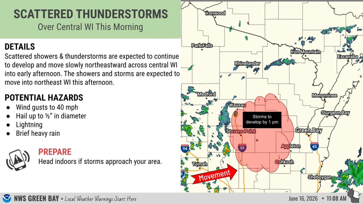
ALT Radar map of northeast Wisconsin showing the current radar indicating storms were developing across central WI, which will move into northeast WI this afternoon.


ALT Tables highlighting max temperatures and precipitation probabilities for sites across northeast Wisconsin this week.


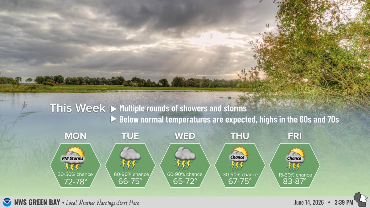
ALT Background photo is a lake under cloudy skies. There is text describing the expected weather this week with a forecast from Monday through Friday indicated sky cover/weather, high temperatures and probabilities of rain.