@KOAA meteorologist in Colorado Springs, CO. MSU Denver Alumni. Certified Broadcast Meteorologist sealholder.
- Tweets 11,134
- Following 997
- Followers 3,553
- Likes 7,006


ALT This graphic displays a severe thunderstorm warning plotted on a map. The warning is in effect until 7:30 PM MDT. The warning includes Baca County, CO. This warning is for Southeastern Baca County. The threats associated with this warning are wind gusts up to 60 MPH and half dollar sized hail. There are 59 people in the warning along with 0 schools and 0 hospitals.


ALT This graphic displays a dust storm warning plotted on a map. The warning is in effect until 4:00 PM MDT. The warning includes US-287 near Campo, CO and US-160 near Vilas, CO and US-160 near Walsh, CO. This warning is for Southeastern Baca County in southeastern Colorado. Near zero visibility in blowing dust expected. These conditions are resulting in Dangerous life threatening travel. There are 1,068 people in this warning along with highway US-287.
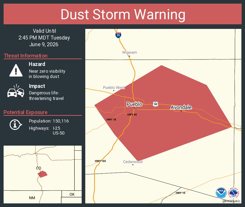
ALT This graphic displays a dust storm warning plotted on a map. The warning is in effect until 2:45 PM MDT. The warning includes I-25, US-50 near Pueblo, CO. This warning is for Central Pueblo County in southeastern Colorado. Near zero visibility in blowing dust expected. These conditions are resulting in Dangerous life threatening travel. There are 150,116 people in this warning along with highways I-25, US-50.


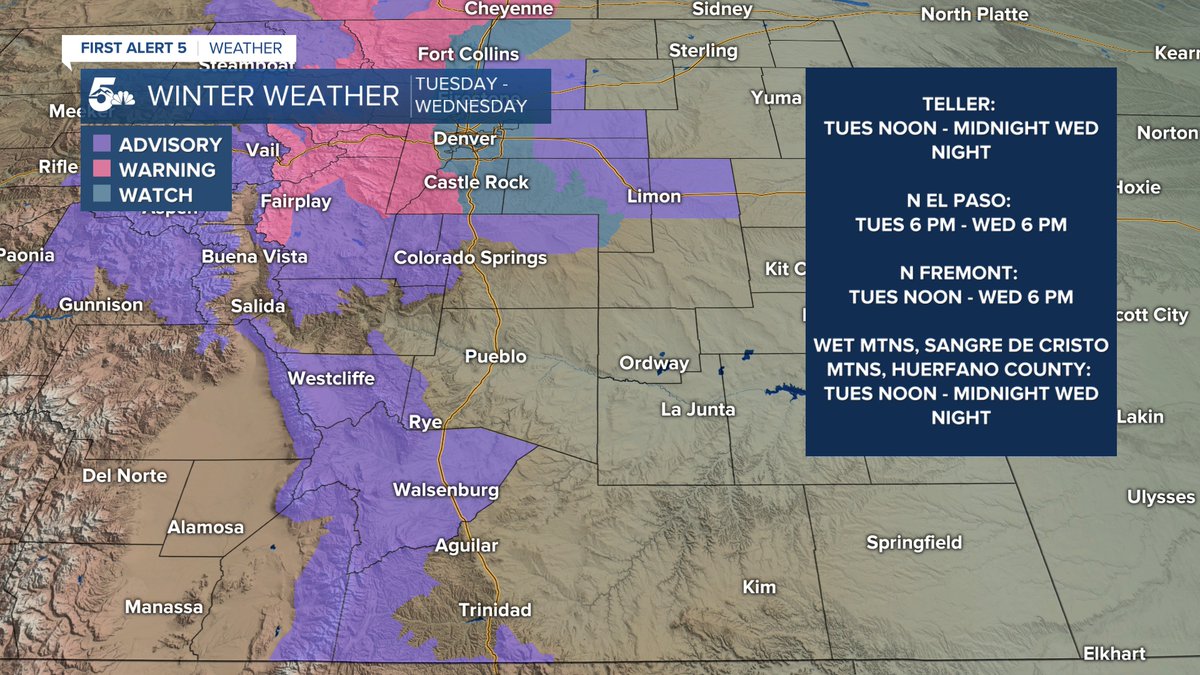
ALT The graphic shows a map of the threat area. The text details to Timing, Hazards, and Confidence of the forecasted threats.