
Official X/Twitter account of the International Society for Archaeological Prospection: follows and retweets are not endorsements.
- Tweets 168
- Following 53
- Followers 309
- Likes 78


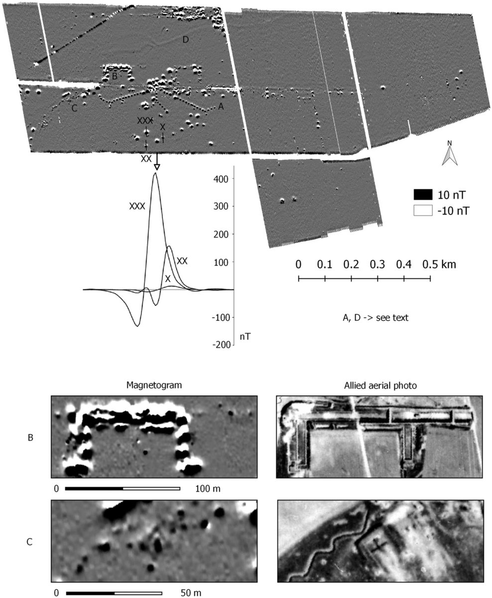
ALT Results of the UAV magnetometer survey in Ganacker with marked detail sections and individual anomalies discussed in the text. Magnetogram: dynamic /−10 nT; black = positive; white = negative; spatial resolution 0.2 m (above). B and C: Detailed comparison of the magnetogram with the Allied aerial photograph of 20.04.1945 (Geodata © Bayerische Vermessungsverwaltung, CC BY-ND) (below). X-XXX: Magnetogram profiles through selected bomb crater anomalies (centre left).


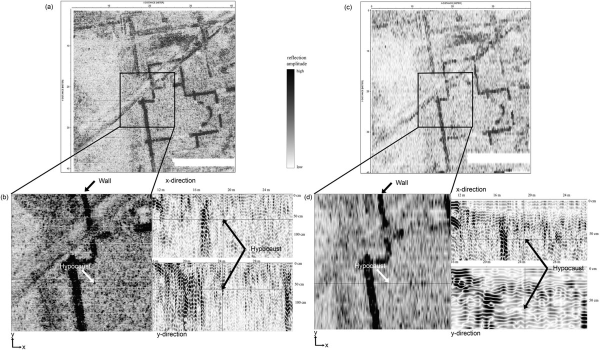
ALT Comparison of the GPR depth slices of 10 cm thickness in 65–75 cm depth of the IDS Stream-C (a) and the IDS Duo (c). The black rectangle represents the zoomed area in the detailed view below. A sample hypocaust picked in the depth slice and the corresponding inline and crossline profiles, to present the visibility in the IDS Stream-C profile data (b) and no evidence at the same location in the IDS Duo data (d). Survey details: IDS Stream-C with 600-MHz antenna and sample interval 4 × 4 cm; IDS Duo with 600-MHz antenna and sample interval 4 × 50 cm. Grid size: 40 × 40 m; the no-data area is due to a table-tennis table. The broad feature that is running diagonal through the depth slices depicts a multiple reflection of a modern gritted footpath.
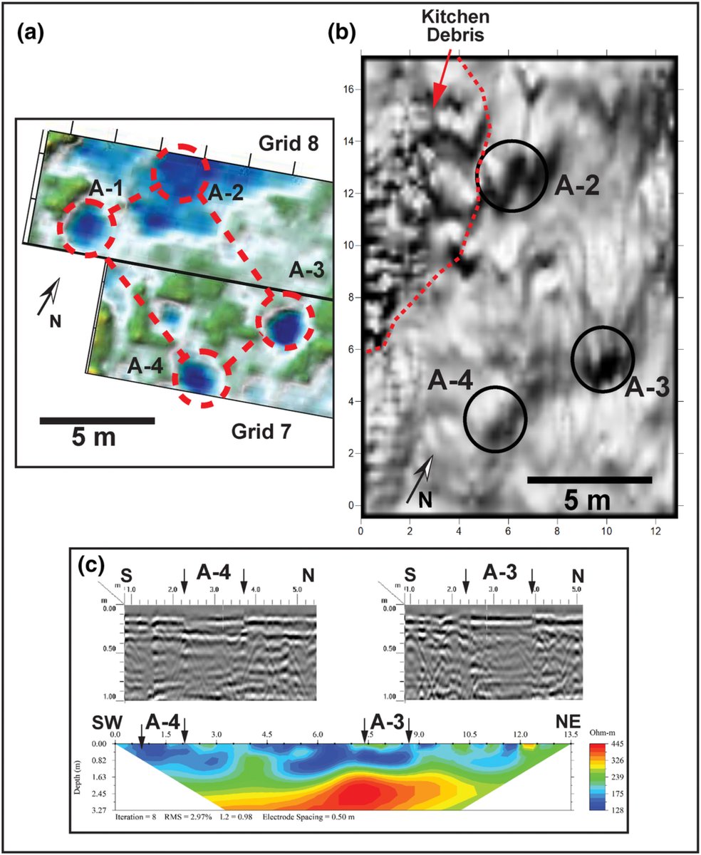
ALT (a) Ground penetrating radar (GPR) depth slice from surface to 0.2 m in G-7 and G-8. Outlines of 4 anomalies (A-1 to A-4) representing post holes are shown. (b) Gradiometer data from G-14 showing bi-polar anomalies at A-2, A-3 and A-4. (c) ERT-1 with corresponding GPR profiles from T-2 and T-3. The number of electrodes in the electrical resistivity tomography (ERT) transect is shown by the black squares at the top of the plot.