
AXIS GeoSpatial employing innovative measurement technologies to capture #geospatial data for integration into your Civil Engineering or #GIS applications.
Joined June 2009
- Tweets 1,078
- Following 365
- Followers 263
- Likes 228
573 Photos and videos


26 May 2023
Remembering and Honoring Those Who Served. Grateful for Our Freedom. Have a safe Memorial weekend!
40
29 Mar 2023
We are just 2 weeks away from the VA Surveyors 75th Annual Convention. Come visit AXIS team at booth #8 to access advanced technology and tools to improve the accuracy, safety and efficiency of your surveying process.
24
17 Mar 2023
Today, we're feeling extra lucky to have such fantastic employees, clients and teaming partners. May the luck fo the Irish be with you todasy and always. Happy St. Patrick's Day! 🍀 🌟
21
24 Feb 2023
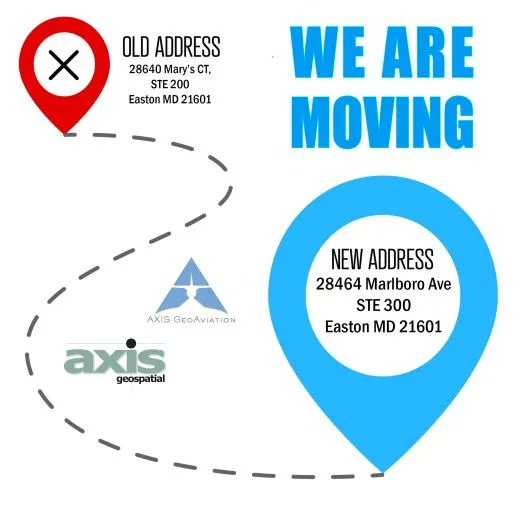
We're excited to announce that AXIS GeoSpatial LLC is moving to a new location!
24
8 Feb 2023
Attending SurvCon 2023 in Atlantic City Feb 22-24? We are just 2 weeks away. Make plans to stop by Booth 16 to speak with our team about aerial surveying & mapping.
1
34
23 Jan 2023
Attending Geo Week in Denver, Feb 13-15? Stop by Booth 327 to speak with our team #geoweek
25
11 Jan 2023
AXIS offers the data to integrate with your geographic information system [GIS] software. Providing you a picture of current infrastructure and the ability to visualize future projects.
24
22 Dec 2022
We wish you a joyful Holiday Season to you and your family, fulfilled with good health, satisfaction and joy.
1
61
30 Nov 2022
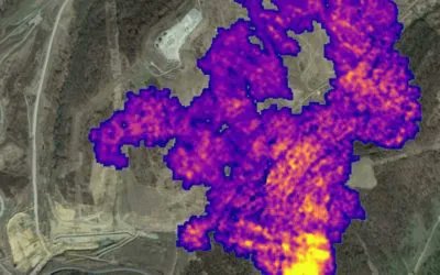
Flying over transmission lines to determine what vegetation and trees could be problematic. It's what we do buff.ly/2BsSyts
22 Nov 2022
Happy Thanksgiving, from our family to yours. Grateful today, and every day for our employees, clients and vendors. #axisgeospatial
1
2 Nov 2022
We are just 1 week away from the Delaware Surveyors Conference. Stop by AXIS booth to learn more about aerial mapping services for your next project area.
27 Oct 2022
Research collaboration reveals new urbanization and landscape modifications at ancient Maya city #lidar buff.ly/3De5OP9
14 Oct 2022
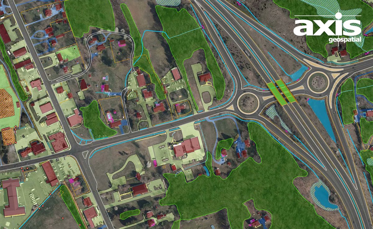
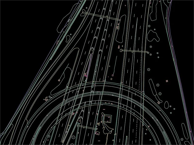
Creating data of existing landscape and infrastructure for transportation planning and highway design. Design scale mapping from AXIS buff.ly/3Mz3XZn
1
6 Oct 2022
We are just 2 weeks away from the Maryland Society of Surveyors Annual conference. Stop by AXIS booth to discuss the aerial mapping solutions we offer to support your survey operations. Visit buff.ly/3V9fy59 for more information

15 Sep 2022
Helping you quickly capture existing conditions and turn data into actionable, accurate, and easily consumable information. buff.ly/2udId17
1
2 Sep 2022
We would like to wish everyone a safe holiday weekend! Our office will be closed on Monday Sep 5th in observance of Labor Day. We will return to our normal hours on Tuesday.

1