
We use maps, geography, and history to understand the connection between places and people in Boston, New England, and beyond. We live at @BPLBoston.
Joined August 2009
- Tweets 8,930
- Following 804
- Followers 6,169
- Likes 3,466
3,824 Photos and videos


We’re moving! The Leventhal Map & Education Center will no longer be posting on X. Stay updated on our work, articles, and events by joining us on Bluesky at @bplmaps.bsky.social. We hope to see you there!
1
2
270
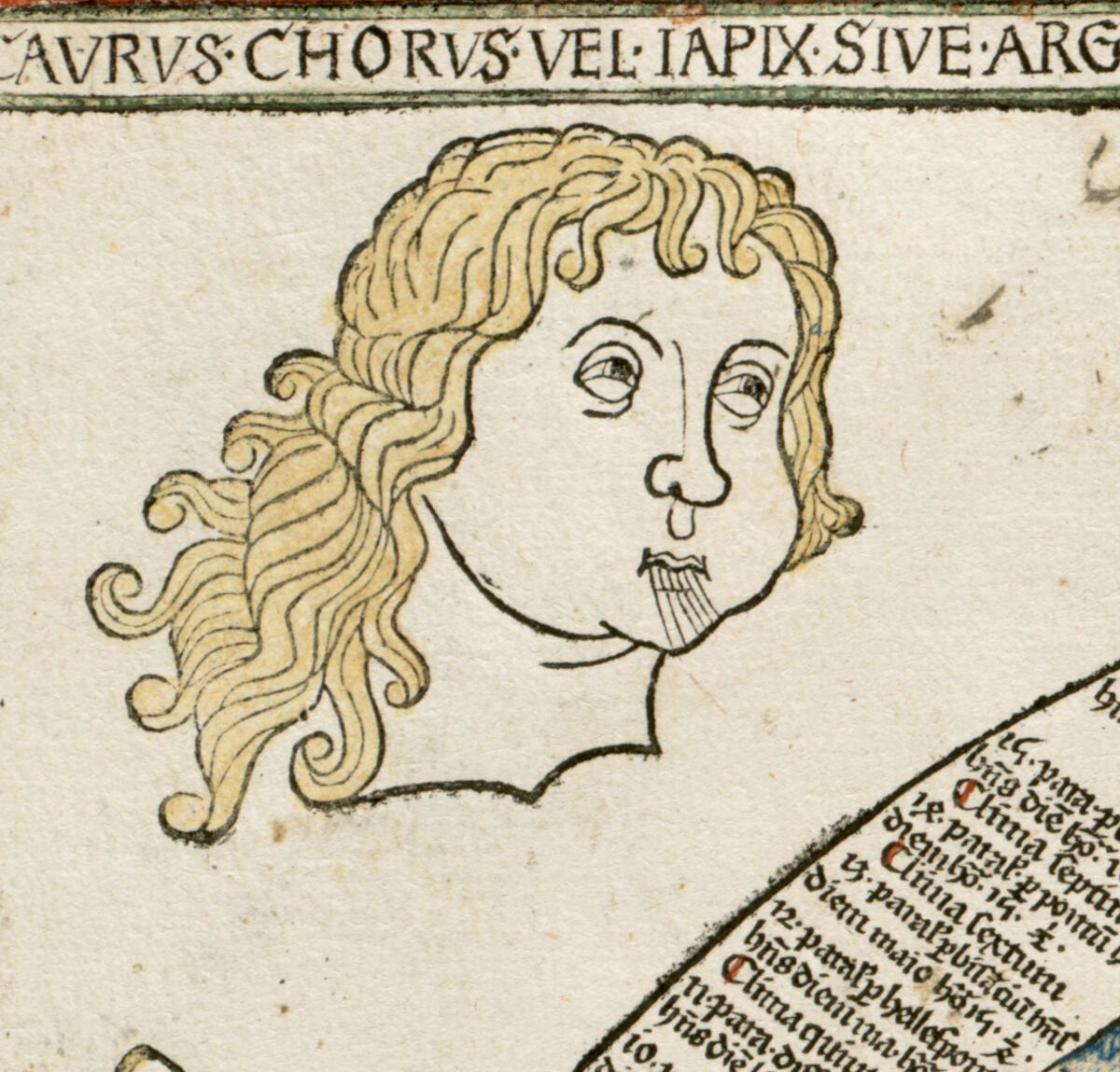
Did you know Boston is *actually* one of the windiest cities in the US, even more than Chicago? Shhh, don't tell! 🤫
Do you think we could ask a couple of the Venti to turn their heads away from Boston just a bit?
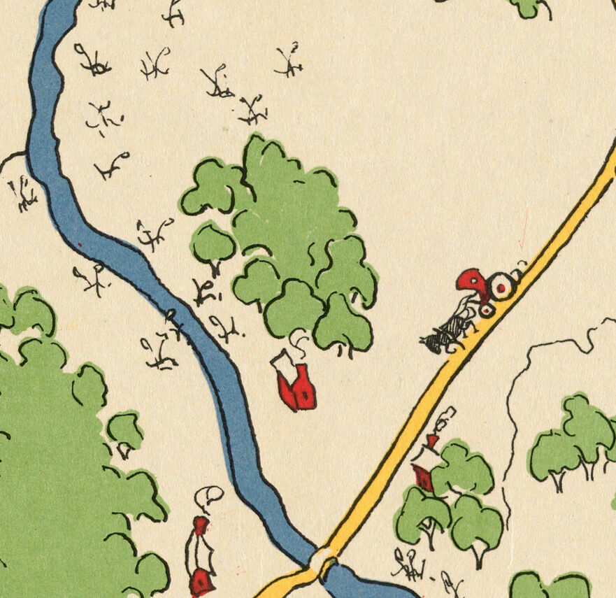
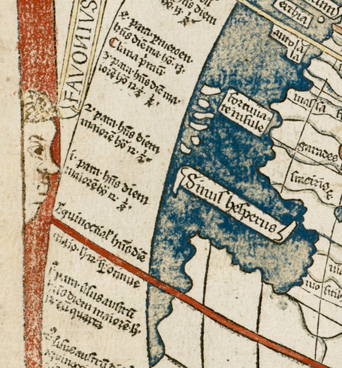
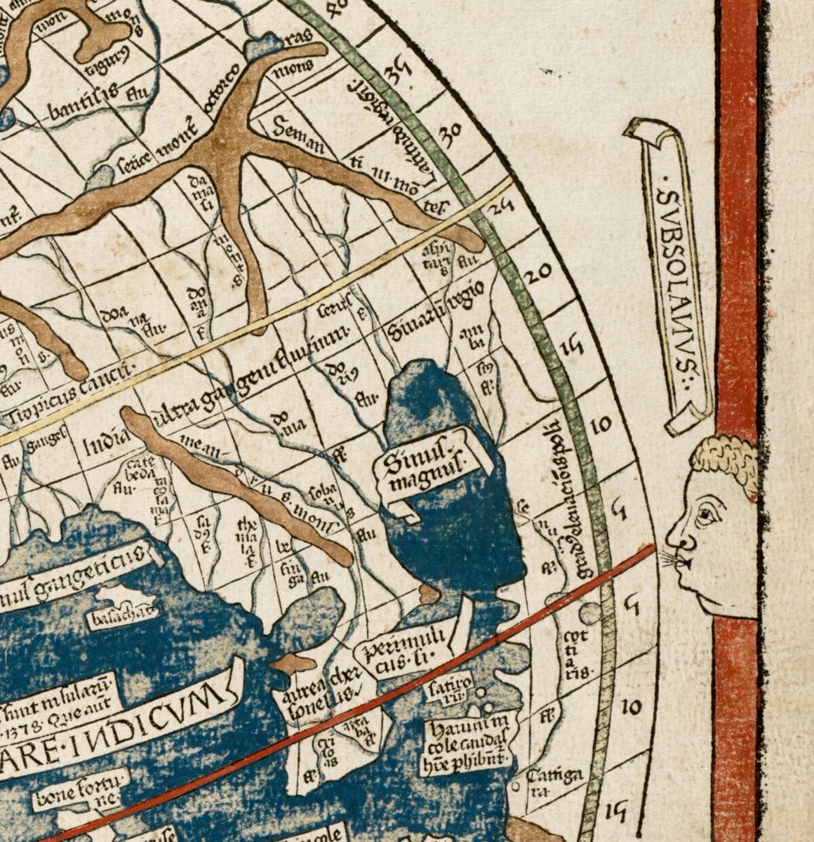
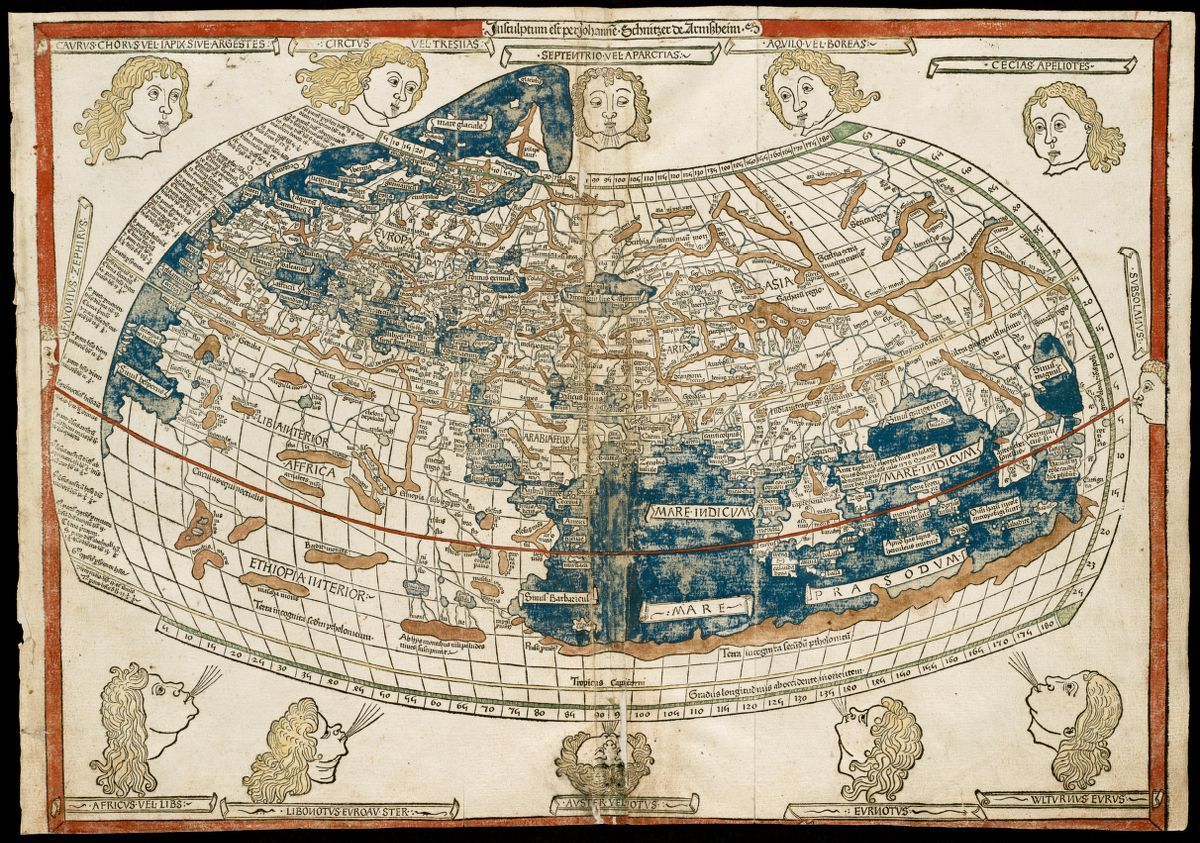
Map: The world (1482)
Article: buff.ly/42zw8S8
1
2
293
Massachusetts occupies a unique position within the US, in that it extends into the North Atlantic ocean and is the most exposed state to the ocean’s weather. Although Maine and New Hampshire are further north, they're sheltered from the weather by Canada's Nova Scotia.
1
206
Carved from a woodblock – an early method of printing – this map names the four main winds that blow from the cardinal directions of north, south, east and west, along with eight minor winds.
172
Data by itself isn’t enough to offer conclusive proof for any claim. That’s what informed interpretation is for 😌☝🏼
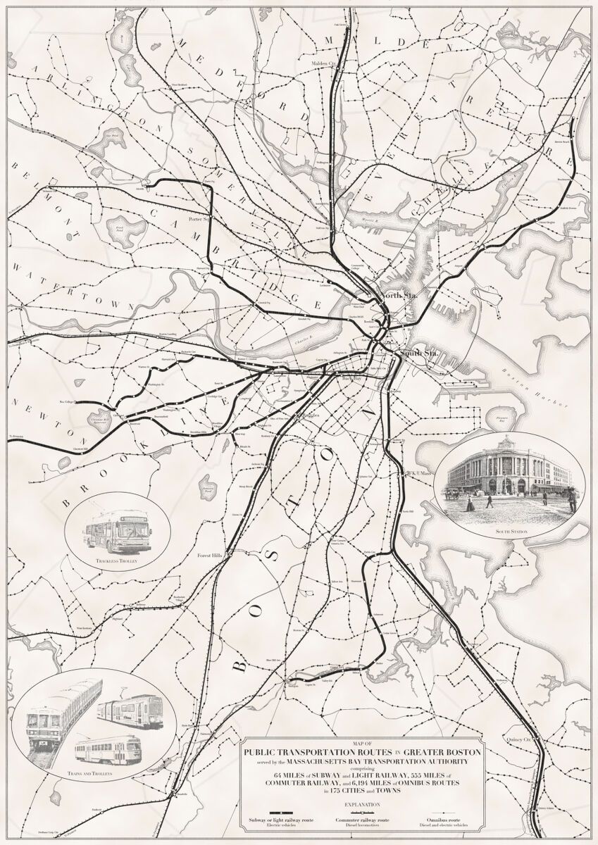
Maps: Map of public transportation routes in Greater Boston served by the Massachusetts Bay Transportation Authority [etc] (2020), The great transit desert (2020)
1
2
5
850
Neither makes alterations to its core transit data, but design choices can bend even the most straightforward map data to fit a message. Which map tells a story of accomplishment? Which map makes an argument for needed improvements? Can both stories be true at the same time?
1
2
185
The information used for these maps did not change, but the purpose did. That’s why careful map reading is so important for deciding how much we trust the stories maps are telling us.
2
156
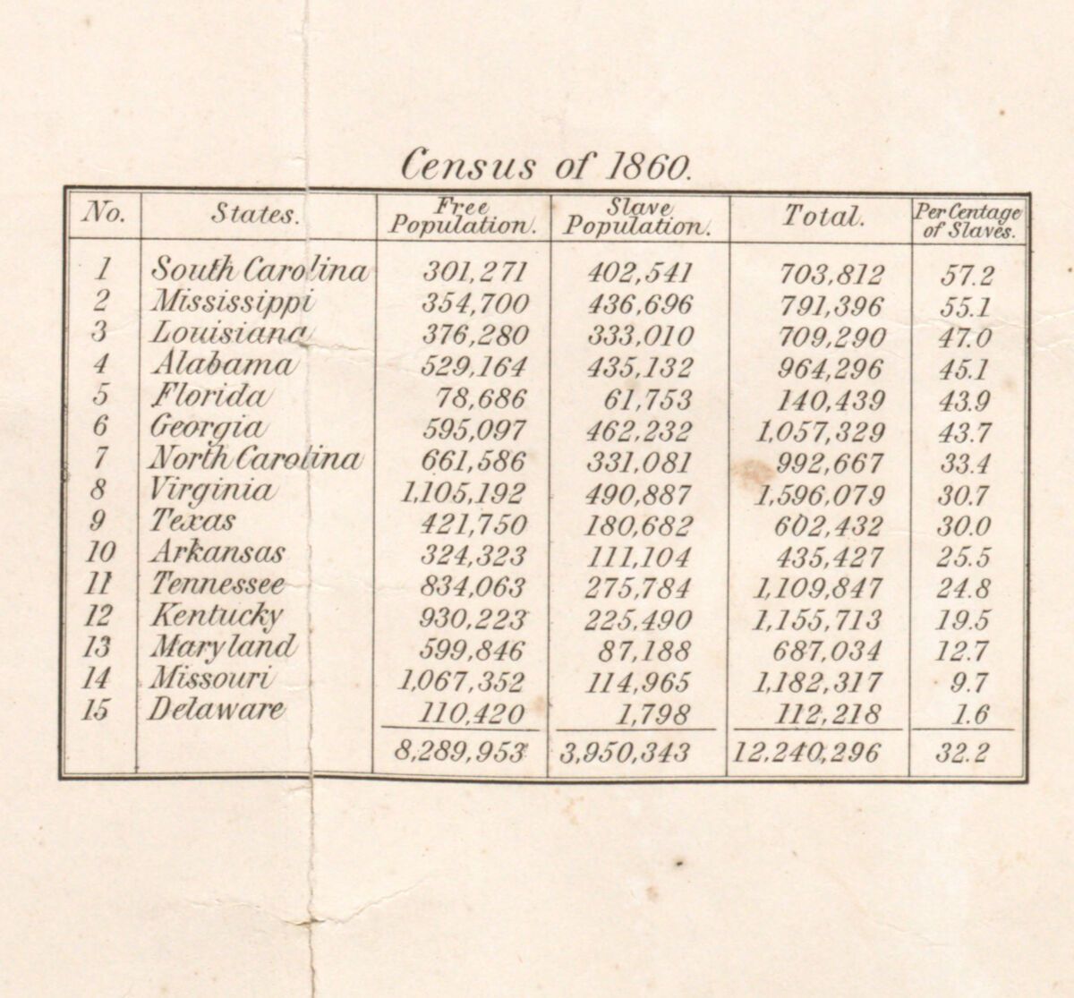
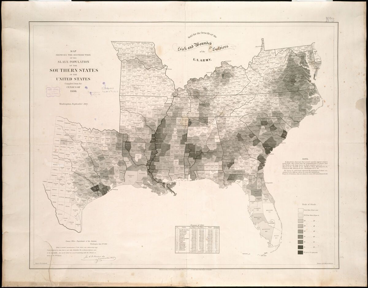
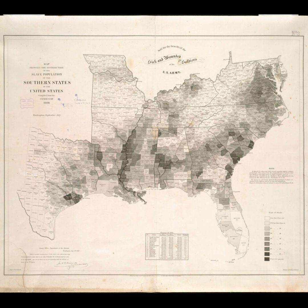
Happy Black History Month from the Leventhal Center!
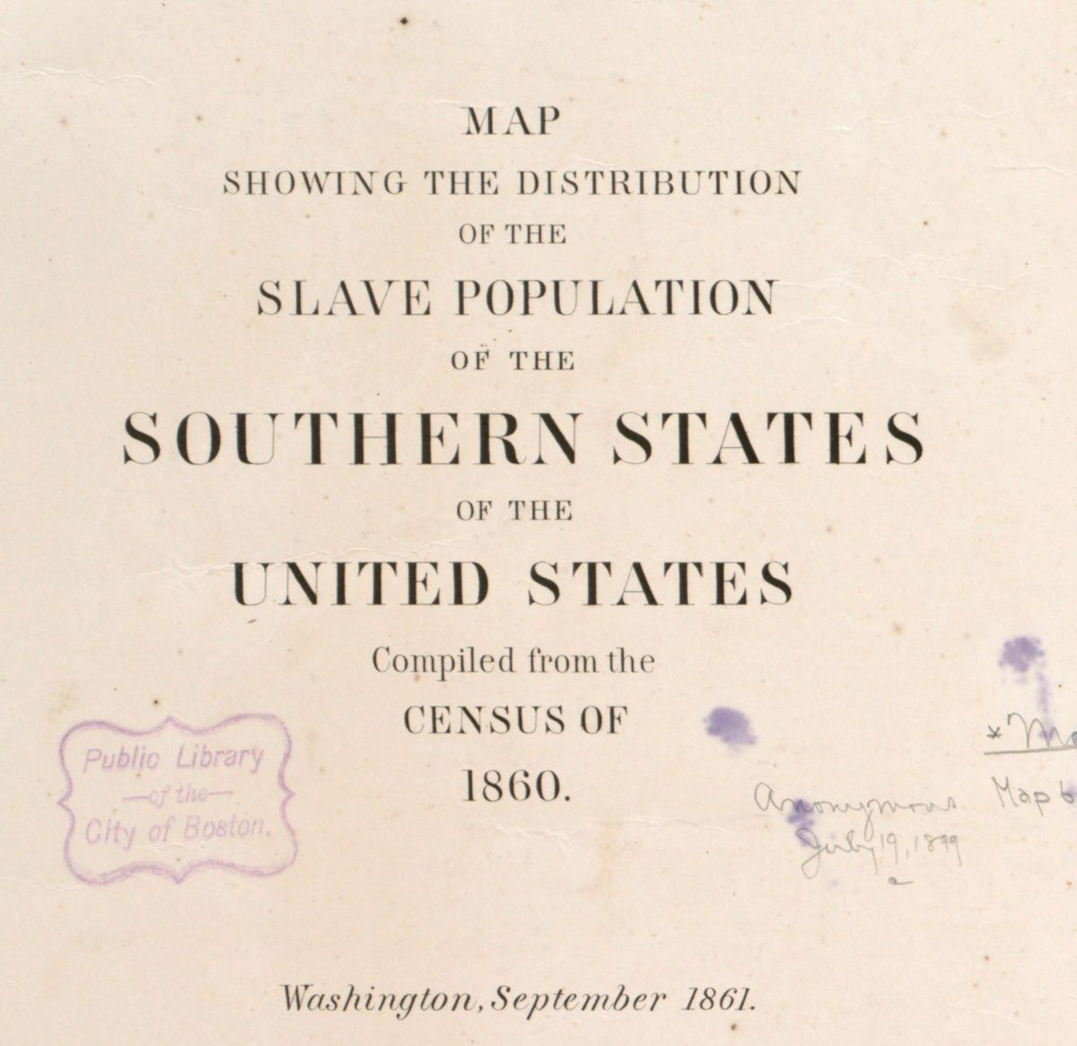
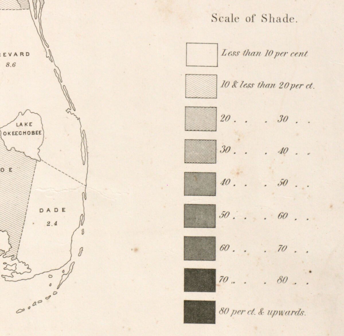
Map: Map showing the distribution of the slave population of the southern states of the United States (1861)
1
3
6
755
Highlighted is a close up of Galveston, TX, the birthplace of Juneteenth (now a national holiday), when on June 19, 1865, slavery was abolished in Texas and one of the last groups of enslaved people in the United States were freed.
1
166
As one of the first statistical or thematic maps published in the United States, consider the impact this map had on the trajectory of the Civil War and the future importance of statistical mapping.
1
162
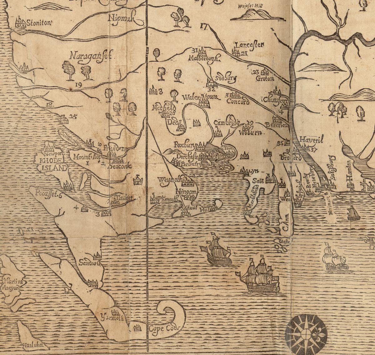
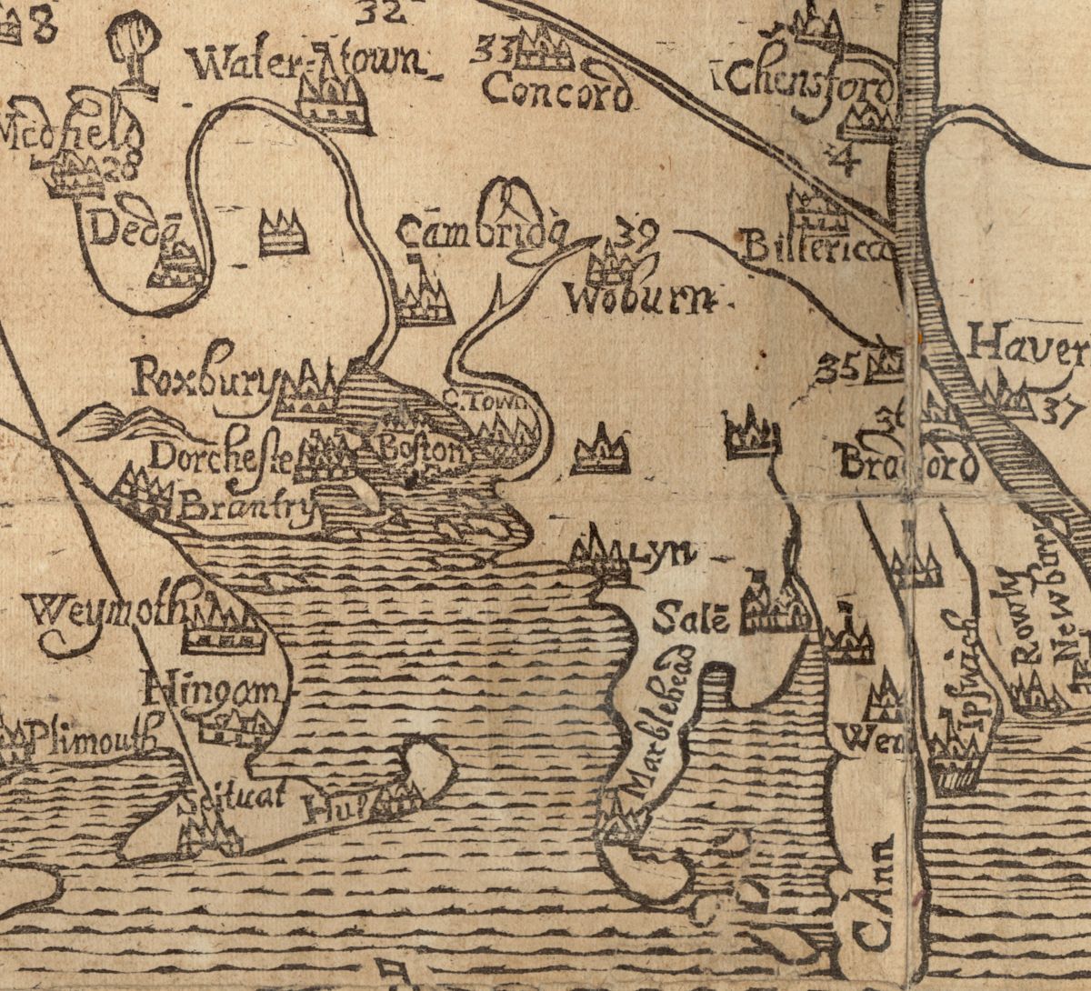
This map was made nearly a century BEFORE the US was founded 🤯
Be sure to look out for our next exhibit, Terrains of Independence (buff.ly/40nEU47), coming April 2025.
Map: A Map of New-England, Being the First That Ever Was Here Cut… (1677)

2
2
10
1,112
By war’s end the native population had been decimated and dozens of colonial towns (numbered on this map) had been ravaged.
This map was the first to be printed in the British Colonies, and though crude in appearance was the best available map of the region during this time.
1
157
One thing to note is the West orientation of the map. This is quite an uncommon orientation, and may have reflected the British ideal of westward expansion further into the North American continent.
1
143