
PhD, Digital Geographer, Researching accessible geospatial technologies small islands w drones. @UniUtrecht in @UUCopernicus in @UUGeo US citizen- Marylander.
Joined April 2008
- Tweets 3,712
- Following 3,086
- Followers 2,412
- Likes 7,106
273 Photos and videos

19 Apr 2024
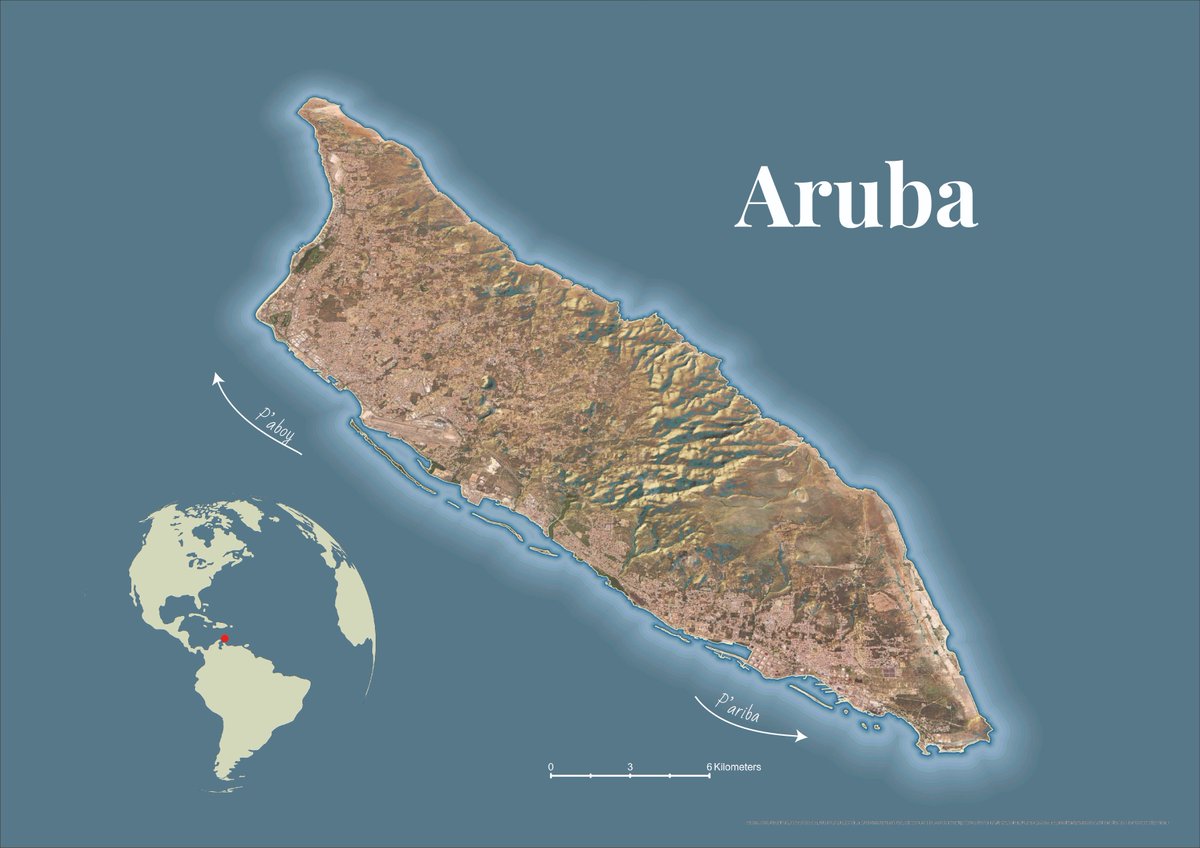
Coordinating a course called Consultancy Project Aruba - proud to see students' research about rainwater harvesting featured in the local news! Minister Ursell Arends a atende presentacion di Rainwater Harvesting 24ora.com/minister-ursell-ar… via @24ora
5
557
ᴮʳⁱᵗᵗᵃ ᴿⁱᶜᵏᵉʳ retweeted

12 Apr 2024
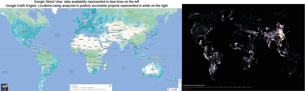
While Geo-tagged 🌍Street View Images 📸 are super useful for different research, commercial data's legal & copyright aspects can cause challenges in using them. We (W/ @HelbichMarco, M. Danish, @bricker) explored these in this 📢new paper! Check it out: doi.org/10.1016/j.healthplac…

3
17
900
8 Dec 2023
4
377
24 Nov 2023
Open postdoc position - help us develop models for a just energy transition to address energy poverty - visualizations, thermal cameras and drones are involved 😃 check it out shorturl.at/EF259
1
1
4
679
22 Nov 2023
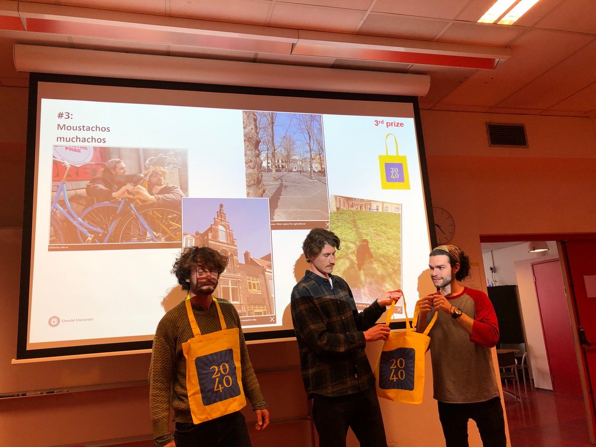
Having a great time at @knag Royal Netherlands Geographic Society with geographers-playing @UUCopernicus Utrecht 2040 Game!
1
406
10 Nov 2023
Want to join the Cartography and Sustainable Development Commission listserv? part of the International Cartographic Association @icawebsite Sign up to join the effort to Map a Sustainable World or/and learn about what others are doing forms.gle/LLwe176EFNZTcogM7
3
23
3,247
10 Nov 2023
Cool job alert - ASSOCIATE PROFESSOR SPATIO-TEMPORAL DATA VISUALIZATION utwentecareers.nl/en/vacanci…
3
6
1,453
10 Nov 2023
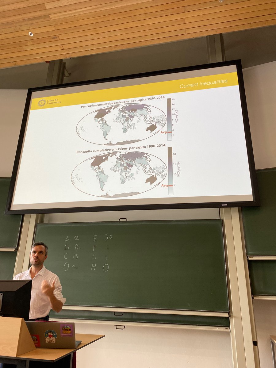
Choropleth map - animation over time displaying Share of final energy use that comes from renewable sources, 2020 - SDG indicator 7.2.1 ourworldindata.org/grapher/s…
1
3
1,252
ᴮʳⁱᵗᵗᵃ ᴿⁱᶜᵏᵉʳ retweeted

18 Oct 2023
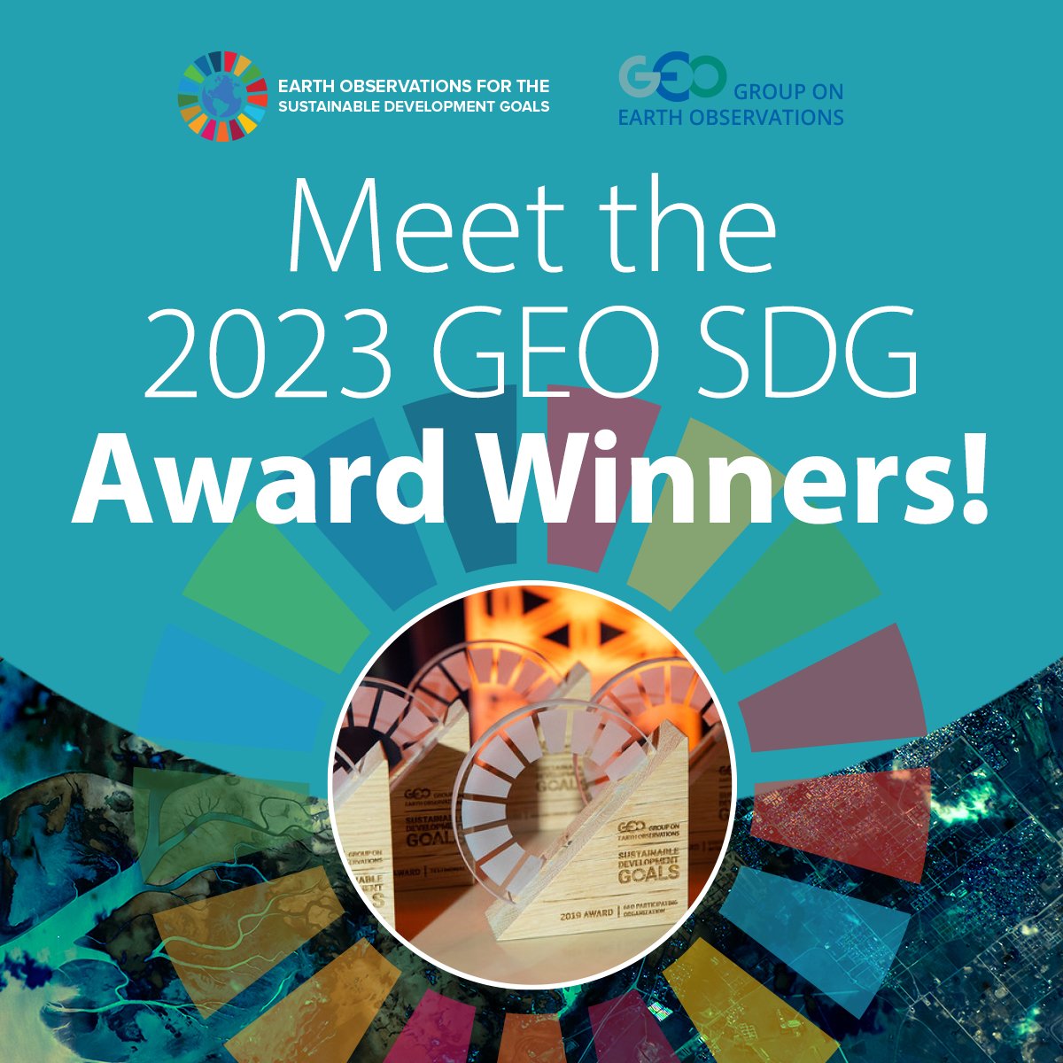
We're thrilled to announce the recipients of the 2023 GEO #SDG Awards! 🏆 Five outstanding orgs have been spotlighted for their innovative use of Earth observations in promoting sustainable development. 🌍
Explore the awardees 👉 eo4sdg.org/announcing-the-20…
18
49
7,726
5 Oct 2023
This looks like such a special and dreamy job 😍 Positionality - my parents are/were librarians and I now make and use maps
2 Oct 2023

NEW JOB - Reference Librarian in Library of Congress, Geography and Map Division
Information at: usajobs.gov/job/751888600
Please share widely

1
12
987
ᴮʳⁱᵗᵗᵃ ᴿⁱᶜᵏᵉʳ retweeted
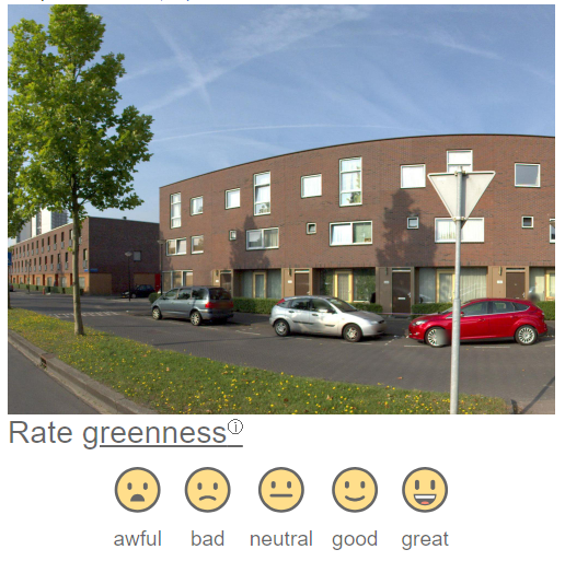
2 Oct 2023
What is your perception of urban spaces🌇? Let us know your opinion in capturing what makes a place green🌳, walkable 🚶♂️, bikeable🚲, safe, and pleasant. Join our web app to share your perception of Amsterdam using street view images📸! percept.geo.uu.nl/
3
9
1,240
ᴮʳⁱᵗᵗᵃ ᴿⁱᶜᵏᵉʳ retweeted

30 Sep 2023
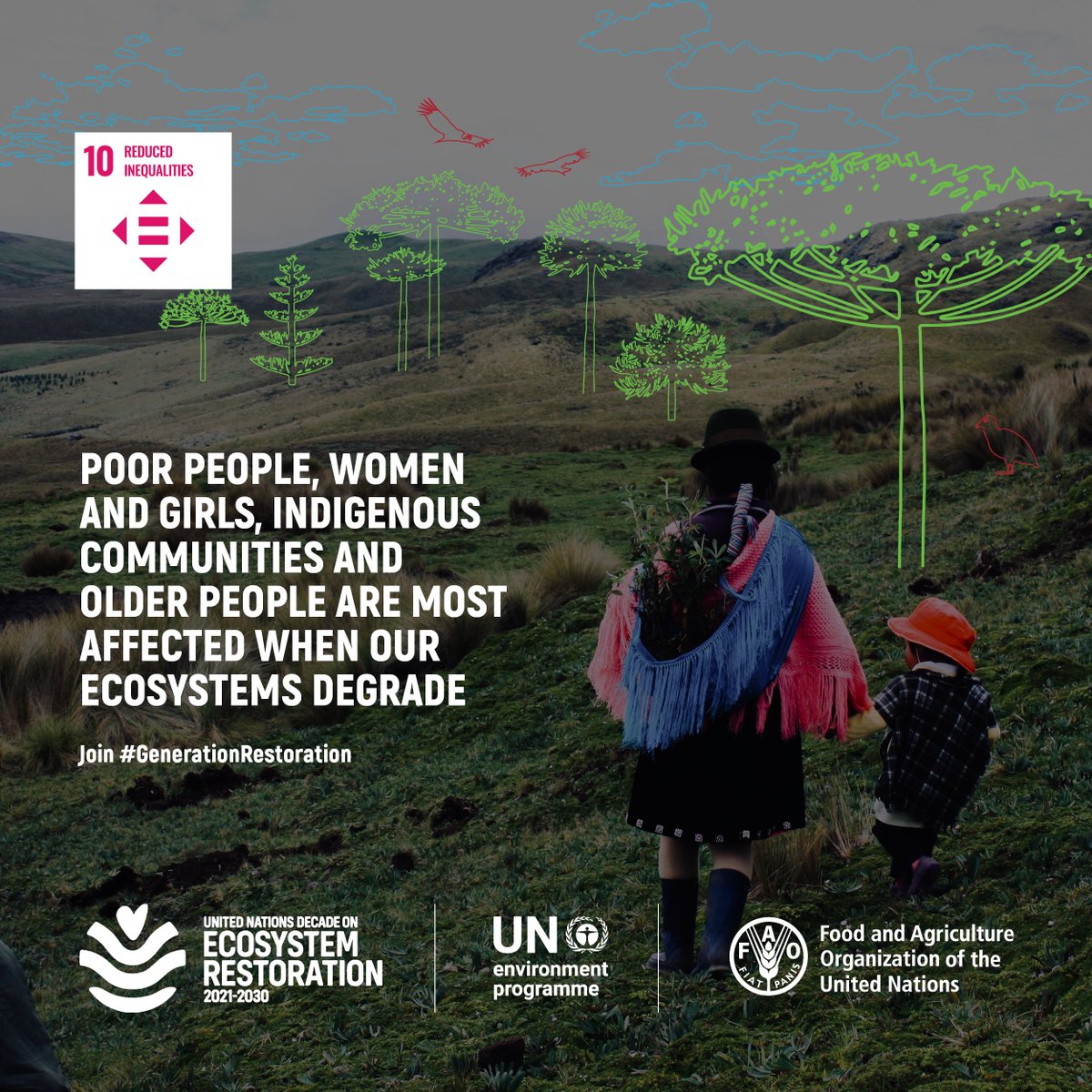
Ecosystem degradation does not affect everyone equally. Women and girls, marginalised and impoverished communities are often the hardest hit.
#GenerationRestoration efforts help those affected build resilience and adapt to a changing environment. bit.ly/3KZAUOu
16
141
241
19,761
ᴮʳⁱᵗᵗᵃ ᴿⁱᶜᵏᵉʳ retweeted

1 Oct 2023
📢 Help us spread the word!🌍Please reshare this invitation
Let's bring together #Indigenous and non-Indigenous scholars to make a difference in #water & #EarthObservations
📌#GEOIndigenousWaterSummit
Lets drive positive change!
Submit your abstract by 🗓Oct. 15
More info 👇
1 Oct 2023

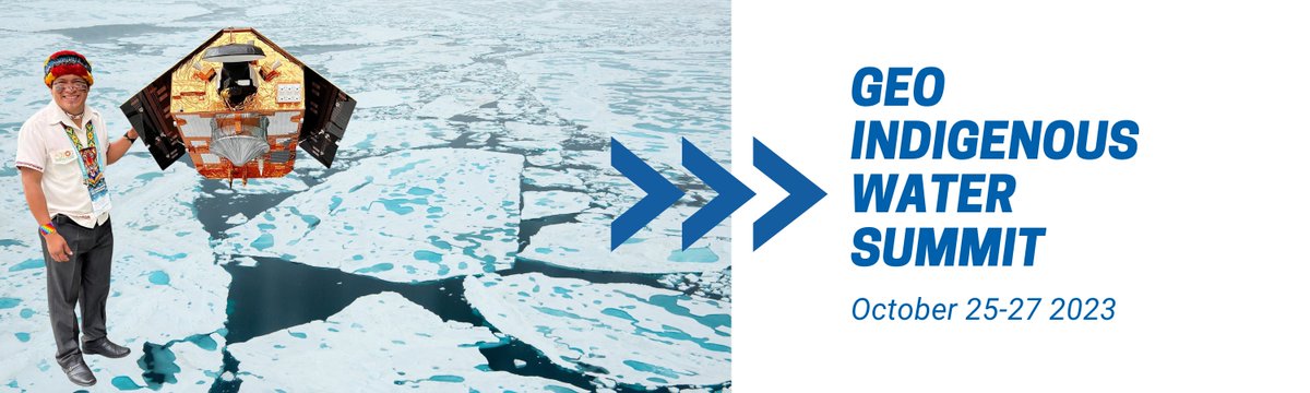
🌊 Calling all #Indigenous & non-Indigenous scholars working at the intersection of #water & #EarthObservations
Join us #GEOIndigenousWaterSummit 🗓Oct 25-27 Submit your abstracts on key topics by
📌Oct 15
📚 Topics & Submission👇
forms.gle/ttsqe1XqnZPcC43LA
Let's innovate together!
1
18
31
6,479
28 Sep 2023
Check out my talk "Understanding, analyzing and visualizing big data: A geospatial approach for the SDGs" at the Integration of Geospatial Information and Statistics for the SDGs in the context of Big Data - UN Datathon 2023 Training Webinar — UN-CEBD: unstats.un.org/bigdata/event…
2
6
25
3,427
28 Sep 2023
Really nice to see what participants learned from this event 😀
27 Sep 2023

#Mapping4SDGs
Thank you @bricker and @RobertERoth for making this possible for this young network of mappers in #Zimbabwe
Hats off @ptmakanga
To more of these 🫶
211

On this #InternationalWomensDay, @PalomaMerodio the co-Chair of @UNGGIM shares her thoughts on how geospatial information can help empower women, bridge the gender gap and help foster a more egalitarian society between women and men 🌐♀️🙌👇
1
20
52
2,732
ᴮʳⁱᵗᵗᵃ ᴿⁱᶜᵏᵉʳ retweeted

3 Aug 2023
We welcome you to the second day of the Thirteenth Session of the United Nations Committee of Experts on Global Geospatial Information Management @UNGGIM . Watch it live on UN Web TV! Connect here media.un.org/en/asset/k1g/k1…
#UNGGIM13
2
6
22
1,517