Research scientist on Microsoft's AI for Good team.
- Tweets 185
- Following 553
- Followers 840
- Likes 810


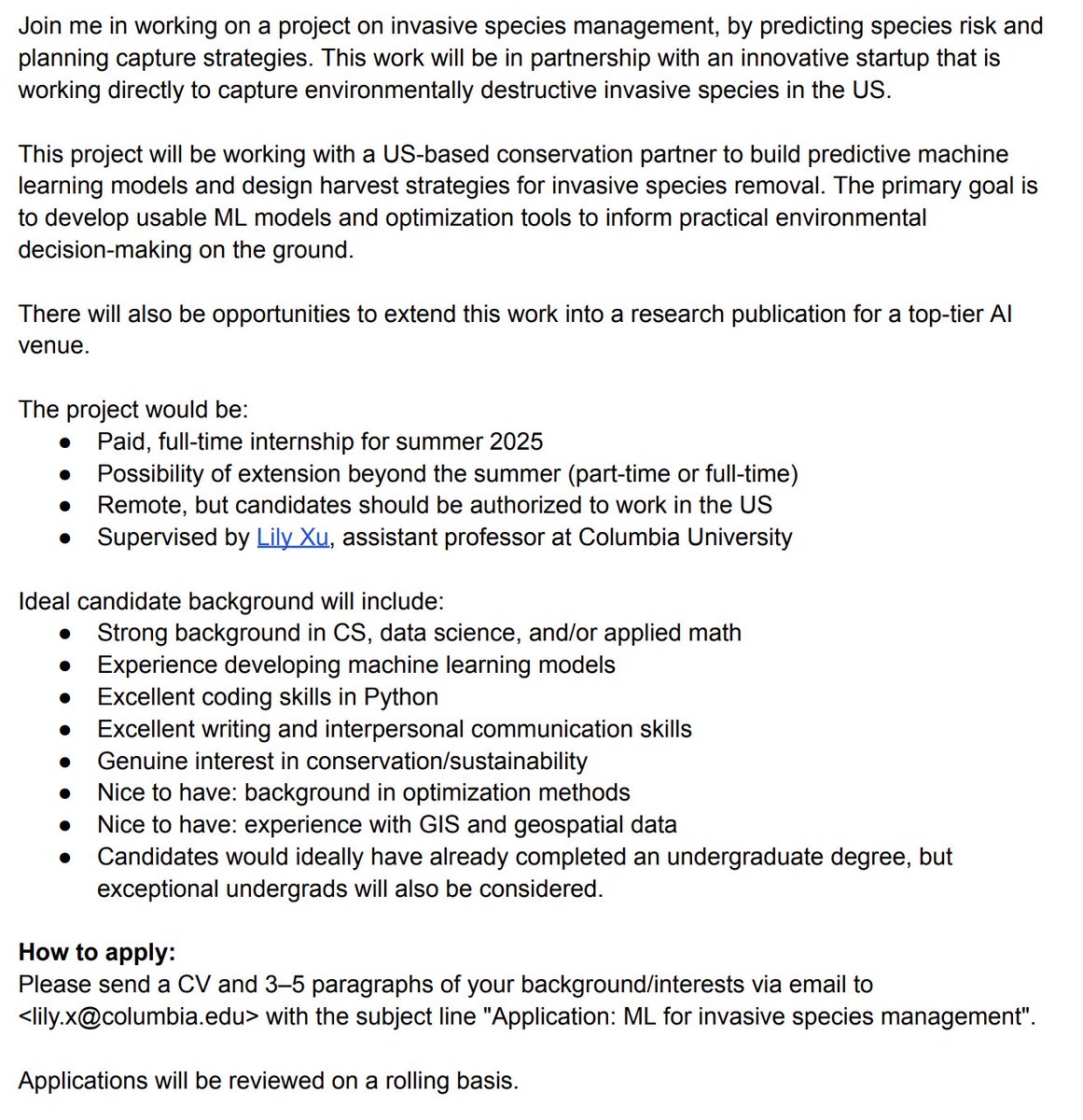
ALT Join me in working on a project on invasive species management, by predicting species risk and planning capture strategies. This work will be in partnership with an innovative startup that is working directly to capture environmentally destructive invasive species in the US. This project will be to build predictive machine learning models and design harvest strategies for Inversa’s invasive species removal efforts. The primary goal is to develop usable ML models and optimization tools to inform practical environmental decision-making on the ground. There will also be opportunities to extend this work into a research publication for a top-tier AI venue. How to apply: Please send a CV and 3–5 paragraphs of your background/interests via email to <lily.x@columbia.edu> with the subject line "Application: ML for invasive species management". Applications will be reviewed on a rolling basis.


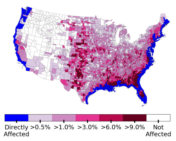
ALT Aerial imagery of a neighborhood along the coast showing half of the houses burned