
Joined February 2009
- Tweets 4,552
- Following 574
- Followers 868
- Likes 4,915
168 Photos and videos


catherine marx retweeted

May 20
SBA Small Business Person of the Year: Derek Ezovski | fox61.com
@FOX61News @cmeast @dezovski @SBA_NewEngland
2
3
83

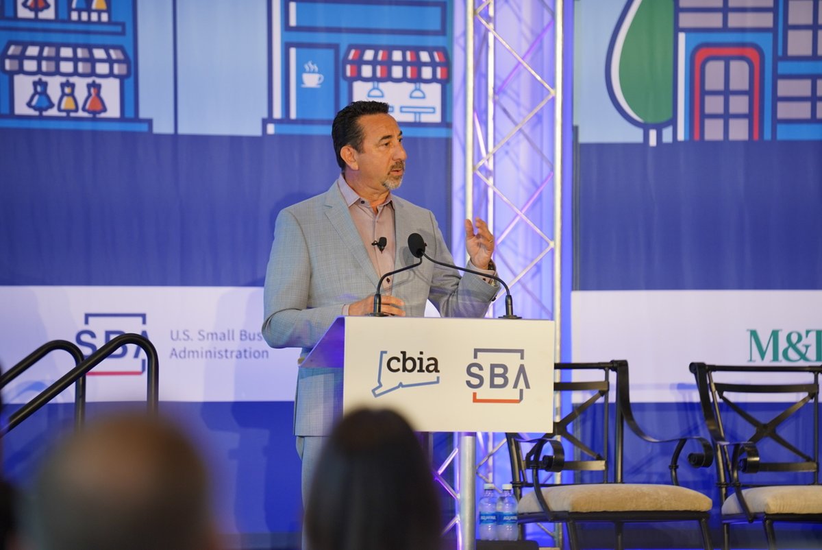
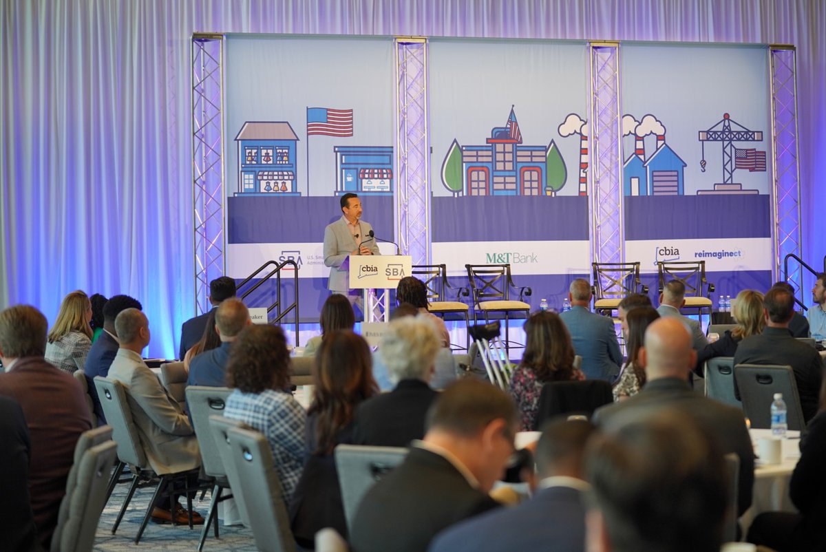
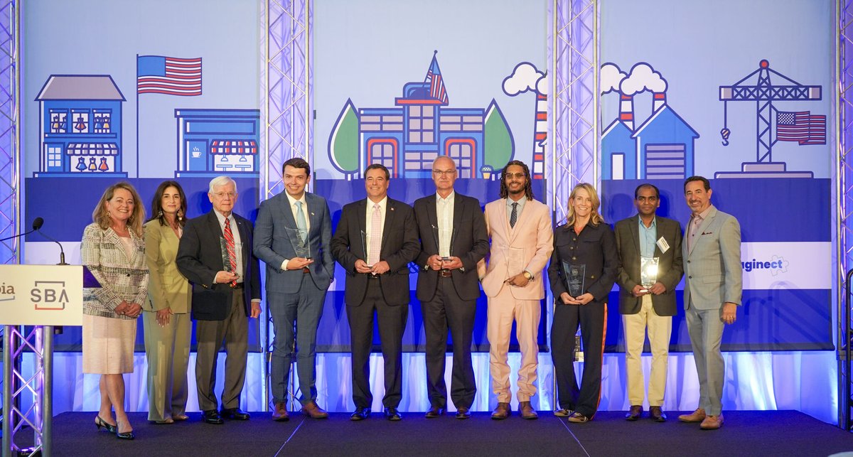
CBIA's @ChrisDiPentima and @SBA_Connecticut's @cmeast kick off the 2026 @SBAgov Small Business Awards, recognizing the exceptional achievements of Connecticut small businesses—the heart of the state's economy.

2
3
75
catherine marx retweeted
May 12
Connecticut's #NSBW 2026 winners take center stage at the National Small Business Week Awards Ceremony & Expo last week. @cmeast @Moragut @HartfordFilm @dezovski @MarionMfg @ridgefieldrunco
2
7
68

Mar 24
Powering the American Dream
🚀 FREE Business Lending Expo
📅 Thursday | 9 AM – 12 PM
📍 Cromwell, CT
Meet 25 SBA lenders & resource partners. Bring your business plan. Make the connection.
@SBAgov @ctsbdc @MdsxChamber
19
catherine marx retweeted
Mar 10
An @SBA_NewEngland collaboration! The CT Business Matchmaker event at the CT Convention Center last Thursday featuring a business expo, a dedicated matchmaking room, & a series of workshops designed to help #smallbusinesses connect w/ procurement opportunities. @StateOfCT

1
1
72
catherine marx retweeted

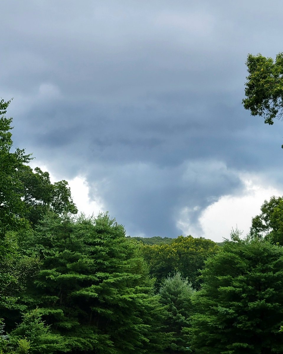
Feb 22
Here’s our storm getting going. We are about to lose our daylight visible satellite shot as it gets dark.
2
9
137
14,503
catherine marx retweeted
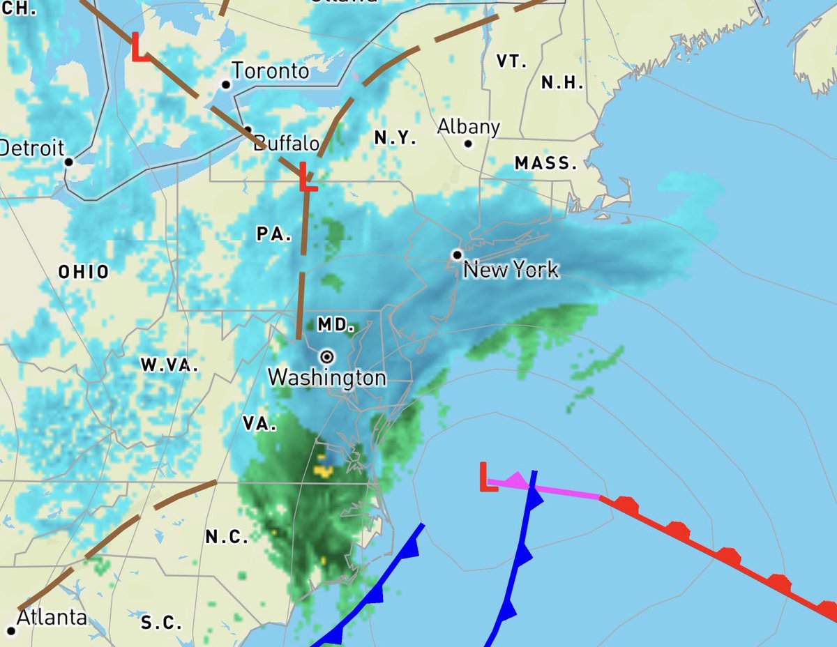
Feb 22
Everything is on track. The storm is starting to rapidly strengthen east of Virginia Beach and is down to 996mb. Heavier snow is moving up toward Long Island now.
Winds are starting to ramp up at the shoreline, Block Island is now gusting over 30 mph.
The snow is moving back into SNE now. By 9 PM it should be snowing pretty hard across most places as the wind continues to pick up. Things really get cranking around and after midnight. The peak of the blizzard with intense snow and potentially damaging wind gusts is roughly 2am-10am west….and more like 4am into early afternoon east. Snowfall rates of 1-3”/hour and maybe up to 4”/hr are expected. Plows will not be able to keep up. The snow will be blowing everywhere. It’s tough to pinpoint exactly where the extreme bands set up but where they do, is where the highest totals will be.
Let’s broad brush the winds and call it 40-60mph gusts inland, 60-80mph along the shoreline with the higher end of that range in the open exposed direct waterfront areas that typically see the highest gusts during nor’easters. Significant outages expected due to the wind combined with the heavy, wet snow.
Some good news… the worst of the storm will not coincide with the early morning (~3am) astronomically high tide cycle in eastern MA. The coastline will still take a beating, and there will be moderate coastal flooding, but the worst of the storm is during the low tide cycle around 9am.
Pretty much everything I’ve been discussing still stands. Charge your devices! I expect it will be a difficult night to sleep with the roar of the wind.

6
11
117
15,227
catherine marx retweeted
Feb 23
Down to 994mb. Lightning ⚡️ starting to ramp up.


3
5
96
9,823
Feb 20
RT @CBIANews: Consider it speed dating for #smallbusinesses. @SBA_Connecticut's CT Business Matchmaker event brings together small business…
2
catherine marx retweeted
Jan 29
After decades of growth, Wolcott fastener manufacturer adds new facility in $4M expansion hartfordbusiness.com/article… via @HartfordBiz @ives_bank @cmeast @CICLending @MichaelPuffer #manufacturing
1
2
65

📅 3 days away!
#ShopSmall 🛍️ on Small Business Saturday.
Learn how you can participate: sba.gov/saturday
2
13
17
1,437
catherine marx retweeted
25 Nov 2025
Getting a jump start today on @ShopSmall by hosting a Walking Tour to #smallbusinesses in Olde Mistick Village. Visiting R.A. Georgetti, Sophia's Mystical Creations, Cloak & Wand, Kitch, & Trattoria Amalfi along w/ @SenBlumenthal @JoeCourtneyCT @LGSusanB @AundreBum @rachel_lenda


1
3
111
catherine marx retweeted
25 Nov 2025
It's a Wrap!!! Our Walking Tour at Olde Mistick Village today was the complete package! 🎁Our friends @WFSBnews @reneedinino19 joined us as well as Olde Mistick Village's management team, led by Chris Regan. Olde Mistick Village is a must visit this holiday season!! 🛍️@cmeast

1
3
87
catherine marx retweeted
25 Nov 2025
1
3
79

catherine marx retweeted
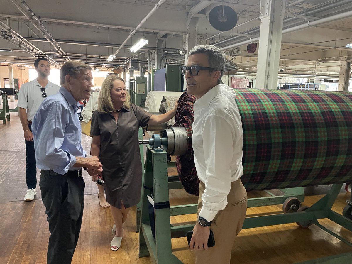
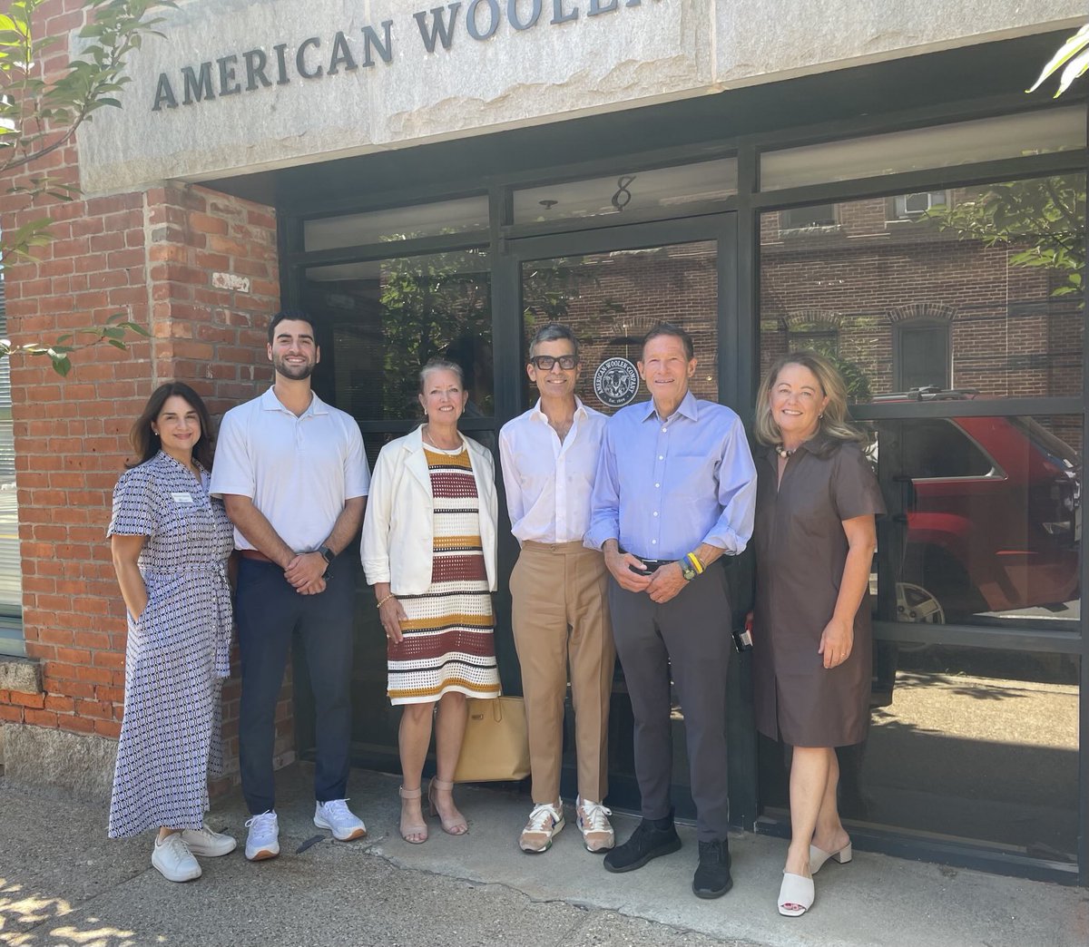
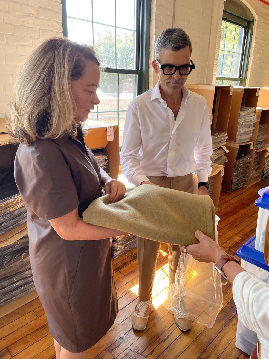
22 Aug 2025
It”s all about the #manufacturing of woven wool at American Wool Company in Stamford Springs today! #madeinamerica 🇺🇸 @cmeast @SenBlumenthal @CBIANews
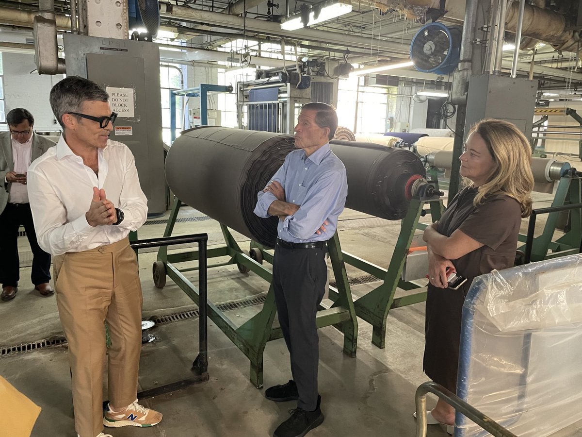

3
5
123
catherine marx retweeted
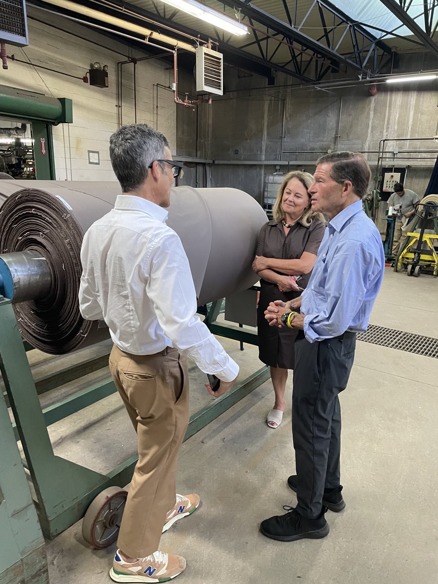
22 Aug 2025
From @USNavy uniforms to Christmas 🎄 stockings - American Wool Co. has it!! Coolest things #madeincnnecticut! 🧦👔 @cmeast @CBIANews @SenBlumenthal
1
4
72
catherine marx retweeted
22 Aug 2025
We had a 🐑 woolly good time on today’s tour at the American Woolen Co @staffordsprings with @SenBlumenthal @cmeast @CBIANews @Moragut #madeinconnecticut #madeinamerica
2
6
182