
A side project of @owenboswarva. Pushing out free #opendata products and tools because I'm nice like that.
- Tweets 658
- Following 585
- Followers 608
- Likes 30

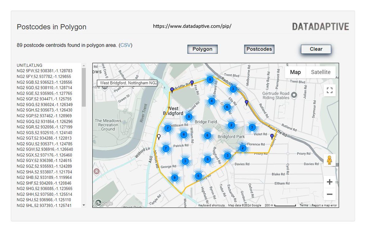


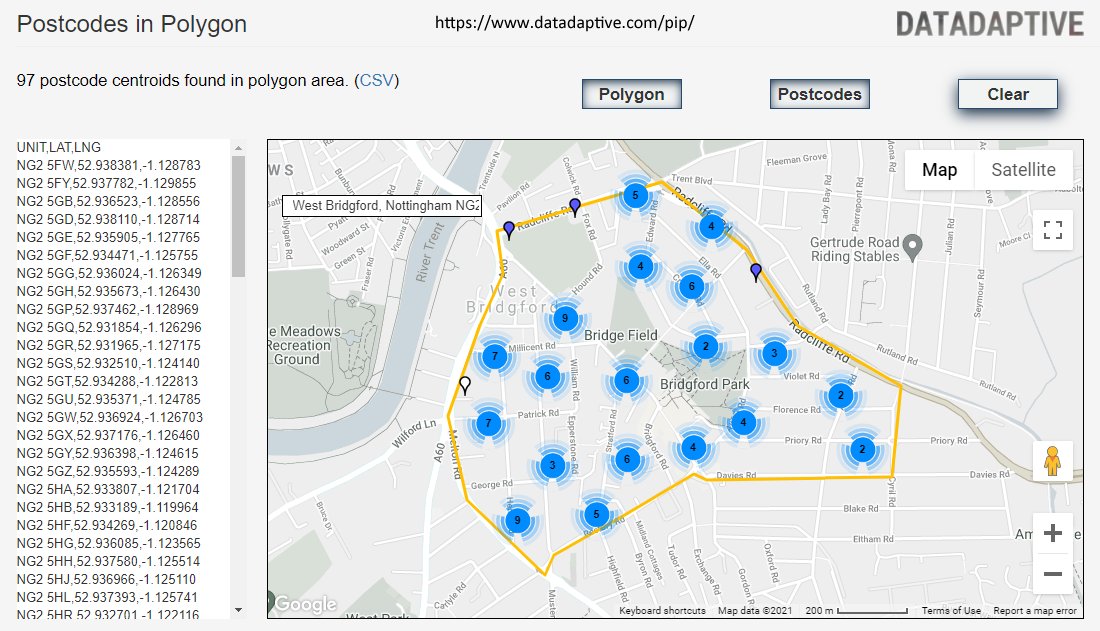


ALT Screenshot of Datadaptive's Postcodes in Polygon tool
ALT Screenshot of Datadaptive's Postcodes in Polygon tool
ALT Screenshot of Datadaptive's Postcodes in Polygon tool
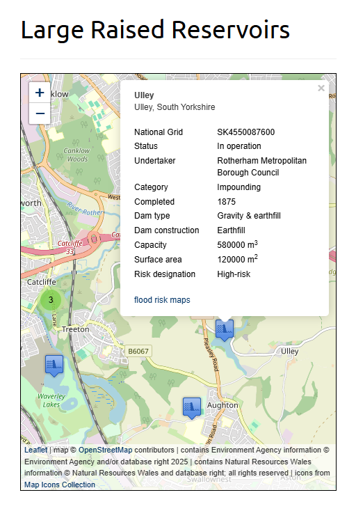
ALT Screenshot of interactive map based on Datadaptive's Large Raised Reservoirs in England and Wales dataset
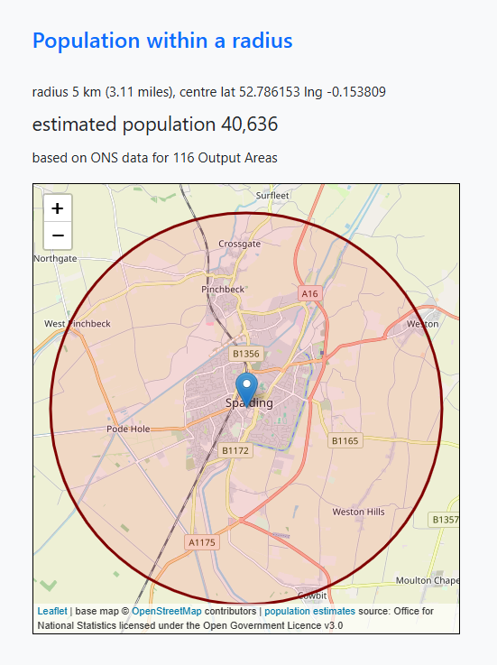
ALT Screenshot of Datadaptive's Population with a radius tool
ALT Job Centre Plus, Solihull – photo by Helen Cobain, taken on 6th October 2012 (CC BY 2.0)
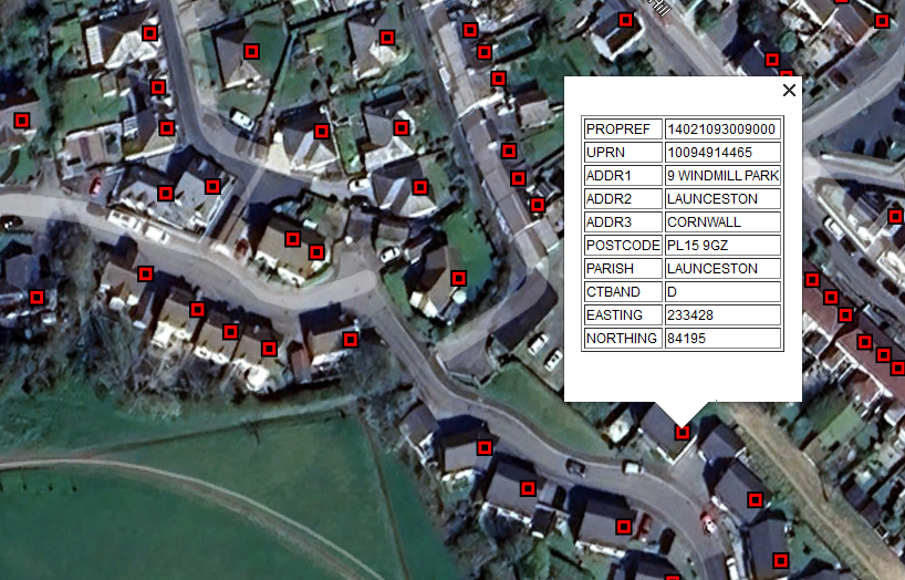
ALT Screenshot of sample of Cornwall's Council Tax address data, visualised in Google Earth
ALT Screenshot of Datadaptive's Postcodes in Polygon tool
ALT Job Centre Plus, Solihull – photo by Helen Cobain, taken on 6th October 2012 (CC BY 2.0)
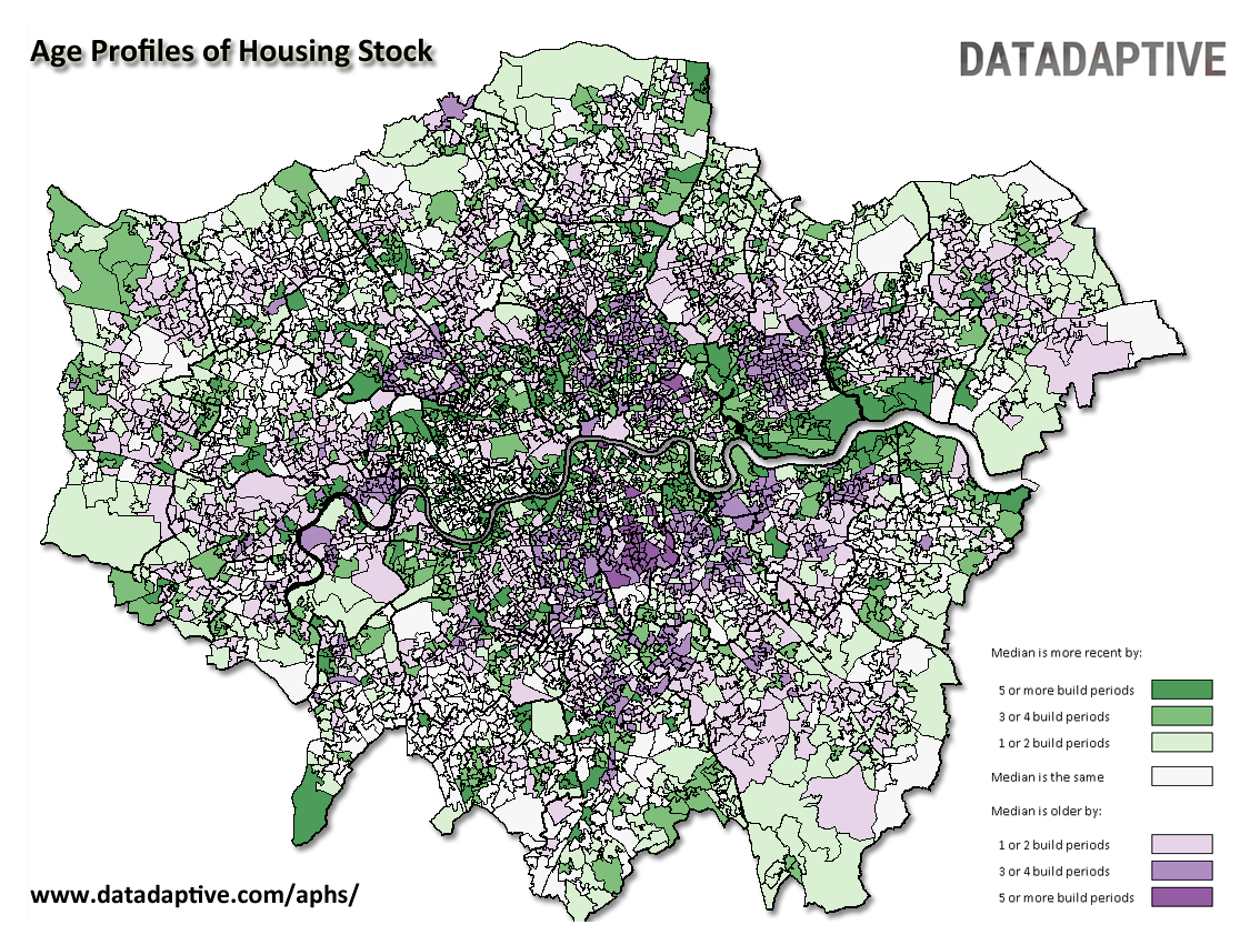
ALT Map of London, illustrating build period data from Datadaptive's Age Profiles of Housing Stock dataset
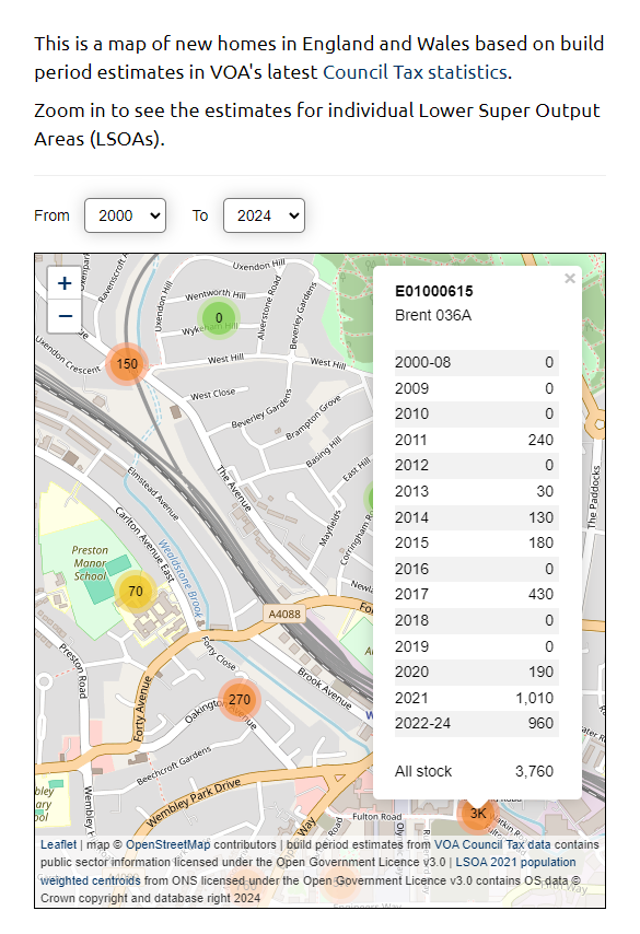
ALT Screenshot of interactive map showing new build homes in England and Wales since 2000
ALT Photo of onshore wind turbines
ALT Screenshot of Datadaptive's Postcodes in Polygon tool
ALT Photo of onshore wind turbines
ALT Photo of old post office
ALT Screenshot of Datadaptive's Postcodes in Polygon tool
ALT Moverly co-founder Ed Molyneux, commented: “We believe that HIPS are absolutely essential if the housing market is to solve the perpetual issues of inefficiency and snail-paced processes. Of course you’d expect us to say that, but it turns out the vast majority of property professionals also recognise the benefits the provision of upfront information can bring."

ALT Photo of onshore wind turbines
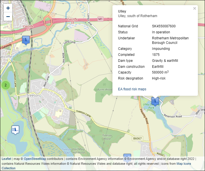
ALT Image of Large Raised Reservoirs map

ALT Map of London, illustrating build period data from Datadaptive's Age Profiles of Housing Stock dataset