
Atmospheric Scientist/AI Professional/Certified Consulting Meteorologist
Joined June 2026
- Tweets 44
- Following 71
- Followers 57
- Likes 84
10 Photos and videos


Pinned Tweet

Jun 3
Coming soon: a brand new GSDM website.
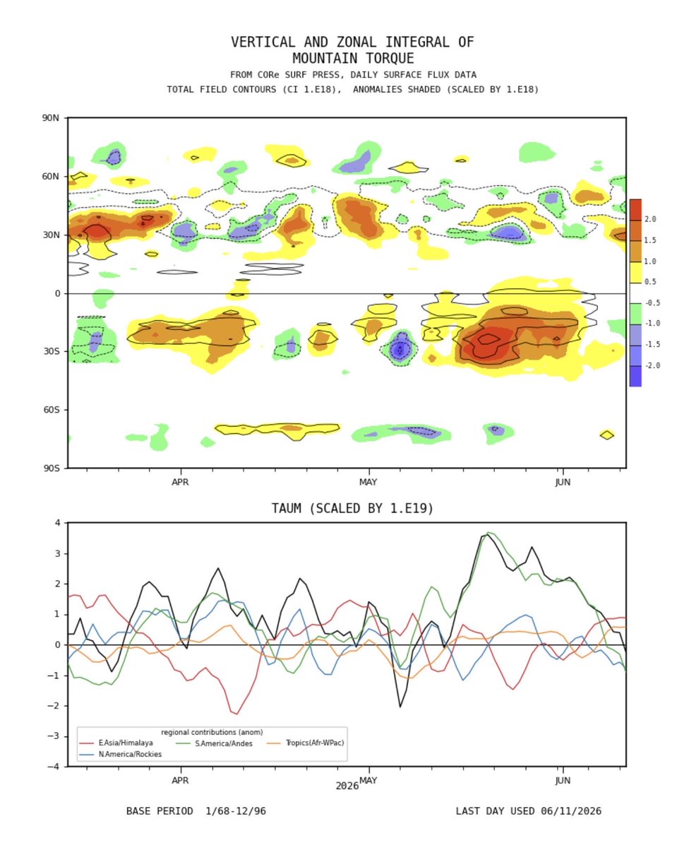
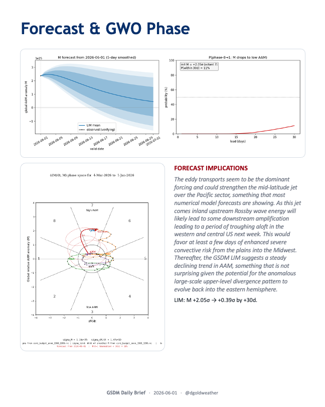
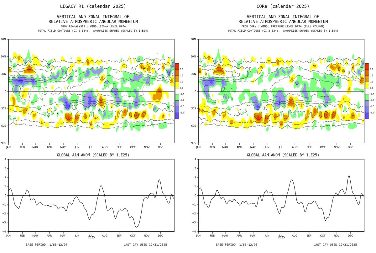
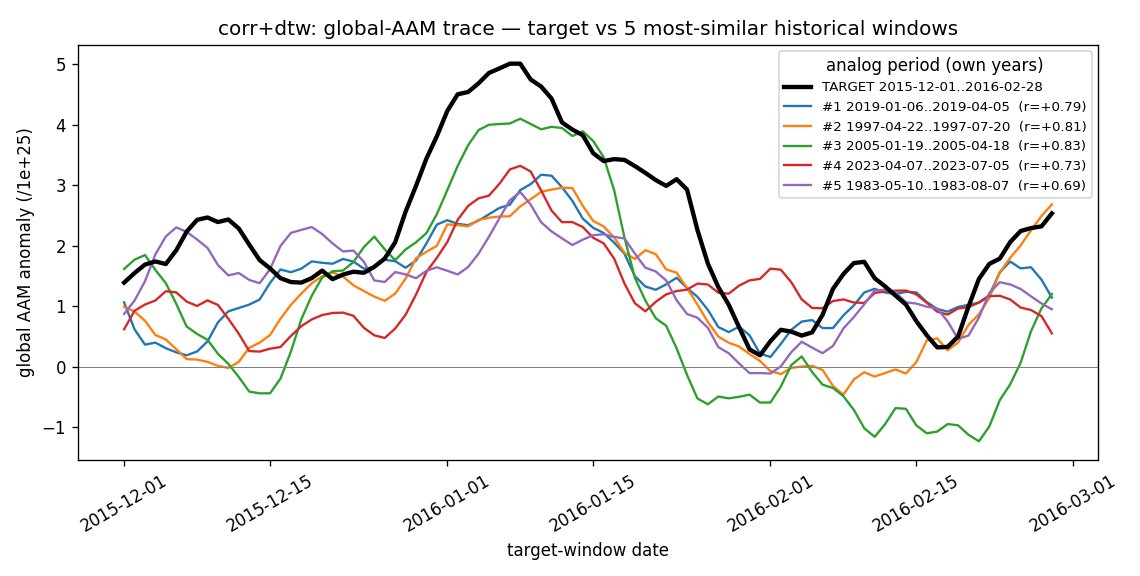
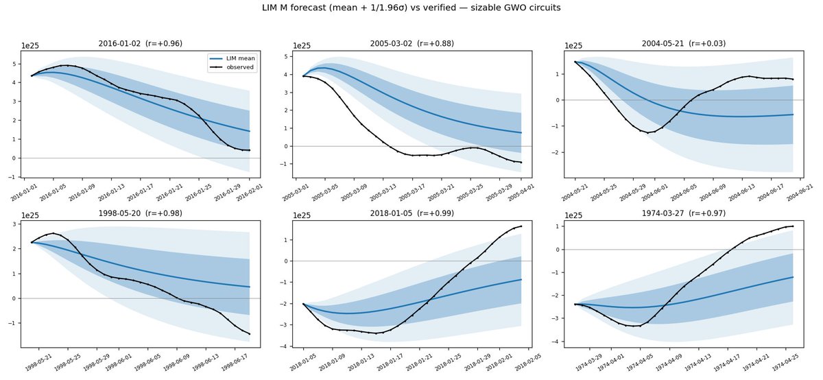
I know that some of you were users of the now defunct GSDM website which had replicated the original ESRL-hosted site where you could access the GWO, Hovmollers of AAM anomalies and its forcings (budget terms). I have rebuilt this from scratch using the new CORe data set. The v2.0 site will be MUCH richer, offering AAM analogs, LIM forecasts, regional contributions for AAM (as well as TauM), wind vector maps highlighting which wind perturbations are most strongly contributing to the zonal mean structures, detailed guidance on how to interpret the data and more! The idea is to better enable users to connect diagnosis of the general circulation to what it means for the forecast. A few sample plots below to whet the appetite!
1
6
27
4,549
Jun 8
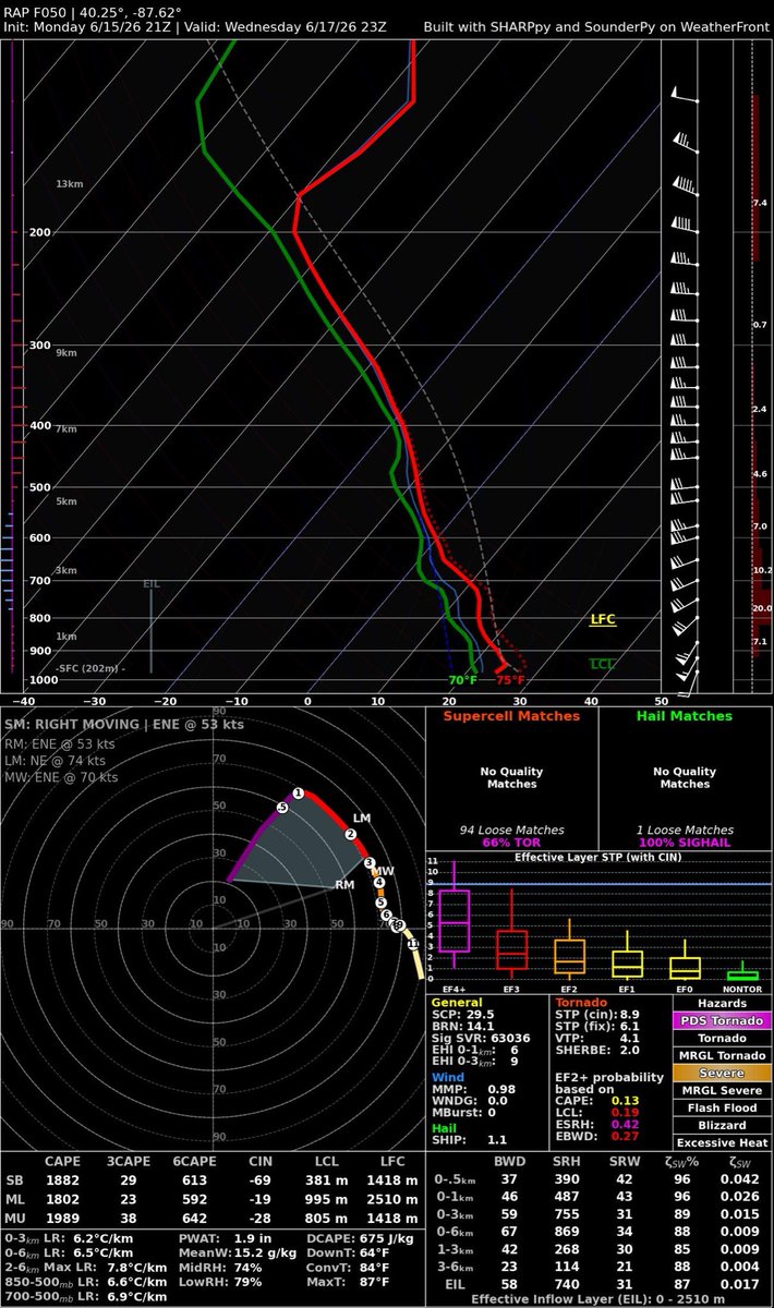
A moist surface-based airmass is in place as far west as the CO/KS border and this moisture should be drawn westward as pressures fall in the lee in response to increasing westerlies aloft over the Rockies. This will yield moderate to very unstable vertical stratification over the high plains and numerous storms will develop along and near the orographically favored initiation regions. I believe one or two significant supercells will develop over the Palmer Divide by mid-late afternoon.
Very large hail is the dominant severe hazard but I would expect at least a couple of tornadoes. This seems most likely after 0z as the LLJ kicks in but I wouldn’t be surprised at all if a tank got going and managed to move sufficiently off hodograph to go nuts. With CINH in place outside of the CI locations, storm structure should be the star of the show and I would not be surprised to see SOTY today for those chasers that can make it. Wish I were there.
Farther east along an effective warm front, a cluster of significant severe storms are likely to develop and these may have even higher tornado potential as they tap rich tropical moisture. I admit that I’d be carefully monitoring both targets in the AM. This set up reminds me a bit of June 11, 2010!

62
Jun 3
Hello friends! I decided to reactivate my account here after a long hiatus. This account will focus mainly on weather and climate and AI. To start with let me share a blog post where I speculate on the causes of the amazing highway-aligned cloud streets that formed Tuesday AM (June 2):
goldweather.wordpress.com/20…
4
140