
Covering severe weather in Michigan. Skywarn storm spotter & chaser; intercepting for over 28 years.
Joined January 2015
- Tweets 683
- Following 105
- Followers 38
- Likes 204
479 Photos and videos


SWS for NW St. Clair Co until 245p. Doppler is tracking a thunderstorm near Capac, moving NE at 20mph. 50mph wind gusts and pea size hail.
Severe Thunderstorm Warning for SE Montmorency and NE Oscoda CO until 245p. Storm is moving NE at 20mph. 60mph gusts and quarter size hail with this cell.
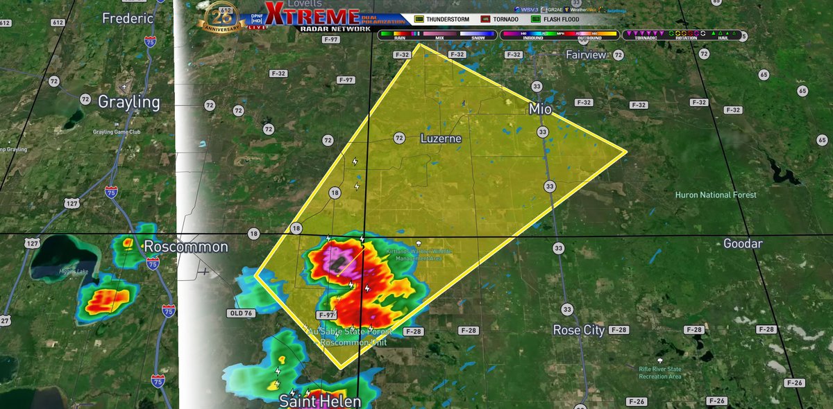
Extended polygon for the Severe Thunderstorm Warning for the storms in Ogema and Oscoda Co. Still holding until 2p
2
SWS for S Lapeer Co until 2p. Storm is moving NE at 35mph with 40mph wind gusts and pea size hail.
2
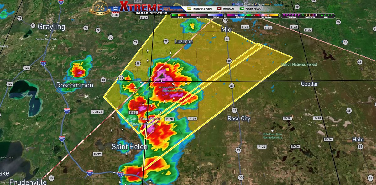
Severe Thunderstorm Warning for SE Crawford, NW Ogemaw, NE Roscommon and SW Oscoda until 2p. Storm is moving NE at 25mph with 60mph winds and half dollar size hail.
1
4
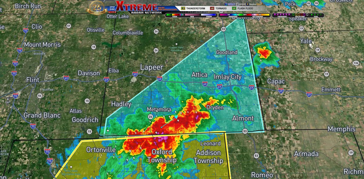
Severe Thunderstorm Warning for N Oakland Co until 2p. Storm is moving NE at 30mph. 60mph winds and quarter size hail.
1
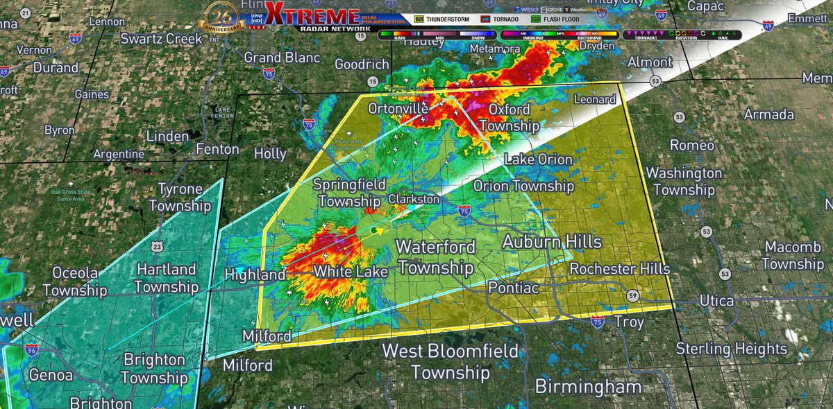
SWS for SE Livingston Co until 115p. Storm is moving NE at 15mph. Winds over 40mph and penny size hail.
5
SWS for Central Oakland Co until 115p. Doppler is tracking a strong thunderstorm moving NE at 25mph. Winds over 40mph and pea size hail.
1
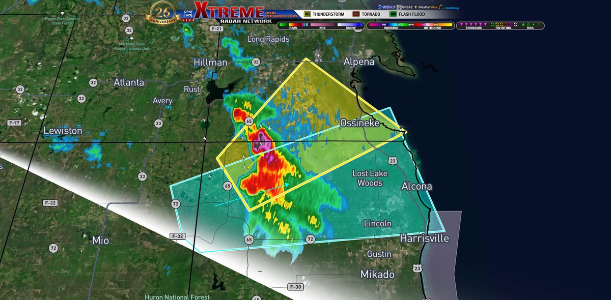
Severe Thunderstorm Warning for S Alpena and NW Alcona Co until 1245p. A severe thunderstorm was located near Curran, moving NE at 20mph. 60mph wind gusts and quarter size hail with this cell.
6
SWS for Alpena, N Alcona and E Oscoda Co until 1230p. Doppler is tracking a strong thunderstorm over Curran, moving E at 25mph. 40mph wind gusts and penny size hail with this cell.
1
26
Today's SPC outlook. Scattered to numerous showers and thunderstorms will develop this afternoon and evening. Isolated strong to severe storms will be possible, with damaging wind gusts and large hail the main threats. For mariners on the west side of the LP, small craft advisory. Strong southwesterly flow with gusts upwards of 35 mph will build waves through the day, upwards of 3 to 6 feet by this afternoon. On the east side, small craft advisory. Southwest winds 30-35mph with waves upwards from 2 to 5 feet by this afternoon. We will keep you updated throughout the day!
1
22
Good morning Michigan! We had a pretty good start to our day, mostly sunny for the LP and party cloudy for the UP. The clouds are slowly starting to push in, bringing some light rain into the area. For this afternoon our next system pushes in for another round of rain and thunderstorms, mainly for the LP. Todays high temperatures are around 1-2p with a decent cool down into the evening and overnight hours.

5

Jun 15
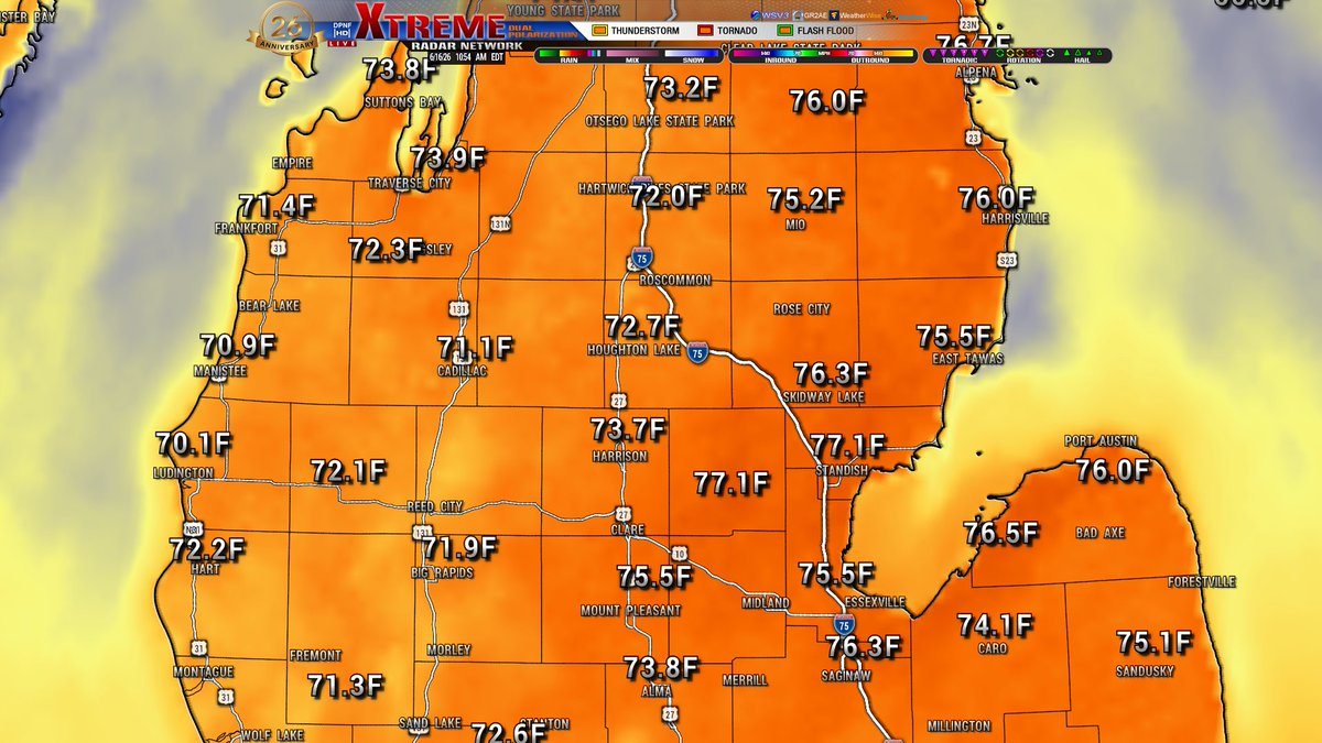
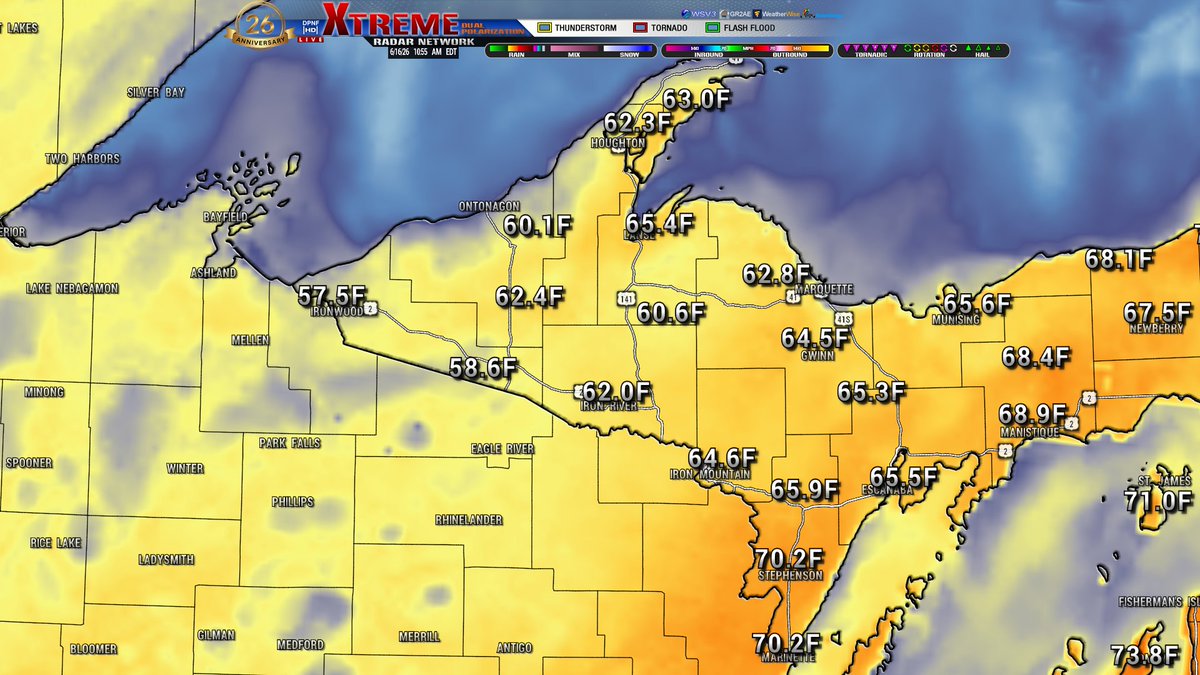
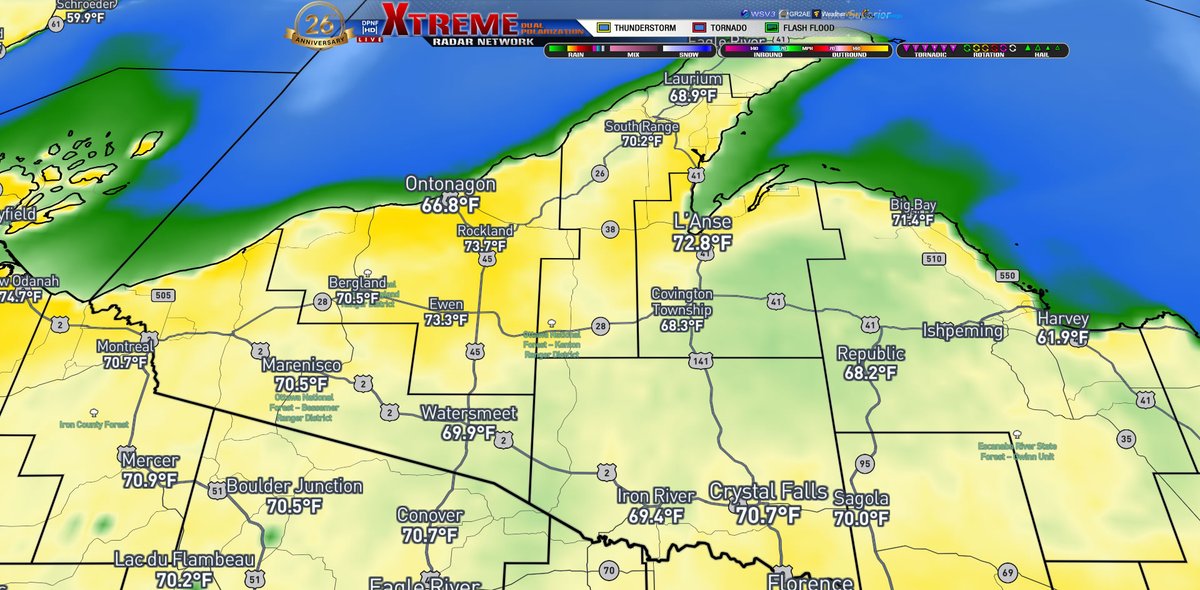
Good morning Michigan! A cool start to our day, warming up into the 70s for most of the state. Current temps are in the upper 50s to lower 60s. Todays highs for the maps are for 5p. Rain in the UP currently, clearing up around 2p with more pushing in around 930p tonight starting in the UP and then making its way down to the northern LP. Tomorrow will be our next system pushing in with our main weather maker coming in on Wednesday with another chance of some severe weather.


21
Jun 14
Severe Thunderstorm Warning for Monroe Co until 145p. Storm is moving E at 40mph with 60mph winds and half dollar size hail.
12
Jun 14
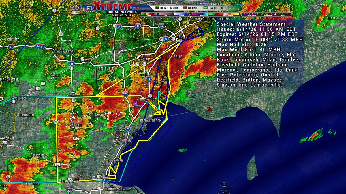
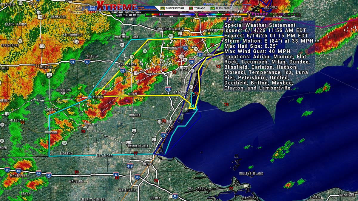
SWS for Monroe and Lenawee Co until 115p. Storms are moving E at 35mph, with 40mph wind gusts and pea size hail.
5
Jun 14
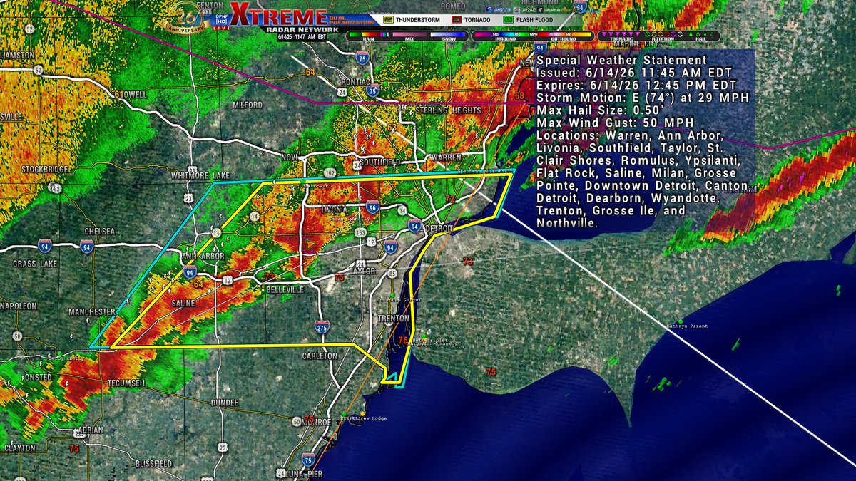
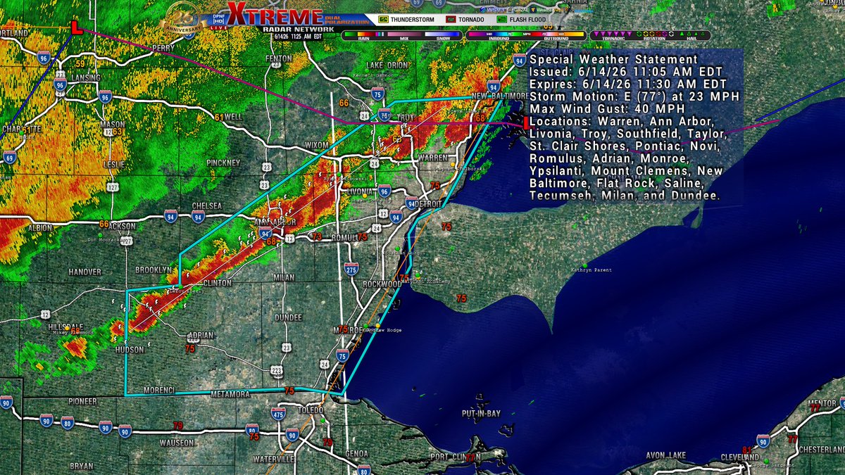
Severe Thunderstorm Warning for SE Washtenaw and Wayne Co until 1p. Storm is moving E at 30mph, with 60mph wind gusts and quarter size hail.
5
Jun 14
SWS for Monroe, Wayne, Lenawee, SE Oakland, S Macomb, and Washtenaw CO. Winds over 40mph.
4
Jun 14
Doppler update. Some light rain moving into the Lansing area. Lapeer Co seeing the most activity right now, some stronger winds and a good bit of lightning.
16
Jun 14
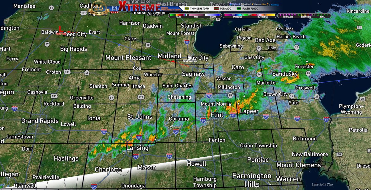
Doppler update. Main line currently moving through Shiawassee, Genesee, and Lapeer Co.

6
Jun 14
Doppler update. Still have a decent cell over NE Clinton and Central Ionia Co currently. Everything is heading due E, every so slightly NE about 87°. A few new pop up's over Allegan Co. We will be keeping an eye on everything overnight into the morning hours!
3