
2,136 Photos and videos


AI is transforming the geospatial industry, but it can be difficult to navigate.
Eagle Technology’s new eBook helps bridge the gap between AI concepts and practical GIS applications, giving you the confidence to apply AI effectively.
bit.ly/4fHCnKd
2
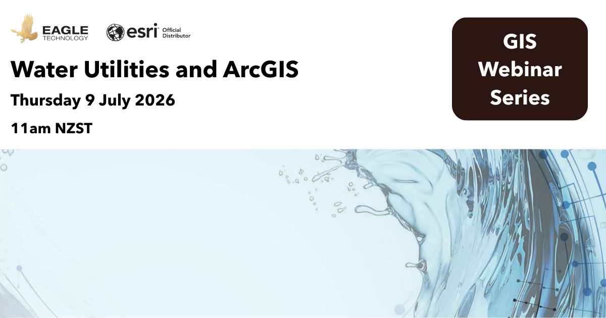
Join us for a focused webinar for water utility professionals exploring how ArcGIS is helping utilities better plan, operate, and manage water, wastewater, and stormwater networks.
Register for the webinar: bit.ly/4otLNLO
12
Learn how ArcGIS supports the full field data management workflow, from the office to the field and back again. This course covers best practices for configuring and deploying ArcGIS field apps for data collection.
Register here: bit.ly/3TW9rmw
17
One week to go to submit your presentation for NZEUC 2026.
NZEUC brings together the Esri user community to share practical GIS work from across Aotearoa.
Submit a 20-minute presentation or a 5-minute lightning talk.
Submissions close Friday 19 June.
bit.ly/4x1m01m
5
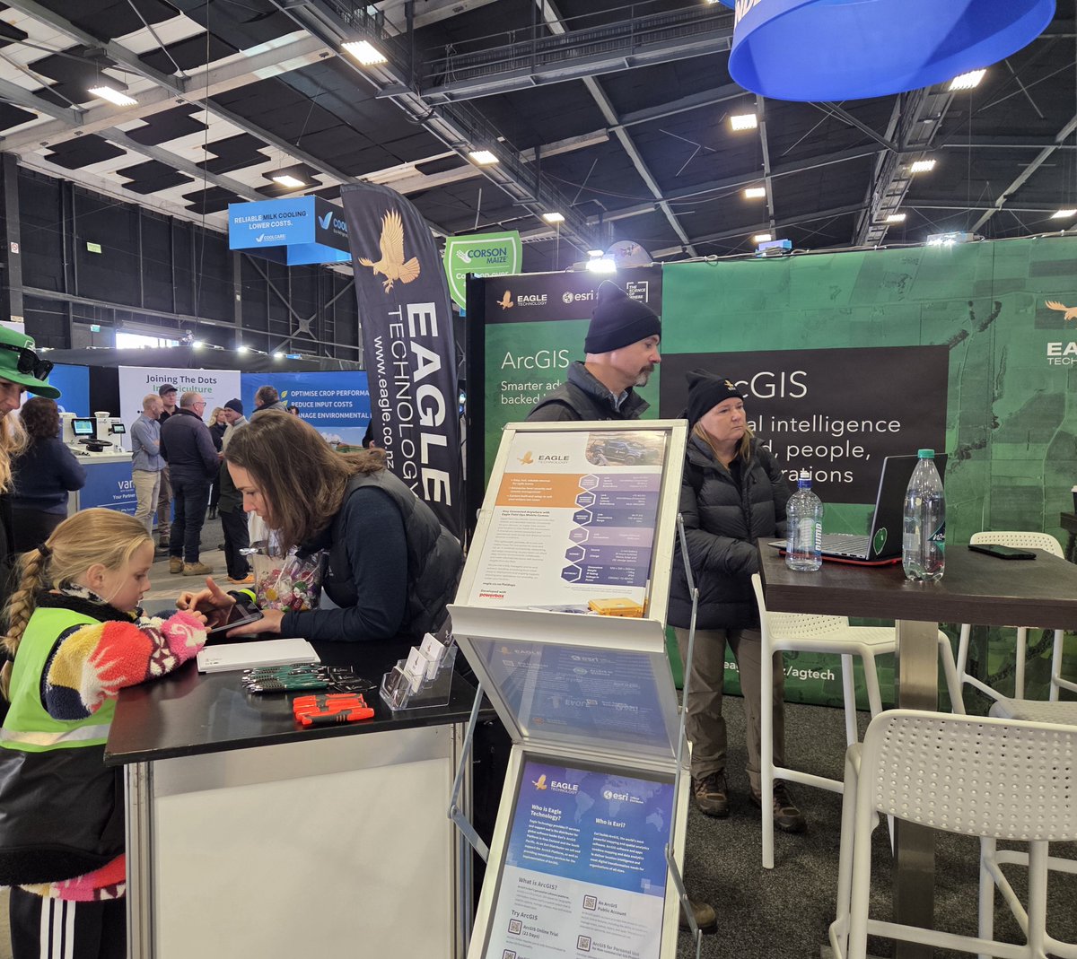
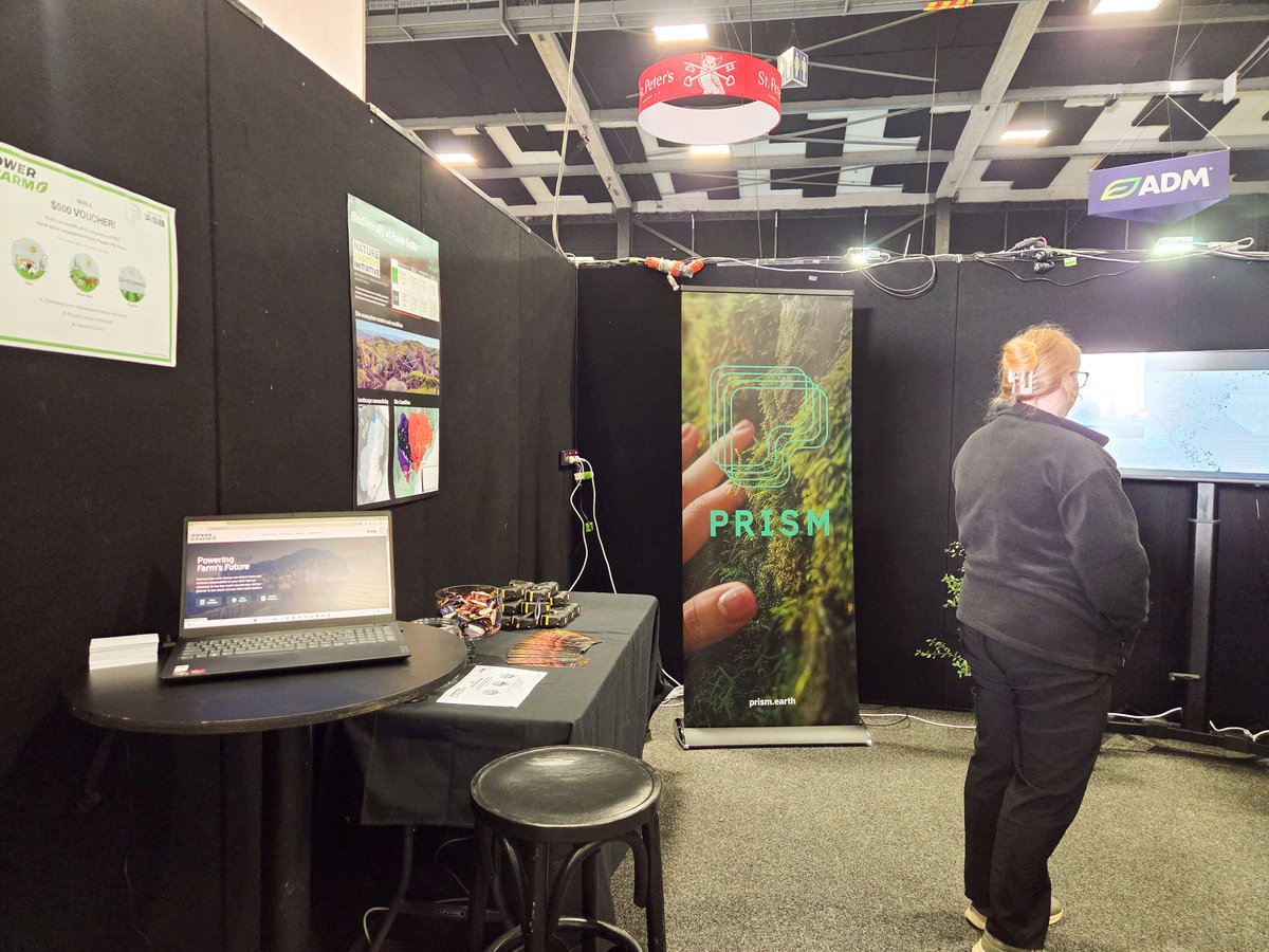
A positive first day at Fieldays®.
The Eagle Technology team is at Booth PD24, connecting with visitors, partners, and customers to discuss how ArcGIS supports decision-making across land, people, assets, and operations.
More information: bit.ly/3Vhun5p


31
Eagle Technology is proud to sponsor the Taituarā 2026 Excellence Awards.
These awards recognise the innovation, leadership, collaboration and community impact happening across local government in Aotearoa.
Learn more: bit.ly/49FNCyS
22
Reminder to register. This virtual course teaches you how to access the Python environment in ArcGIS Pro, script common data management tasks, and automate geoprocessing workflows.
Dates: 22-26 June (mornings only).
Register here: bit.ly/3bRpcVt
11
We’re looking forward to Fieldays tomorrow!
Visit us at Booth PD24 to connect with the team and explore how ArcGIS is supporting smarter decisions across agriculture, land management, and infrastructure.
More information: bit.ly/3Vhun5p
1
37
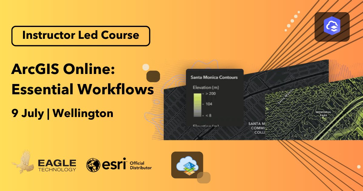
Learn how to discover, create, and share web maps, apps, and other content in ArcGIS Online to add geographic context and business insight to your projects. The concepts covered also apply to ArcGIS Enterprise portals.
Register via the link below.
bit.ly/4slC8HQ
11
New to ArcGIS Pro or looking to build your GIS skills?
This hands-on course will help you map, manage, analyse, and share data using foundational GIS knowledge.
Register now: bit.ly/2YF08Jv
23
The Call for Presentations for NZEUC 2026 is open.
Share your ArcGIS work, technical workflows and lessons learned with New Zealand’s Esri user community.
Submit a 20-minute presentation or 5-minute lightning talk by 19 June:
bit.ly/4x1m01m
8
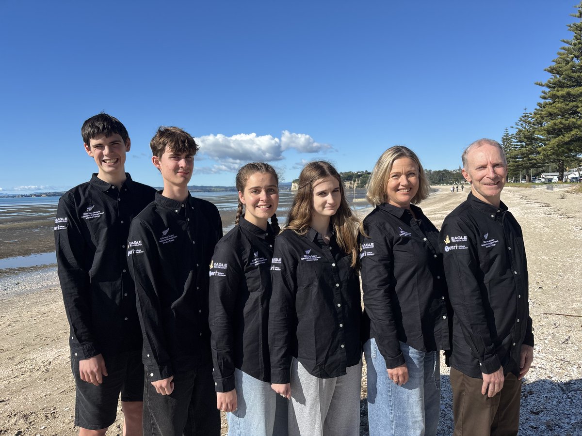
Eagle Technology is proud to support the NZ team heading to the 2026 International Geography Olympiad in Istanbul.
Best of luck to the students representing New Zealand this August.
Learn more: igeo2026.org/

12
Fieldays is a week away! Come meet our team and connect with us at booth number PD24. We are looking forward to seeing you all there!
Find out more about Fieldays: bit.ly/3Vhun5p
7
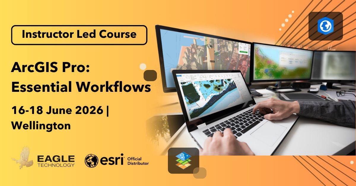
Sign up for our ArcGIS Pro: Essential Workflows course to build your foundational GIS skills and learn through hands-on exercises how to work more confidently and efficiently in ArcGIS Pro.
Register here: bit.ly/2YF08Jv
14
Check out the Working with Utility Networks in ArcGIS course and learn how to model, edit, and analyse utility networks to better manage assets and respond to outages.
Register now: bit.ly/40pRjmr
8
ArcGIS Reality for ArcGIS Pro (May 2026) adds improved 3D realism (Gaussian splats), automated ground control workflows, expanded satellite support and more!
bit.ly/3Q776px
16
Metadata is central to content discovery, understanding, and reuse. Esri introduced Dublin Core in ArcGIS Online and Enterprise to simplify it. ArcGIS Pro 3.7 extends this style, providing a consistent editor focused on key metadata elements.
bit.ly/4uBxaIt
22
ArcGIS Drone2Map 2026.1 adds faster processing, improved accuracy, rapid-mode outputs, better image calibration, expanded thermal support, cloud-optimized formats, and new sharing options (e.g., oriented imagery and immersive 3D workflows).
bit.ly/4fKRH8D
14
ArcGIS Pro 3.7 lets map frames override layer visibility, so you can show the same area with different highlighted info in each frame more easily, without needing separate maps. More below!
bit.ly/4tTXr3n
15
Interactive Contour in ArcGIS Pro 3.7 creates contour lines on click, connecting equal-value cells in a raster. It helps analyse features like slope, ridges, and valleys across surfaces such as elevation, bathymetry, or temperature.
bit.ly/3RKgaky
10