
loves @ayeletoz. Opinions are my own. Maybe my dog's
Joined April 2008
- Tweets 35,931
- Following 412
- Followers 773
- Likes 48,395
3,678 Photos and videos


Eran Belinsky retweeted

בצבא תמיד "מחדדים נהלים".
במשטרה הכול "ארוע נקודתי".
1
9
360

Jun 12
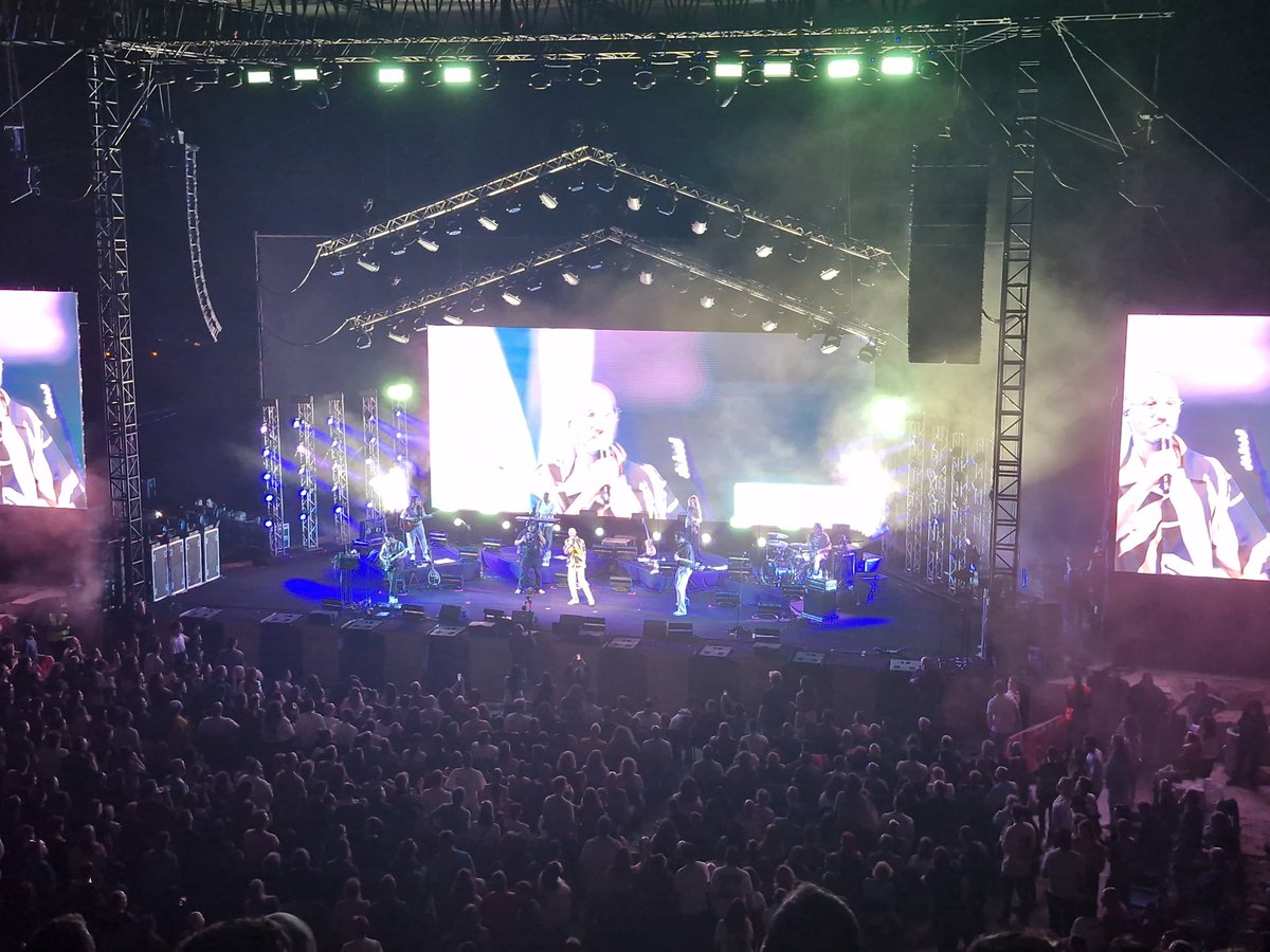
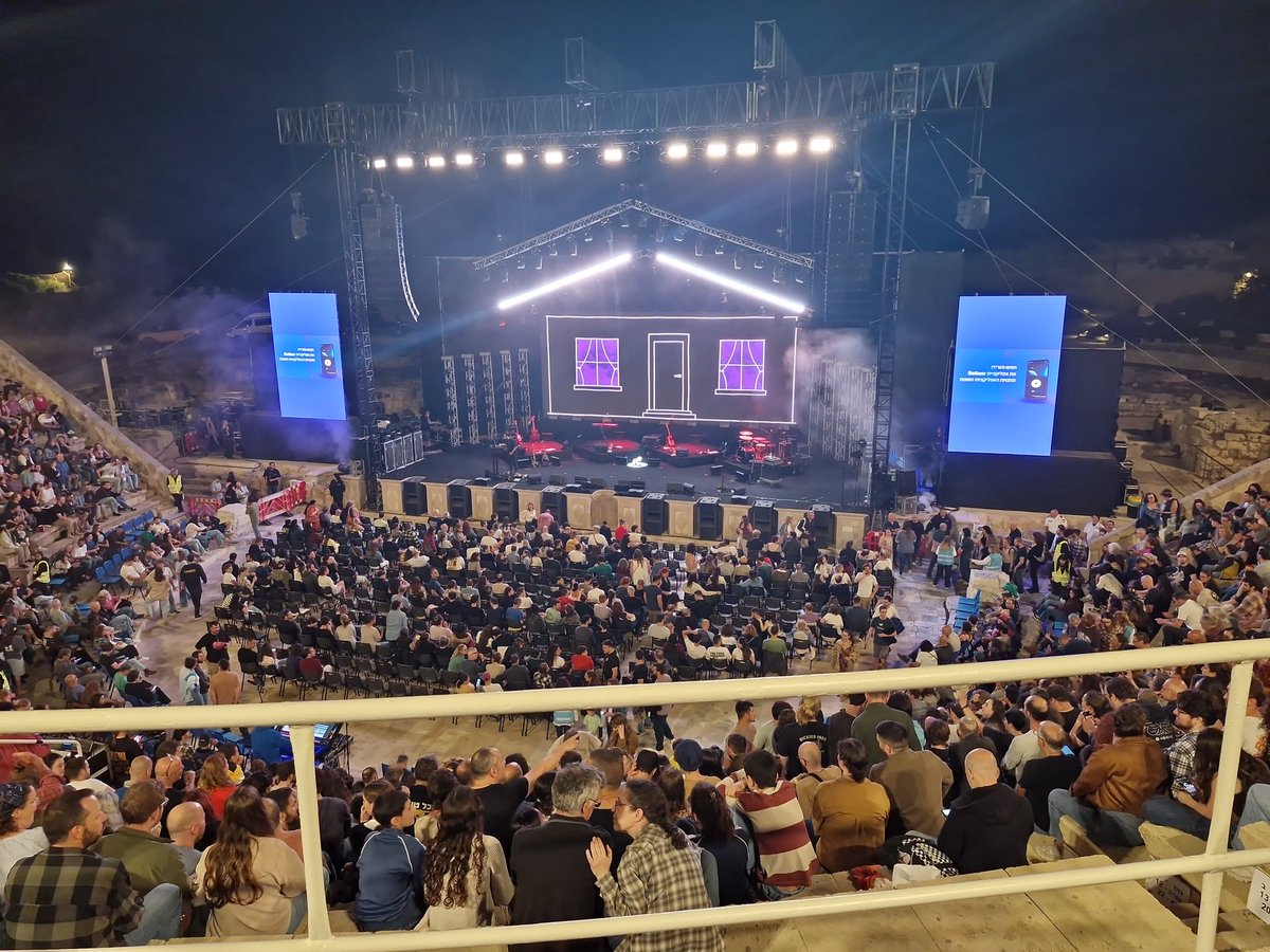
לקחנו את ירדן להופעת הקאברים של דיוויד בואי של "העכבישים מפלוטו" של @alterman הערב בגריי בתל אביב. מעבר לכל מיני תקלות טכניות ואישה שבאופן קצת מוזר ביקשה שינמיכו את העוצמה (בהופעת רוק?!) היה מדהים, כולל הופעות אורח של מיכל שפירא (לא הכרתי) וקובי פרחי מאורפנד לנד ששרו נפלא!
3
33
Jun 10
"רפורמת החשמל של השר אלי כהן"? הוא אפילו לא מופיע בתיאור בוויקיפדיה של ההיסטוריה של הרפורמה:
he.wikipedia.org/wiki/ה…
israelhayom.co.il/business/a…
1
25
Eran Belinsky retweeted

קואליציה שלמה יודעת שטלי גוטליב עברה עברה פלילית, פגעה בשירות הביטחון הכללי, בסוכנים שלנו ואנשי ונשות הביטחון.
אם לטלי היו קוראים טאלב היו תוך 4 שניות מגישים נגדה כתב אישום ומסירים את החסינות.
אבל אנחנו תקועים עם קואליציה של אלפקות. לא מפסיקים לירוק על כולנו.
90
150
1,249
8,569
Eran Belinsky retweeted

Jun 9
השופטים והציבור הכריעו: התמונה של הצלם יובל טינה בשם "מלאך בכחול", שבה רואים דג מנטה ענק (כנפתן ענק) במפרץ אילת, שוחה כמה מטרים מעל שחיין, נבחרה לתמונה הטובה ביותר בתחרות "ים ישראלי" שיזמה החברה להגנת הטבע

11
22
790
11,938
Eran Belinsky retweeted

Jun 9
במשך יותר משנתיים הגולש הזה פרסם נגדי כמה מההתבטאויות המטרידות והמבזות ביותר על רקע מיני שבהן נתקלנו ברשת. בעזרת חקירה מעמיקה הצלחנו לחשוף את כל פרטיו, אך כשהגשתי נגדו תביעה - האיש הכחיש מכל וכל שמדובר בו ודרש דחייה על הסף. בהחלטה תקדימית (ראו בשרשור) כב׳ השופט אביים ברקאי נעתר>>
152
234
2,963
100,191
Jun 8
ראיתם את האייקונים המעודכנים של פיקוד העורף? לא מתחרים עדיין בכרמל שאמה והסטיקרים שלו אבל יש שיפור, גם בצליל "תם הטקס"
1
37
Jun 7
ימחשמם
Jun 7

מה הביטו לשמיים עכשיו? מחר יש בחינת מתכונת לתלמידים שלי! לא לעשות בלאגן בבקשה.
1
2
62
Jun 7
מה הביטו לשמיים עכשיו? מחר יש בחינת מתכונת לתלמידים שלי! לא לעשות בלאגן בבקשה.


1
112
Eran Belinsky retweeted

Jun 7
In the 17th century, cucumbers were mostly called cowcumbers.
3
17
248
34,882
Eran Belinsky retweeted

אחד הדברים שאני אוהב ב״אומנות המלחמה״ הוא המעבר המהיר מ״הבור״ לשוק.
הפרק הראשון של הספר מתרחש בחצר המקדש, שם מבוצע התכנון האסטרטגי לקראת המלחמה. השליט ואנשי הצבא מנתחים את האויב, את השטח, את התנאים השונים. הטופ של הטופ של התכנון הצבאי.
ורגע אחרי סון טסו לוקח את הקורא לדון על… דבק. על עלויות המלחמה.
והנושאים כל-כך צמודים כי הדרך הבטוחה לאבדון היא לתכנן במקדש ולשכוח מה יקרה למחיר הדבר בשוק.

תקציב הביטחון הוא אירוע שיצא משליטה
2
1
113
9,886
Jun 7
התייעצתי עם ג'מיני לגבי הישימות של דטה סנטרים בחלל. אמ;לק - זה מאוד לא פשוט וכרגע כנראה אין ישימות מעשית.
g.co/gemini/share/f9c0aa7ffd…
52
Eran Belinsky retweeted
Jun 5
Website of the Day: This site plays a note every time someone edits a Wikipedia article. The larger the edit, the deeper the note. listen.hatnote.com/
2
48
281
33,547
Jun 4
מסתבר שלמדתי באוניברסיטת "תל אביב". האם למדתם באוניברסיטה "העברית"?
12
1
167
21,895
Jun 4
גם ה CIA טועים - לצמח הם קראו מעגן מיכאל
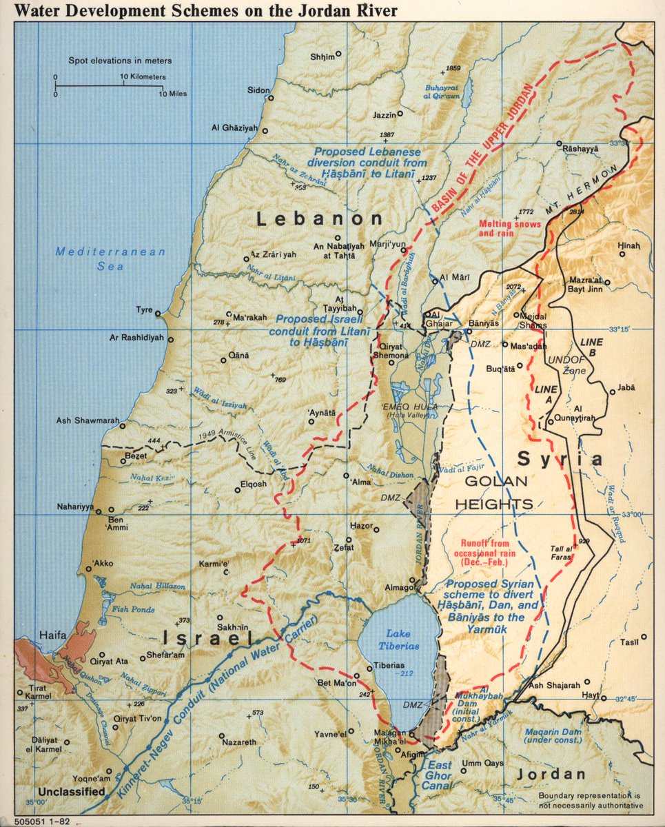
Jun 4

Declassified 1982 Jordan Water Development Map Created By The CIA
This 1982 CIA map of the Jordan River focuses on competing water development projects and regional control of water resources involving Israel, Lebanon, Syria, and Jordan.
Rather than emphasizing politics alone, the map shows how strategic access to rivers, tributaries, dams, and canals shaped regional tensions.
The map traces the upper Jordan basin, including the Hasbani, Banias, and Dan rivers, which are critical headwaters feeding into the Jordan River and the Sea of Galilee (Lake Tiberias).
It highlights proposed Israeli, Lebanese, and Syrian diversion projects, along with existing infrastructure such as Israel’s National Water Carrier and Jordan’s East Ghor Canal.
The red dashed outline marks the basin of the upper Jordan watershed, emphasizing how snowmelt from Mount Hermon and seasonal rainfall supplied water to multiple states.
The map also shows the disputed and militarized geography of the region, including the Golan Heights, demilitarized zones, cease-fire lines, and UN-monitored areas.
Produced in 1982, the map reflects a period when water security was considered a major geopolitical issue in the Middle East.
Control of water resources had already contributed to tensions before the Six-Day War, and by the early 1980s the issue remained deeply connected to military strategy, agriculture, settlement policy, and regional diplomacy.
Unlike many Cold War CIA maps focused purely on military forces, this one demonstrates the Agency’s growing interest in environmental and infrastructure intelligence.
Water availability was recognized as a strategic resource capable of influencing economic development, population growth, and political stability.
The map’s detailed hydrological and topographic presentation also shows how CIA cartographers combined physical geography with political boundaries to explain complex regional disputes in a clear visual format for policymakers and analysts.
More Declassified 1980s CIA Maps: brilliantmaps.com/cia-maps-1…
125
Eran Belinsky retweeted

אל תגידו ״מה את קופצת, זה בשכונה חרדית״.
1. להקצות מדרכות על פי מין זה לא חוקי ולא מוסרי, דכאני (ומטורלל). לא משנה איפה.
2. מפרידי המדרכות הם הרפורמים האמיתיים. יהודים לא חיו כך אף פעם. לא בתנ״ך, לא בא״י או בבבל, לא במרקש ולא בשטעטעל.
3. ריד מיי ליפס: זה לא יישאר בשכונה החרדית.

3
11
212
3,184
Jun 1
האם העובדה ש קבלנים נתקעים עם מלאי הולך גודל של דירות שלא נמכרות תוביל אותם בסופו של דבר להיכנס לשוק השכירות ולהתחיל להשכיר את הדירות שהם לא מצליחים למכור?
themarker.com/realestate/202…
1
240
May 31


59