
European Space Agency's Climate Office, often tweeting about ESA's Climate Change Initiative programme
- Tweets 3,986
- Following 452
- Followers 12,182
- Likes 2,241


ALT Global Above-Ground Biomass estimates for 2024, derived from the the CCI Biomass v7 product
ALT Promotional ESA webinar graphic with a colored heatmap map of Europe. Text reads: “WEBINAR – SATELLITE RETRIEVALS OF LAND SURFACE TEMPERATURE & RELATED APPLICATIONS.” Date/time: “17/06/2026 | 16:00 CEST.” Button: “REGISTER NOW.” ESA (European Space Agency) logo at top left.
ALT Surface soil moisture and normalised indices per date of the product time series across the Occitanie and Tunisian study sites.
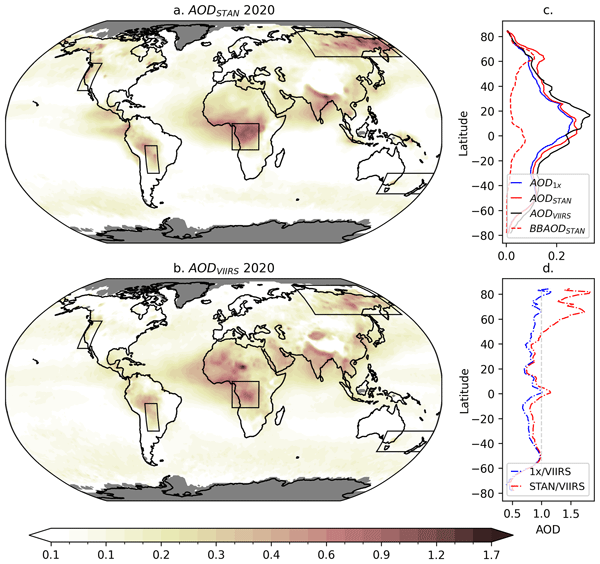
ALT Multi-panel scientific figure comparing global wildfire smoke aerosol optical depth (AOD) in 2020: two world maps show modeled AOD (AOD_STAN) and satellite-observed AOD (AOD_VIIRS) with darker shading indicating higher smoke aerosol, plus side plots showing AOD versus latitude and model-to-satellite ratios; boxed regions highlight key fire areas such as the western U.S., South America, and central Africa.
ALT Promo graphic for the UK Earth Observation Conference 2026, 15–17 September at the University of Warwick, with a stylised glowing Earth.
ALT Six-panel transect maps of CCI VP CRDP-2 FAPAR for 2004, 2012, and 2019: whole transect (top) and best-quality pixels (bottom), with grey areas for missing or low-quality data
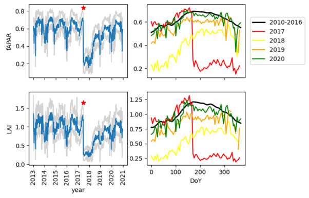
ALT Four-panel plot for a Portugal forest fire: fAPAR and LAI time series show a sharp 2017 drop at the red star with gray uncertainty, plus seasonal cycles for 2017 and following years
ALT ESA quote card with portrait of Christiaan van der Tol and text about combining measurements from multiple sensors, with validation using ground truth data
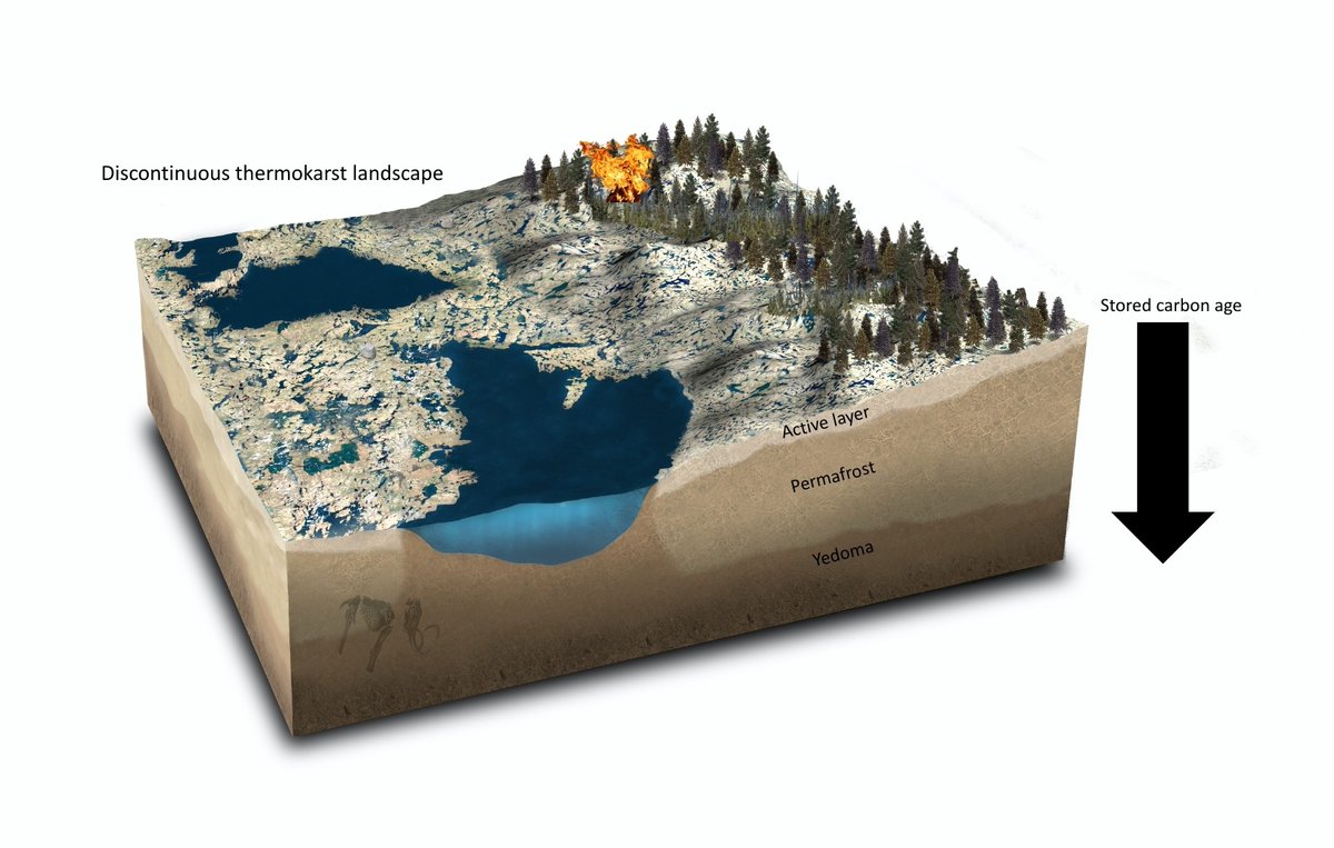
ALT Visual showing a model of different permafrost layers and stored carbon age
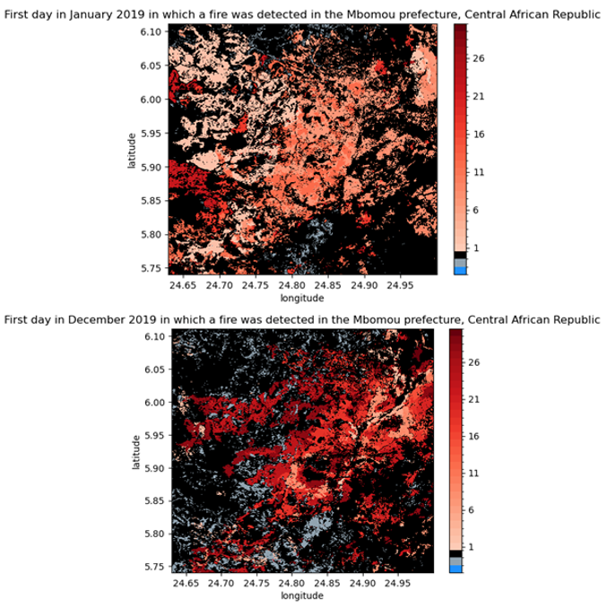
ALT Fire maps (January 2019 & December 2019) from Sentinel‑2 FIRE dataset for M'bomou, Central African Republic: red shades show day of month fires occurred (brighter = earlier), black = unburnt, grey = unobserved.
ALT ESA webinar poster with leafy green forest canopy under blue sky, text: “Satellite retrievals of vegetation parameters” and date 20/05/2026