
3 Feb 2023
2
142
28 Jan 2023
#AutomaticTillageControl Die variable Tiefensteuerung von @geoprospectors gibt's Ratasich Landtechnik in 7304 Großwarasdorf bredal.at/ #Bodenbearbeitung #knowyoursoil
1
213
5 Oct 2022
#TosoilMapper más #AutomaticTillageControl para mejor eficiencia en el campo. Control total de las operaciones de cultivo del suelo. #knowyoursoil con @geoprospectors
1

5 Oct 2022
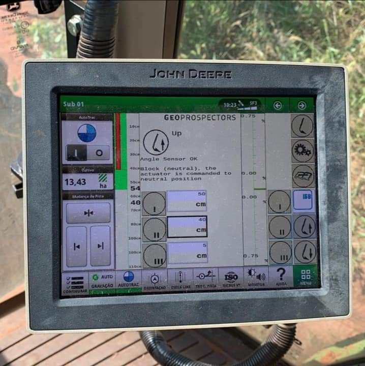
Een taakkaart gemaakt om plaats specifiek te woelen via #Dacom #AutomaticTillageControl dieper waar de structuur vaster is, ondieper waar de structuur losser is. Brandstof besparing van 6.2 liter per hectare.@DacomNederland @ValtraGlobal #cloudfarming #precisielandbouw #isobus
4
2
18
20 Apr 2022
#ATC #AutomaticTillageControl for #VariableDepth applications from @geoprospectors operates on all #ISOBUS compatible terminals. To #knowyoursoil ask office@geoprospectors.com
1
2

17 Nov 2021
Next stop on our Demo Tour: #LoginEKO in Serbia. Our Team arrived yesterday and started right away with the demo of the #topsoilmapper and the #automatictillagecontrol #ATC #knowyoursoil


1
4
19 Jul 2021
The grain has been harvested 🌾🚜
Now is the best time to analyse your fields and know your soil. #TopsoilMapper #AutomaticTillageControl #ATC #knowyoursoil #harvestime

1
3
12 May 2021
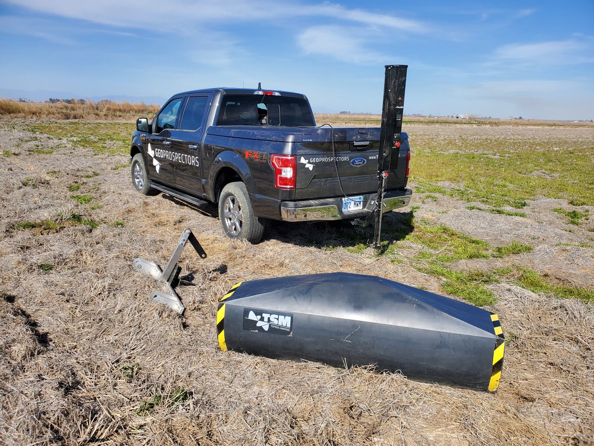
The #TopsoilMapper in conjunction with the #AutomaticTillageControl. Get ready to treat your soils as they deserve it with technology form @geoprospectors GmbH #knowyoursoil
4
30 Apr 2021
Create #TillagRX maps with the @geoprospectors #TSM_Cloud and pilot your cultivator with the #AutomaticTillageControl kit via ISOBUS. #knowyoursoil office@geoprospectors.com
29 Apr 2021
Buscando compactación con un #TopsoilMapper y luego confirmación de su importancia con un #CTS1000. Acá data maps exportadas en @farm_qa Finalmente un sistema #AutomaticTillageControl permite la cultivacion variable dolo en las zonas que lo necesitan.
29 Apr 2021

#topsoilmapper #texturezones directing sampling for soil compaction. We know there is compaction here and the #CTS1000 confirms the #topsoilmapper data. Next step is to make it actionable with Automatic Tillage Control from @geoprospectors
2
23 Apr 2021
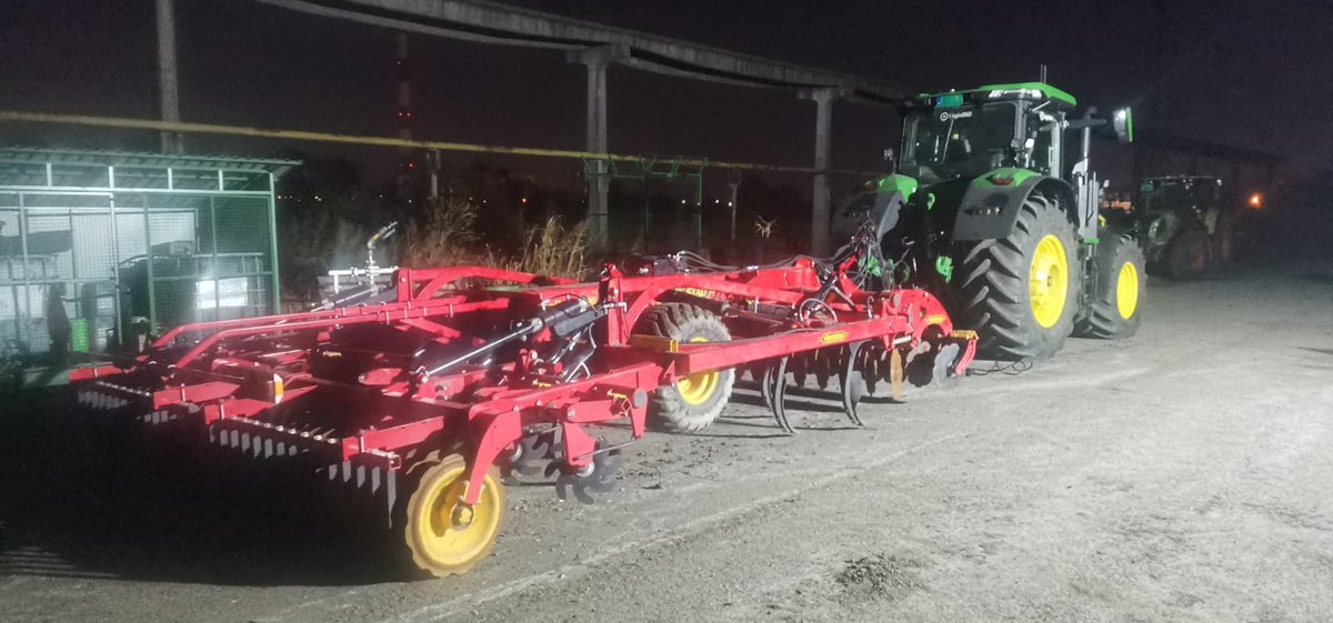
Ein #AutomaticTillageControl Kit von @geoprospectors auf einem #LemkenKarat, um bodenstrukturabhängig variable Tiefensteuerung zu ermöglichen.
1
26 Mar 2021
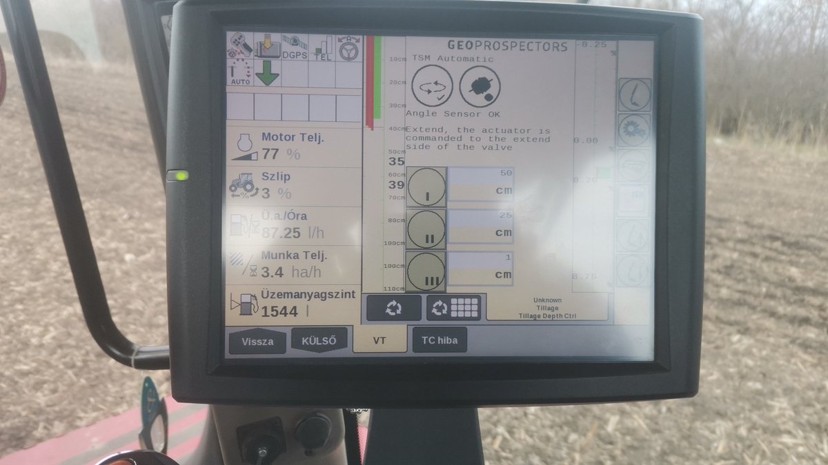
AutomaticTillageControl through the ISOBUS with @geoprospectors #smartAG technology. office@geoprospectors when you need a real time variable tillage solution.
2
26 Mar 2021
Real time tillage depth setting with the #TopsoilMapper and an #AutomaticTillageControl kit from @geoprospectors #knowyoursoil and get rid of compaction
2
23 Mar 2021
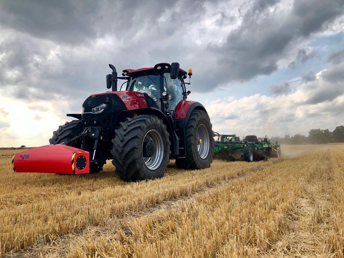
#AutomaticTillageControl on a @Case_IH AFS700 ISOBUS terminal. Variable rate tillage with technology from @geoprospectors
3

22 Mar 2021
22 Mar 2021

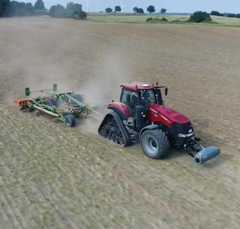
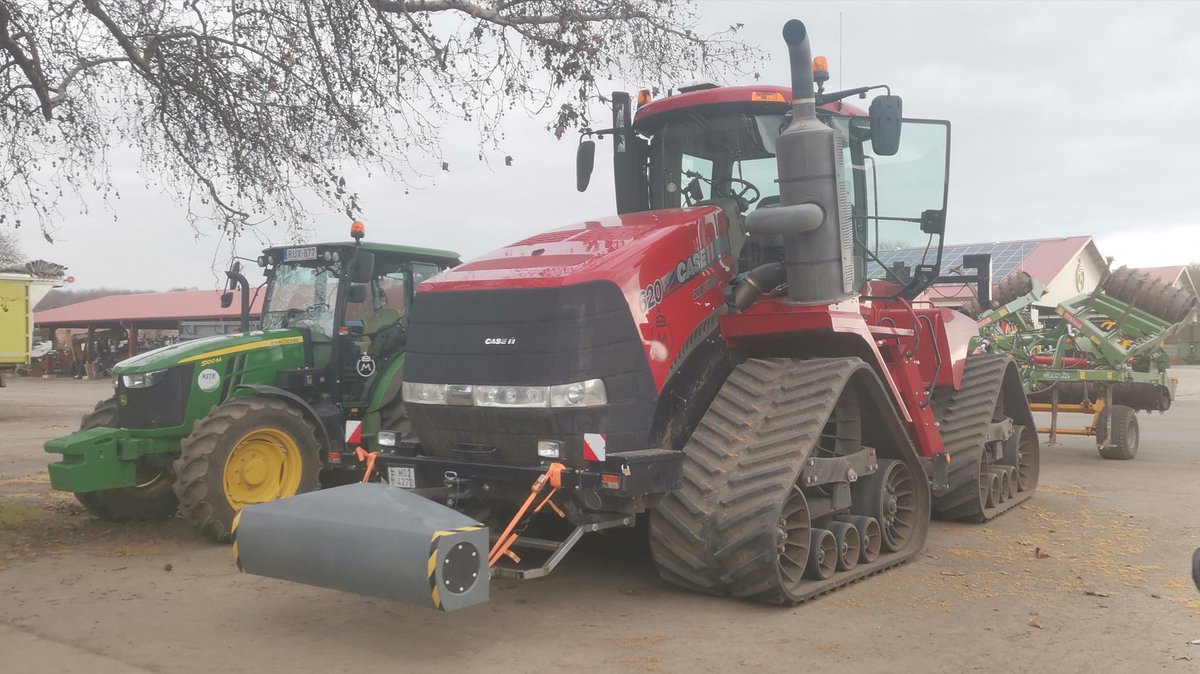
Ready to go for some #AutomaticTillageControl with the @geoprospectors #TopsoilMapper on a @Case_IH #QuadTrac in Hungary.
2
22 Mar 2021
Ready to go for some #AutomaticTillageControl with the @geoprospectors #TopsoilMapper on a @Case_IH #QuadTrac in Hungary.
1
8
18 Mar 2021
Generate your Tillage Rx and then make it actionable! #variabledepthtillage #knowyoursoil #automatictillagecontrol


1
3
5 Feb 2021
Joint use of #TopsoilMapper plus a CTS1000 to get a clear picture of #soilcompaction situation in a field. From there you may generate #variablerate tillage maps. #AutomaticTillageControl @geoprospectors @AmityTechnology office@geoprospectors.com
18 Jan 2021
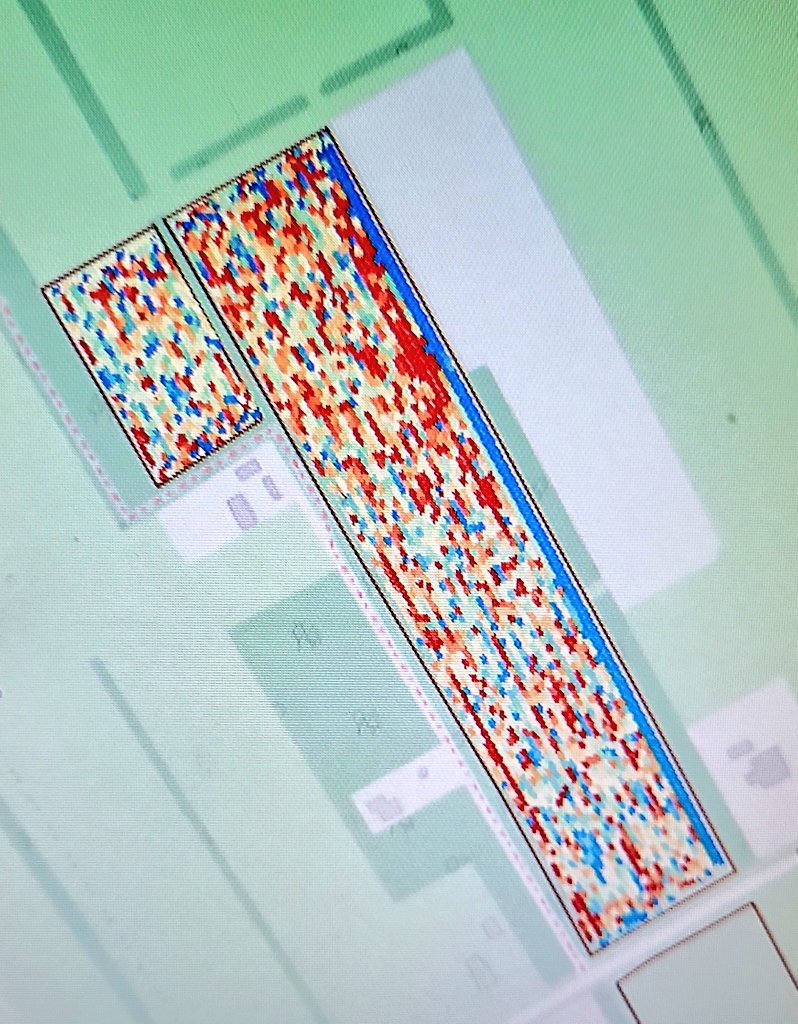
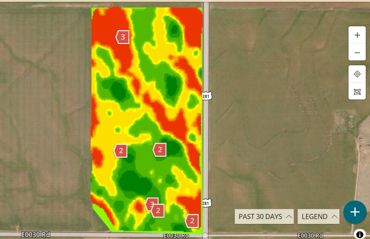
This soybean field was mapped with the Topsoil Mapper from @geoprospectors and a Depth to Interface map was generated. The thickness of the compacted layer was found using the CTS1000 from @farm_qa by @benjaminbmunson With that info we generated a Tillage Rx.

ALT Depth to Interface
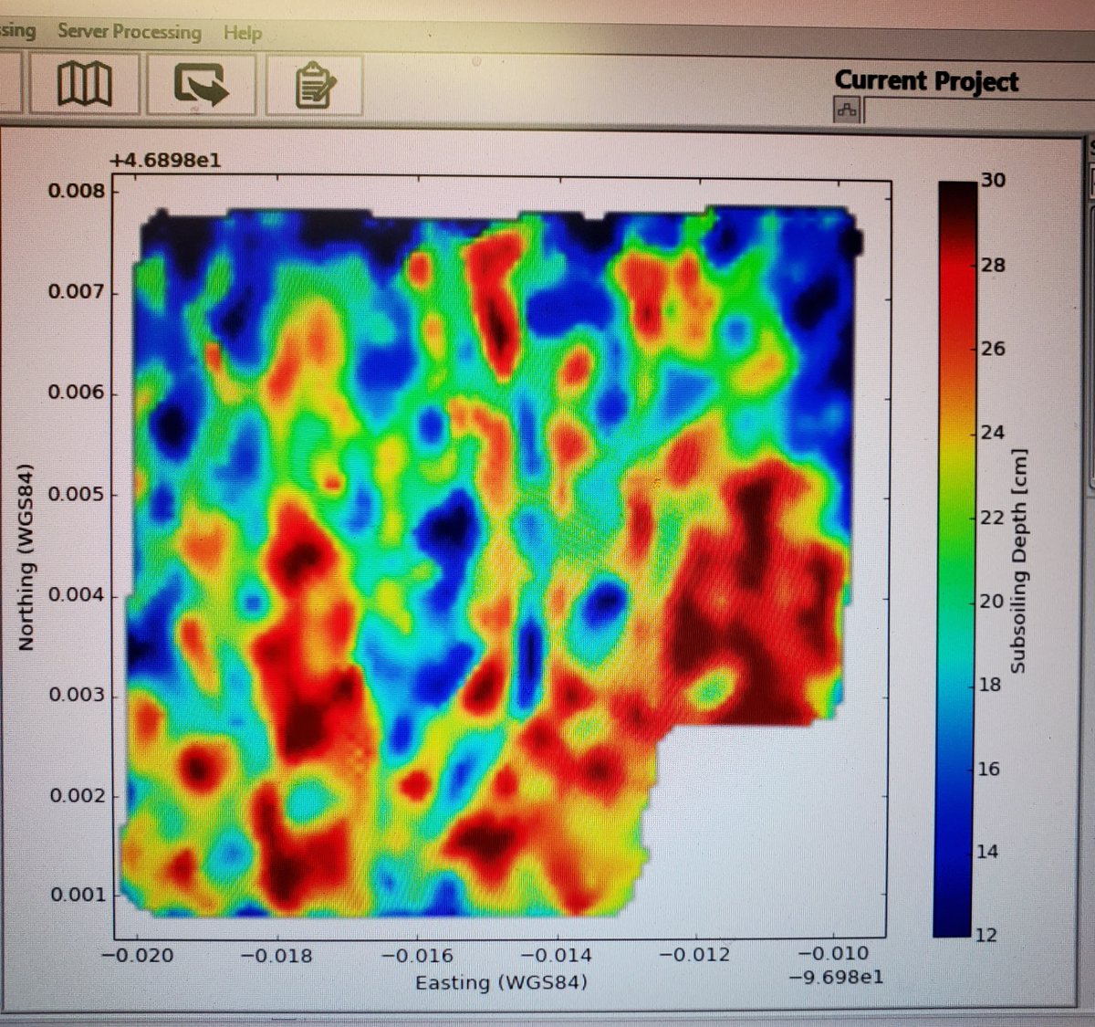
ALT Tillage Rx
1
21 Jan 2021
Trace compaction and cultivate your soil with a complete solution from Geoprospectors GmbH. #TopsoilMapper for better understanding of the soil structures. #AutomaticTillageControl for variable depth tillage along with documentation of the job done. office@geoprospectors.com
1
20 Jan 2021
Cuando tienes que lidiar con la #compactación del suelo, consulte a @Geoprospectors. Comprensión de las estructuras del suelo con topsoil-mapper.com #VRTillage #AutomaticTillageControl
2