
May 23
Hello Sweetie 🍁
#smokefleet needs a 🇨🇦 chapter..The EH Team?
#coldsmoke? #northernsmoke?
Ps..we're mutuals on my main
1
5
70
May 23
Hola Muchacho 🍁
The Dr's here representin the Crazy Canucks
#coldsmoke #smokenorth
Just spitballin some #'s
The EH?Team (tm)
Need a smokin ride meme

1
3
26

Feb 27
1
1
153

Feb 17
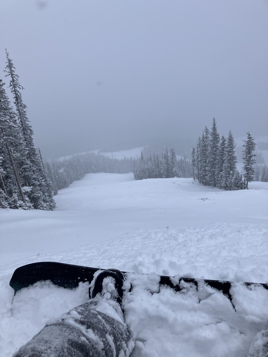
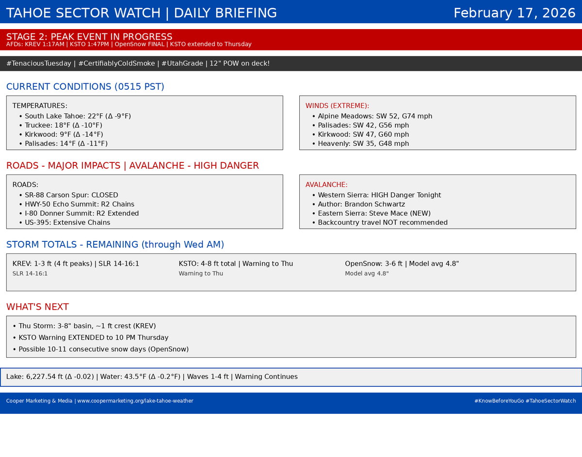
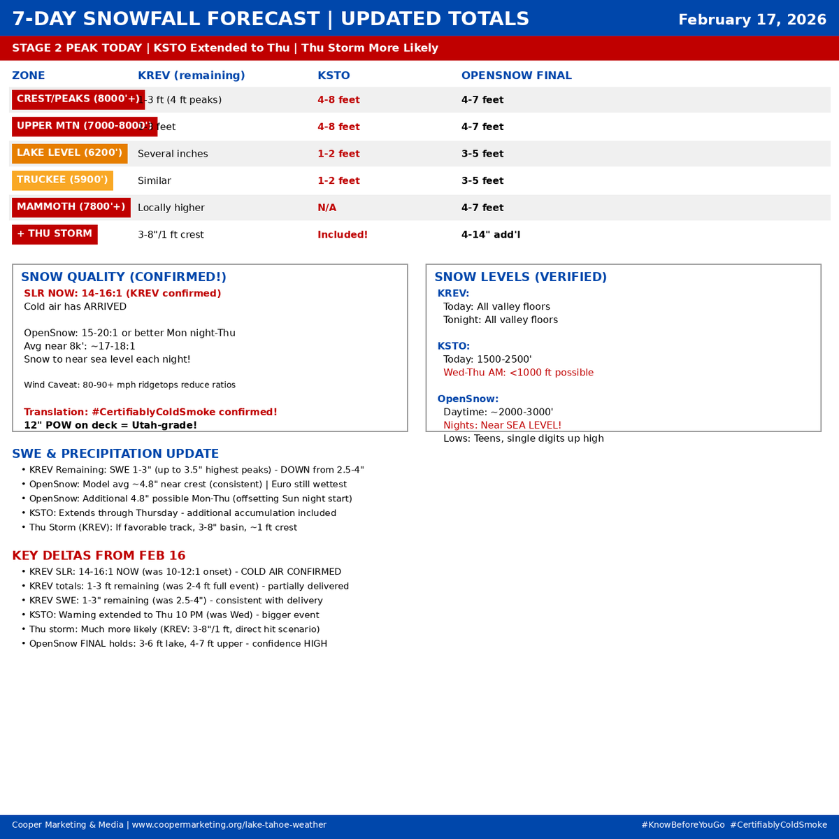
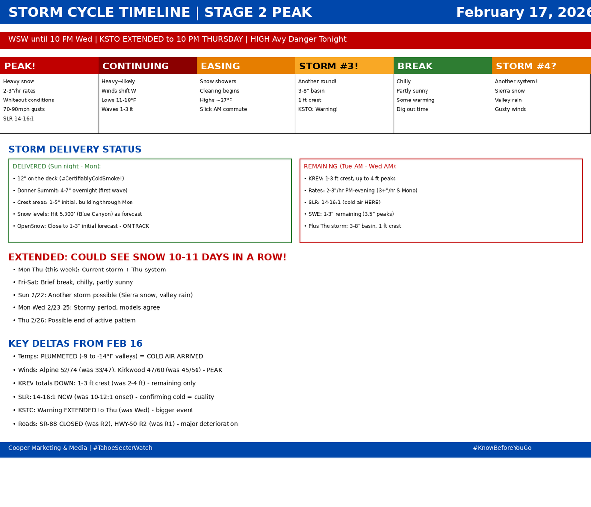
¡Buenos días, my friends
Cup'O'Joe in hand, #StokeLevelSOLID and rising on this #TenaciousTuesday. Pre-dawn, we have 12" of fresh on the deck here at the #HippieHaus. This is #CertifiablyColdSmoke—that #NoKaOi Utah-grade powder we've been waiting for.
But make no mistake: Stage 2 is the hammer, and it is just getting started.
The Peak Surge (8 AM – 10 PM Today)
The most impactful window of this storm is hitting now. We are looking at:
• Intensity: Snow rates of 2–3" per hour this afternoon.
• Winds: Sustained at 45–65 mph with ridgetop gusts screaming at 100 mph.
• Quality: Temperatures have plummeted (-13°F on the ridgetops; 9°F at Kirkwood). This cold air is driving ratios toward 20:1—pure #ColdSmoke.
Mtn Ops & The Road "Junk Show"
Every major Sierra route is under chain requirements. SR-88 Carson Spur is CLOSED due to snow. I-80 and Hwy 50 are a gauntlet of chain controls and whiteouts.
Your Mtn Teams and Patrol are out there doing the heavy lifting this morning. Have patience with the avy-mitigation holds and #NO-Uphill transit. These crews are the backbone—give them the space to work so we can get to the goods.
Avalanche Watch: HIGH DANGER
The danger is rising quickly. Natural and human-triggered cycles are increasingly likely as we surpass the 6" loading threshold. Avoid avalanche terrain. The danger is real, and it stays high through tomorrow. #KnowBeforeYouGo
The 10-Day Streak?
The "break" on Wednesday is short-lived. Storm #3 is already tracking for Thursday (another foot at the crest possible), and signals are point toward Storm #4 on Sunday. We could be looking at 10–11 consecutive days of snow.
"Every day, think as you wake up, today I am fortunate to be alive, I have a precious human life, I am not going to waste it..." — Dalai Lama XIV
Stay safe, be kind, and keep the fire in your bellies.
Tahoe Sector Watch: 👉 bit.ly/LakeTahoeWeather
Stay'n Thirsty for POW
Coop
1
3
759
¡Buenos días my friends,
Cup'O'Joe in hand, #StokeLevel back to 11 and back on the Weather desk, as chill to the morning air, light wind, with a few stars poking about. Today, there is a 20% chance of snow before 1600. Cloudy through mid-morning, then gradual clearing, with a high near 36º at lake level. Winds SW 5/15mph. Tonight, Snow likely, mainly between 1900 and 0400. Increasing clouds, with a low around 14º. Breezy, with a southwest 15/20mph, gusts around 30mph. Chance of precipitation is 60%. Possible lake-level snow accumulation of 1/2" possible.
The Sit-Rep: We have a fast-moving, moisture-starved system arriving late today into Thursday morning.
The "Haves vs. Have-nots": NWS Reno warns of a "banded snowfall scenario" where narrow bands could drop 1 inch per hour rates for a brief period overnight.
The Totals: High peaks (Western Tahoe Basin) could see up to 4 inches. Donner Pass has a 35-40% chance of hitting 3 inches.
The Winds: A 110kt jet stream is moving overhead. Expect westerly gusts of 70 mph tonight over Tahoe peaks.
Be aware in the BC: No Kooks, Karens, Jimmies, Nancies, or Jerries. Check SAC before, have your gear (AND know how to use it), and make a plan!
We are in a quick-hit cycle. Today offers a window of calm before the wind ramps up and the "banded" snow moves in tonight. It won't be deep, but 1-4" of #MaNatural sets the stage for a #ColdSmoke #TheologianThursday #FreshCoat!
Tahoe Sector Weather: bit.ly/LakeTahoeWeather
"Every day, think as you wake up, today I am fortunate to be alive, I have a precious human life, I am not going to waste it… I am going to benefit others as much as I can."
― The Dalai Lama
Stay'nThirsty for POW
Coop | RS#69
1
5
364


23 Dec 2025
Clocked in. Did one stretch. Logged off. 💤☀️
Created by NightCafe artist u/ColdSmoke | “The Nap Master”
1
5
446

22 Dec 2025
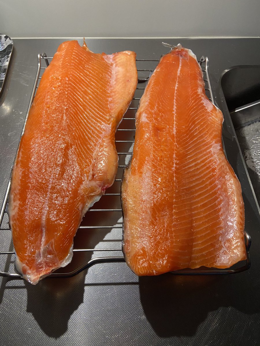
Olemme joululomalla. Tänään meni lohet kylmäsavuun. Rauhallista joulua. @saunahermanni @WeberGrills #coldsmoke #salmon #firewalkwithme


2
52

22 Dec 2025
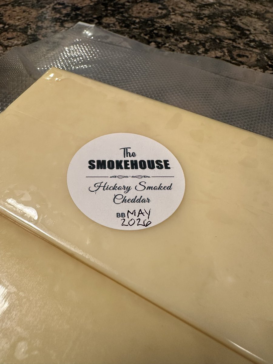
It’s that time of year again…extra old hickory smoked cheddar aging to perfection.
#smokedcheese #coldsmoke #smoker #backyardbbq
2
3
115

4 Dec 2025
Probably pairs well with a coldsmoke
4 Dec 2025

Anybody traveling to MT that wants to take the pudding shots I have from last be week with to try to and raise a few more $$ for Chase HMU.
2
10
2,197

16 Nov 2025
Don’t leave without a Mo Club burger, pairs well with a Coldsmoke scotch ale from Kettlehouse brewing
5
269

27 Oct 2025
Ohhh noooooo, my rooms mini fridge fits a full 8 pack of Coldsmoke.....
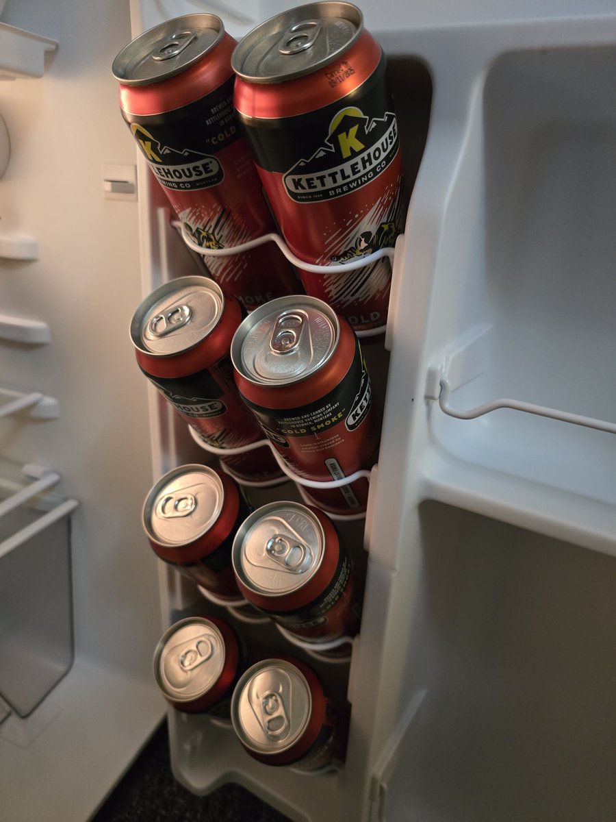
3
22
425

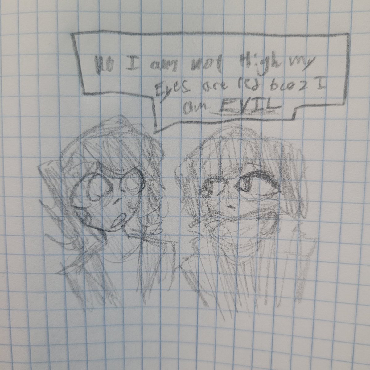
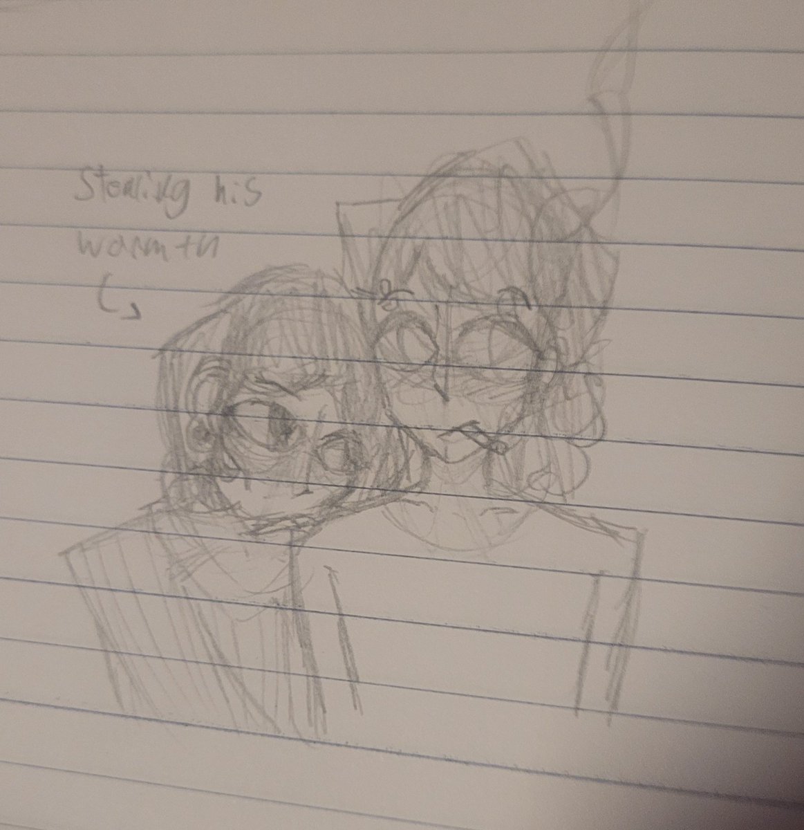
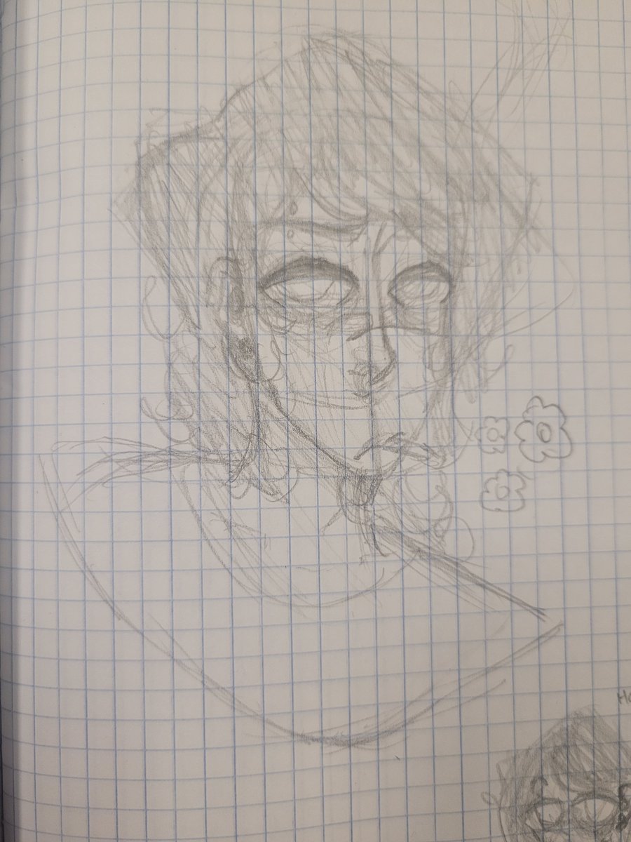
idk coldsmoke doodles and leviathan
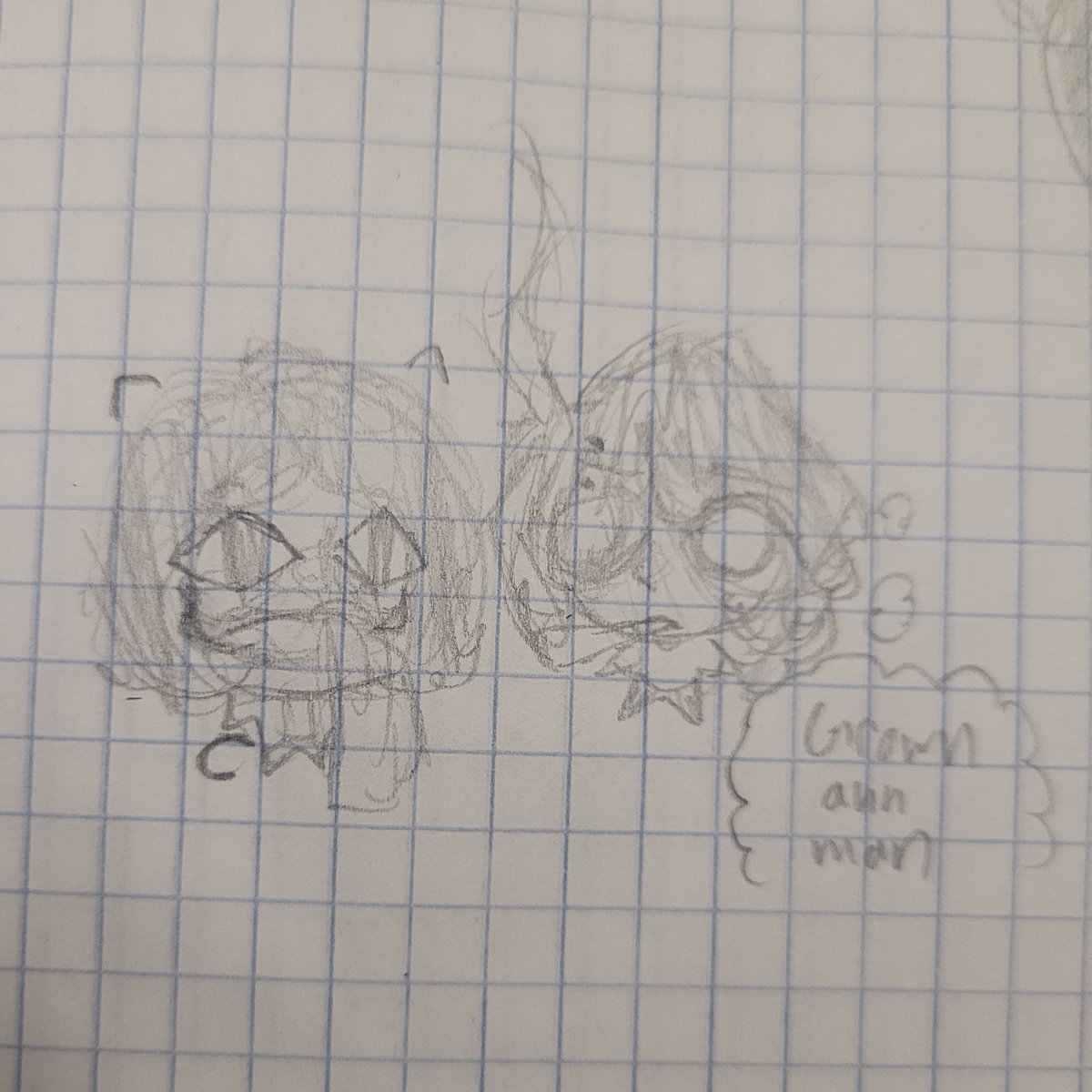


1
22

9 Oct 2025
Not verified so can’t dm but happy to chat - mark at coldsmoke dot co
2
226

8 Oct 2025
🚨 Doctor 420 Alert 🚨
Just when I thought my lungs had seen it all, along comes a frosty little miracle from @FreezePipe.
The Spiral Coil Pipe hits smoother than Barry White in silk pajamas, cold smoke, zero choke, and packaging so good I thought I’d accidentally ordered luxury glassware for aliens.
Freeze Pipe gets it. Built-in glycerin coil, removable bowl, smooth as hell.
No personal code (yet), but use FALL15 for 15% off while your lungs still work. (Limited Time)
🎥 Watch the full review, the Doctor is IN, and the prescription is pure ice.
#FunPotGrow #GetScreened #FuckCancer #Doctor420Approved #TheGreenScene #FreezePipe #ColdSmoke
2
2
4
418

30 Jun 2025
no Billings Gazette in the Billings airport shop and no Summer Honey at the Billings airport bar…a Coldsmoke was $9……what happened to the Magic City
1
8
212