
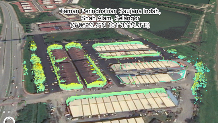
Apr 6
🛰📷 En esta nueva entrada mostramos cómo crear un modelo 3D utilizando imágenes aéreas con 𝘉𝘦𝘯𝘵𝘭𝘦𝘺 𝘊𝘰𝘯𝘵𝘦𝘹𝘵𝘊𝘢𝘱𝘵𝘶𝘳𝘦.
Leer más: bit.ly/3D_Bentley-ContextCap…
#3D #MDT #fotogrametria #dron #bentley
1
3
89
Apr 6
🛰📷 En esta nueva entrada mostramos cómo crear un modelo 3D utilizando imágenes aéreas con 𝘉𝘦𝘯𝘵𝘭𝘦𝘺 𝘊𝘰𝘯𝘵𝘦𝘹𝘵𝘊𝘢𝘱𝘵𝘶𝘳𝘦.
Leer más: bit.ly/3D_Bentley-ContextCap…
#3D #MDT #fotogrametria #dron #bentley
3
45

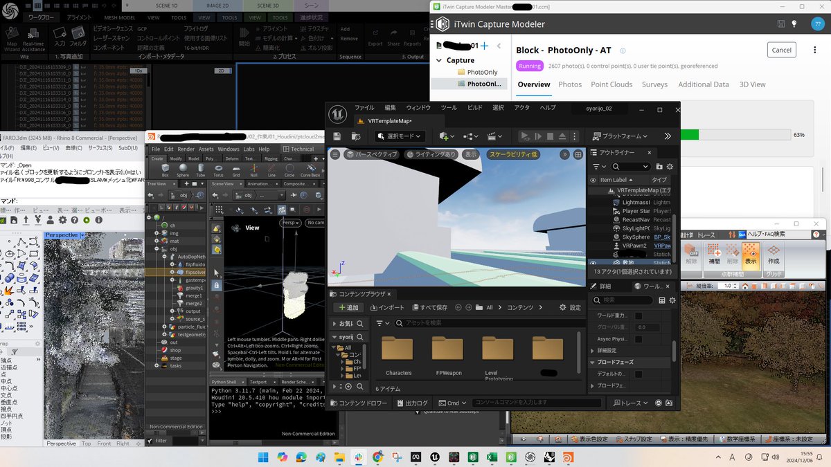
6 Dec 2024
スレッドリッパーを積んだメモリ500GBのお化けPCを可愛がるために、UE5/Houdini/ContextCapture/RealityCapture/トレポン/ライノで、同時に処理をさせてみる。VR/点群/シミュレーション/フォトグラの四暗刻単騎ドラ100
3
435

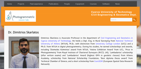
27 May 2024
📚 Prof. Dimitrios Skarlatos re-used ENGINEER #drone imagery from the Tombs of the Kings for the #Photogrammetry II module at #CUT for the needs of #Geomatics BSc! ✈️🗺️
Students will process #RTKdrone photos to create #Orthophotos and #DSMs using #ContextCapture. 🖥️✨
1
2
41

26 May 2024
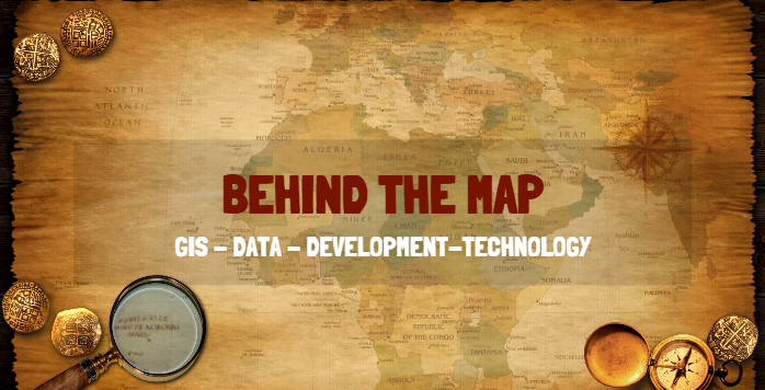
GIS Blurb: Behind the Map
Behind every Map is a slew of technologies. This is true for the many diverse fields. For instance, let's go down the GIS rabbit hole.
In GIS, you will find:
1⃣ Desktop Applications: There are all types of desktop applications that GIS professionals might use. For instance, Survey 123, ArcGIS Pro, QGIS, GRASS, Excel, Google Sheets, Libre Office Calc, RStudio, Python Notebooks, Visual Studio Code, Visual Studio IDE, PostgreSQL Admin 3, MSSQL Studio, Blender, Adobe Products, Pix4D, Bentley ContextCapture, and ESRI Site Scan for ArcGIS just to name a few.
2⃣ Databases: In the GIS field, there are all types of databases. There are File databases, SQL Databases / Geo-Databases, Network Database and NoSQL Databases such as Graph Database just to name a few.
3⃣ Servers: Yep, there are all kinds of servers in GIS and this is especially true in large government institutions or private Entities. You will find GIS Servers such as ArcGIS Server, Geo-Server and QGIS Server. These servers are used for sharing data such as vector and raster data and for different types of geospatial processing such as geocoding. Not only GIS Servers and Tile Servers but entities such as ESRI, offers enterprise products and under their Portal offering, ESRI offer many other types of servers such as Portal for ArcGIS, ArcGIS Data Store and ArcGIS GeoEvent Server, which enables real-time event-based data streams to be integrated as data sources in your enterprise GIS setup. But wait, there is a lot more such as Web Servers (IIS, Apache, Nginx), DNS Server and more.
4⃣ Systems: Not only are there a lot of Desktop Applications and Server Software, but there are also physical systems that are behind the Map. For instance, take your Desktop at work. Depending on what you do in the Data / GIS arena, you might be running with a ASUS TUF RTX 4090 OC Graphics Card (PCIe 4.0, 24GB 384Bit GDRR6X, HDMI 2.1a, DP 1.4a, ARGB), w/SPS x Dino DP to HDMI Converter with a AMD Ryzen Threadripper 3970X 32-Core, 64-Thread Unlocked Desktop Processor or better. On top of that, you have to think about drives and volatile memory (DDR5 / RAM) that goes into these systems and lets not forget about the motherboard and power supply.
5⃣ Networks: That is right, networks. If it was not for networks, all those servers would not be possible. Networks are made up by many different devices such as modems, routers and switches. A lot goes into networking and creating different topologies and securing network infrastructures.
On that note, it's evident that there's a vast landscape Behind the Map. GIS encompasses a multitude of facets, offering diverse career opportunities for individuals to explore and specialize in various areas.
#gis #gisdata #IT #gisanalyst #analyst #informationtechnology #technologies #tech #dev #gisdev #python #QGIS #ArcGIS #GRASS #GeoServer #Networks #Servers #Database #MSSQL #PostgreSQL
1
4
13
740

13 Mar 2024
フォトグラソフトは昔はPhotoScan(現MetaShape)、Pix4D、ContextCaptureの3強だったんだよね
それぞれ出来るデータに一長一短あって昔からやってる人はみんな使い分けて使ってる
時代と共にコンテキの影が薄くなってきてRealityCaptureが出てきたね
それぞれ一長一短ある
26
785


11 Jun 2023
Students, do you want to build your tech skills this summer?
Complete a series of learning paths and assessments to earn yourself a #badge for Bentley Education’s Recognized Future Professional - #ContextCapture!
Start learning today - bit.ly/3L7Vmuc
#BentleyEdu

2
79

1 Jun 2023
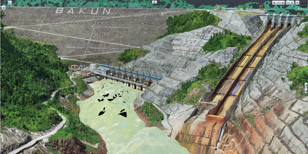
🏭⚡💡 Per il suo progetto di digital twin del suo impianto idroelettrico di Bakun, Sarawak Energy ha utilizzato ContextCapture e MicroStation per generare modelli della realtà e #PlantSight per visualizzare meglio le risorse #iTwin #ProjectWise Più info 👉bit.ly/3ApUizi
2
125

23 May 2023
1.Notes on Production
- 10s of ptc tilers do exist for #3DTiles #potree #I3S etc
- All major commercial 3d-scan suites offer 3D-tiles export like @RealityCapture_ #ContextCapture Metashape Cesium Ion
- also conversion between 3Dtiles/I3S/etc exists via loaders-gl
1
2
110
⚡Actualizar las subestaciones puede ser un trabajo tedioso.
🕵️Descubre cómo se puede transformar el proceso utilizando modelos de realidad, diseños 3D y #GemelosDigitales con #OpenUtilities Substation y #ContextCapture.
👉 bit.ly/3p3Xo9J
1
2
154

22 Mar 2023
2023/1/28リツイートだジビ!
#MCS - #CuGo で撮影した写真を使って #3Dモデル を作成。
3D上で寸法や面積の計測や、従来点検でわかりにくい橋面と床版の損傷位置関係がビジュアル的にバッチリわかるジビ!
#福井 #新技術 #NETIS #橋梁点検支援性能カタログ #CuboRex #RX0M2 #ContextCapture
28 Jan 2023

今日は #MCS を使った橋梁点検
10台の小型カメラで桁下空間を撮影し、3Dモデルをつくります
キャタピラが付いたロボットなので、悪路も難なく走破可能だジビ!
#ジビル #福井県 #建設コンサルタント #橋梁点検 #新技術 #CuboRex #CuGoV4 #SONY #RX0M2 #Jackery #3D
2
9
1,219

3 Feb 2023
ContextCapture uses photographs and other data to automatically generate 3D models of existing infrastructure,buildings
WhatsApp 919819244332 919835212345 Bentley Gold Partner in India vivek@cttec.in 971502306503(Dubai) Visit CTtec.ae Or CTxTECH.in
1
1
80

14 Jan 2023
أنظمة بنتلي:
تأسست عام 1984 وتقوم بتوفير الحلول البرمجية لصناعة البنية التحتية. لديهم مجموعة من برامج GIS و BIM مثل Bentley Map و Bentley ContextCapture لإنشاء نماذج ثلاثية الأبعاد عالية الدقة لبيئات العالم الحقيقي والتي يتم استخدامها في العديد من مشاريع البنية التحتية.

1
4
1,578

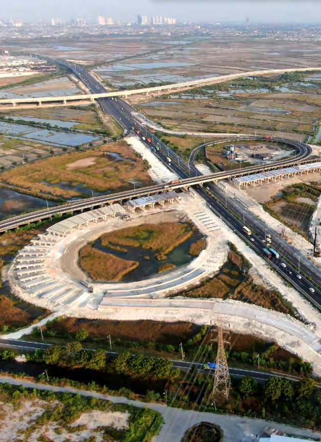
31 Oct 2022
Para la Copa Mundial Sub-20 2022 🎉⚽ en Indonesia, PT Hutama Karya construye la carretera de peaje Surabaya-Gresik y el diseño lo aceleró con #ContextCapture, #PLAXIS, #OpenRoadsDesigner y #MicroStation. Baja el ebook y encuentra otras obras ejemplares 👉 bit.ly/3KPDDcG
1
1

25 Oct 2022
AI: augmenting not changing AEC workflows
The new revolution will bring convenience, not disruption, writes Greg Demchak (@frame242) of @BentleySystems
aecmag.com/ai/ai-augmenting-…
#realitymodeling #realitymesh #AI #ContextCapture
4
6

5 Oct 2022
🏁 Obejrzyj, jak #technologia firm @Siemens i @BentleySystems poprawia #bezpieczeństwo na drogach w inteligentnych miastach!
📽️ bit.ly/3SOB4KN
#ContextCapture #cyfrowebliźniaki #mobilność #inteligentnemiasta #symulacja #AR #rozszerzonarzeczywistość #FIA #digitaltwins

2

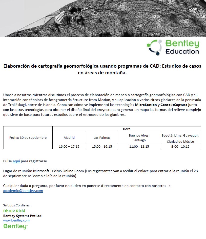
El 30-9 asistiremos la Seminario Virtual: Elaboración de cartografía geomorfológica usando programas de CAD: Estudios de casos en áreas de montaña con las aplicaciones #MicroStation y #ContextCapture de @Edu_Bentley
Para más información ve al enlace:
forms.office.com/Pages/Respo…

22 Sep 2022
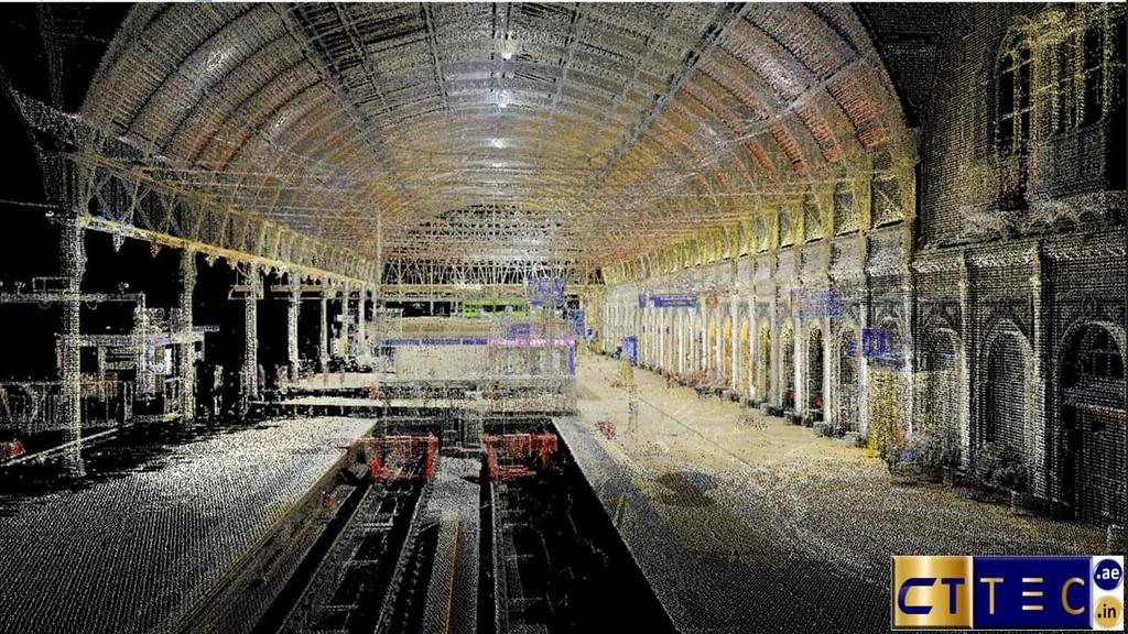
Smart City Reconstruction | This article explains how the 3D point clouds produced from sensors are used as data input and processed using Bentley ContextCapture software, while testing the performance capability using various inputs. gim-international.com/conten…
2