
Jun 4
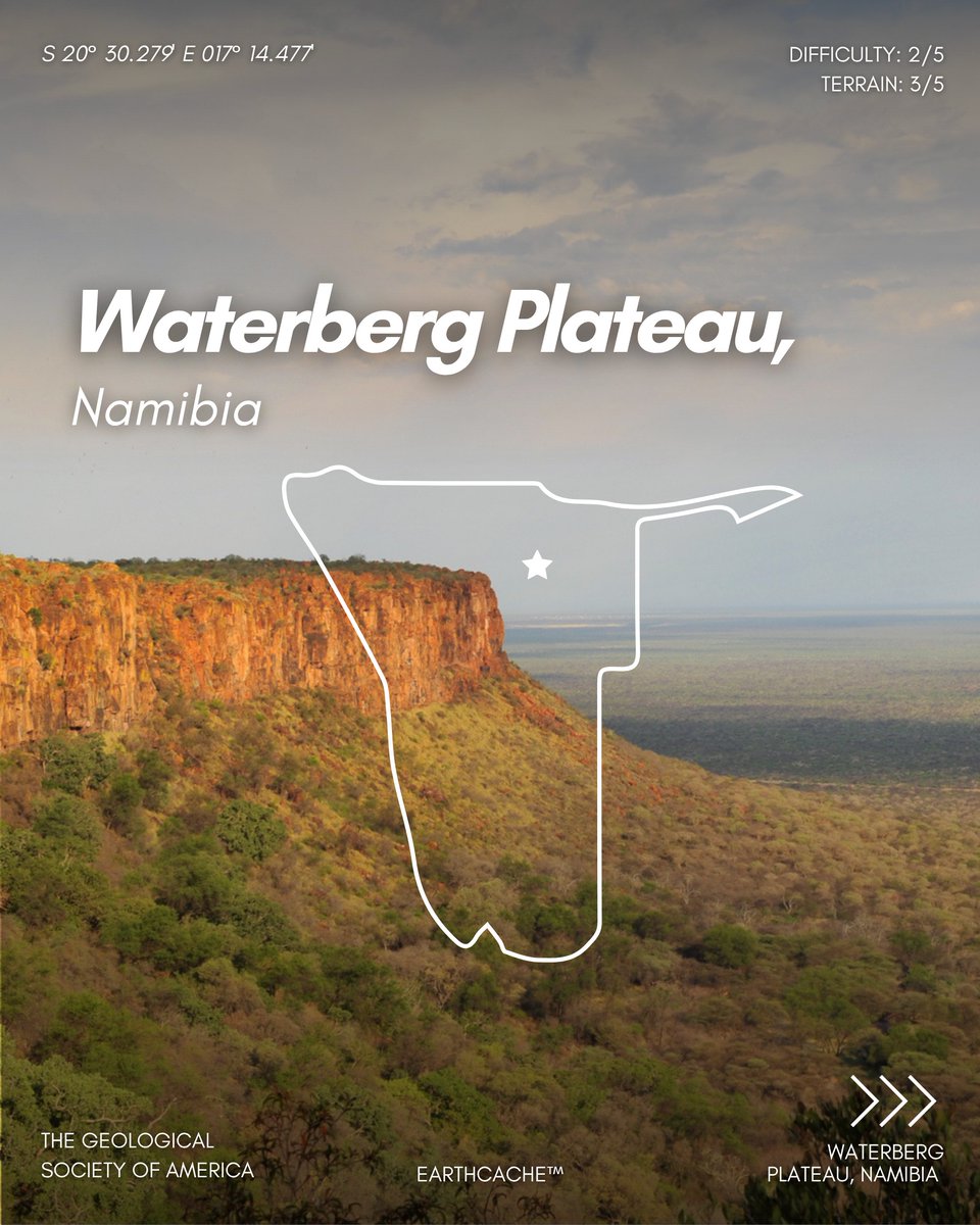
EARTHCACHE: Waterberg Plateau, Namibia.
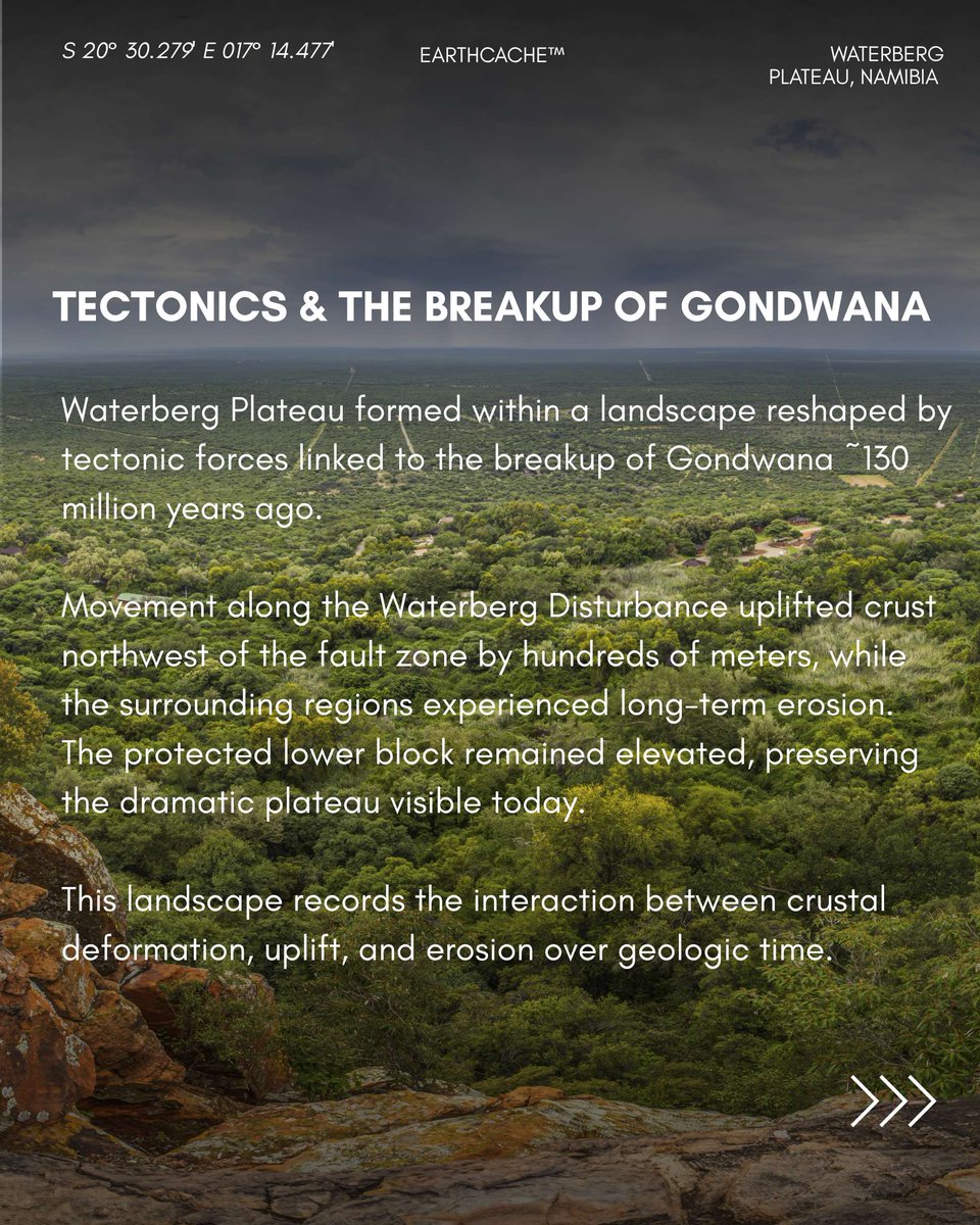
Rising up to 200 meters above the surrounding landscape, the Waterberg Plateau in Namibia tells a story that began nearly 130 million years ago during the breakup of Gondwana. As Africa and South America separated, powerful tectonic forces reshaped the region, uplifting rock layers and leaving behind the dramatic plateau seen today.
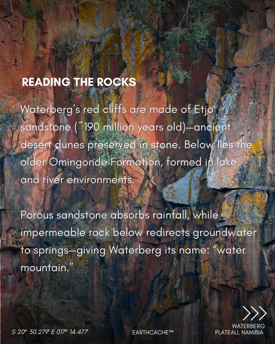
The plateau’s striking red cliffs are composed of porous sandstone from the Etjo Formation—ancient petrified desert dunes deposited ~190 million years ago. Beneath it lies the older Omingonde Formation, made up of conglomerate, sandstone, and mudstone from an even older lake-filled environment.
But the geology here does more than shape the landscape; it controls water. Rainfall is absorbed into the sandstone like a giant sponge, then redirected along the underlying impermeable rock layer to emerge as springs at the plateau’s edge, giving Waterberg (“water mountain”) its name.
Namibia is also a fitting backdrop to GSA’s 2026 Thompson Field Forum, where participants are currently exploring the southern region’s extraordinary geologic history, landscapes, and field relationships firsthand.
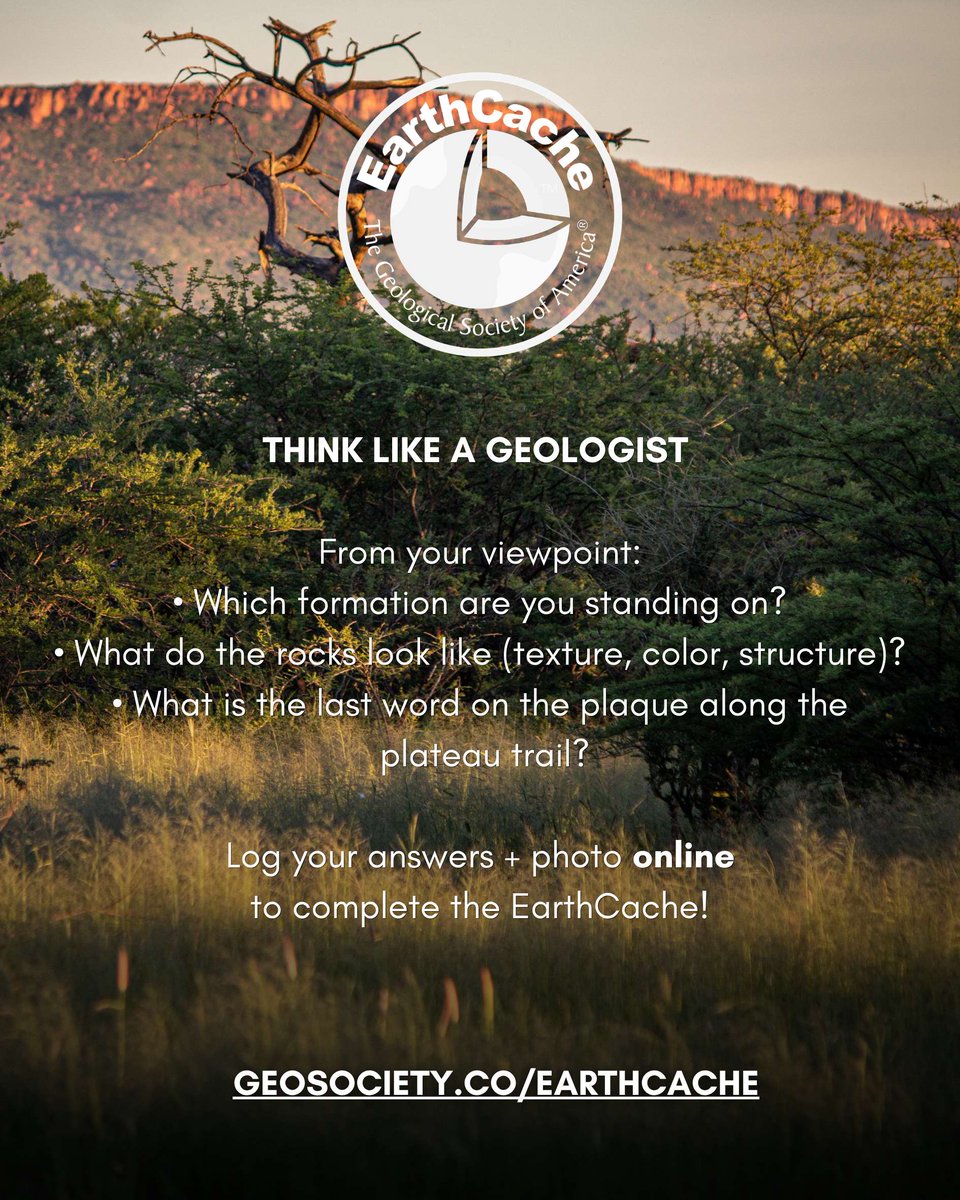
🧭 Explore this EarthCache at: geosociety.co/GCAZ4DK
📍Location: Waterberg Plateau, Namibia
📊 Difficulty: 2/5 | Terrain: 3/5
#EarthCache #Geology #Namibia #PlateTectonics #Geoscience
3
8
592

Jun 1
2026 Earthcache purgeと呼ばれる活動で、5年間活動してないオーナーのアースキャッシュに対して警告が送られたそうです。30日間にオーナーメンテログが投稿されなければ一時停止され、その30日後にアーカイブされるとのこと。
ざっとチェックした感じでは日本には対象となるものはなさそう。
1
7
573
May 24
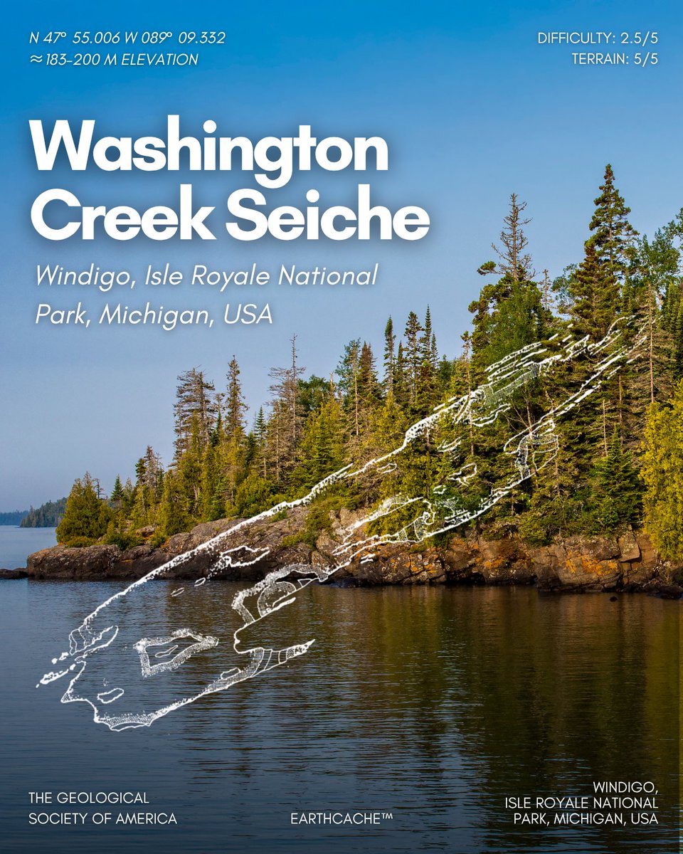
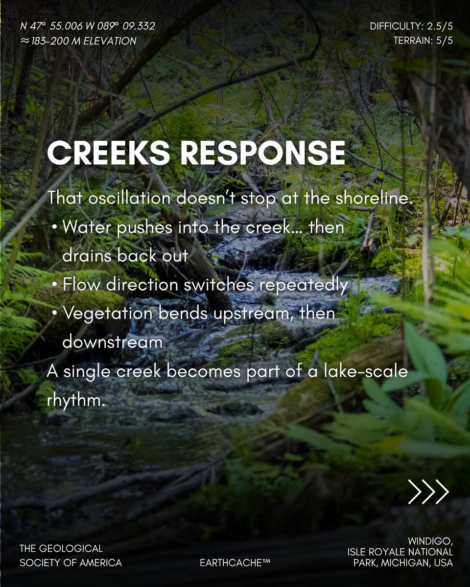
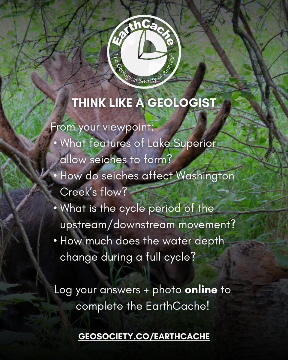
EARTHCACHE: Ever seen a creek flow both ways? At Windigo, Isle Royale National Park, Michigan, the Washington Creek does exactly that. Along the shoreline of Lake Superior, water doesn’t just move steadily downstream—it periodically reverses direction in a rhythmic back-and-forth motion driven by a phenomenon called a seiche.
A seiche is a basin-scale oscillation of water, triggered by strong winds or atmospheric pressure changes over large lakes. As water piles up on one side of Lake Superior, gravity pulls it back, setting up a repeating wave that can push water in and out of connected streams like Washington Creek.
The result? A creek that appears to “breathe,” switching between upstream and downstream flow as the lake oscillates.
🧭 Log your EarthCache (GC5ECEY): geosociety.co/seiche
📍Location: Windigo, Isle Royale National Park, Michigan, USA
📊 Difficulty: 2.5/5 | Terrain: 5/5
#Michigan #IsleRoyale #EarthCache #Seiche #Hydrogeology

4
15
985

May 19
A9 Australia in 2020, before everything shut down. Earthcache at the southernmost point of Australia was really cool. #USGeocachingHour
2
29
May 14
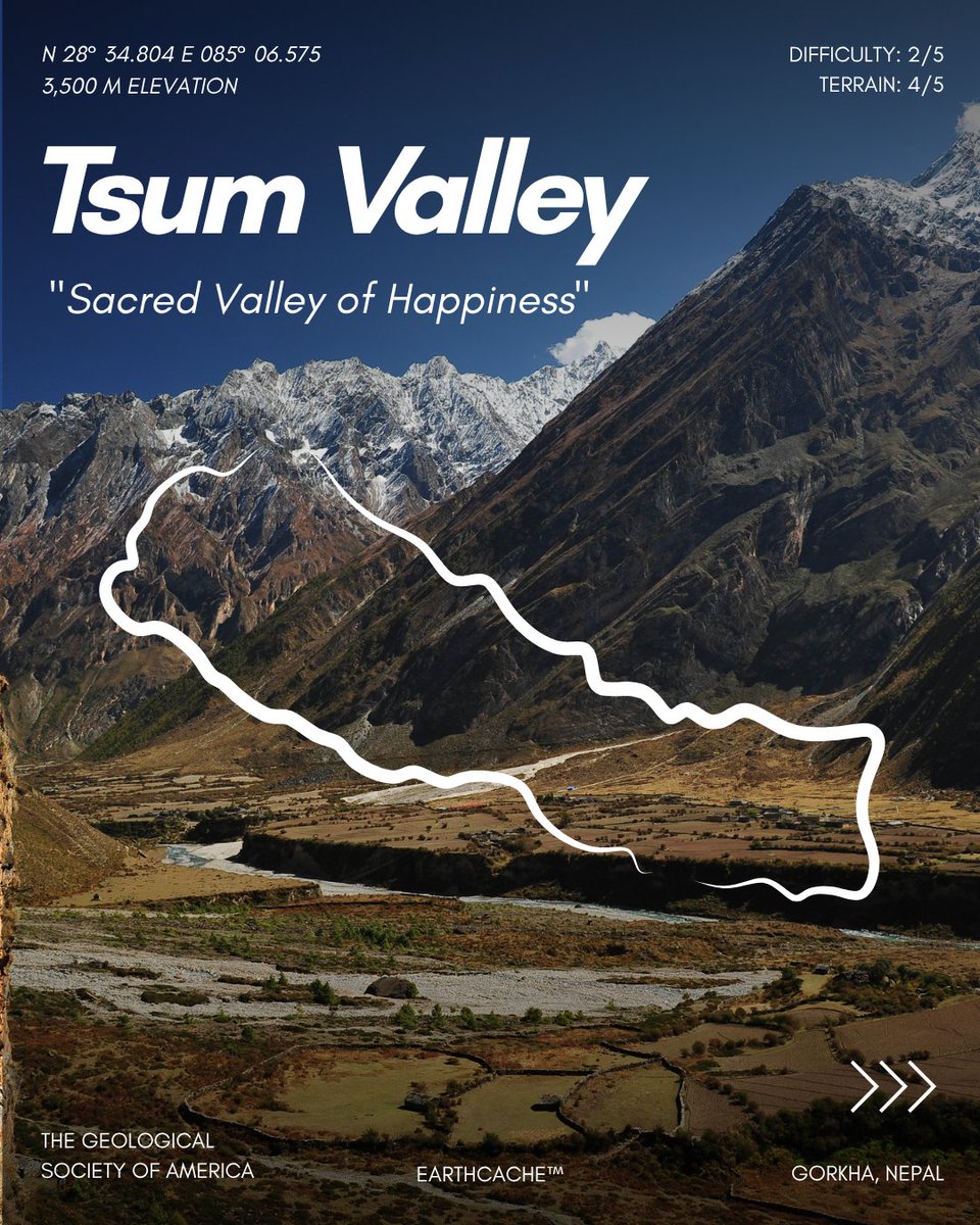
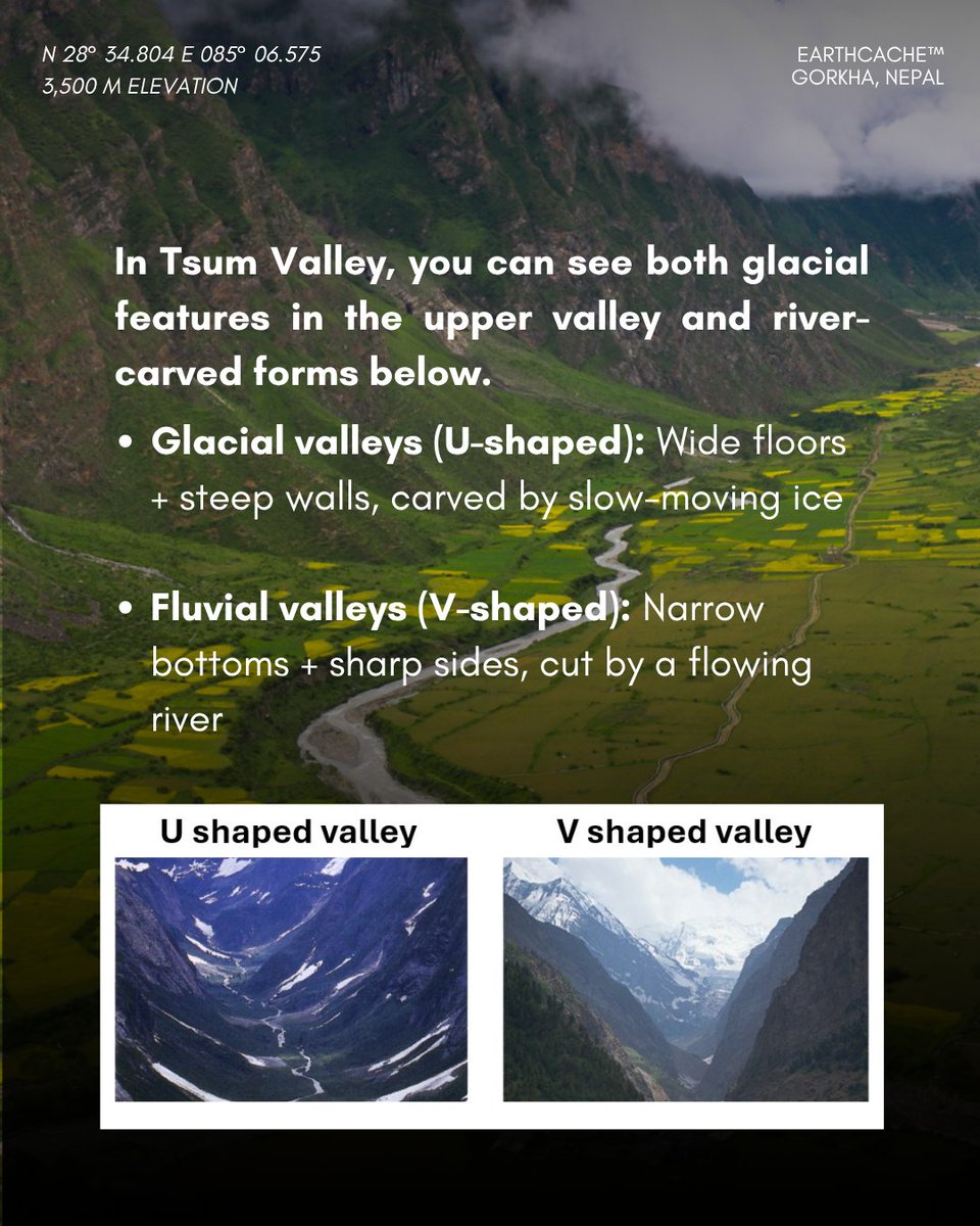
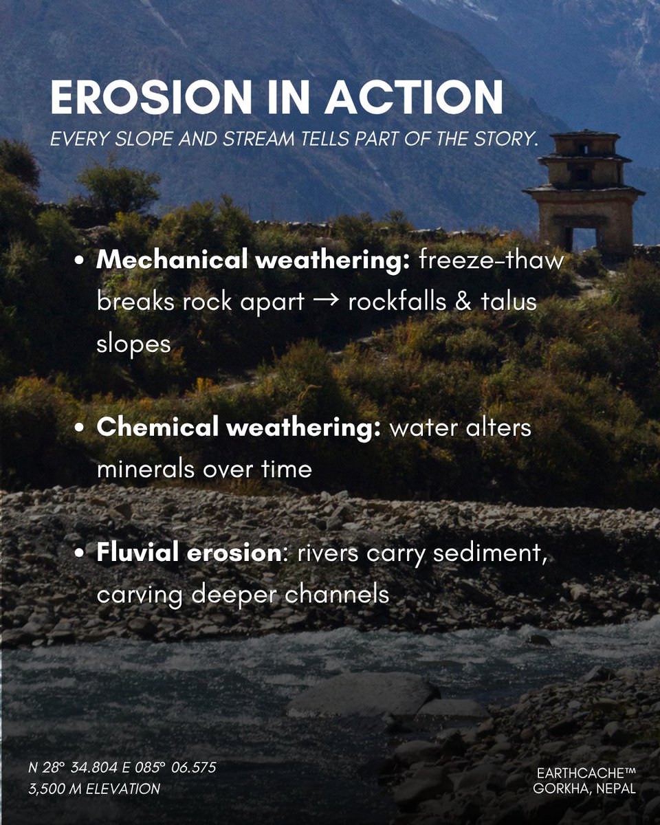
EARTHCACHE: Nestled in the remote Manaslu Conservation Area, Nepal, Tsum Valley stretches between ~1,900–4,000 meters in elevation. Once a sacred, hidden valley (“Beyul”), it remained isolated until trekking access opened in 2008. Today, it offers a rare, up-close look at powerful geologic forces shaping the Himalaya.
From glacially carved valleys to river-driven erosion, this EarthCache highlights how landscapes evolve.
🧭Explore this EarthCache (GCBEM7X): geosociety.co/tsum-valley
📍Location: Gorkha, Nepal
📊 Difficulty: 2/5 | Terrain: 4/5
#EarthCache #Travel #Nepal #Geology

2
10
503
May 8
EarthCache Spotlight: Dolores Canyon, Colorado, United States
More than 1,000 ft deep, Dolores Canyon reveals ancient limestone and sandstone layers shaped by uplift and erosion over millions of years. 🔗 Discover more: geosociety.co/EarthCache


1
8
486
Apr 30
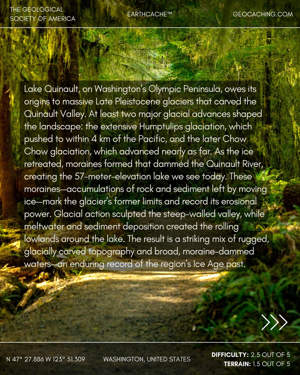
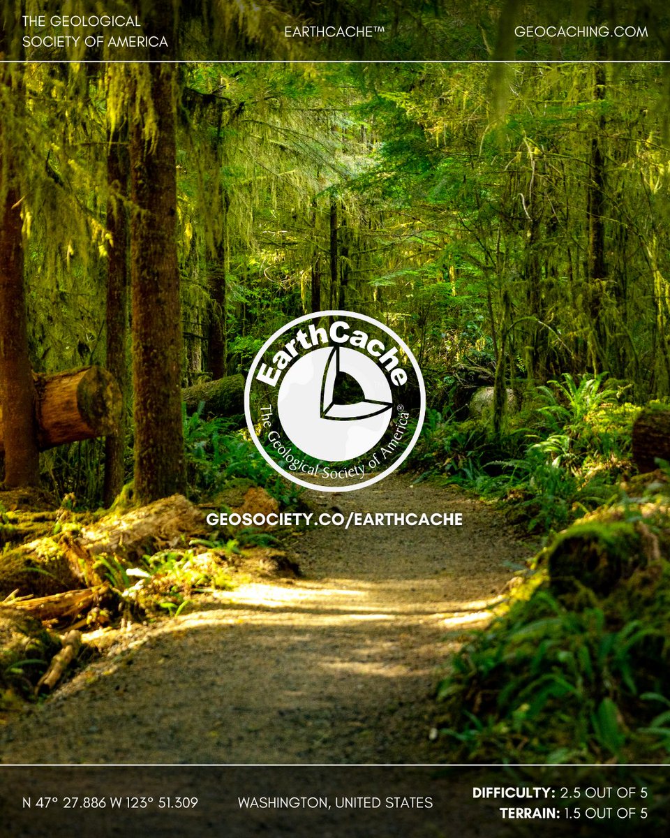
EarthCache Spotlight: Lake Quinault, Washington, United States
Lake Quinault formed when retreating Ice Age glaciers left moraines that dammed the Quinault River. Today, the lake’s broad basin and surrounding rainforest reflect its glacial origins. 🔗 Discover more: geosociety.co/EarthCache
8
557
Apr 26
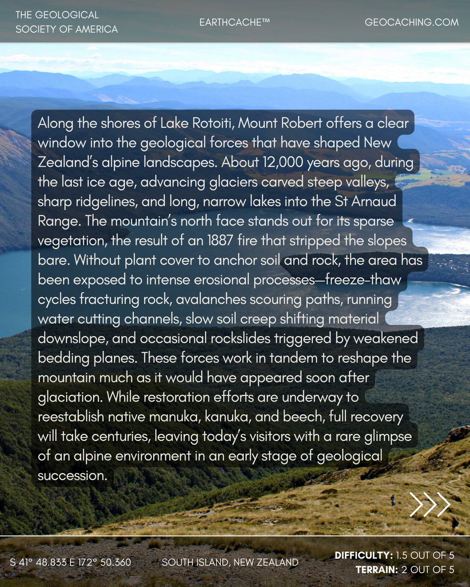
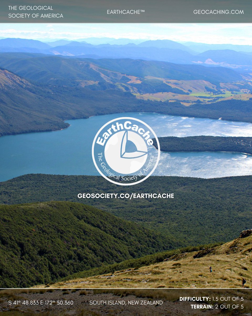
EarthCache Spotlight: Mount Robert, New Zealand
On Lake Rotoiti, glacial carving shaped sharp ridges and deep valleys. A 1887 fire removed vegetation, accelerating frost wedging, rockslides, and erosion—reshaping the post-glacial landscape over time.
🔗 geosociety.co/EarthCache

2
8
755
Apr 12
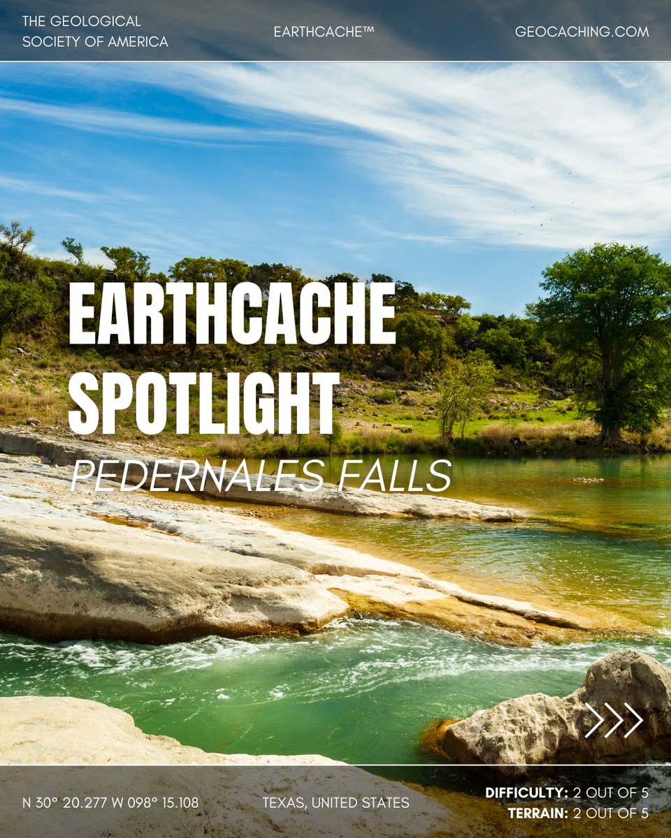
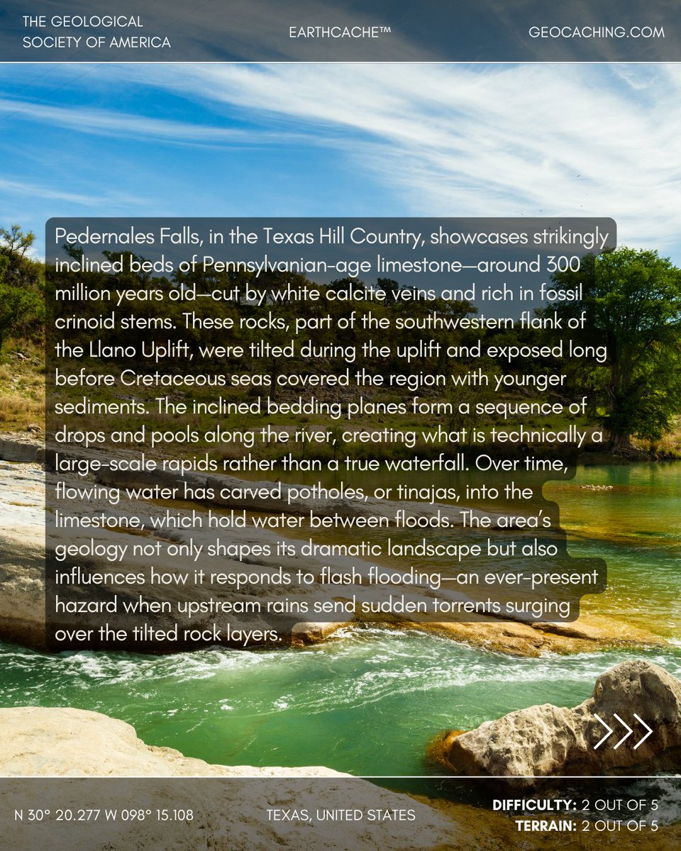
EarthCache Spotlight: Pedernales Falls, Texas, United States
Here in the Texas Hill Country, the Pedernales River flows over tilted beds of Pennsylvanian-age limestone, their dark surfaces streaked with white calcite veins and fossils from an ancient sea. These layers, part of the Llano Uplift, were tilted and exposed long before younger Cretaceous sediments blanketed the region.
The angled rock creates a series of natural drops and pools—more rapids than true waterfalls—while constant flow carves potholes, or tinajas, into the bedrock. It’s a landscape shaped by geologic forces and sculpted by water, both gentle and sudden, as flash floods can transform it within minutes.
📍 Location: Texas, United States
📊 Difficulty: 2/5 | Terrain: 2/5
🔗 Discover more EarthCaches and start your adventure: geosociety.co/EarthCache
#EarthCache #Geology #TexasHillCountry

1
1
4
679
Mar 30
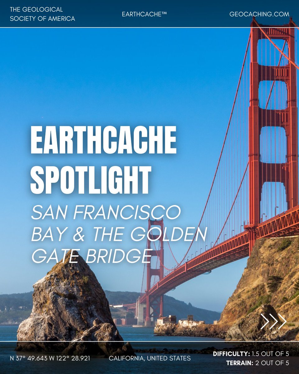
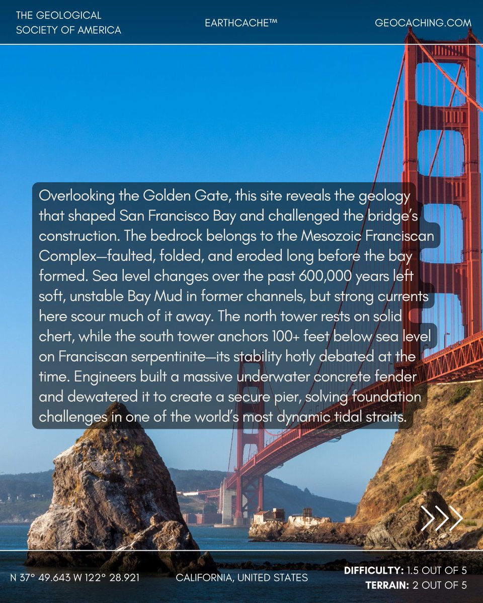
EarthCache Spotlight: Golden Gate Bridge, California, United States
The Golden Gate’s towering span rests on the complex geology of the Mesozoic Franciscan Formation—faulted chert to the north and debated serpentinite bedrock to the south. Here, strong currents scour away soft Bay Mud, exposing firmer foundations for the bridge’s piers. Building the south tower meant enclosing a football-field-sized section of seabed, pouring an underwater concrete fender, and dewatering it to reach bedrock more than 100 feet down—an engineering first in this tidal strait.
📍 Location: California, United States
📊 Difficulty: 1/5 | Terrain: 2/5
🔗 Discover more EarthCaches and start your adventure: geosociety.co/EarthCache
#EarthCache #Geology #GoldenGate

2
6
534

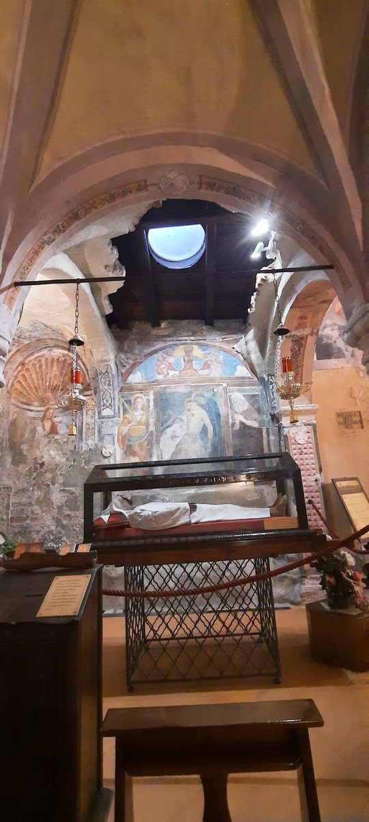
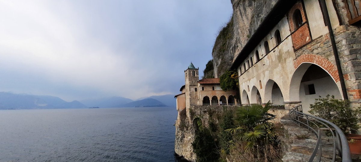
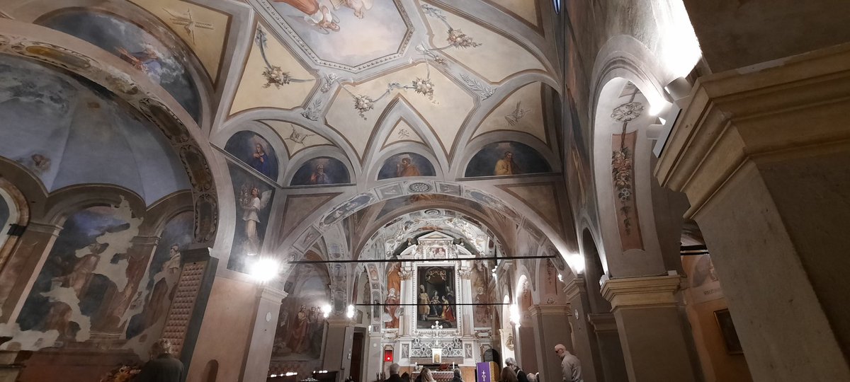
Eremo di Santa Caterina, Lago Maggiore.
Adventure Lab, EarthCache and multi-cache.
#geocaching #geocachingadventures #GeocachingItaly @GoGeocaching #ilovegeocaching
1
4
158

Mar 21
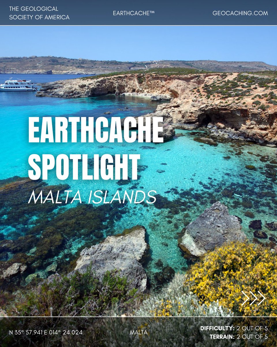
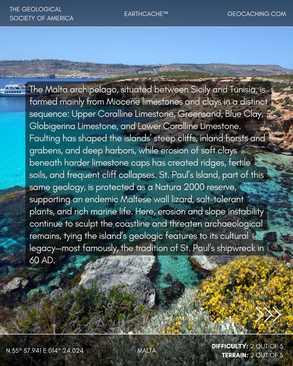
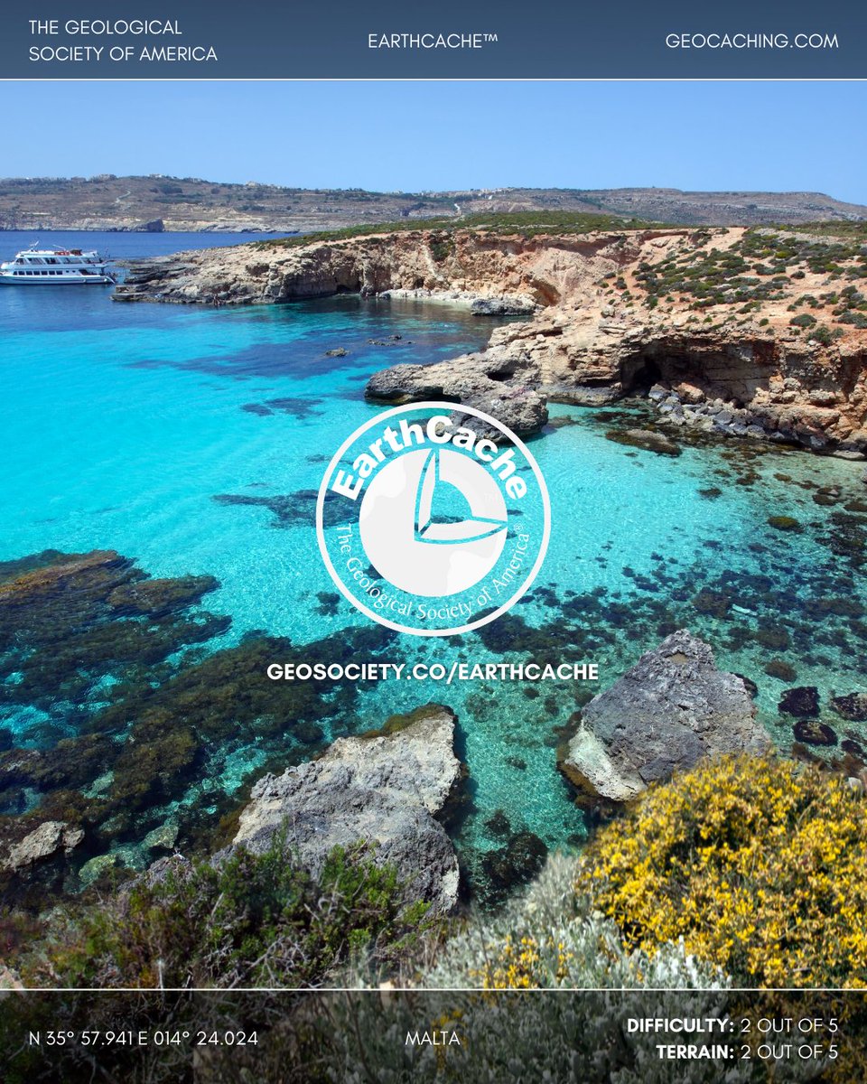
EarthCache Spotlight: Malta Islands
Part of the Malta archipelago, St. Paul’s Island is shaped by layers of Miocene limestone and clay, with hard Upper Coralline caps over softer Blue Clay that erodes into fertile slopes and unstable cliffs. Faulting and erosion continue to reshape the coastline, a process that has exposed its rich geology and threatened ancient remains.
Now a Natura 2000 reserve, the island is home to an endemic Maltese wall lizard, salt-tolerant plants, and vibrant marine life—while also holding deep cultural significance as the traditional site of St. Paul’s shipwreck in 60 AD.
📍 Location: Malta
📊 Difficulty: 2/5 | Terrain: 2/5
🔗 Discover more EarthCaches and start your adventure: geosociety.co/EarthCache
#EarthCache #Geology #Malta
1
8
595
Mar 7
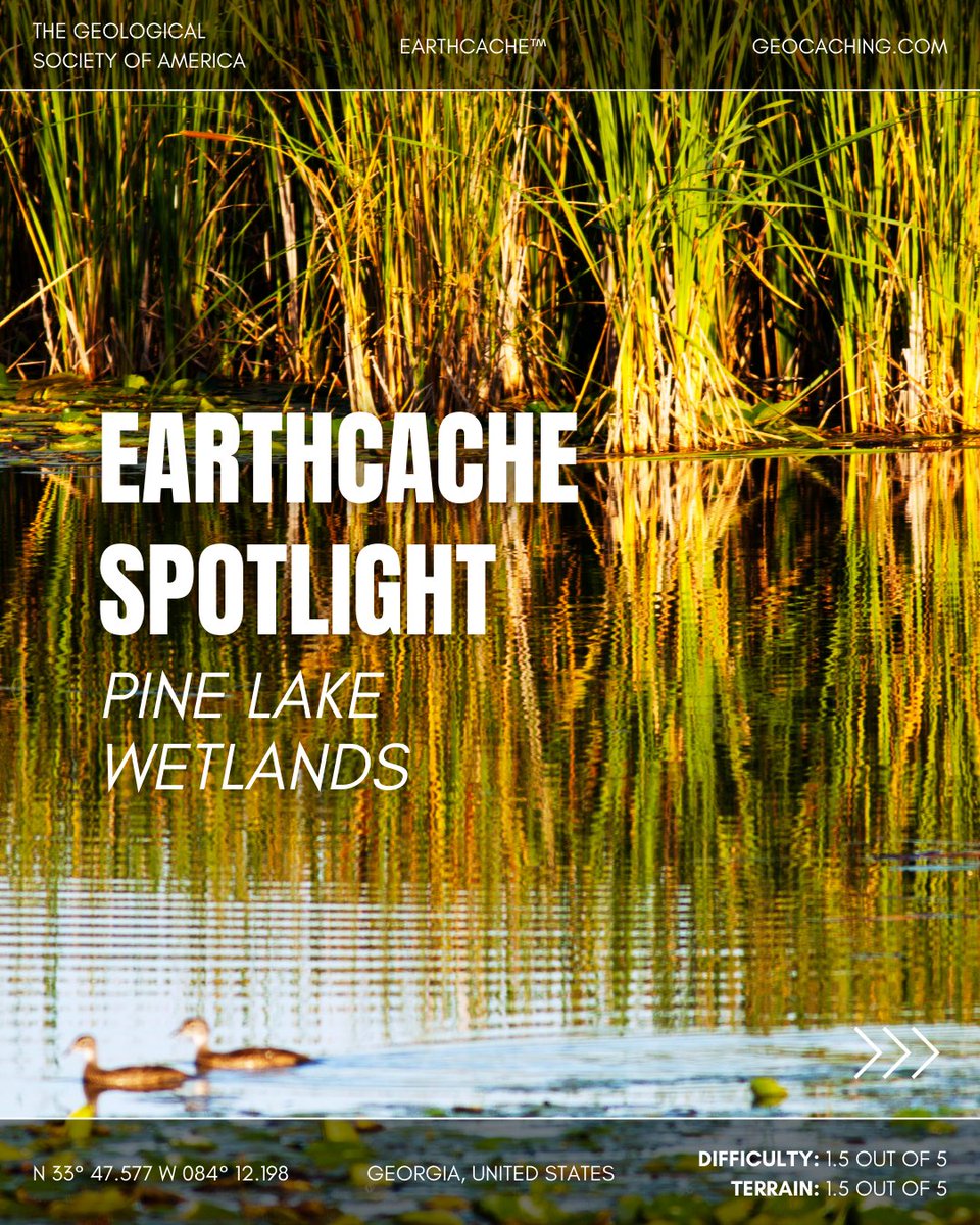
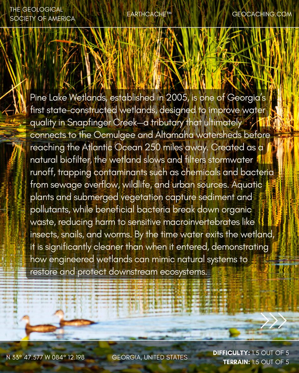
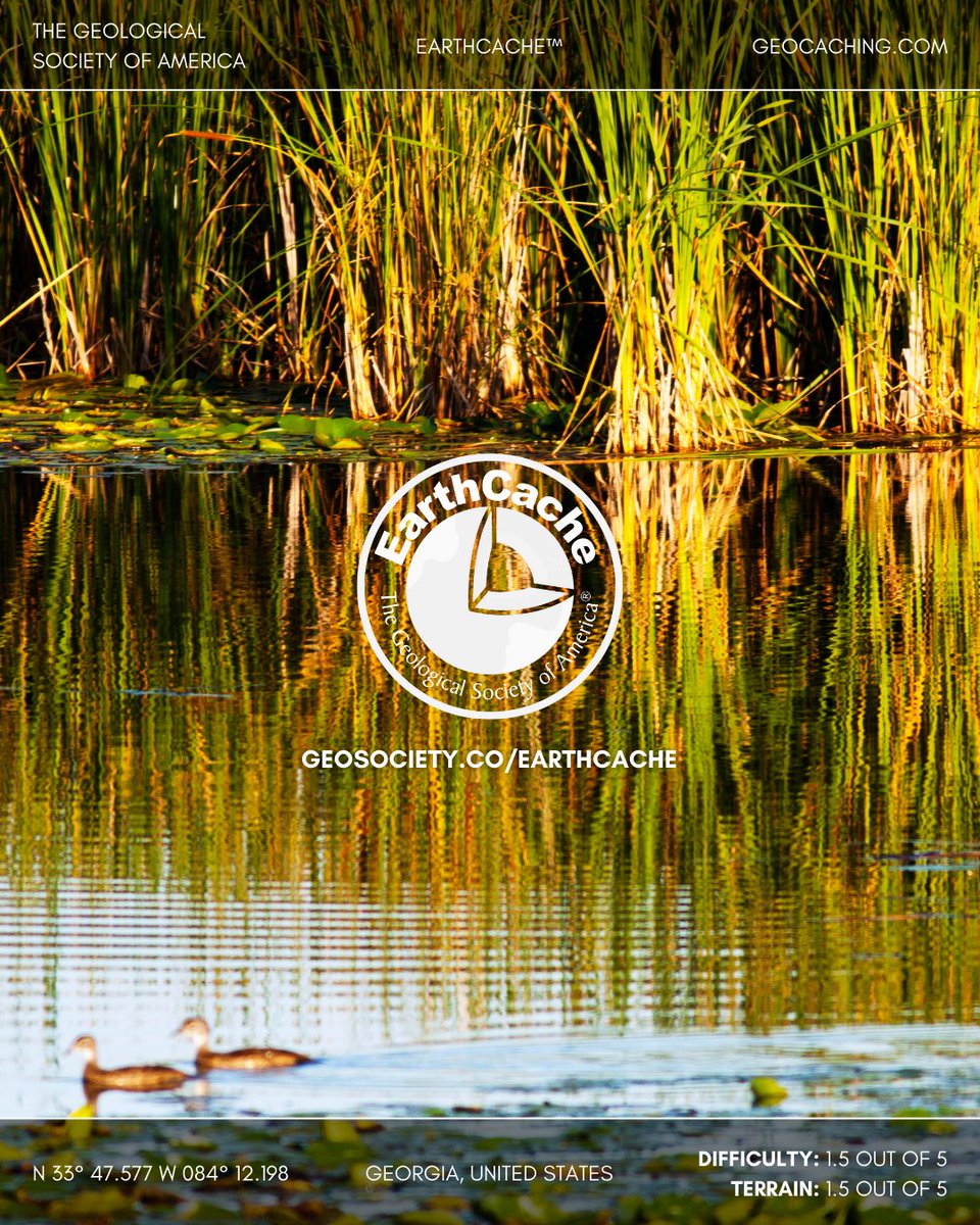
EarthCache Spotlight: Pine Lake Wetlands, Georgia, United States
Built in 2005, Pine Lake Wetlands was one of Georgia’s first state-made wetlands, designed to naturally filter and clean the waters of Snapfinger Creek before they flow toward the Atlantic Ocean. Native plants slow the current, trapping sediment and pollutants, while beneficial bacteria break down organic waste. This living filter protects aquatic life downstream and shows how engineered wetlands can restore the balance of natural waterways.
📍 Location: Georgia, United States
📊 Difficulty: 1.5/5 | Terrain: 1.5/5
🔗 Discover more EarthCaches and start your adventure: geosociety.co/EarthCache
#EarthCache #Wetlands #WaterQuality
2
7
680

Mar 1
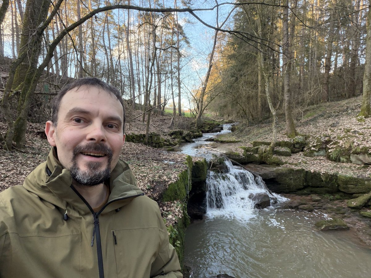
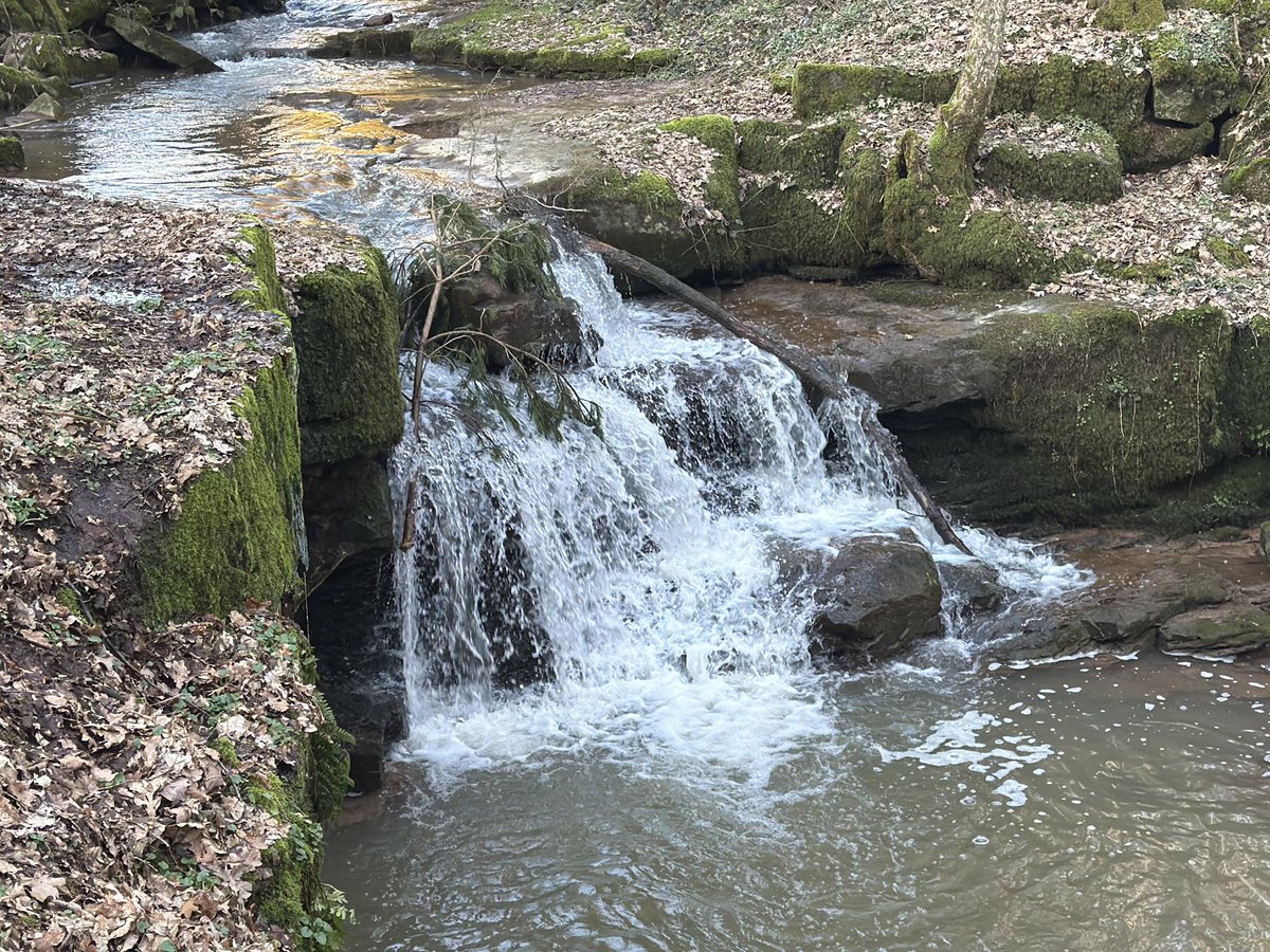
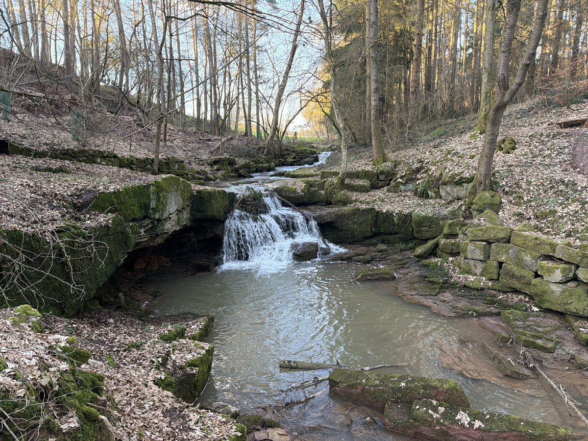
Heute war ich mal an der Neuwiesgraben Schlucht in #Dittlofsroda und habe dort einen #Earthcache gesucht. Es war sehr idyllisch dort.
#Geocaching #gcfrde #geocachingfranken @GoGeocaching

5
60
Feb 17
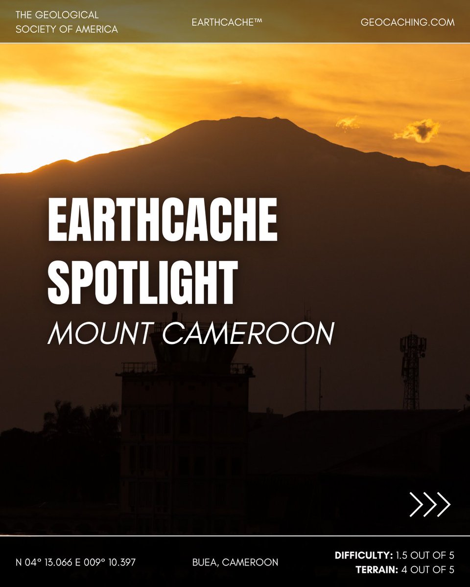
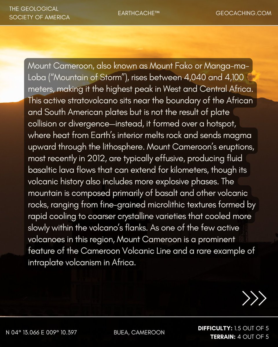
EarthCache Spotlight: Mount Cameroon, Cameroon
Towering above the Gulf of Guinea at more than 4,000 meters, Mount Cameroon is the tallest mountain in West and Central Africa and part of the Cameroon Volcanic Line. Born from a hotspot deep within Earth’s mantle, this active giant has built itself through repeated lava flows, most recently in 2012. Basalt dominates its slopes, displaying textures from smooth, fast-cooled surfaces to coarser crystalline interiors, telling the story of magma’s journey from depth to summit.
📍 Location: Cameroon
📊 Difficulty: 1.5/5 | Terrain: 4/5
🔗 Discover more EarthCaches and start your adventure: geosociety.co/EarthCache
#EarthCache #Geology #Volcano
1
8
599
Feb 15
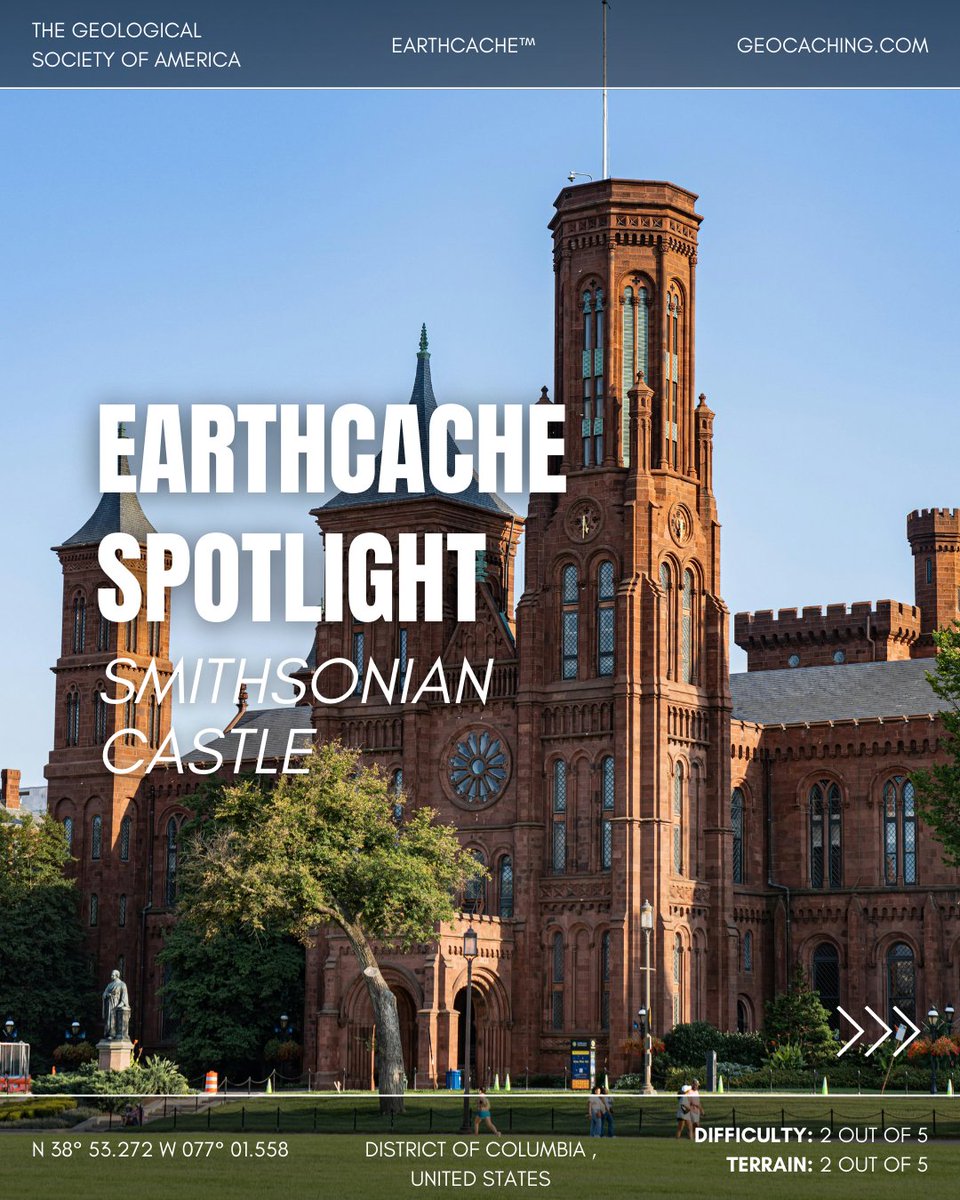
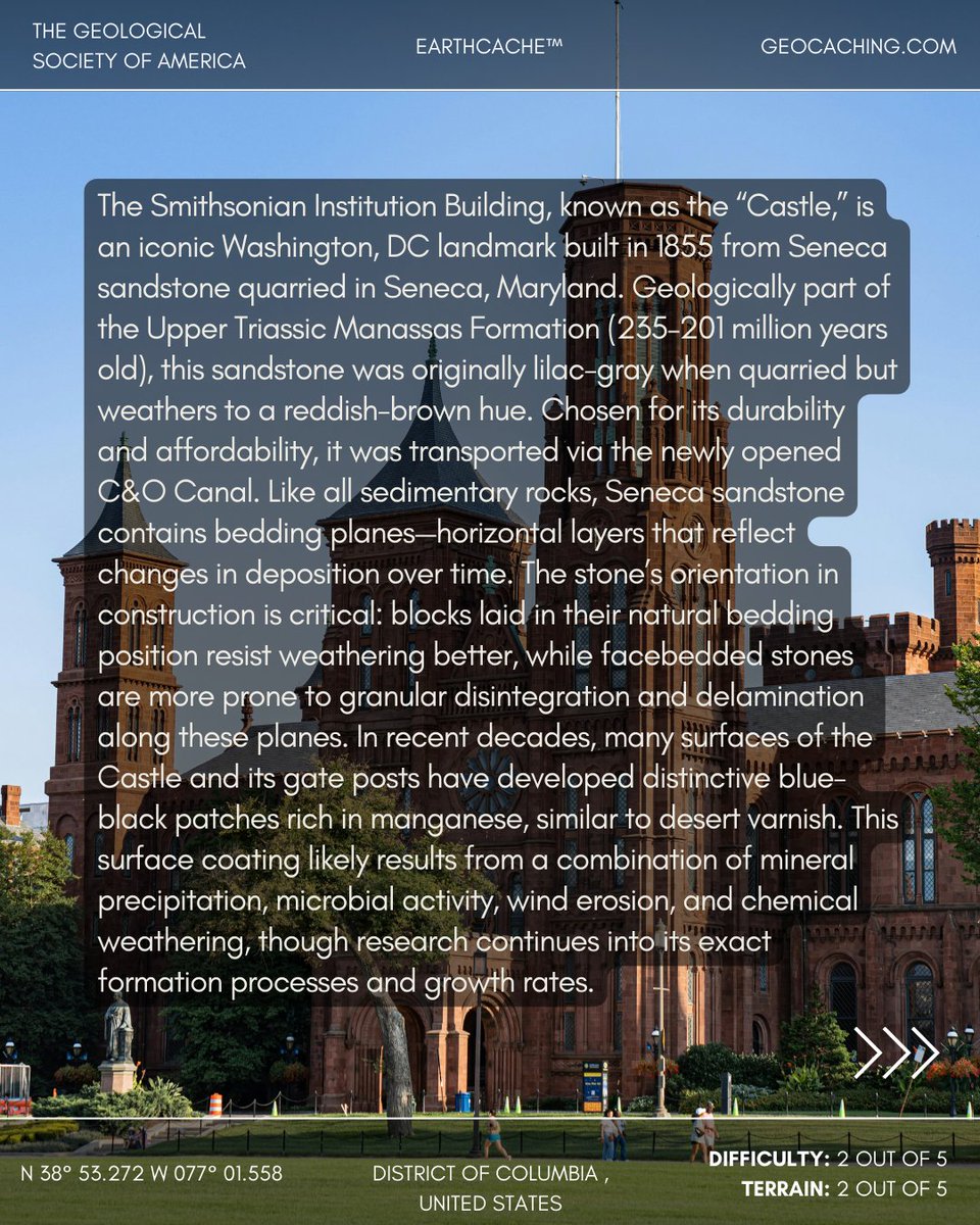
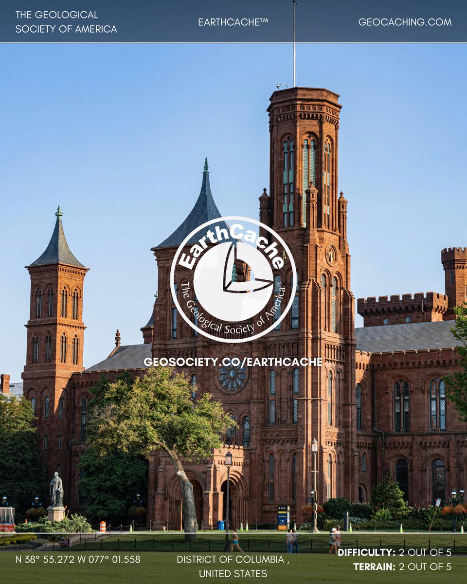
EarthCache Spotlight: Smithsonian Institution “Castle,” Washington, D.C., United States
Built in 1855, the Smithsonian Castle was constructed from Seneca sandstone of the Upper Triassic Manassas Formation, quarried in Seneca, Maryland. Originally lilac-gray, the stone weathers to a warm reddish-brown, with durability tied to how its bedding planes were positioned during construction. In recent decades, blue-black manganese-rich patches—similar to desert varnish—have formed on its surface, offering a visible record of ongoing geologic and weathering processes in an urban landmark.
📍 Location: Washington, D.C., United States
📊 Difficulty: 2/5 | Terrain: 2/5
🔗 Discover more EarthCaches and start your adventure: geosociety.co/EarthCache
#EarthCache #Geology #Sandstone
5
629
Jan 31
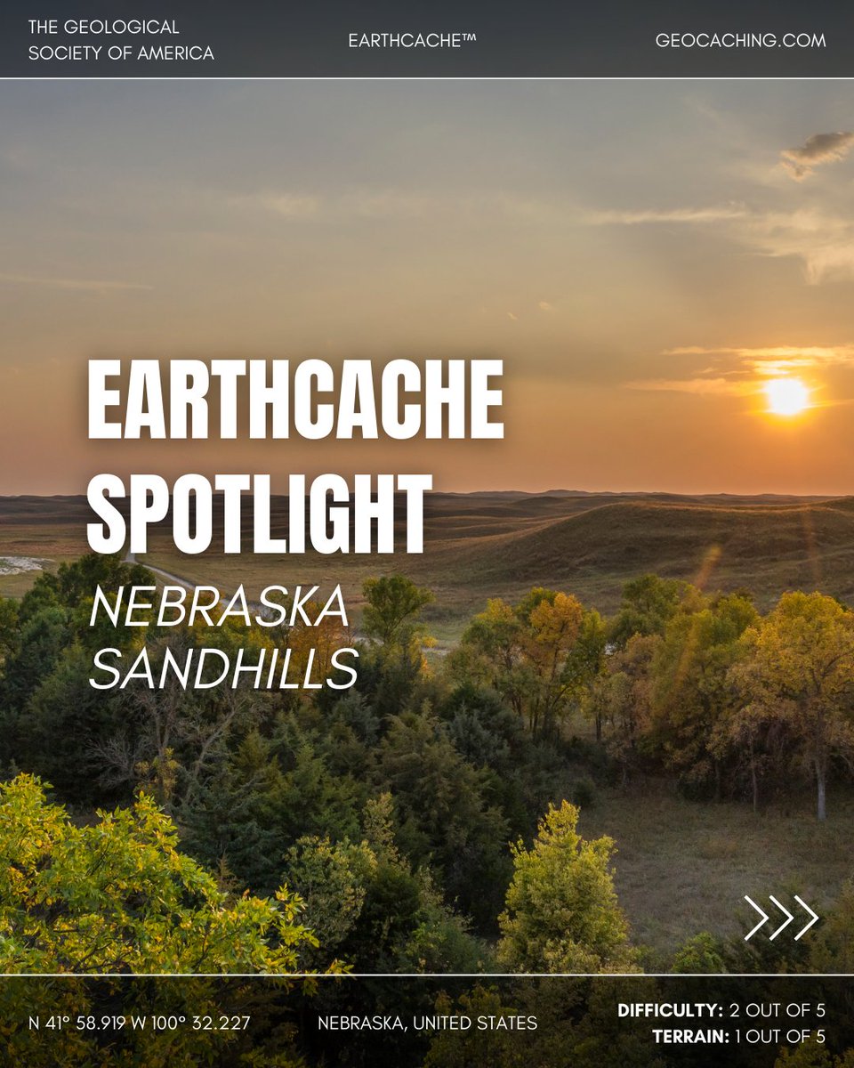
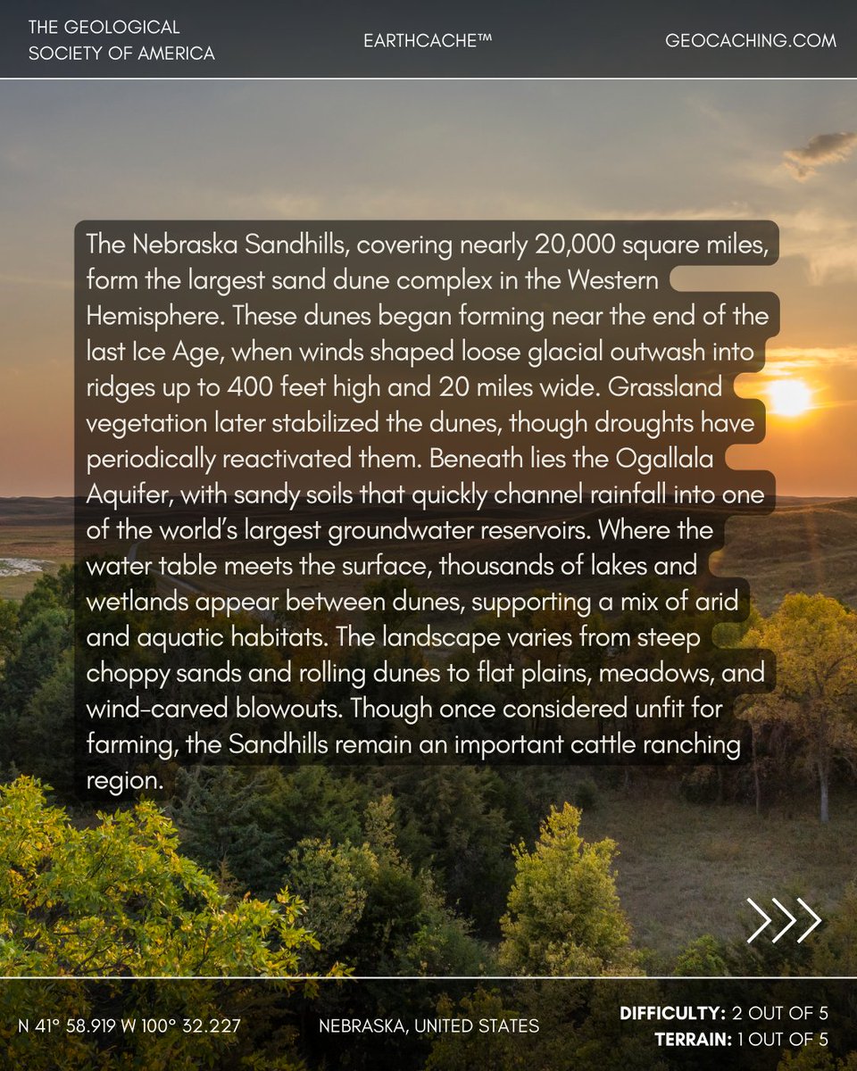
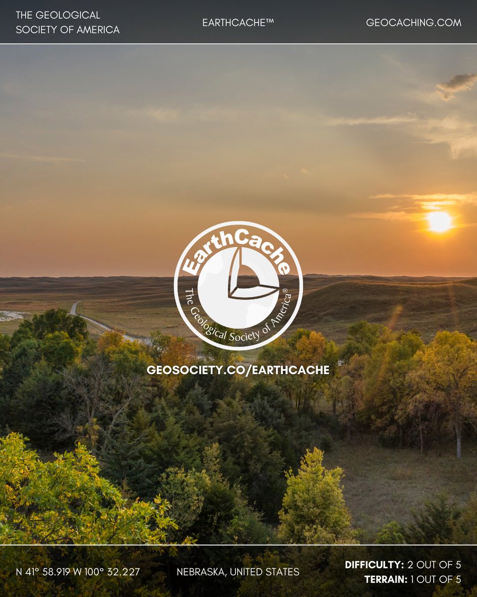
EarthCache Spotlight: Nebraska Sandhills, United States
Spanning nearly 20,000 square miles, the Nebraska Sandhills form the largest sand dune complex in the Western Hemisphere. Shaped by winds at the end of the last Ice Age, dunes up to 400 feet high were later stabilized by grasslands. Beneath lies the Ogallala Aquifer, where sandy soils recharge one of the world’s largest groundwater reservoirs, creating thousands of lakes and wetlands between the dunes.
📍 Location: Nebraska, United States
📊 Difficulty: 2/5 | Terrain: 1/5
🔗 Discover more EarthCaches and start your adventure: geosociety.co/EarthCache
#EarthCache #Geology #SandDunes
1
10
590

A4- For the coming week not at all, I'm more of a go with the flow person with little plans whenever I geocache. I wing it wherever I go. Even with all the snow I found 144 today. 1 earthcache, 1 event, and the other 142 all adventure labs. #USGeocachingHour
2
12
Jan 6
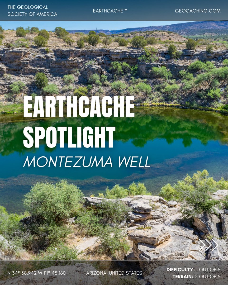
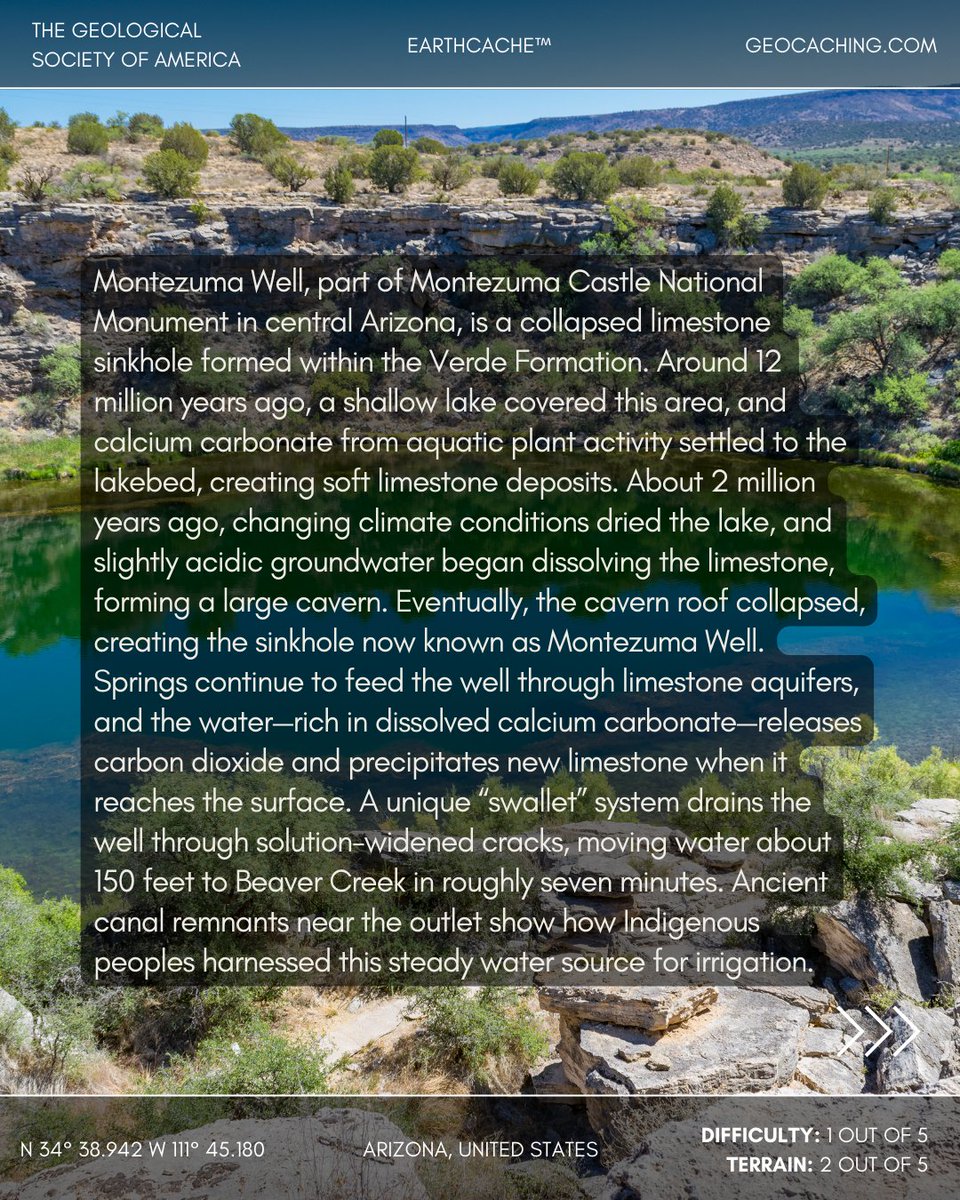
EarthCache Spotlight: Montezuma Well, Arizona, United States
Formed within the Verde Formation, Montezuma Well is a collapsed limestone sinkhole created when acidic groundwater dissolved a cavern that eventually gave way. Springs feed the well with calcium carbonate–rich water, which releases carbon dioxide and deposits new limestone at the surface.
A natural “swallet” drains water through cracks to Beaver Creek in about seven minutes—a feature once used by Indigenous peoples to irrigate crops.
📍 Location: Arizona, United States
📊 Difficulty: 1/5 | Terrain: 2/5
🔗 Discover more EarthCaches and start your adventure: geosociety.co/EarthCache
#EarthCache #Geology

4
643