
Jun 6
こんなにスッカスッカなのね、もっと近所の更新頑張らないと!
と思ったら更新日が結構古いですね。
3D情報の入力して、こう言うマップ見て結果を確認してモチベーションを維持したいところですが、F4mapとかの方が向いてそうです。
2
83
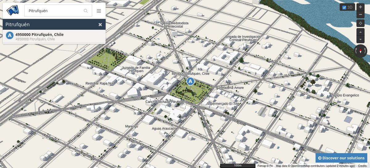
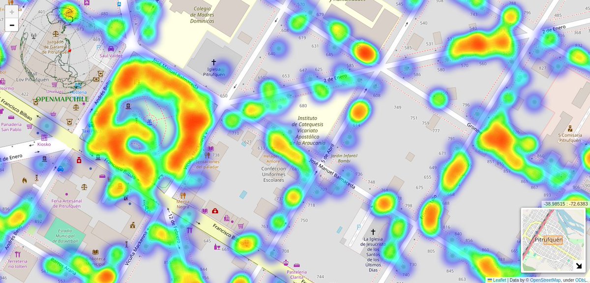
Mapa 1: complemento por defecto, todos los árboles en #3D en la plataforma de F4Map caracterizados por la altura 📐y tipo de hoja🌲 🌳
Mapa 2: Nube de calor, Densidad de árboles con librería #folium en #python3, calles con islas de 🔥
#Pitrufquén 🇨🇱
1
2
109

💥 ما هو F4map؟
هو محرك عرض خريطة ثلاثية الأبعاد يعتمد على:
بيانات OpenStreetMap.
مكتبة العرض ثلاثي الأبعاد CesiumJS أو محرك خاص مبني على WebGL.
يعرض المباني، الشوارع، الأشجار، والأنهار بشكل ثلاثي الأبعاد تفاعلي.
💥باقي التفاصيل هنا👇
t.me/geographygeography2020/…

5
20
1,290

12 Feb 2025
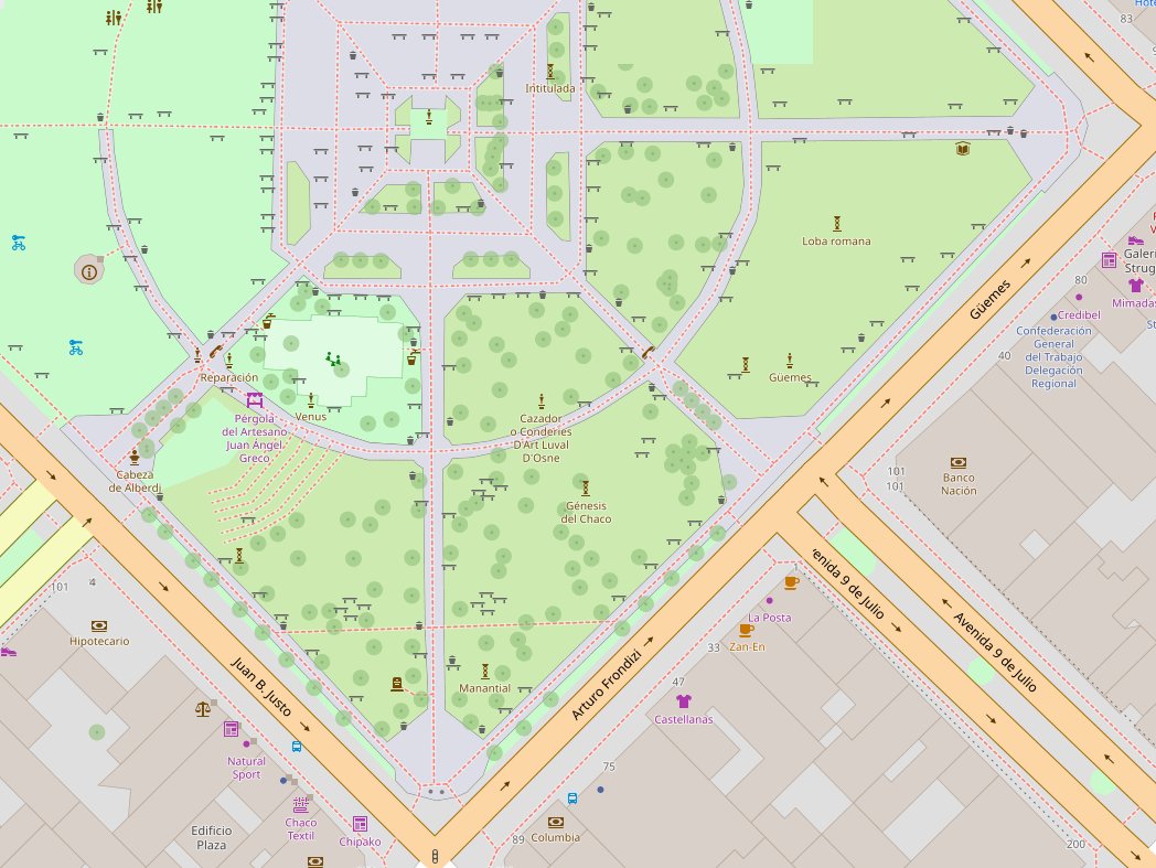
#F4map, un visor 3D para ver los mapas de #OpenStreetMap en tres dimensiones!
Probalo aquí para ver nuestra Ciudad, #Pergamino: demo.f4map.com/#lat=-33.9054…
2
3
108

24 Jan 2025
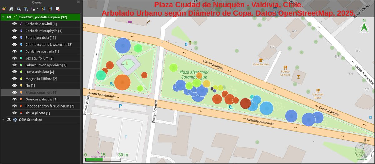
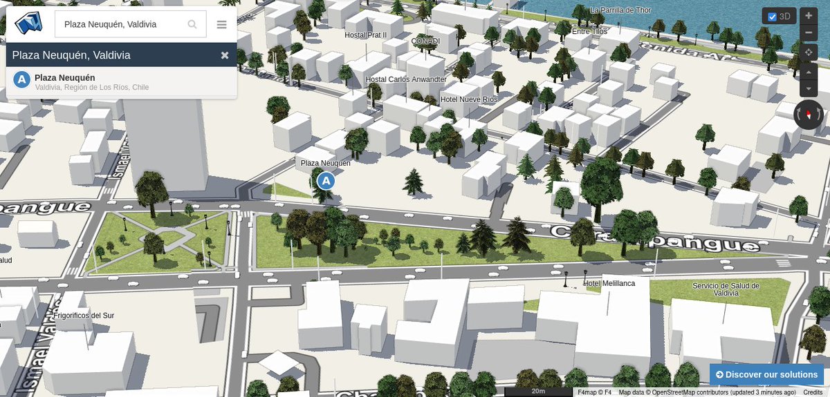
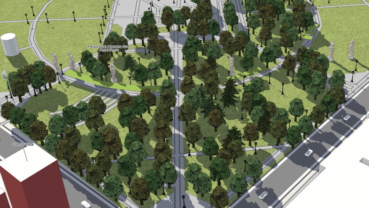
#Mapa del #Arbolado Urbano de "Plaza Ciudad de Neuquén" en la ciudad de #Valdiviacl. Se presentan 37 individuos | 14 especies, según tag:diameter_crown de #OSM #F4Map #3D #QGIS Proyecto🚧: #AUPV 🌲🌴🌳📌📸🗺️🇨🇱 openstreetmap.org/#map=19/-3…
3
8
931

15 Oct 2024
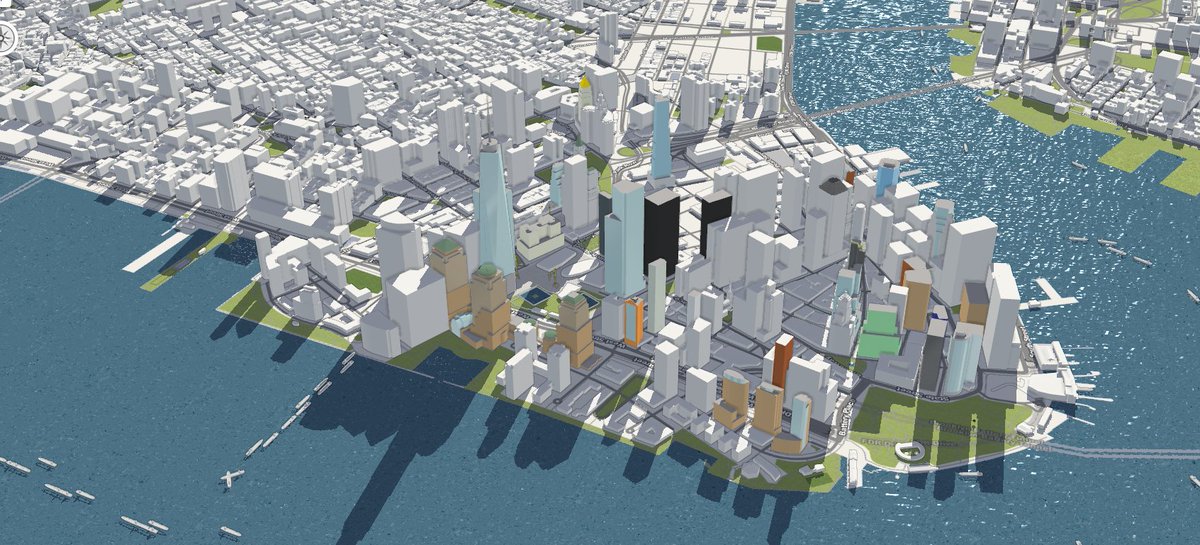
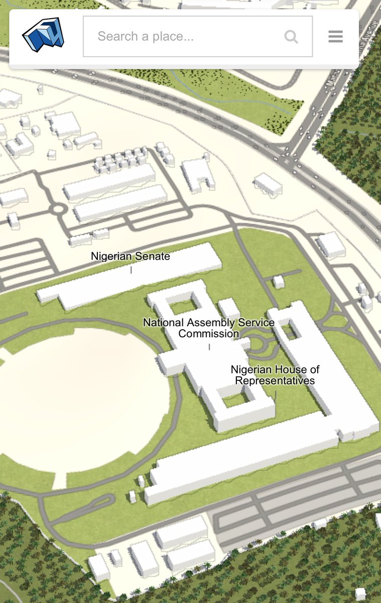
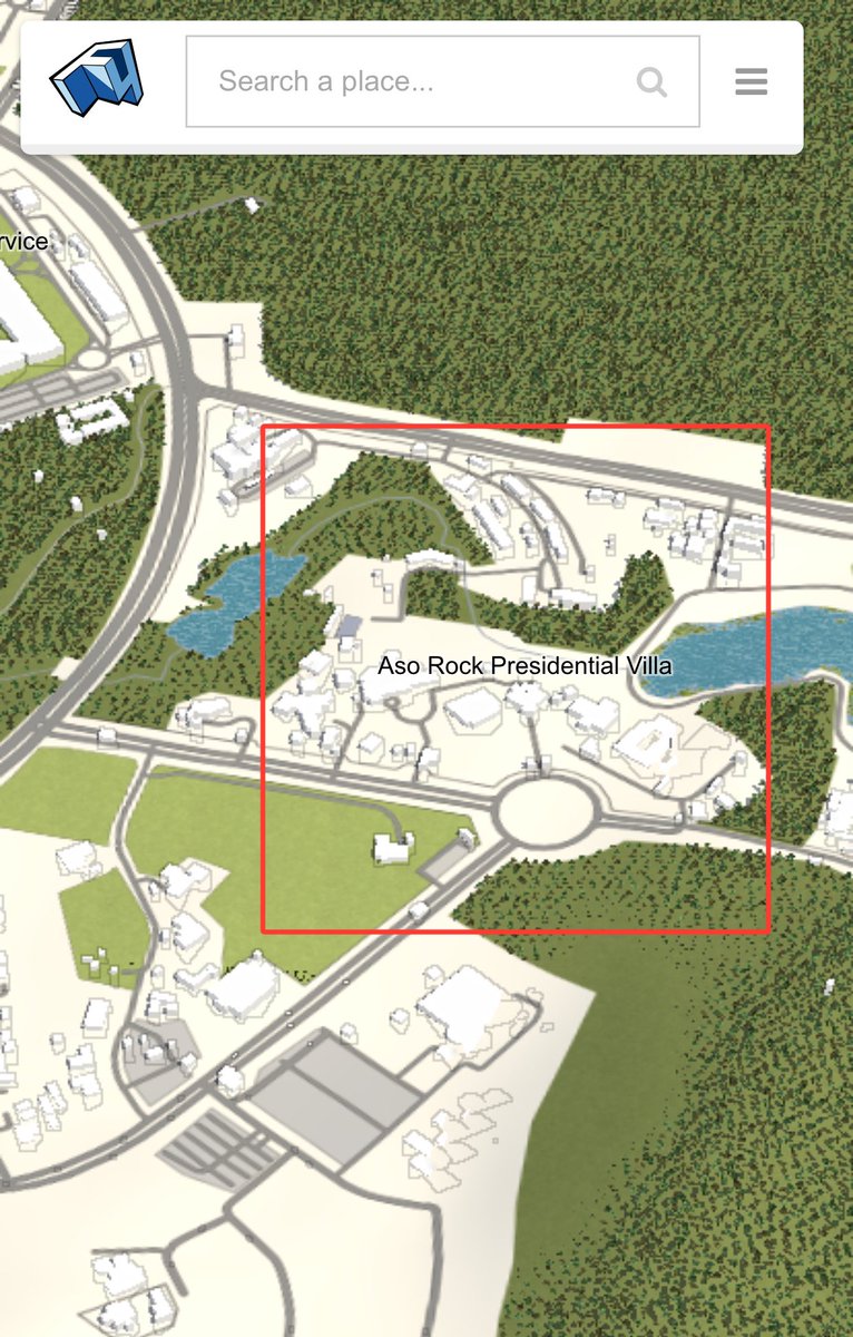
Here is aerial view of “Aso Rock, Nigerian Presidential Villa” as render by F4Map.
The tool uses Open Street Map data to plot individual buildings on a 3D map — It renders individual buildings with a high level of detail as seen in the pictures and video below.
2
4
20
1,528

7 Aug 2024
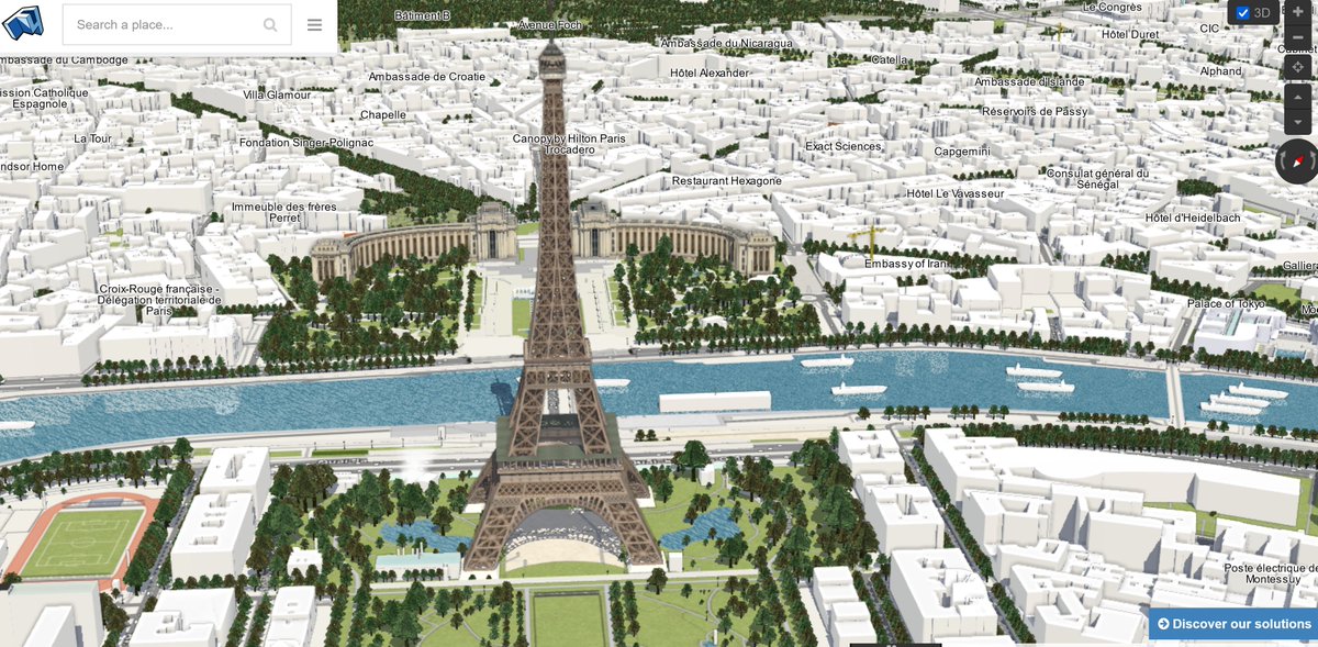
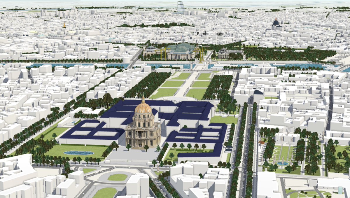
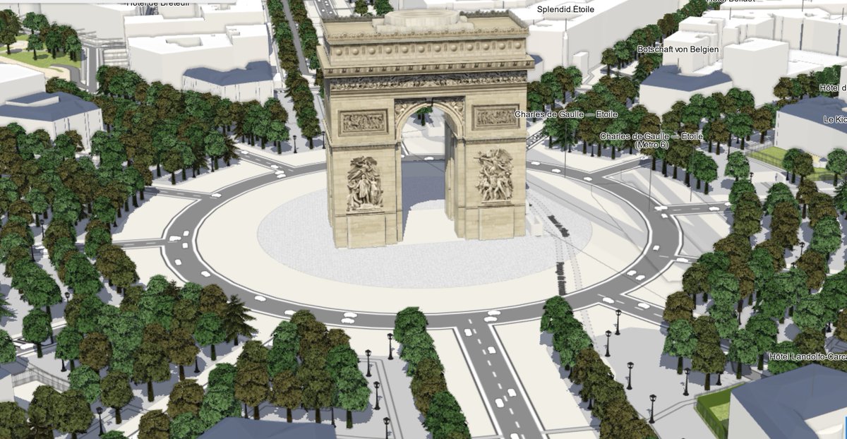
Wenn ihr mal in Paris und eigentlich überall
virtuell unterwegs sein wollt und die Sehenswürdigkeiten sucht,
versucht mal diese interaktive Karte zu nutzen.
Auch auf dem Smart geht's sehr gut.
Schaltbare Features
Demo F4Map auf Basis der #OpenSteetMap
demo.f4map.com/#lat=48.85788…

3
52

14 Jul 2024
F4mapって建物類を3D表示するだけのサイトだと思ってたけど、Ground elevationsチェックしたら標高も反映されるのか!
知ってる山を3D化するの超楽しい。
山頂付近の森林限界抜けたところの植生ちゃんとOSMでマッピングしといて良かったと思いつつ、雌阿寒岳&阿寒富士&オンネトーを表示。

1
2
7
301

#LSPPDay23
My learnings revolved around gender data, intersectionality, biased data sets, F4map demo, OSM and data accessing methods.
Also had a fun networking session later.
#60Daysoflearning
#LearningWithLeapfrog
@lftechnology
7
243

2 Jun 2024
De a poquito estoy mapeando la plaza 25 de Mayo en Openstreetmap. La vista que da F4map es alucinante, y eso que no tiene todos los detalles que se mapean.
demo.f4map.com/#lat=-27.4518…
3
4
30
1,132
6 May 2024
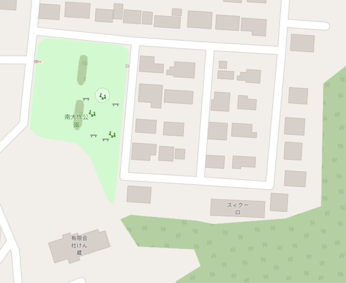
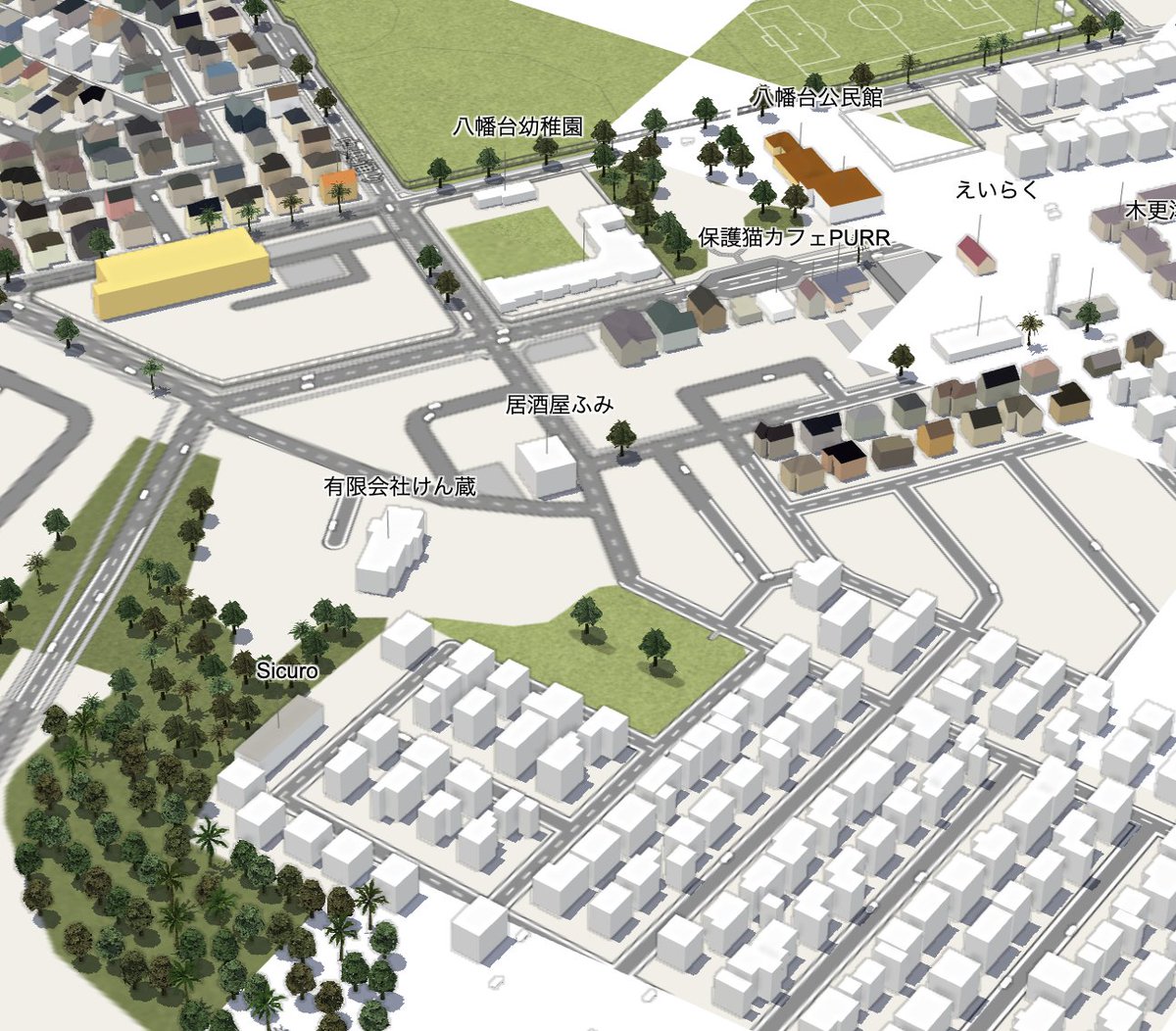
先日の迷子猫探しで新しく見つけた八幡台三丁目のアパートをOpenStreetMapに追加。
近所をブラブラ歩いてみるのも新しい発見があって面白い。
F4map道路に車が走るようになったのね。
このエリアこんなに車は走ってないけど。
将来はバスとかも出るようになるのかな?
openstreetmap.org/changeset/…
1
3
424

22 Mar 2024
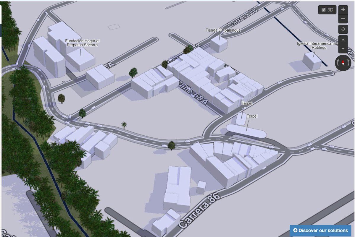
Les comparto otra vista de cómo va el mapeo del Barrio Palenque en la comuna 7 Robledo, Medellín. Ene esta ocasión una vista en 3D de F4map
demo.f4map.com/#lat=6.278523…
1
1
87


21 Oct 2023
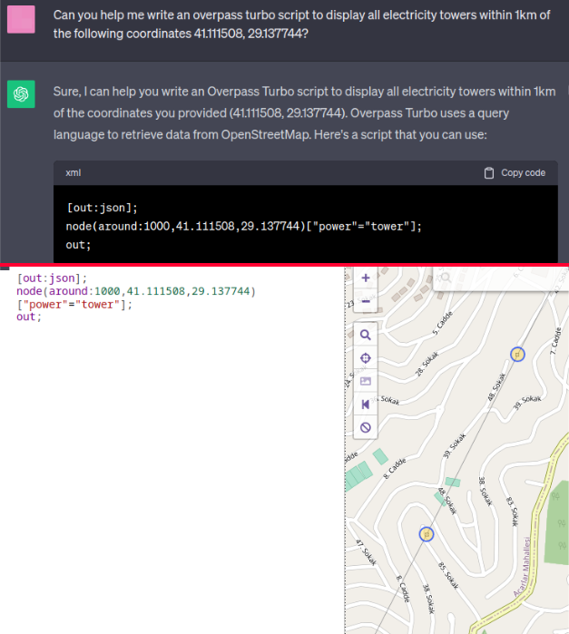
Alternatively, you can also ask ChatGPT to create an overpass turbo to display them. The top image below shows my request and the code. The bottom image is the script on overpass turbo showing the same electricity towers as previously seen in the f4map. Both options are great.
3
982
21 Oct 2023
Both F4map and overpass turbo use OpenStreetMap which rely on contributors to add entries (e.g. electricity towers). It is possible that some areas are not up to date. However I have used it numerous times to find towers in the middle of nowhere and has never failed me.
1
4
143
21 Oct 2023
Alternatively, you can also ask ChatGPT to create an overpass turbo to display them.
The top image below shows my request and the code. The bottom image is the script on overpass turbo showing the same electricity towers as previously seen in the f4map.
Both options are great.

1
6
439
21 Oct 2023
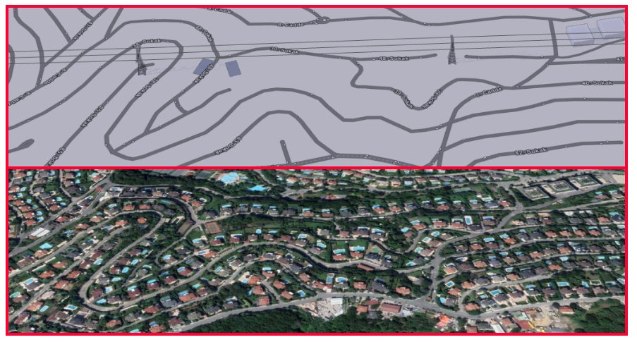
f4map is an amazing tool which has 3D mapping of lot of structures, including power lines. I use it whenever I need to track them down quickly.
You can see the comparison between the f4map (top) and Google Earth (bottom) of the same location.
demo.f4map.com/
1
3
24
7,122
23 Jul 2023
openstreetmap
自分で入力した部分をf4mapで確認するのが好き。
3D情報の入力、頑張ってるけど気合い入れてやらないと進まない。
「みんなで作る自由な地図」
夏休みの自由研究とかにどうですか?
demo.f4map.com/#lat=35.33936…
2
8
490

18 Jun 2023
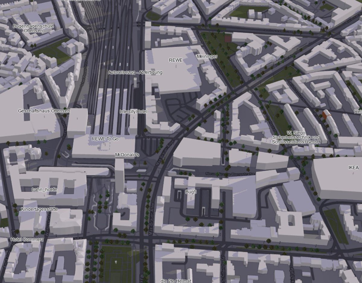
F4Map uses Open Street Map data to plot individual buildings on a 3D map. This is a useful tool when there is no 3D building coverage in Google Earth and when your inspection requires a high level of detail
#GeoINT
demo.f4map.com/#camera.theta…
2
1
250