
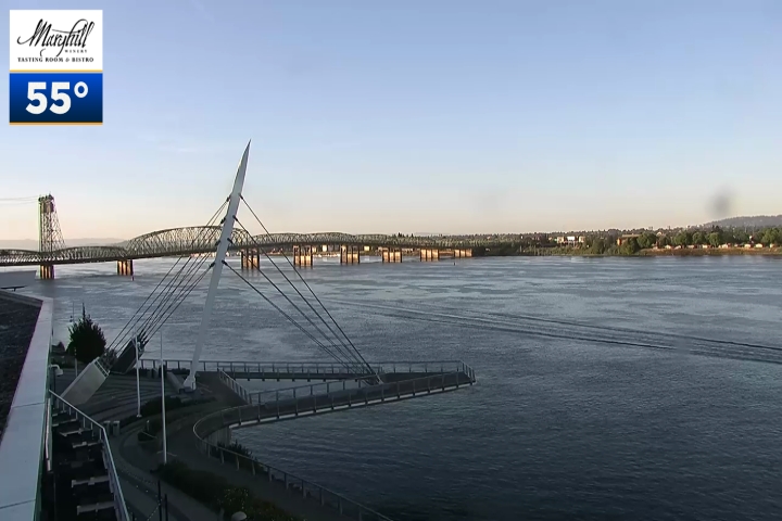
It is a #FirstAlertWeatherDay for the Portland metro area and other parts of Oregon. Our @fox12weather team says you can expect hot temperatures today and tomorrow. Now is the time to get the windows open and run the fans to bring in cool air.

1
3
47

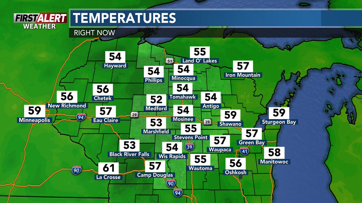
[6:07 AM Friday]- Most of north central Wisconsin is starting out with sunny skies, but there are more fair weather clouds up north.
Gusty winds are expected during the afternoon.
#wiwx #wsawwx #FirstAlertWeather #FirstAlertWeatherDay
STORY: wsaw.com/2026/06/12/first-al…


1
68

Jun 12
Brace yourselves. #FirstAlertWeatherDay.
Full forecast: wfsb.com/2026/06/11/technica…
3
1,389

Jun 11
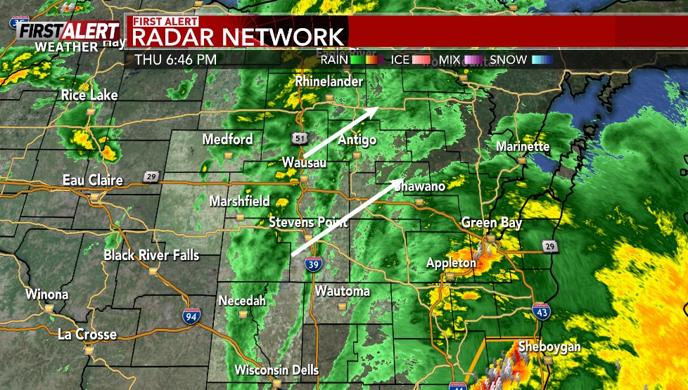
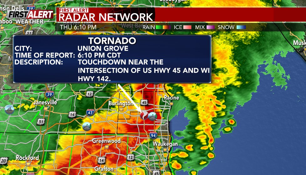
#FirstAlertWeatherDay: (6/11/26) At 6:46 PM, gusty showers are producing wind gusts up to 40 mph, along with some downpours. A First Alert for a reported tornado near Union Grove in Kenosha County just after 6 PM with severe storms. #wsawwx #wiwx
Radar: wsaw.com/weather/radar


569

Jun 11
#FirstAlertWeatherDay: (6/11/26) At 6:46 PM, gusty showers are producing wind gusts up to 40 mph, along with some downpours. A First Alert for a reported tornado near Union Grove in Kenosha County just after 6 PM with severe storms. #wsawwx #wiwx
Radar: wsaw.com/weather/radar
457
Jun 11
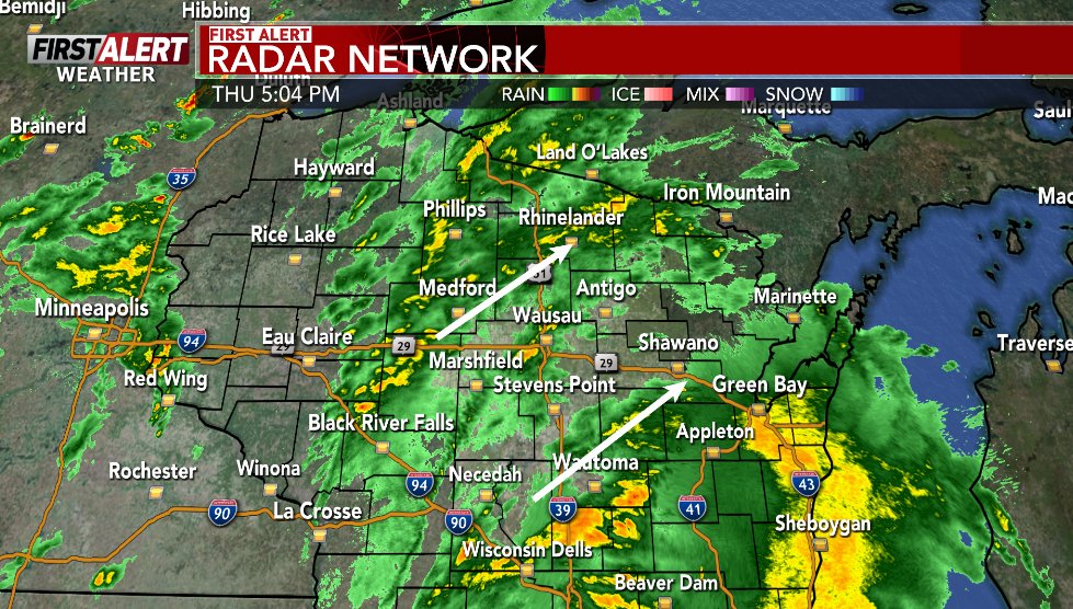
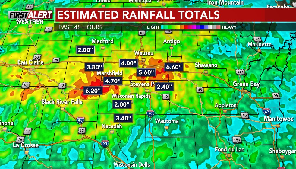
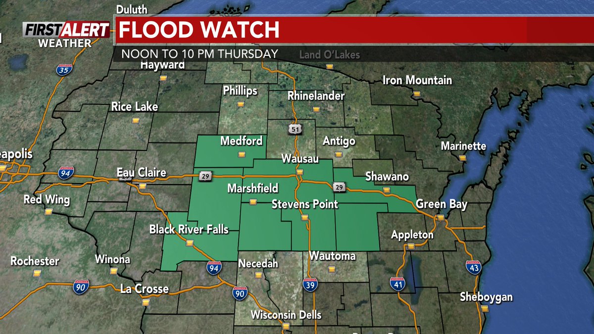
#FirstAlertWeatherDay: (6/11/26) At 5:05 PM, rain is moving across the region. Some pockets of heavy rain possible thorugh late Thursday evening. Heavy rain fell on Wednesday with 2-5" Central WI. A Flood Watch until 10 PM. #wsaww #wiwx
Radar: wsaw.com/weather/radar


121
Jun 11
#FirstAlertWeatherDay: (6/11/26) At 5:05 PM, rain is moving across the region. Some pockets of heavy rain possible thorugh late Thursday evening. Heavy rain fell on Wednesday with 2-5" Central WI. A Flood Watch until 10 PM. #wsaww #wiwx
Radar: wsaw.com/weather/radar
95
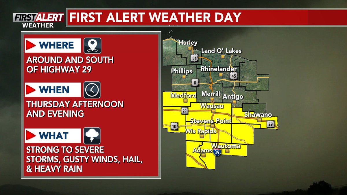
[12:06 PM Thursday]- Thunderstorms are passing through mainly around and south of Highway 29 early this afternoon. These storms are moving east/northeast at around 40-45 MPH.
#wiwx #wsawwx #FirstAlertWeather #FirstAlertWeatherDay
RADAR: wsaw.com/weather/radar/

125
[10:15 AM Thursday]- Rain is falling out west. The severe weather threat remains higher in south Wisconsin, but a few strong to severe storms remain possible south of Highway 10.
#wiwx #wsawwx #FirstAlertWeather #FirstAlertWeatherDay
MORE INFO: wsaw.com/weather/

1
181
Jun 11
Today, 'HHH' does NOT stand for 'Haney, hot, and happenin'.'
It does, however, stand for hazy, hot, and humid. #FirstAlertWeatherDay
Full forecast: wfsb.com/2026/06/11/technica…
1
1
5
1,355
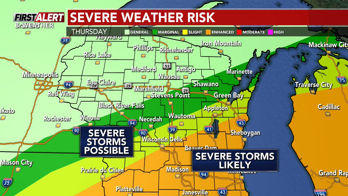
[5:04 AM Thursday]- The #FirstAlertWeatherDay for Thursday has been expanded to include Marathon, Talyor, & Clark Counties. For these counties, it's due to flooding potential.
#wiwx #wsawwx #FirstAlertWeather
MORE INFO: wsaw.com/2026/06/10/first-al…


72
Jun 11
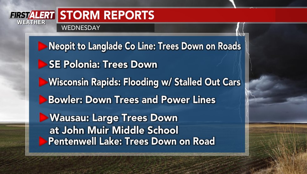
#FirstAlertWeatherDay: Storms from Wednesday morning, afternoon, and early evening produced some heavy rainfall along with damaging wind gusts. #wsawwx #wiwx
Forecast: wsaw.com/weather/forecast

1
115
Jun 11
#FirstAlertWeatherDay: Storms from Wednesday morning, afternoon, and early evening produced some heavy rainfall along with damaging wind gusts. #wsawwx #wiwx
Forecast: wsaw.com/weather/forecast


1
67
Jun 10
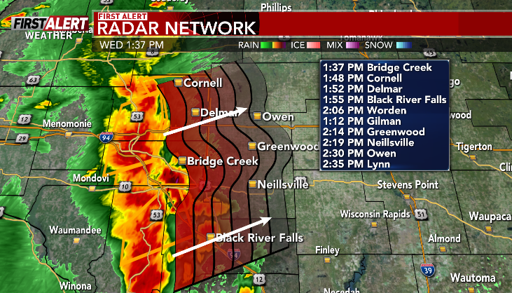
#FirstAlertWeatherDay: (6/10/26) At 1:38 PM, a line of severe storms is just off ot our west, moving into Taylor & Clark County around 2 PM. The storms could get to Gilman at 2:12 PM. Damaging winds, heavy rain, and up to 1" hail possible. #wsawwx #wiwx
Radar:

2
215
Jun 10
#FirstAlertWeatherDay: (6/10/26) At 1:38 PM, a line of severe storms is just off ot our west, moving into Taylor & Clark County around 2 PM. The storms could get to Gilman at 2:12 PM. Damaging winds, heavy rain, and up to 1" hail possible. #wsawwx #wiwx
Radar:
2
161
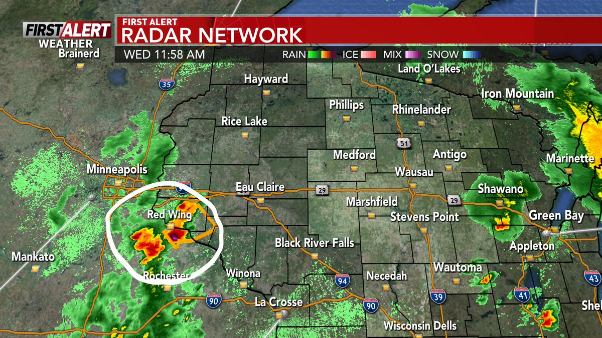
[12:02 PM Wednesday]- Thunderstorms from Wednesday morning are essentially out of the area, but the initial cells for round two this afternoon are forming out west.
#wiwx #wsawwx #FirstAlertWeather #FirstAlertWeatherDay
MORE INFO: wsaw.com/2026/06/10/first-al…


67
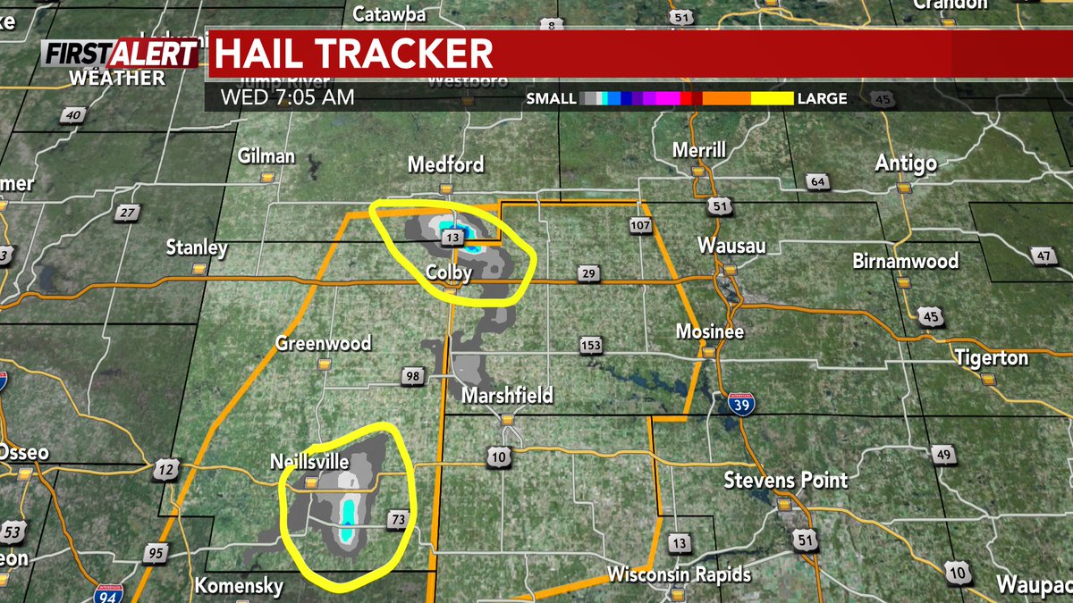
[9:07 AM Wednesday]- The line of storms from this morning is "weaker", but still capable of producing strong winds and hail as it moves further east at around 45-50 MPH.
#wiwx #wsawwx #FirstAlertWeather #FirstAlertWeatherDay
MORE INFO: wsaw.com/2026/06/10/first-al…
107
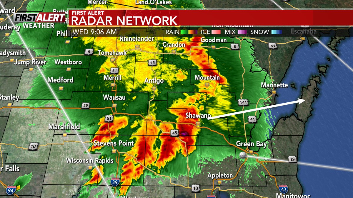
[7:07 AM Wednesday]- The strongest part of this line of storms this morning has consistently been around and south of Highway 29.
#wiwx #wsawwx #FirstAlertWeather #FirstAlertWeatherDay
MORE INFO: wsaw.com/weather/

94

Jun 10
Get ready for even hotter conditions heading into the end of this week as heat index values reach triple digits across the area. #FirstAlertWeatherDay #hot #stayhydrated

2
120